 |
| Hmmm, here we go again. |
I had a great night at my camp last night. A food drop along with some good weather and a lot of water meant that last night was about as comfortable as it gets when you’re camping in the middle of a tough, long walk. Climbing out of the tent this morning I was greeted by a gorgeous day too, the open forest had just a hint of a mist that was quickly lifting and burning off, the forest almost translucent in the early morning sunlight. With the prospect of a fairly big day in front of me I didn’t muck around too much this morning, I’d eaten brekky and was packed up and on my way by around 8:30am, well that’s pretty early for me anyway!
 |
| I had a fairly early start today. |
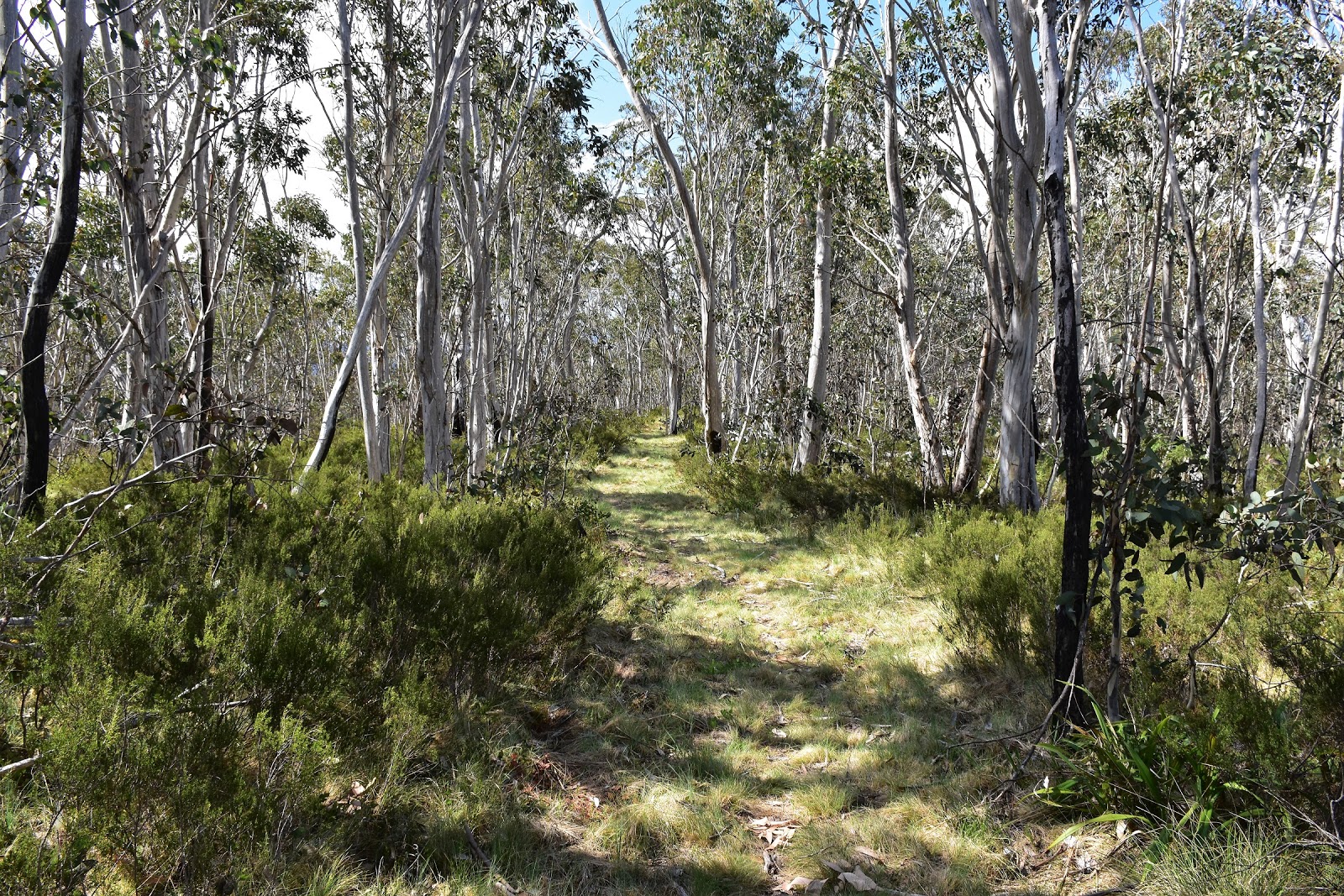
After stashing my food bin back in the scrub I set off on the day’s first endeavour, that of climbing Johnnies Top. Almost immediately I crossed the deserted Benambra Corryong Road and started a climb that I was guessing would last until well after lunch time. Climbing away from the road the AAWT initially climbs fairly gently, through dry open eucalyptus forest, the open forest making it fairly easy to spot the local wallabies out grazing in the cool of the morning. After a kilometre or so the route started to climb a little more steeply up a fairly pronounced spur, the going along here was really nice though, the AAWT crossing an area full of rocks where I was keeping an eye out for the track markers to make sure that I’d have no navigational hiccups.
 |
A few hundred metres after leaving camp the AAWT crossed the Benambra Corryong Road, this spot makes an ideal food drop spot.
 |
A few of the locals were out and about this morning.
 |
There is a pad that faded in and out a bit as I climbed the spur, the open forest was pretty pleasant to walk through though.
 |
Reaching a rocky section on the spur there was enough track markers to prevent any real navigational issues.
|
|
|
|
Maybe it was due to the good weather, maybe last nights food drop, maybe the fact that I was heading through country that I’d never walked through before but whatever the reason My Feral mojo was at a high this morning, normally faced with an almost 1000 metre climb carrying my pack my mood would be a little more subdued - some people might even say
grumpy, but today all was good as I headed up the mountain. After a steep pinch I picked up an old overgrown fire track which I then followed fairly easily up to Turnback Creek Track, the old road was a lot clearer than I’d thought that it may have been, although there was the usual fallen trees and a bit of scrub to negotiate but that’s pretty standard on the Victorian sections of the AAWT.
 |
I got a couple of views back down to the Fraser Tableland as I climbed.
 |
The AAWT picked up this old fire track as I climbed towards Turnback Creek Track.
 |
A fat Feral favourite, once I'm down on all fours crawling under these things it's always a fair effort getting back onto two legs!
 |
| Turnback Creek Track |
|
|
|
Emerging from the scrub onto Turnback Creek Track I was now faced with a long fire track walk for the next few hours as I made my way to the summit. After climbing fairly solidly along Turnback Creek Track for a kilometre or so I picked up Beloka Range Track which would take me on a fairly undulating walk along a long spur. The good news was that the walk along Beloka Range Track was allowing me a few views through the trees, initially burnt Alpine Ash before higher up I was peering through the Snow Gums. As is usual in my Feral world there was some bad news to go with the good news though, yes as I was slowly inching my way up Johnnies Top, sweat running freely off my brow, at the same time big black clouds once again appeared to be closing in on me. Now I was starting to get use to this and I’d worked out that the best course of action was to just keep shuffling my way north and more often than not the localised storms would pass me by.
 |
Heading up Beloka Range Track, the black clouds are stalking me.
 |
I got a few views through the trees on Beloka Range Track.
 |
Beloka Range Track
 |
I've just met Johnnies Track, time to look for a bit of shelter I think.
|
|
|
|
Unfortunately my tactic didn’t work so well today, after one last short climb I arrived at Johnnies Track just as the storm that had been stalking me finally delivered, bugger! After quickly digging out my pack cover, dry bag for my DSLR and my gortex jacket there was a flurry of arms and legs as I quickly tried to water proof everything before it got wet. With the camera safely away and the pack covered I noticed a large fallen dead tree that would provide me with a modicum of protection, heading over I dropped the pack and climbed into my little grassy shelter. Now with the diameter of the dead tree only marginally bigger than the Feral fat guts it took a bit of manoeuvring to position myself so that I was more or less out of the rain. After I while I managed to find the right spot that would keep my relatively dry, and I spent the next twenty minutes in my prone position as I waited for the storm to pass through. I figured that as I wasn’t really in that much of a hurry it was definitely worth kicking back for awhile and chilling out in the hope that I could stay dry.
 |
Time to sit back and chill out for a bit, on Johnnies Track.
|
Eventually the thunder and rain passed me by and I emerged from under my log. I was now on the last few metres of my climb up to the summit of Johnnies Top. Somewhat ironically by the time I arrived at the cleared area and the telecommunication towers that mark the top, I was again sweating under a blue sky. The summit area of Johnnies Top is a potential camp as there is water from a tank hidden a few metres into the Snow Gums, being early in the afternoon I decided to keep moving today though, but not before I had a good go at draining the tank;). After successfully rehydrating and filling my water bottles and getting a text message out to Sam, I set off on the fairly long descent off Johnnies Top down to Buenba Creek. Now Chapman’s notes suggested that
there is sometimes a faint foot track to follow, so I was braced for a fairly slow scrub bash down here. Leaving the summit ridge the AAWT takes a turn to the east and I was expecting something a little vague to mark the spot that I’d change direction, so I was quite surprised to arrive at the spot and find a tree with approximately 100 individual track markers hammered into it. Fair dinkum there was that much metal hammered into this tree that it must of needed a tetanus shot!
 |
Climbing up Johnnies Track the last few hundred metres towards Johnnies Top, the sun was out again, sweet!
 |
 |
The very welcome water tank up on Johnnies Top.
 |
The AAWT starts of very well defined.
 |
| There was no shortage of track markers dropping off Johnnies Top. |
|
|
|
|
Anyway with my descent’s first navigational challenge successfully completed I continued on down the hill on what was a very well defined and easy to follow track, the track clearing fairies have obviously been down here recently, happy days! Since leaving Cleve Cole I’d been coping a few afternoon storms passing through but generally I’d only get one storm that would take the edge of the heat and humidity and then things would be fine for the rest of the day, dropping down the long spur towards Buenba Creek it looked like today was going to break that short lived tradition though. My second storm for the day was rapidly closing in on me now, when the first few fat drops hit me I stopped to put my pack cover on but with the ambient temperature on the warm side I decided to forego the waterproof jacket this afternoon, after all my shirt could do with a good rinse out!
 |
I was expecting something a little more scrubbier than this on my descent down to Buenba Creek.
 |
 |
The track clearing fairies obviously have a sense of humour....
 |
| Time for the second round of storms today. |
|
|
|
With the rain hammering down and lightning and thunder crashing around me, sometimes a little too close for comfort, I cranked up the pace a little. Thankfully the worst of the storm arrived as I was already on the last bit of my descent so I was a fair way from the top of the mountain, so it could of been worse. The well defined pad off Johnnies Top drops fairly easily for the first 4 kilometres or so but the last kilometre and a half down to Buenbra Creek is seriously steep, and now wet and slippery.
 |
Thankfully I was a fair way down the mountain when this one hit me.
 |
At least my shirt got rinsed out.
 |
 |
| The last couple of hundred metres down to Buenba Creek was steep. |
|
|
|
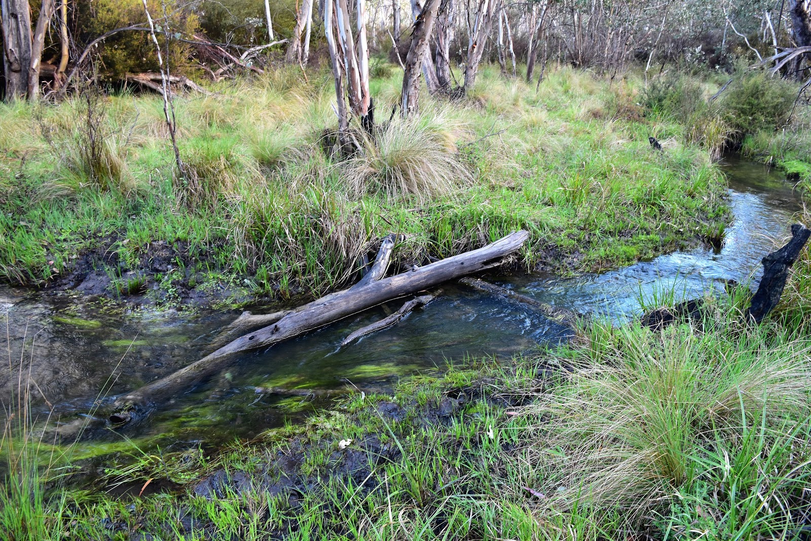
Now for some reason I’d been imagining myself frolicking along some nice gassy river flats beside Buenba Creek (probably because all the photos that I’ve seen of it feature open grassy paddocks, I’m thinking). So when I finished my steep descent off Johnnies Top at the wet and swampy Corner Creek and all I could see in front of me along the valley was swampy tussock grass and trees, you could probably say that I was mildly disappointed. Not only was the grass wringing wet but I was still wringing wet as well and with the tree cover in this steep valley it didn’t look likely that things would dry off in the next hour or so, bugger. Heading east upstream along Buenba Creek the AAWT is just a route really, so long as you keep the creek within sight you can’t really go too wrong though. The are lots of brumbie pads that sometimes help to make walking through the tussock grass a little easier but inevitably the pads would end up in a muddy wallow which would require a bit of fancy Feral footwork to get through with reasonably dry boots. After passing through a bit of a constriction in the valley I decided that I’d had enough for the day, finding a nice spot on a grassy bank above the bubbling Buenba Creek I got the tent up and threw all my dry gear in. My biggest concern tonight wasn’t that things were a little damp though, I was more concerned with the number of Feral horses in the valley and making sure that I hadn’t camped on a brumbie freeway, getting trampled whilst lying in my tent would of been a sub-optimal outcome.
 |
I've reached the Buenba Creek Valley, but where are those open grassy meadows that I'd been imagining?
 |
Crossing the swampy Corner Creek, these damp flats with the tussock grass made for surprisingly hard walking, especially as things were wet.
 |
| The AAWT along here is pretty well off piste. |
|
|
The Dirt.
I walked 24 kilometres today and climbed 1100 metres on another hard day on the AAWT. After 23 days on the AAWT I’ve walked 390 kilometres along with 18,885 metres of climbing. Water today was available from a tank on Johnnies Top and then again once I reached the valley from either Camp Creek or Buenba Creek, if there is anyone who is thinking of following in my footsteps after reading this then Buenba Creek is a good spot to start diligently treating your water on the journey north, there are a lot of feral horses running around between here and Thredbo. As is usual there are a few options when it came to camping today but the best ones are near the water on Johnnies Top (in the Snow Gums, away from the telecommunication towers) and then down on the Buenba Creek flats. Navigation was pretty straightforward today, reading my notes I’d thought that today might of had it’s moments when it came to route finding but on the ground today things were pretty easy, I guess the only real potential for embarrassment would be once the valley is reached and the AAWT heads off up stream off piste, but so long as you never wander too far from Buenba Creek then it would be hard to go too far wrong. I got a Telstra mobile signal from Johnnies Top this afternoon. I used John Chapman’s notes and maps as well as Rooftop’s Bright - Dartmouth Adventure Map for an overview.
Relevant Posts.
AAWT, Day 1, October 2017.
AAWT, Previous day, November 2017.
 |
| I got a little bit of late afternoon sun, unfortunately it didn't reach into the valley as far as my camp. |
 |
| My camp beside Buenba Creek. I was hoping that I wouldn't get trampled by one of my equine mates tonight. |


No comments:
Post a Comment