 |
Boots off for my crossing of Dead Horse Creek.
 |
| Early morning near Buckwong Creek. |
|
After yesterday afternoons big storm the weather had once again cleared by the time I emerged from my wet tent this morning, while yesterday’s rain had soaked the outside of the fly the insides were now soaking wet with condensation after a very still and humid night. So with the sun slowly creeping into the Buckwong Creek valley I settled in and enjoyed a very relaxed breakfast as I shuffled the tent around chasing the early morning sun. By 8:30am I decided that once again I’d better start plodding my way north, Canberra wasn’t getting any closer unfortunately.
 |
Once again the Buckwong Creek flats made for fairly easy walking this morning.
 |
The trick is to find the spot the AAWT leaves the flats.
 |
| While the brumbie pads make life a little easier through the scrub, they can sometimes make navigation a little trickier. |
|
|
Leaving camp this morning the AAWT continued up the creek flats for awhile, once again brumbie pads making walking a little easier but also confusing the navigation somewhat. I was now slowly climbing up to meet Misery Trail and to be honest once I’d left the creek flats and made sure I was actually on the AAWT and not a horse track, then the walking up here was pretty clear and obvious. Although the climb was a little convoluted to begin with as the pad skirted around some Tea Tree in a wet gully, but once I started to gain a little altitude the pad was clear and well marked, it is a fairly steep little 400 metre climb though and I was certainly happy enough to emerge from the Snow Gums onto Misery Track.
 |
Once climbing the AAWT was steep but defined.
|
Misery Track heads along the crest of Davies Plain Ridge and far from being miserable, this old fire track made for very nice walking as it undulated along the ridge through an avenue of Snow Gums. I wasn’t feeling 100% today though, I seemed to be struggling a little with a lack of energy so every little climb was a bit of an ordeal today, so I was pretty happy to arrive at the high spot where Misery Track drops off the ridge to the west and drop my pack for awhile. With the sun out I managed to get a bit of tent drying happening as a recovered from the climb and enjoyed my first lunch. Now while I wasn’t feeling 100% I did have one stroke of good luck today, I managed to get a mobile signal so I was able to get a text message out to Sam letting her know that all was well, once again lifting a metaphorical weight off my shoulders.
 |
The Snow Gums on Misery Track allowed me a few views.
 |
Misery Track
 |
| Having smoko where the AAWT leaves Misery Trail (I got a mobile signal here). |
|
|
After a good break in the sunshine I shouldered the pack and set off on a fairly long descent that I would eventually finish 600 metres lower down on Smoke Oh Creek. Chapman once again suggested that the going is a little vague down here but for the most part things on the ground today were pretty clear and well marked…..for the most part. Before the AAWT started to drop off Davies Plain Ridge I walked through an area that still had a fair covering of hail stones left over from last nights storm, something that I wasn’t expecting on what was now a pretty warm day. Passing through the hail stones the AAWT then began the descent proper, dropping to cross Macs Creek Track on the way I continued down to eventually enter a wide grassy gully. This gully is where things do actually get a little vague in spots but with the AAWT more or less corralled in by steep hills on either side it wasn’t hard to find my way down to Dead Horse Creek.
 |
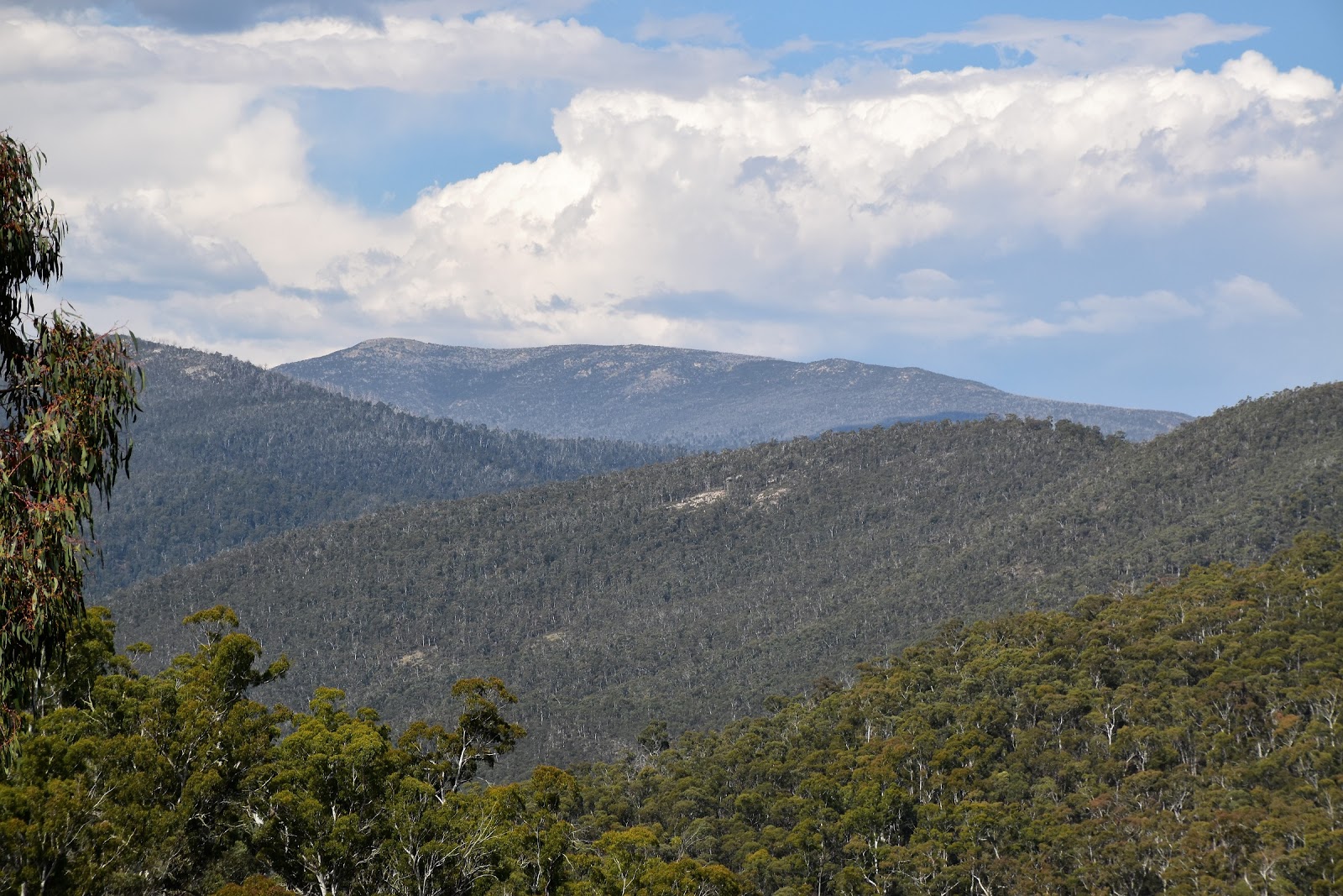
Looking across towards the Cobberas.
 |
 |
There was still a bit of hail left over from yesterdays storm.
 |
 |
Clambering over another fallen tree.
 |
 |
The last section down to Dead Horse Creek was a little vague.
 |
| It was hard to go to far wrong in this gully though. |
|
|
|
|
|
|
|
After following Dead Horse Creek downstream for awhile I got to another boots off crossing, apart from the inconvenience putting my boots on and off I really enjoyed these crossings where I’d get my feet wet. Lingering for as long as I could stand the cold water I eventually climbed up onto dry land again, finding a nice grassy spot with a convenient fallen log to sit on while I waited for my feet to dry off a bit. With my energy levels approaching those of the average 90 year old I once again shouldered my pack and headed off, now following a fairly rough but defined pad that contoured along the hillsides beside Dead Horse Creek. I could see a couple of little plunge pools down in the creek that if I had a little more mojo I might of dropped down for a dip, today though it was just a matter of shuffling on.
 |
That's the AAWT dropping into Dead Horse Creek on the far bank.
 |
Just after the crossing of Dead Horse Creek the AAWT passes through some more Omeo Gums.
 |
| The Omeo Gums have a multi trunk set up, kind of like a Mallee Tree. |
|
|
Crossing Smoke Oh Creek the AAWT now started to climb a little higher above the creek, the going along here was a little vague in spots, particularly where the brumbies had made their own tracks through the open scrub. Even though I had no energy this section was actually pretty enjoyable, being a fair way up the side of the hill the open forest was now giving my a few views of the craggy Cobberas, now a lot closer than the last time I’d got a glimpse of them. Around an hour after my crossing of Smoke Oh Creek, including a couple of sections where I was scouting around for awhile deciphering the correct route, the AAWT emerged from the scrub onto Limestone Creek Track and all was pretty easy on the AAWT again.
 |
The AAWT heading down Dead Horse Creek.
 |
There were a couple of nice little plunge pools along here.
 |
There are a few grassy openings which the brumbies seem to love.
 |
The Cobberas
 |
Have I mentioned the horses...?
 |
I'm thinking that's The Pilot.
 |
The AAWT climbing easily up to Limestone Track.
 |
| It's spots like this where I had to be careful with navigation, it was very easy to head off on a tangent following a brumbie pad. |
|
|
|
|
|
|
|
Almost as soon as I arrived onto Limestone Creek Track the fire track started to drop very quickly down to the Limestone Creek ford. Arriving at the creek I found Hilly and Libby already camped on the grassy shelf above the creek, they were certainly going better than me by the look of it. After stopping for awhile to compare notes and have a bit of a chat I decided to give the ladies a bit of space and head on a bit further to find a spot to camp. So after crossing Limestone Creek I trudged up the firetrack in the late afternoon light to Stony Creek. I was in the dark a bit about whether I would actually find enough flat ground to pitch my tent on here, but thankfully when I arrived I was able to push a few metres through some scrub to a bit of a grassy opening above the creek. Thankfully the sometimes subterranean Stony Creek was also flowing above ground here which made this a pretty good campsite, being in a steep, vegetated valley I was hoping that I’d be away from marauding horses over night too.
 |
 |
| Dropping down Limestone Creek Track to Limestone Creek. |
|
The Dirt.
I walked 16 kilometres today and climbed 700 metres on another hard day today. My AAWT stats so far after 25 days are 421 kilometres along with 20185 metres of climbing. After leaving Buckwong Creek this morning the next water was when I arrived down at Dead Horse Creek, after that it was Limestone Creek and then camp at Stony Creek. There are lots of camping options today, Dead Horse Creek and Limestone Creek are probably the pick of them…..although the Davies Plain Ridge would be good if you don’t mind hauling your water up. I camped 20 metres up stream of the Stony Creek ford on Limestone Creek Track, this spot is only really good for one tent. Navigation today wasn’t overly tough but there were a couple of spots that needed a bit of concentration. The first spot is where the AAWT swings down a wide gully to meet Dead Horse Creek and the second spot is on the climb up to Limestone Creek Track above Dead Horse Creek, there are a lot of brumbie pads along here. I got a Telstra signal today up where the AAWT leaves Misery Track to start descending down to Dead Horse Creek. I used John Chapman’s notes and maps as well as Rooftop’s Bright - Dartmouth Adventure Map for an overview.
Relevant Posts.
AAWT, Day 1, October 2017.
AAWT, Previous day, November 2017.
 |
| My Stony Creek camp. |
 |
| Stony Creek |


No comments:
Post a Comment