 |
| The AAWT was reasonably well defined for most of today. |
My night up on Mt Wills turned out to be a very pleasant little stay. I had everything I needed up there, a dry place to sleep, a dry place to cook and eat, a mobile signal and enough of an AM signal so that I could find out what was going on in the world. Happy days indeed! Yep, after around 20 days on the AAWT it wasn’t taking a lot to make me happy now, vita wheats and warm water -
it must be my lucky day. Somewhere to sit that isn’t covered in ants -
who needs 5 star accommodation anyway. Dry toilet paper -
what are all the poor people doing now days? Yes, life was now well and truly boiled down to simple pleasures. My mood only got better his morning as I opened the hut door to be greeted by bright sunshine, sitting in the sun eating breakfast I couldn’t help but smile.
 |
| Brekky at Mt Wills Hut was a very civilised affair this morning. |
Setting off this morning I was heading down towards Mt Wills South, I’ve actually been down here a long long time ago on what turned out to be a bit of an off track epic where I dropped off Mt Wills South and headed west down to Big River, my main memories of that walk were navigational difficulties and scrubby walking. So setting off today along the ridge line that leads from Mt Wills to Mt Wills South I was slightly surprised to find a bit of a pad and plenty of track markers, sweet! Life was getting even better! Seriously though the walk along the ridge line to Mt Wills South is an excellent little section of the AAWT, with views across to the Bogong High Plains, plenty of big rocks, gnarly mature Snow Gums and enough open grassy openings to make progress easy, this little bit had everything I like really.
 |
The AAWT heads off along the crest leading across to Mt Wills South.
 |
The Mt Wills section of today's stroll made for superb walking.
 |
There are a lot more track markers than I remember from my last visit.
 |
Heading along to Mt Wills South the AAWT wanders through a lot of huge granite rocks.
 |
There was even a few glimpses back to the Bogong High Plains.
|
|
|
|
|
Reaching Mt Wills South I skirted to the east of the summit and continued on a bit further down the ridge line, the AAWT takes an acute 90˚ turn to the east along here so I was concentrating furiously not to miss the spot, having experienced Mt Wills off piste on that walk years ago the scaring was only now just starting to heal;) Thankfully there were enough track markers as well as other hints that walkers had been through that meant staying on the AAWT down here was actually pretty easy. Once I’d found the spot to start heading east the AAWT joins a very old fire track. Actually from here until I emerged from the scrub onto the Omeo Highway I was following old fire tracks, the closer I got to the highway the clearer and more defined the fire tracks became.
 |
I passed just to the left of Mt Wills South.
 |
I picked up a series of old fire tracks dropping down off Mt Wills
 |
The Parks Vic guys at Omeo have done a good job at keeping the AAWT fairly clear, unfortunately they look to be fighting a losing battle when it comes to blackberries though.
 |
The closer I got to the Omeo Highway the easier the walking became.
|
|
|
|
Heading along the Omeo Highway this morning I was once again looking for a track disappearing into the scrub, not too sure exactly how overgrown or if the track would actually be sign posted, I kept a fairly close eye on the map. Reaching a sharp corner on the highway I noticed an AAWT post along with some flagging tape leading into the scrub, this was the start of Gill Spur Track which I would follow for the next two or three kilometres. Initially Gill Spur Track was a little scrubby as it left the highway but heading out along the top of what I’m guessing was Gill Spur, the track actually seemed to get clearer, there was the occasional tree down to negotiate but most of the scrub was pretty well under control. Once again I was now keeping a close eye on my navigation as I had to pick the spot to leave Gill Spur Track and drop down steeply to Gill Creek, Chapman’s notes suggested ‘this turn is easily missed’ so I was assuming that I was looking something resembling a wombat track burrowing through the scrub. So imagine my surprise when out of the bush emerged a clear and defined path leading steeply off down hill, I was thinking
how easy is this AAWT stuff.
 |
I had a kilometre and a half down the Omeo Highway, a fairly easy little interlude to the days walking.
 |
This is Gill Spur Track heading off the Omeo Highway, it looks worse than it actually was.
 |
Hmmm, my favourite.....on Gill Spur Track.
 |
| Dropping off Gill Spur I picked up a walking track that dropped fairly steeply down to Gill Creek, it was all pretty straight forward though. |
|
|
|
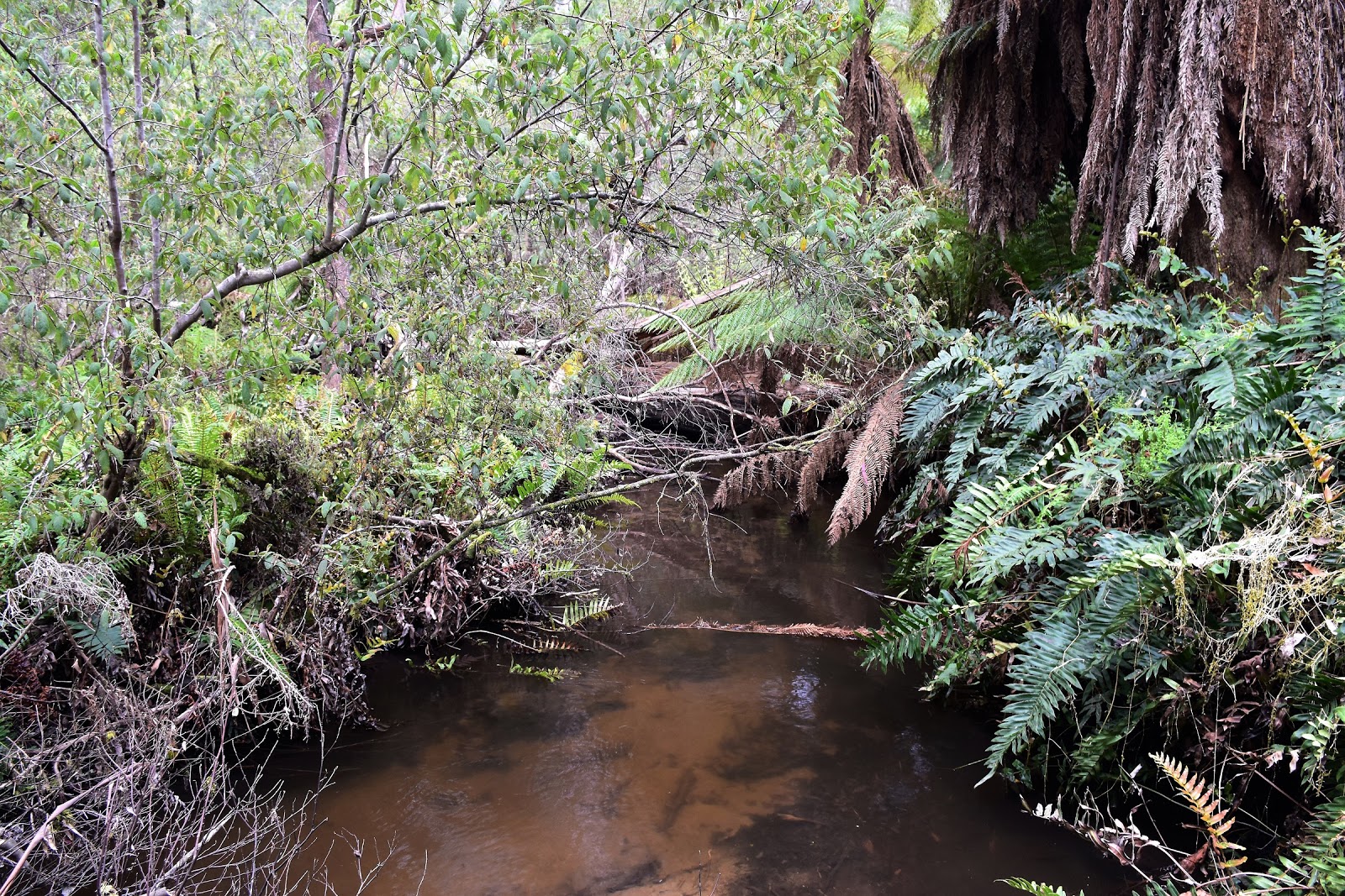
While the pad down to Gill Creek was clear enough it was also very steep and slippery, especially towards the bottom of the valley. Bottoming out in this ferny, claustrophobic little valley at a tiny camp site it didn’t take me long to decide to keep walking today. The banks of Gill Creek are pretty ferny and damp, so with another storm looking as though it was imminent I wasn’t too keen on spending the afternoon picking leaches and mozzies off myself down there. After moderately successfully jumping across Gill Creek and managing to keep my boots dry I set off up towards Wombat Divide Track. After a very steep but short climb I picked up an old benched track that led me north through a tunnel of vegetation for awhile, before I picked up another old track and started a long 400 metre plus climb up a spur. It was climbing this spur that I copped today’s storm, I was sweating that much on the climb though that I didn’t even bother pulling on the gortex this afternoon. By the time I staggered to the top of my climb at Wombat Divide Track the rain had long gone and my shirt was once again soaked in sweat and not rain water.
 |
Gill Creek
 |
There are a couple of small tents sites down here but it looks pretty leachy.
 |
After a short steep climb away from Gill Creek I picked up this old track tunnelling through the scrub.
 |
Heading up the long climb towards Wombat Divide Track I got my daily shower.
 |
| The rain didn't hang around for long though. |
|
|
|
|
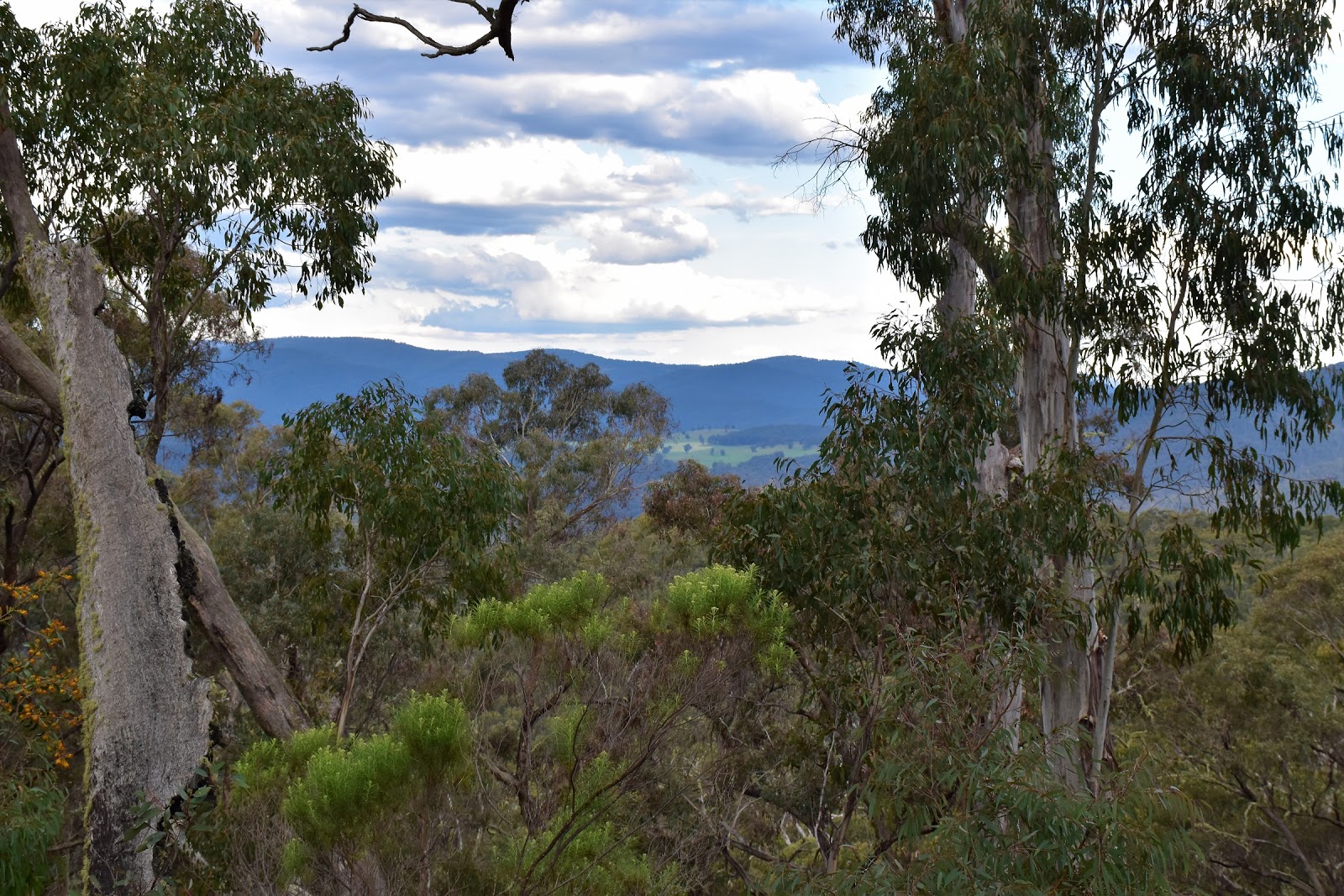
Dropping the pack for awhile on meeting Wombat Divide Track I sat down to have my second lunch while I sussed out some likely spots that I could camp at tonight. While Taylors Crossing was doable I wasn’t overly keen, another 10 kilometres would of turned the day into a bit of a death march I was thinking. So instead of heading all the way down to Taylors Crossing I decided to aim for Four Mile Creek a relatively easy stroll of another around 7 kilometres. The good news was that most of my climbing was finished for the day and the walking was pretty much all on clear tracks. Meeting Eight Mile Spur Track not only did the descending get serious but I also started to get some views through the trees down to the Fraser Tableland. The tablelands are an area of farmland which in itself isn’t that unusual, but it would mark virtually the only spot along the whole length of the AAWT where I’d walk past private land.
 |
Wombat Divide Track, time for another break. I got a signal from up here so was able to get another text away.
 |
| I still had a fair walk to go today but at least it was mostly down hill:) |
|
Dropping down the last few hundred metres the AAWT is a little cryptic, there are quite a few options but they all end up in the same place on Four Mile Creek Track so picking the exact route wasn’t critical really. Once on Four Mile Track I followed the undulating track down stream for awhile, I was looking for the spot that the creek crossed the track where hopefully I’d find somewhere to pitch the tent for the night. Arriving at the ford I sussed out Mr Chapman’s suggestion for camping but they were all pretty overgrown and uninviting, eventually I decided on a small grassy spot twenty metres before the creek crossing, the only negative with this spot was that it was right beside Four Mile Creek Track. I was banking on the fact that this 4wd track wouldn’t see much over night traffic, but staying beside a vehicle track always has it’s risks, so we’ll see how that goes.
 |
My first glimpses down to the Fraser Tableland.
 |
Dropping steeply down Eight Mile Loop Track.
 |
| Four Mile Creek Track. |
|
|
The Dirt.
I walked 22 kilometres today and climbed 725 metres on another hard day on the AAWT. My AAWT stats on the walk so far are 354 kilometres walked with 17,295 metres climbing. After leaving Mt Wills my next easily accessed water was down at Gill Creek, from there I didn’t get water again until I reached Four Mile Creek. After leaving the Mt Wills summit ridge the next reasonable camping is down at Gill Creek, although it looks like it would be pretty miserable in damp weather. After Gill Creek the next good option is Four Mile Creek. Navigation today was actually pretty reasonable although that will largely depend on when the track clearing fairies have last come through. The descent off Mt Wills and the drop into and climb out of Gill Creek are likely spots that could cause issues. I got a Telstra mobile signal today from the spot where the AAWT meets Wombat Divide Track. I used John Chapman’s notes and maps as well as Rooftop’s Bright - Dartmouth Adventure Map for an overview.
Relevant Posts.
 |
| Four Mile Creek |
 |
| My Four Mile Creek camp. The creek crosses the track in the gully twenty metres down the track. |


No comments:
Post a Comment