 |
| Summit Trail, Mt Baw Baw. |
I haven’t done many walks with any snow in them this year. I had big plans for a snow walk or two, but a series of events (mainly my health) have conspired to keep me away from the High Country over Winter. With the ski season drawing to it’s end it opens up a few options regarding visiting the more easily reached areas around the resorts, so that is why after finishing work this morning I decided to head up to Mt Baw Baw and go for a stroll.
 |
| Mt Baw Baw was pretty well deserted this afternoon. |
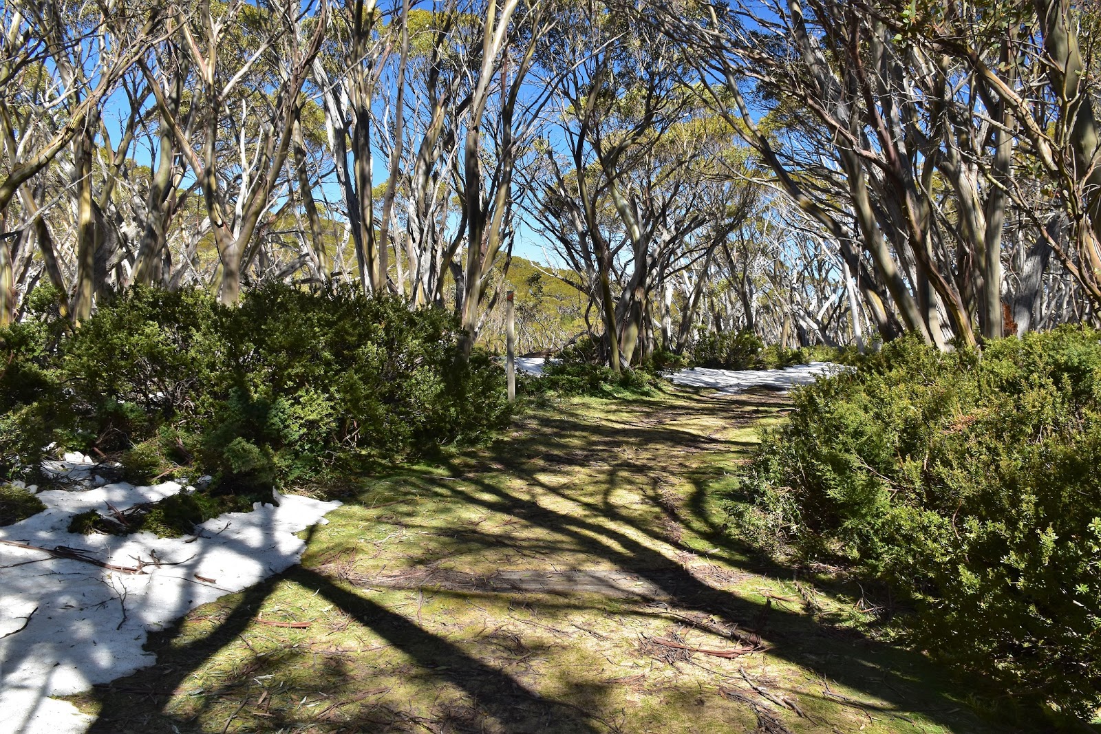
Arriving at the almost deserted car park at lunch time I soon had my boots on and was on my way. The hardest bit of walking around the Mt Baw Baw Ski Resort can actually be finding the start of the trails I think, once you are orientated and away from the village things are all pretty straightforward for the most part, but things are a little more cryptic in village area. Dropping down in a north easterly direction I arrived at the signposted Beech Trail and was on my way. Like most of the trails today Beech Trail is predominantly a cross country ski trail, in the warmer seasons these ski trails make for pretty good walking tracks in my experience though.
 |
| The biggest navigational challenge for me this afternoon was locating the start of the track in the village. |
Beech Trail largely heads north west contouring a ridge that the Mt Baw Baw Tourist Road comes in along so, with the occasional car passing along the road this section of the walk doesn’t feel that remote really. After a nice easy ten minutes or so I reached Saxton’s Picnic Area at the western extremity of Beech Trail, this shady little spot with some typical Mt Baw Baw, big mossy covered granite rocks, would of made a nice spot for a break if I hadn’t just started walking, even at the sloth like walking pace that I move at it was a bit early to stop. Returning back to the village I immediately picked up Mueller’s Trail and was on my way up onto the more enjoyable section of the walk.
 |
Once on Beech Trail things were pretty easy though.
 |
| The view from Saxton's Picnic Area was OK I suppose, but there is a lot better to come. |
|
Mueller’s Trail is named after Baron Ferdinand von Mueller who was the first European to climb Mt Baw Baw back in 1860 as well as being a famous botanist. I’d only climbed a few metres up Mueller Trail when I started to encounter lingering snow drifts and for the rest of the days walk snow would be fairly constant. Muellers Trail provided the biggest climb of the day but it’s a fairly gentle ascent for the most part and I made my way easily up to a trail junction called Five Ways. I haven’t mentioned it yet but the day was a ripper, blues sky with hardly a cloud in the sky and an ambient temperature hovering around 10˚ making it great for walking, and with a fair covering of snow around the weather wasn’t hurting my photos either.
 |
After crossing this little creek on Muellers Trail I started to climb.
 |
 |
By the time I arrived at Five Ways there was a lot of snow about.
|
|
|
Leaving Five Ways I headed north along Village Trail as it slowly arced it’s way around the boundary of the Mt Baw Baw Ski Resort boundary. This down hill ski slopes are all on the western side of Mt Baw Baw and this eastern side of the mountain is where most of the cross country ski trail are. Village Trail contoured around to arrive at Baragwanath Flat after twenty minutes or so, this is the spot where the link track heads off into the Baw Baw National Park to meet the Australian Alps Walking Track out near Mt St Phillack. The last time I was on this track a couple of years ago the weather wasn’t quite as benign as it was this afternoon as I was pushing through a blizzard.
 |
Heading along Village Trail I got some glimpses through the Snow Gums to the distant Latrobe Valley.
 |
Spring is slowly coming to the alpine country.
 |
The south facing slopes were still holding a good coverage of snow.
 |
Village Trail dropping down to Baragwanath Flat....it wasn't all snow.
 |
Baragwanath Flat
 |
| Baragwanat Flat |
|
|
|
|
|
Continuing on along Village Track, now heading south, the track leaves the ski resort area and enters the Mt Baw Baw National Park, yeah, the heading on this post is a little misleading really as 90% of today’s walk is within the Mt Baw Baw Ski Resort. Now however, I was actually in the national park and suddenly the wide cross country skiing trail became a bushwalking pad, the walking is better (in my opinion) although gaiters or long pants are probably the go along here to minimise the scrub massage. I was now mostly contouring the southern slopes of Mt Baw Baw and the southern aspect meant that there was some pretty deep snow drifts along here.
 |
 |
 |
Village Trail is a lot rougher along this southern section.
 |
Village Trail
 |
Village Trail
 |
Village Trail
 |
| Village Trail tracks along the southern side of Mt Baw Baw along here. |
|
|
|
|
|
|
Post holing my way through the waist deep snow it was somewhat ironic that I could look down through openings in the Snow Gums and quite easily see the Yallourn Power Station belching Co2 into the atmosphere at a rate of 10.7 million tonnes a year (yep, that’s not a typo). If the conservatives and vested interests groups can keep this in-action up for a bit longer we won’t have to worry about the children born today battling snow on Mt Baw Baw I suppose, not that they give a fuck as the selfish, greedy pricks will all be dead by then…..cough!….now where was I….
 |
 |
Some of these drifts on Village Trail were pretty deep.
 |
Post holing my way along Village Trail.
 |
My legs got a bit of a scrub massage along this section of Village Trail.
 |
| Yallourn Power Station was easily visible down in the valley. |
|
|
|
|
This section of the walk needs a little concentration to stay on the track, especially when it’s mostly under snow like today, there are some snow poles scattered about but they are sometimes few and far between. The snow plain sections that weren’t buried in snow are also fairly overgrown so that didn’t help much. Approaching Neulynes Plain I climbed a few metres north and picked up the more substantial Summit Track. Now there was no signposting in evidence here and the track was well and truly under snow so I needed to be keeping an eye on the map on this bit, I’m guessing that there maybe a signpost buried under the snow so it might be clearer once the snow melts, maybe?
 |
Village Trail approaching Summit Trail.
 |
Looking down towards the Latrobe Valley from Village Trail.
 |
 |
| I climbed a few metres north to pick up Summit Trail, there was no signpost but it may have been buried in snow? |
|
|
|
The semi adventurous walking was now over for the day as I climbed up Summit Trail towards the Mt Baw Baw Cairn. Still being on the southern side of the mountain there was quite a bit of snow lingering along here, the Snow Gums looking particularly photogenic along here I think. Speaking of Snow Gums, unlike in a lot of the alpine country in Australia the Snow Gums up here haven’t been burnt, so Mt Baw Baw National Park is a great place to come to check out these beautiful trees. Reaching the summit cairn I took the obligatory photo and then headed a couple of minutes north to the real highlight up here, Mueller’s Lookout.
 |
Summit Trail
 |
| The Mt Baw Baw summit and cairn. |
|
On a good day Mueller’s Lookout is a magic spot and this afternoon was a ‘good day’. Muellors Lookout not only looks out across the rolling hills of the Mt Baw Baw National Park but this afternoon I could easily see as far as the snow covered Bogong High Plains, with Mt Buller and Mt Howitt in the middle distance. Sitting here in the sun I couldn’t help reflecting on my AAWT walk last year, it was almost this time last year when I’d shuffled my way out of Walhalla, gazing out over these distant snow covered peaks I could only dream of a winter attempt on the AAWT…..maybe one day?
 |
The view from Mueller's lookout is pretty sweet.
 |
I'm thinking this is Mt Buller (that is a Feral fact though!)
 |
Looking up towards the Bogong High Plains and Mt Hotham.
 |
| The rolling hills of Mt Baw Baw Nationla Park still had a good covering of snow today. |
|
|
|
My walk was pretty well over now as I dropped down Summit Trail back to Five Ways before picking up Village Trail and heading towards…you guessed it….the village. To be honest I’m not exactly sure if I stayed on the route as Melanie Ball has described it along here, I was now passing through the downhill skiing section of the resort and there are multiple ways to head down to the village. After stopping for a couple of minutes to watch a pair of Alpine Dingos (there is a breeding program set up here to try and ensure their ongoing survival) I meandered my way through the Mt Baw Baw Village back to the ute under the warm afternoon sun.
 |
Heading down Summit Trail I got another glimpse down to the Latrobe Valley.
 |
Back on Village Trail again, a little more defined again now.
 |
Looking back towards Mt Baw Baw from Village Trail.
 |
| From Village Trail. |
|
|
|
The Dirt.
I walked 11.7 kilometres and climbed around 350 metres on this stroll. In her book
Top Walks in Victoria, Melanie Ball rates this as an Easy-Medium grade walk but I’m thinking that when there is still snow on the ground then this was a Medium grade walk, for me anyway. The tracks are mostly clear enough (even under snow) but the southern most section along Village Trail is very overgrown and ill defined, you’ll definitely be pushing through scratchy scrub with your legs for a kilometre or two along here. Like I mentioned earlier the Baw Baw Plateau is a really good spot for gnarly old Snow Gums, the other nature based highlight up here is the Lyrebirds on the drive up to the mountain, I don’t think that I’ve ever driven this road and not seen Lyrebirds.
Relevant Posts.
Mushroom Rocks to Mt Whitelaw, AAWT, Baw Baw National Park, 2017.
Baw Baw Village to Mt St Phillack, Baw Baw National Park, 2016.
Mushroom Rocks, Baw Baw National Park, 2016.
 |
| Village Trail |
 |
| There is an Alpine Dingo breeding program up in the Mt Baw Baw Village. |
 |
| Wandering back through the village in the late afternoon sun, another great little walk was coming to it's end. |


No comments:
Post a Comment