 |
| The view from the summit of Mt Sturgeon was fairly intimidating this afternoon. |
Today was an
interesting day, while I was sweating my way up Mt Sturgeon this afternoon that I had a bit of an unsettling, #Me Too type of encounter….and it was all my fault.
To put it mildly I was pretty well stuffed by the time I set off in the late afternoon heat to climb Mt Sturgeon. I’d spent the morning and early afternoon slogging my way around the Serra and Wonderland Ranges a little further north, on what was fairly warm day. So with well north of 20 kilometres and 1000 metres already under my belt, I was shuffling my way up onto the crest of the ridge that would lead me to the Mt Sturgeon summit even slower than normal, lost in my own sweaty world. With no cars in the carpark except mine, and thunderstorms all around me I wasn’t really expecting any company now. So to say I was surprised when someone behind me cheerily greeted me was an understatement!
Turning around and wiping the sweat stained tears out of my eyes I was greeted by a young, activewear clad lady, probably in her mid twenties. Now this lady looked like she was going a lot faster than me and to be honest I was pretty smelly and sweaty by that time of the day so I wasn’t really in the mood for company, oh yeah that and the fact that I’m old and grumpy as well! Anyway, I was keen to stop for awhile and let my new friend go, but stupidly instead of just stopping to rest I asked my new friend ‘is there was anyone coming up behind me or was she on her own?’. Now my reasoning for uttering that was that it would be a good excuse to stop for a bit longer and wait rather than have another person come up behind me and scare the shit out of me again.
As soon as the sentence had come out of my mouth I knew how it would sound to this young lady though, but it was too late. So what to do? The young lady headed off up the mountain, now in front of me, and eventually I started shuffling my way up as well. Being a one way walk I was definitely going to bump into this lady again, so I decided that when I did I’d try and explain to her what I was trying to ask in my somewhat clumsy way and maybe reassure her that I wasn’t some mountain climbing, bushwalking creep.
Fifteen minutes later, walking along the ridge I did indeed meet my new friend again. The young lady was on a rock lookout 10 metres off the main track. Thinking that I might freak her out even more if I shuffled over to check out the view as well, I decided that after sharing pleasantries I’d just keep trudging up to the summit. Well that was the last I saw of her. I’m guessing that as soon as I disappeared into the trees heading up the mountain she made a bee line down the hill and back to her car.
Now while it was definitely a misunderstanding it still worried me enough that I couldn’t stop thinking about it all the way home that night, replaying in my mind how I should of handled it so I didn’t freak this young lady out. I take the piss a fair bit on my blog in regards to my weight and general lack of fitness, but at around 125kg and 6’3” (in hiking boots) I can understand why I might look a little intimidating to some people. So anyway, on the very remote chance that the young lady that was climbing Mt Sturgeon, late on a Friday afternoon in early April happens to read this waffle then I’m really sorry if I freaked you out, I didn’t mean it but I totally understand.
 |
| There is a lot of GPT work going on in the Grampians at the moment. |
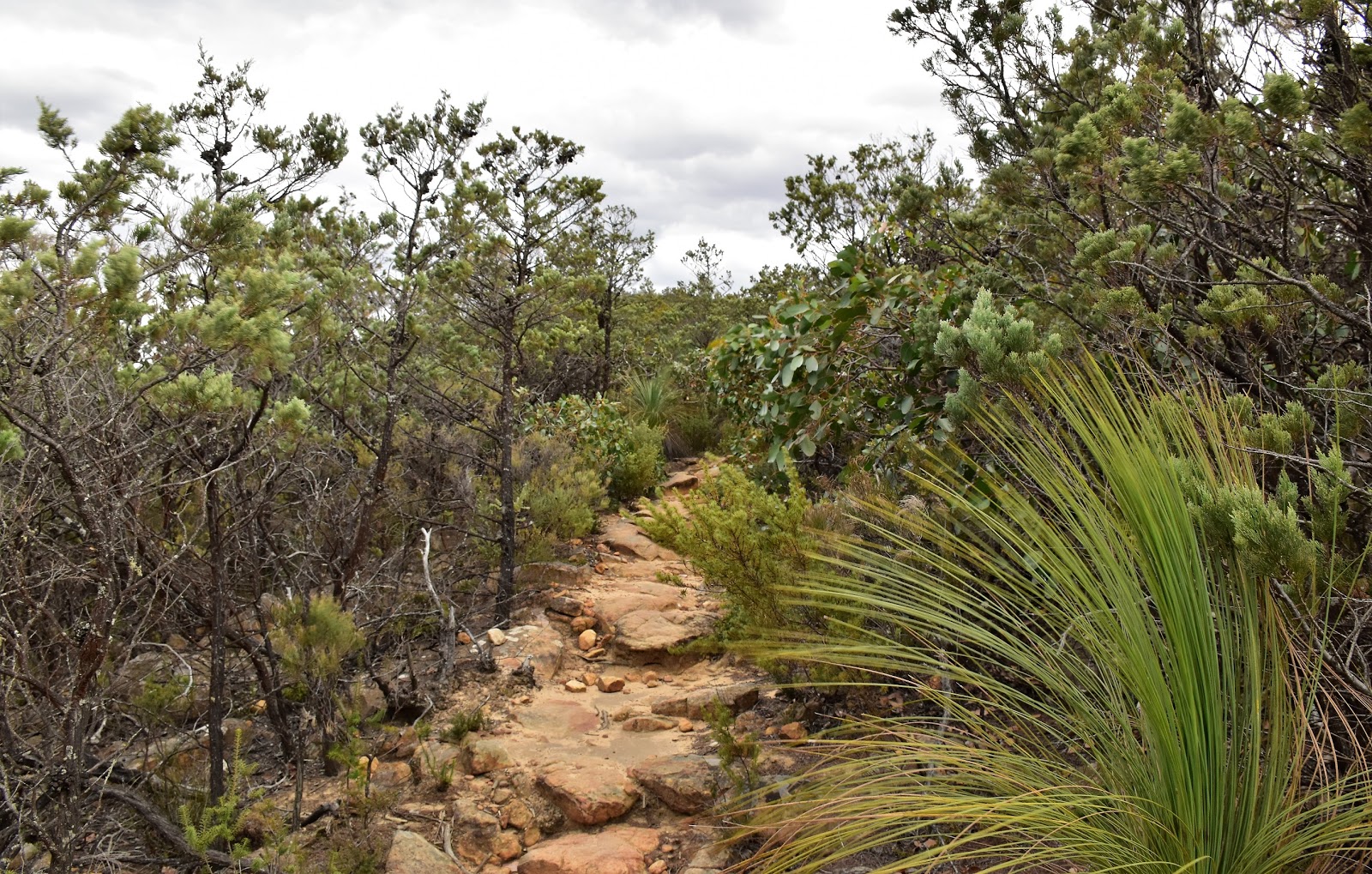
Hmm, so what about the actual walk? Well it’s a walk in three parts really. The first distinct section of the track had me tracking my way northwest along the base of the mountain. The pad along here passes through dry open Eucalyptus forest complete with quite a few Grass Trees. As I’ve eluded to in my rambling preamble, I was a pretty tired walker as I shuffled my way along the soft sandy track this afternoon, the hot and humid conditions weren’t helping with my Feral mojo either. Passing a spur track that looks like it heads towards The Piccaninny, which I guess is where the Grampians Peaks Trail will comes in.
 |
This is a pretty well sign posted and easy to follow track for the most part.
 |
The first part of the stroll tracks through open forest along the base of the mountain.
 |
| There are some views through the trees up to the ridge line. |
|
|
After passing the spur trail my route contoured a little way further to the west before I started up he next distinct section of my walk. On this bit of the walk is the track climbs up a spur to eventually attain the Mt Sturgeon ridge line. Climbing up here the views started to open up a bit and glancing north along the range towards Mt Abrupt and Signal Peak didn't exactly fill my heart with joy. I’d spent all day rambling around various parts of the Grampians National Park and, apart from a few sprinkles, I’d largely managed to stay dry. Looking up the Serra Range and the looming black clouds, it appeared that my good luck was about to run out.
 |
The climb up to the ridge is solid but not overly steep.
 |
Being a Grampians walking track there is fair bit of rock involved.
 |
The vegetation gets a bit more stunted up on the ridge.
 |
| The view north towards Mt Abrupt looked a little concerning. |
|
|
|
Like I mentioned early I think that the pad that I was climbing now is probably part of the new Grampians Peaks Trail, the amount of dry stone steps and track work only really adding to my suspicions. Once on the ridge line I was suddenly walking through a a fair bit of low, wind pruned scrub as I tobleroned my way towards the summit. The good news up here was that the the views were almost constant, while today things were looking a little grim I’m thinking that this would be a great spot early on a crisp clear winters day.
 |
It's a total guess but I'm thinking that this might form part of the new GPT when it's finished.
 |
Mt Sturgeon. I had one more saddle to pass through.
 |
| Looking south from the summit overhead conditions didn't look too bad. |
|
|
The ridge walk is the third distinct section of this walk and after passing over a few knolls and across some high saddles I started the last climb up to the summit. I was now really racing the weather a bit and looking along the Victoria Valley it looked like it was a race that I wasn’t going to win! So it was no surprise that just as I arrived at the summit the rain hit me. The grey conditions were already making taking photos hard work, but now with rain scudding through it was even harder trying to do justice to this place.
 |
Dunkeld was spread out below me.
 |
Looking across Victoria Valley towards the Victoria Range.
 |
| The small Piccaninny in the foreground, with the much larger Mt Abrupt towering over it. |
|
|
Looking down at Dunkeld from the summit I was definitely looking at a ‘sunburnt country’ this afternoon, the agricultural land to the south was looking very parched indeed. Using a few short windows in the passing showers I was able to take a few photos without drowning my DSLR but I’m really keen to get back up here in more benign conditions. The summit up here is really a couple of rocky outcrops separated by a bit of a saddle and I would of really liked to have explored the area a bit longer but after managing to get a few photos there was no real point in hanging around.
 |
There are two rocky outcrops of similar height, separated by a high saddle, to explore up here.
 |
Looking north along the Serra Range as I descended.
 |
| Mt Abrupt |
|
|
As I’ve mentioned this walk is a retrace type of walk and indeed my walk back to the ute held little in the way of surprises for me. With the danger of getting struck by lightning receding as I dropped off the mountain, the main interest was now getting back to the ute without getting totally soaked. Judging by the number of Wallabies and Kangaroos around the local wildlife seemed to like these overcast humid conditions and they weren’t hard to spot in the open forest, always a good thing in my eyes. Thankfully I did manage to retrace my steps and stay relatively dry, the rain only really arriving in earnest once I was safely back in the ute and heading home.
 |
The track passes this big cairn.
 |
Grass Trees and Native Pines...what's not to like?
 |
| Back on the flat the track is a little sandy. |
|
|
The Dirt.
According to my GPS I walked 6.8 kilometres and climbed around 425 metres on what I’d call an easy-medium grade walk. This is a walk to do in clear cool conditions I’m thinking as the views are really the main feature of the stroll, hot and humid overcast conditions certainly weren’t ideal this afternoon. Mr Thomas has written this walk up in some of his old books and the Daly’s wrote it up in their Victoria book, but to be honest the Parks Vic stuff that you can get for free online is all you really need to safely complete this stroll. The track is well sign posted and defined and it looks like there has been a fair bit of work done on it for the GPT.
Relevant Posts.


No comments:
Post a Comment