 |
Trentham Railway Station.
|
I vaguely remember walking the Domino Trail years ago and not being that impressed with it, so needless to say it’s not a walk that I’ve been in a big hurry to revisit. Back in the day I walked out of Trentham, along the trail out to around about Domino Creek and then more or less walked back along the same ground. It was an OK walk although more suited to a bike I thought, which makes sense I suppose as it is a rail trail. This morning though I was going to push on all the way through to Lyonville and then use a variety of quiet 4wd tracks to return to Trentham and largely eliminate any retracing.
 |
Trentham Railway Station - it was another fairly early start this morning.
|
For me the walk started at the old Trentham Railway Station, this old station has been restored and not only has ample parking but is also the Trentham tourist information office. I have to say I really got lucky with the weather today too, being mid winter in Victoria and with an altitude of around 700 metres things can get decidedly chilly up here. While the ambient temperature was hovering around 4˚ when I left the ute the overhead conditions were clear and sunny, well as sunny as it gets at 8:30am in Victoria in winter. Entering the old station I reset the GPS and set off for Lyonville, well after spending ten minutes pottering around the station - it’s not every walk that the trail head is actually on a railway station platform.
 |
The walk starts on the platform of the old station.
|
Dropping down onto the old railway formation I started shuffling my way west, the first kilometre of this walk basically making it’s way through the outskirts of Trentham. Unlike it’s nearby neighbours of Daylesford, Hepburn Springs and Castlemaine, Trentham had largely avoided gentrification when I was here on my last visit (admittedly that was around ten years ago), but gentrification has caught up with Trentham now. Making my way out of town along the rail trail I was not only walking past the rustic old buildings but now also a profusion of new developments and flash country estates - there’s no drama getting a decent coffee in town nowadays!
 |
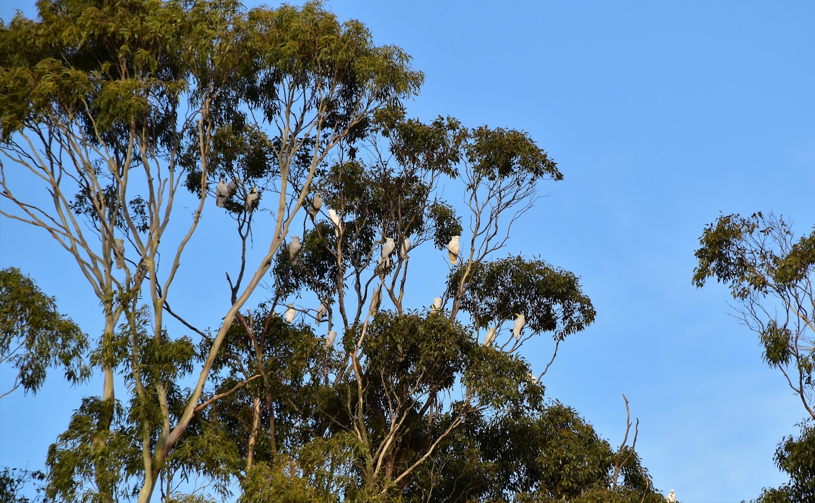
The Cockies were making a fair bit of racket this morning.
 |
Radiata Pines feature at both ends of the rail trail.
|
|
Eventually the track entered the native scrub of the Wombat State Forest and the walking improved immeasurably (well, that’s my opinion anyway). The forest along here is typical dry Eucalyptus, for the most part with a fairly open understory, although things do get a bit lusher where the track crosses the damper gullies. It was these gullies that were the second surprise of the walk, the track crossing a succession of creeks that all had good amounts of water in them, something that is not all that common in the dryer country to the north west of Melbourne in my experience (although the middle of winter is the optimal time for water I suppose!).
 |
Once into the Wombat State Forest the scenery on the Domino Trail improved a lot.
 |
The country was a lot damper than I remember from my last visit.
 |
The bridge over Blue Creek is a little un safe, the track crosses it on a newer bridge.
|
|
|
After crossing Doctors Creek, Blue Creek and Domino Creek the rail trail climbed gently to curve through a fairly high cutting before dropping down a bit to the historic trestle bridge at the Coliban River. With the bridge being fairly decrepit now days the track is re-routed to avoid the crossing and heads south for a few minutes to pick up a 4wd track that parallels the old railway, this short detour is the spot to get a half decent photo of the old trestle bridge. As with the other watercourses that I’d crossed today the Coliban River also had a decent flow of water in it, although a walkers bridge meant that I didn’t get my boots wet here today.
 |
The Manna Gums are a feature of the walk (I didn't see any Koala's though).
 |
Manna Gums.
 |
The Domino Trail clubs gently and passes through a long cutting after crossing Domino Creek.
|
|
|
Resuming my journey west after crossing the river I was almost immediately walking through the outskirts of Lyonville, the bush now giving way to rural land. I never got this far on my last walk along the Domino Trail so everything was new for me now. After passing through a low cutting the cleared section of the trail finished, I climbed a few steps and entered the quiet streets of Lyonville. The old railway use to go all the way across to Daylesford back in the day, I’ve actually featured a little bit of it before on a post about a walk I did at Musk years ago. Like Trentham it looks like Lyonville is in the process of being gentrified ( the big give-away being the Tesla recharging station outside the Radio Springs Hotel I think!). After a bit of a break at the small picnic ground and a poke around town checking out some of the old buildings it was time to start heading back.
 |
The track by passes the Coliban River Trestle Bridge.
 |
The Coliban River Trestle Bridge.
 |
Back in the rural land....approaching Lyonville.
 |
The Radio Springs Hotel at Lyonville. There are a couple of Tesla charging stations out the front, now that may not be remarkable to any of my friends from distant countries, however in Australia we still have a fair chunk of our population clinging to the belief that the internal combustion engine has a long and prosperous future.... It's funny but they are generally the same people that think it would be a good idea for the government to get into building new coal fire power plants.
 |
There seemed to be quite a few wind mills at Lyonsville, however despite an extensive 2 minutes on google I couldn't find any information about why.
|
|
|
|
|
My walk back to Trentham started off by retracing just over a kilometre of the rail trail until I was back on the eastern side of the Coliban River, once over the river I left the rail trail and followed a series of old 4wd tracks eastwards towards Trentham. Being a working forest (a more palatable euphemism for a forest where logging takes place) means that there is no shortage of un-signposted and sometimes un-mapped tracks heading off at tangents into the scrub along here, so I kept a fairly close eye on my maps. Actually not all the forest is a ‘working forest’ the rail trail actually mostly heads through a special protection zone that has been protected from logging, protection that was granted after the community protesting about proposed logging.
 |
Leaving Lyonville I checked out the old school....
 |
...and the old Nissen Huts.
 |
The old railway still has a few mile markers scattered along it...I'm guessing this one indicated that it was 67 miles to Melbourne?
 |
There is bridge over the Coliban River.
 |
Coliban River.
|
|
|
|
|
Eventually my 4wd track emerged onto a more substantial gravel road opposite some cleared land, following the gravel road for a few minutes I met up with a dedicated walking track heading off into the scrub on the right. If anyone ever follows in my foot steps then this turn needs to be watched for carefully, there is no sign post and the track isn’t overly obvious, the give-away is a small track marker nailed onto a tree a few metres off the road. The walking track crossed a damp gully and then climbed gently to parallel the rail trail for a few hundred metres before joining it for the last bit of my walk back into Trentham.
 |
Heading back through Wombat State Forest along the 4wd tracks.
 |
Domino Creek.
 |
Doctors Creek.
 |
A crisp and clear winters morning....life was pretty good!
|
|
|
|
Just before the old station there is a small factory on the left with a variety of castings, a virtual menagerie of wild animals. King Kong was well behaved but they had the cattle tied up…yes, you’ll have to check out my photo to know what I’m waffling on about. Back at the Trentham Station I spent a little while checking out the old rolling stock, there is something about these old relics from the past that brings a smile to my face…although that could be because I’m an old relic too!
 |
After following this gravel road for a few minutes I picked up this walking track...
 |
....there is a track marker here but you need to look closely.
 |
Spin it around 180˚ ;)
 |
I'm about to re-join the rail trail.
|
|
|
|
The Dirt.
According to my GPS I walked 14.6 kilometres and climbed 157 metres on this easy-medium grade stroll. It’s only really the distance that gets this walk above an easy rating I think, the route is pretty well level for the most part. I used the notes and map out of the House of Chapman’s book
Day Walks Melbourne book and they are all you really need to do this walk. That said I did carry the 2nd edition of the Meridian Wombat State Forest 1:50,000 topo map, mainly because I wasn’t sure how clear that the 4wd track section of the walk would be. This walk was a bit of a surprise for me, the bush was a lot more picturesque than I remember (particularly the Manna Gums and the creeks), Lyonville is a pretty little town and the Trentham Railway Station is a fascinating place to explore.
Relevant Posts.
Musk Walk, 2014.
Blue Mountain Walk, Wombat State Forest, 2019.
 |
| At least the cattle were tied up! |
 |
| The walk was over... it was now time to poke around the station for awhile. |
 |
| There is a good variety of rolling stock here. |
 |
| These old carriages were used for transporting cattle back in the day. |
 |
When I was the Feral Kid every goods train would have one of these Guards Vans at the back of the train...complete with a guard. I should of done these photos in sepia tone I think!
|


No comments:
Post a Comment