 |
| Pyrites Creek is not without it's charms. |
Cairns, not the north Queensland city but the stone variety. Cairns seem to perform a variety of functions in the bush, including but not limited to navigational aids, historical markers, marking high points and sometimes even decorative installations. For all the versatility that those piles of stones have, they also split the outdoor community. From my observations walkers are split into three camps when it comes to cairns. There is a fairly rabid, ‘kick ‘em all down - there should be no man made aids’ out in the bush (I always wonder how many of these type of hardcore bushies are kicking down cairns whilst clutching their high tech sat nav aids and standing on a man made walking track?). Then there is the overwhelming majority in the middle ground who, while not actually building any cairns don’t find them overly offensive…and just maybe find them useful to mark an obscure track junction occasionally. Thirdly there is another small group who can’t seem to resist building random piles of stones through out the bush.
 |
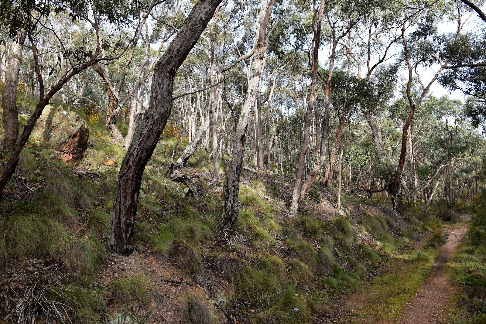
| Heading off - this section of Lerderderg State Park has a bit of a neglected feel to it. |
For anyone who is wondering I fall into the middle group when it come to cairns, I’m not out building them but have been relieved occasionally to spot one, especially in tricky navigational spots. So what’s all this waffling on about the pros and cons of cairns about? Well I’m glad you asked! You see navigation on this walk is a little tricky, with not a lot in the way of signposting or track markers (or even tracks) and fairly convoluted topography without many stand out geographical features. I did this walk around 8 years ago and remember giving up on trying to stay on the described route and just heading off piste on a compass bearing to find my way back to my ute, so on going back this morning I was a little non plussed to arrive at the first un-marked and un-signposted track junction to find the small rock cairn that use to mark the spot, kicked over.
 |
The walk starts with fairly easy climb up Antimony Mine Track.
 |
Early morning on Antimony Mine Track.
 |
I was looking for this old track heading off to the left....
 |
| There use to be a cairn here. |
|
|
|
Twenty minutes earlier I’d left the ute and set off climbing fairly easily up one of the few signposted tracks, the Antimony Mine Track. Initially this track climbs up beside some nice rural land before the bush closes in on both sides. Once past the rural land the track follows the crest of a wooded spur climbing towards the walks high point. The
go here is to pick the spot to leave the main track and head left down a lesser, slightly over grown track. With the cairn now kicked down here you need to keep an eye on the map and drop off to the left just before a high point. Once located the lesser track made for some nice walking as it dropped into a gully before starting a long descent down to Pyrites Creek.
 |
Early Spring is a good time to walk in these dry forests west of Melbourne.
 |
Dropping down towards the old Drapers Lode Antimony Mine.
|
|
There is an old 4wd track that follows the gully most of the way down to Pyrites Creek, crossing a very interesting wire mesh bridge and passing by the old Drapers Lode Antimony Mine along the way. After leaving the old mine site the 4wd track deteriorated a little into a rough walking pad, although with the gully here verging on being a gorge it meant that navigation wasn’t really an issue. After passing beneath some towering rocky bluffs my walking pad eventually faded away as I crossed the last grassy flat before I arrived at the gently trickling Pyrites Creek.
 |
Apparently the army, who used this area for training after WW2, built this bridge.
 |
It's a little hard to tell from the photo but I was at least 3 metres above the ground here.
 |
| It seems that it wouldn't be a Feral walk without a Grass Tree. |
 |
The old crusher plant at Drapers Lode Antimony Mine.
 |
The mine shaft has been partially sealed off.
 |
Heading down towards Pyrites Creek.
 |
| Dropping down towards Pyrite Creek the gully gets a bit gorge like. |
|
|
|
|
|
On reaching Pyrites Creek any semblance of a formal walking track was gone for awhile. Last time I did this walk I alternated between walking the dry creek bed and the adjacent, lightly wooded creek side flats. It turned out that there was a couple of issues with that plan this morning though, the first one being that the creek was actually flowing which meant that I’d have to get around some of the deeper pools. The second issue today was that the idyllic lightly wooded grassy flats beside the creek hads obviously had a big fire through them since my last visit, what was previously nice walking through mostly native scrub was now a scrub bash in spots through waist high thistles.
 |
Pyrites Creek had a trickle of water flowing between it's deeper pools today.
 |
I headed down stream, short cutting some of the creeks meanderings.
 |
Pyrites Creek
 |
| Climbing in and out of the creek wasn't always that easy. |
|
|
|
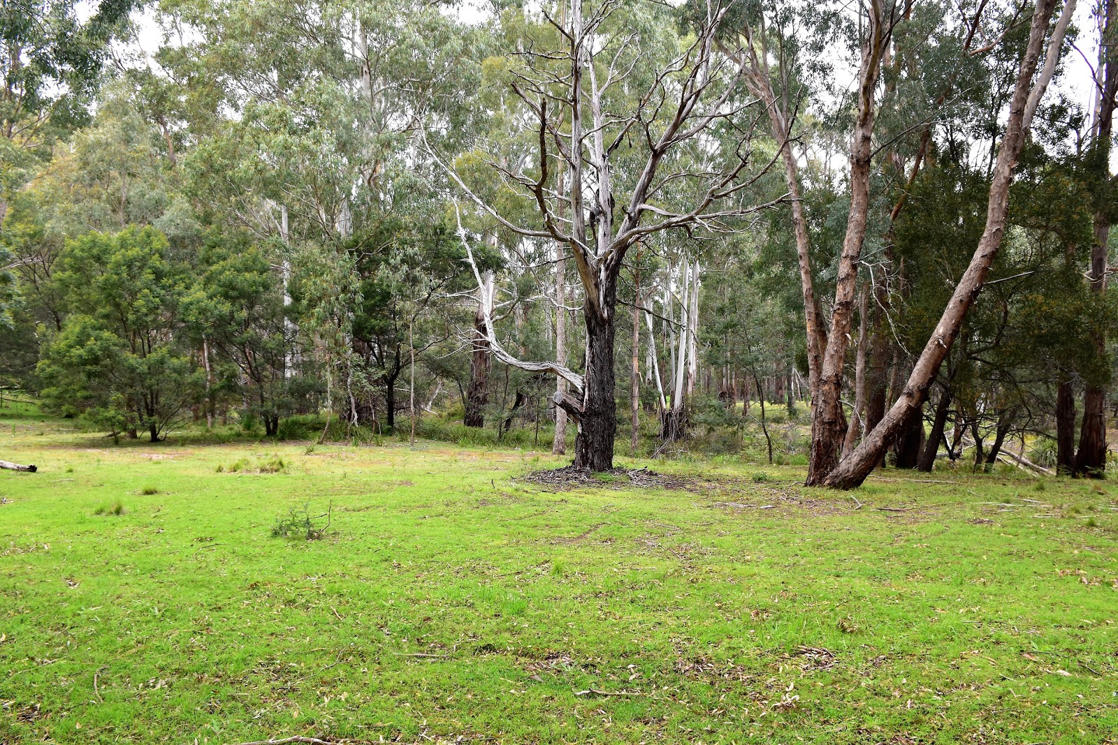
Apart from the thistles my walk down Pyrites Creek wasn’t too bad, well apart from the occasional shower of rain scudding through anyway. As I mentioned early the best way to progress down this valley is to short cut the creeks meanderings, heading across the creek flats and some times climbing across the bottoms of the spurs. So long as I kept a close eye on the map and another on the topography progress was fairly strait forward. Just over an hour after starting my creek side walk I arrive at a big grassy flat at the spot where Monument Gully and it’s fire track came in from the west. The gassy flats here would make a nice spot to camp if anyone wanted to make this walk into an over night stroll I think however for me today they were more important as a navigational aid.
 |
There were some deeper pools on some of the corners.
 |
The thistles were a pain in the arse...or shins actually.
 |
Pyrites Creek
 |
| Walking through the Kangaroo Grass was a lot more pleasant than the thistles. |
|
|
|
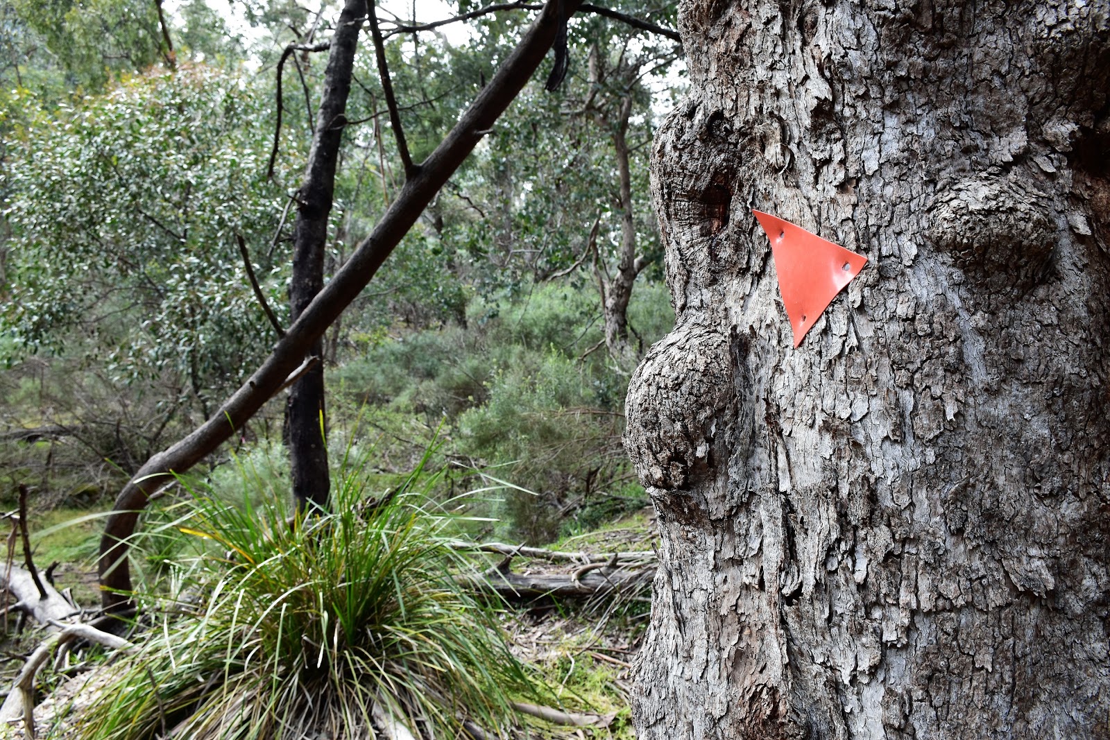
I was now looking for a small gully that climbed away from Pyrites Creek to the east, the gully is called Wobbly Gully and it’s critical to find it. Thankfully I knew that the gully headed off around 300 metres from Monument Gully, although finding that out once I’d already walked 800 metres from Monument Gully probably wasn’t ideal - yes I was keeping a close eye on my map and notes! After re-tracing my foot steps for a few hundred metres I found the fairly nondescript gully that I was looking for, there is actually a track marker here although you’ll struggle to see it unless you are walking the creek bed.
 |
After walking through a couple of light showers of rain the weather was now looking pretty good.
 |
I needed to be careful of old mine shafts when short cutting the ends in the creek.
 |
There is a nice grassy area where Monument Gully Track meets the creek.
 |
| If you reach this ancient old gum tree over hanging Pyrites Creek turn around....as like me you've gone too far! |
|
|
|
Once I’d identified Wobbly Gully I found the very occasional track marker and even had an intermittent pad to follow for awhile. This was the spot that I’d struggled to stay on the described walk all those years ago when I last walked here, Wobbly Gully being easy enough to follow but picking the spot to head into the hills was a problem on my last visit. So this morning I was concentrating furiously as I scrub bashed my way up the gully, determined to stay on track (so to speak). After passing through a couple of grassy clearings, passing an old campsite, picking the right gully at a couple of forks and avoiding a few old tracks heading into the dry hills I once again took another look at my map and notes and pretty quickly realised that I had no idea where I was.
 |
If you walk the creek bed from Monument Gully Track you'll be a chance of spotting this track marker for Wobbly Gully on the east bank.
 |
The old walking track has returned to nature...at least initially.
 |
I passed by the Nipple Tree?...
 |
| ....and through an old fence line. |
|
|
|
Well no idea is a bit melodramatic, I knew I was in Lerderderg State Park….somewhere! Vowing to myself that it would be a long time before my ample shadow would again grace this part of the park I stopped and had a closer look at my map. On my last walk here I’d ended up heading off piste until I intersected with a boundary fence which I then followed back to meet my outward route of Antimony Mine Track. That plan was going to be my fall back again today, although thankfully whilst trudging my way a bit further up Wobbly Gully looking for something resembling a spur that would take me in the right direction I came across a substantial, un-mapped fire track that was vaguely heading in the direction that I wanted to go.
 |
There are some very nice grassy flats in Wobbly Gully.
 |
| Wobbly Gully |
|
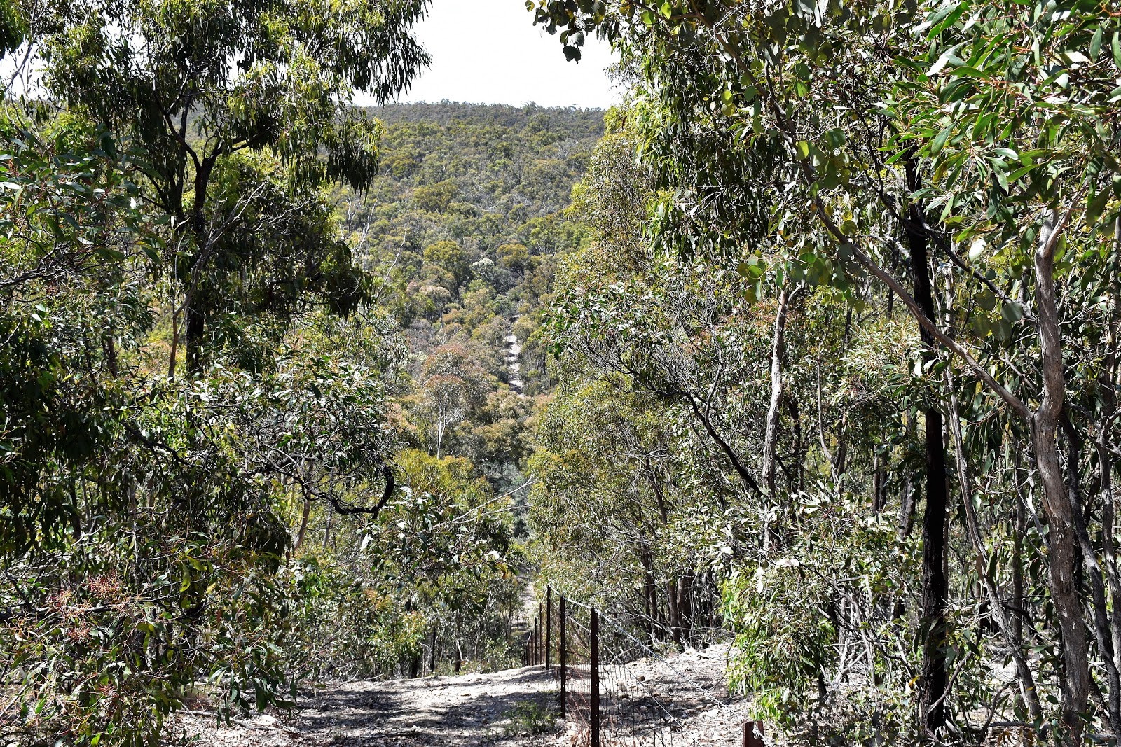
It only took a second decide that the fire track looked easier walking than heading across country on a bearing, so up it I went. Ironically now I was climbing into the dry open hills this mornings showers had largely passed my by and I was now walking under a warm sun. Everything went pretty good for awhile now as I climbed, we’ll until my climb topped out and I started a steep descent, hmm this wasn’t part of the plan. Still with the track still heading in vaguely the direction that I needed to go I continued on, plunging down the steep loose track into a valley. Once at the bottom of the descent the track track passed through a dilapidated old gate. Figuring that this old gate and fence line probably marked the boundary of the park I decided that, just like my early visit, I’d follow the fence line back to meet my outward route. To be honest that was about it for this walk as a followed a rough pad beside the fence for a couple of kilometres, before eventually emerging onto Antimony Mine Track. One thing about following this fence though is that while the navigation is easy enough the topography can be a little steep as the fence drops into and climbs out of a couple of decent sized gullies.
 |
This fire track headed in the basic direction that I needed to go and was a lot easier than scrub bashing through the hills.
 |
| Eventually my fire track met this boundary fence which I followed back to Antimony Mine Track - it wasn't a flat walk though! |
|
The Dirt.
I walked 16.3 kilometres and climbed 643 metres on this hard walk. The walk is only really hard due to the navigation involved really, physically it’s not a super hard walk I don’t think. This walk was written up in Mr Tempest’s book
Daywalks Around Victoria and if you’ve purchased the book he offers the GPS track as a download, I’m not a huge fan of just blindly following GPS tracks as it is a bit like walking by numbers to me, but….this place is super tricky to navigate through, once away from Pyrites Creek the topography is a jumble of medium sized, lightly timbered hills with little in the way of long range views which means that if you can’t find the described route you’ll have to work off a bearing. There is a boundary fence to the south of Wobbly Gully but getting to it may not be easy. As you may have guessed I’m not overly impressed with this section of Lerderderg State Park, fire damage, flood debris, erosion, weeds all knocked my Feral mojo around. On the glass half full side of things I suppose you could say that there is a bit of old mining history to check out, there are a couple of grassy flats that would make nice bush camps, oh yeah and if you do venture in here you probably won't be overrun with other walkers.
Relevant Posts.
Lerderderg East Walk, Lerderderg State Park, 2018.
The Old River, Lerderderg State Park, 2017.
 |
| Back on Antimony Mine Track and heading down to the ute. |
 |
| There's enough parking for around 6 vehicles at the start of the walk. |


No comments:
Post a Comment