 |
Not quite Monet, but all I could do this morning.
|
I did this little walk one Friday morning after finishing up a few hours at work. Over the previous couple of days at work we’d been suffering through mid thirty Celsius temperatures so it almost goes without saying that as soon as I finished up for the week the rain arrived. As I pulled up at the start of the walk I sat in the ute for thirty minutes listening to the radio while waiting for the thunderstorms to pass me by. Luckily for me I’d decided on a very easy suburban parkland walk for today, so a bit of rain wasn’t going to worry me too much. With the thunder moving off into the distance and the rain easing off a bit I grabbed my pack, re-set he GPS and set off.
 |
Sitting in the ute waiting for the storm to pass through - yes I'm hardcore!
|
I started this stroll near the corner of Lakeview Drive and Hull Road setting off towards Lilydale Lake along Olinda Creek. I didn't pack my waterproof camera when I set off for work at 5am this morning as the ambient temperature was still in the mid twenties Celsius at that stage of the day, rain was the last thing on my mind. Not having my waterproof camera meant that initially I was only pulling my DSLR out of it’s dry bag for the briefest of times. After crossing a bridge my track stayed between Olinda Creek to my right and the Hull Road Wetlands to my left as I sloshed my way north.
 |
Reaching the dubious shelter of some trees I dug the DSLR out for a photo.
 |
Entering the Hull Road Wetlands.
 |
Olinda Creek
|
|
|
Now I have to mention this was another of those walks where I was making it up as I went along to a certain degree, I’d done zero research on-line and my mud map was 18 years old, still with this walk being decidedly suburban there was little chance of things going too pear shaped. After ten minutes or so my track started to skirt around the the last of the Hull Road Wetlands and I climbed away from Olinda Creek to emerge onto a waterlogged Bellbird Drive - a suburban road. With the rain still coming down I was reluctant to pull my old map out so I just kept heading towards the lake. After another ten minutes or so I came to a track that dropped back down and crossed Olinda Creek, figuring that it was probably going to go in the general direction that I wanted to go I dropped down and crossed the creek. Once across the creek I turned left, passed through a big carpark and started to walk around another wetlands, this time in Bellbird Park.
 |
Bellbird Drive
 |
There is a variety of different sign posts along the length of this walk.
|
|
Thankfully the rain that had accompanied my so far more or less stopped now and I was just walking beneath some gun metal grey skies. After a few minutes I picked a series of boardwalks that crossed the wetlands and continued my meandering walk, arriving at the almost deserted Lilydale Lake soon after. Lilydale Lake is a very popular spot - normally, although on this cold, wet and miserable weekday morning crowds weren’t going to be an issue for me. Arriving at the lake I had to make another tough navigational choice, a clockwise or anti clockwise circuit of the lake, with my old notes suggesting that clockwise was the go that was the direction that I headed.
 |
I crossed over these wetlands on a long series of boardwalks.
 |
Bellbird Park Wetlands
 |
Dropping down to arrive at the lake - I wasn't battling the crowds this morning!
 |
Arriving lakeside I was looking for something to photograph.
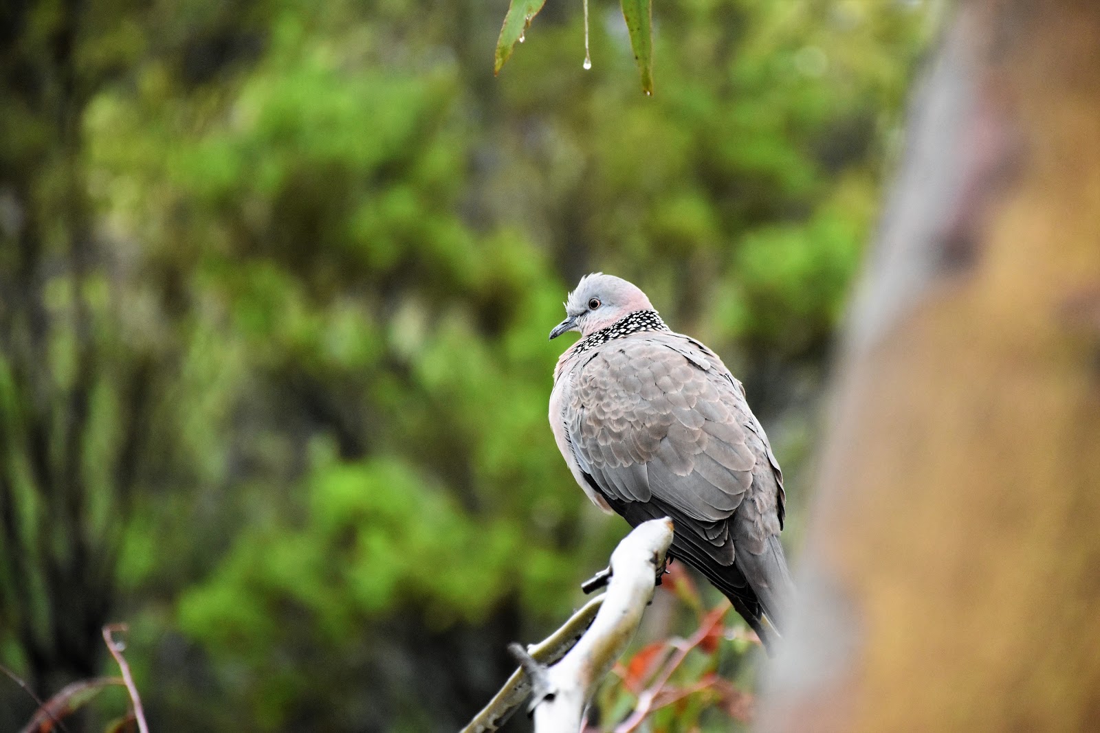
 |
Thankfully there is a lot of birdlife around here.
|
|
|
|
|
I was now walking what is a 'get fit' circuit for the locals I’m guessing, although today I only met one jogger out braving the weather. The path around the lake is one of those substantial crushed granite jobs so it made for very easy walking as I first passed between some more wetlands and the lake before heading across the big day use picnic area. The main interest now for me were the substantial numbers of water birds, I’m guessing that the native birds were probably enjoying the fact that three weren’t too many humans (and their dogs) around today. After passing through the day use area it was only a few minutes before my path led me to the dam wall and the old Cashin Brothers Flour Mill Ruins, the old ruins actually pre date Lilydale having been built back in the 1850’s when the area was used for wheat cropping. Apart from being a good spot to check out the ruins the Lilydale Lake dam wall is arguably the best spot for a view, with the lake framed by Mt Dandenong in the distance (or is it Mt Dandenong framed by the lake?).
 |
My route passed between those wetland and the lake....
 |
...before crossing Olinda Creek...
 |
....and arriving at the Lilydale Lake day use area.
 |
The beach was a little busy.
 |
Lilydale Lake
 |
The Cashin Brothers Flour Mills Ruins.
 |
Arguably the best view of the day....looking out over Lilydale Lake from the dam wall, with Mt Dandenong in the distance.
|
|
|
|
|
|
|
Once over the lake wall I kept turning left until I eventually arrived back at my outward route. Heading back towards the ute I took a more direct westerly route that mostly avoided the wetland meandering. With the rain now stopped I was able to get a couple of nice photos down into the corridor of native bush that lines Olinda Creek from Bellbird Drive so the distinctly suburban section of the walk back was actually pretty good. Leaving Bellbird Drive I found myself back in the Hull Road Wetland and my mornings walk was as good as over. While this walk wasn’t an epic it did allow me to stretch my legs a little and de-stress after another hard week at work, not a bad outcome really.
 |
Lilydale Lake
 |
This bloke was keen to strike a pose for me.
 |
Lilydale Lake
 |
I walked this substantial crush granite path around Lilydale Lake.
 |
The view off Bellbird Drive down to the native bush lined Olinda Creek was a pleasant one.
|
|
|
|
|
The Dirt.
I walked 6.1 kilometres and climbed 30 metres on this easy stroll. This is one of those walks that would be suitable for wheelchairs or strollers I think. Being a Feral walk I was pretty relaxed when it came to researching this walk, I just grabbed my copy of Tyrone Thomas’ old book
40 Bushland & Park Walks In Metropolitan Melbourne and used the mud map from the book. whilst writing up this walk I’ve discovered that there is an abundance of information online, although I think the Yarra Ranges Council map is probably the only thing you need…even the relevant Melways page will get people through this one safely.
Relevant Posts.
Mt Lofty Walk, Warrandyte State Park, 2017.
Mt Dandenong Walk, Dandenong Ranges National Park, 2018.
 |
| The mornings rain had freshened the bush up a little after a few days of hot weather. |
 |
| There's an old weir on Olinda Creek that you can see from Bellbird Drive. |
 |
| Olinda Creek from Bellbird Drive. |
 |
| Back in the Hull Road Wetlands. |
 |
| Approaching Lakeview Drive, my walk was pretty well over. |


No comments:
Post a Comment