 |
| Kilcarnup Beach.....wow! |
I think I made the right call staying in accommodation again last night in Gracetown. I’d arrived last night looking very weather beaten, however after a good nights sleep, a decent feed, lots of rehydration and sitting in the spa filled with cold water, I woke up this morning feeling pretty good. With today promising to be the hottest day of my walk so far I was pretty keen to head off bright and early again, although with the shuttle back to town starting at 8am it wasn’t quite as early as I’d liked. Having said that I couldn’t really whinge as the people at the Gracetown Caravan Park provide an excellent service for C2C walkers, they certainly looked after me above and beyond my expectations.
 |
| After getting dropped off back down at the Gracetown boat ramp in Cowaramup Bay, I was on my way south again. |
It was around 8:30am when I got back to the Gacetown boat ramp this morning and resumed my C2C journey. First up this morning had to find my way through Gracetown, it’s generally when these longer tracks pass through towns that make for the hardest navigation I’ve found and the C2C is no different in that respect. After making my way along the sand of Cowaramup Bay, clambering over some rocks and passing some early morning sun bathers, I left the beach and climbed up into town. The go along here is to head along the streets towards Huzzus carpark, once at Huzzus carpark I started to see the occasional C2C track marker again.
 |
I walked the sand of Cowaramup Bay first up today.
 |
| When the sand ended I climbed up to Huzzas carpark. |
|
Leaving Huzzus car park I followed the wide tourist walk out onto Cowaramup Point. Not only are there some beautiful lookouts along this stretch but there is also a touching memorial to the 9 people that died here when the cliff collapsed during a surfing competition back in 1996. Nearing the end of Cowaramup Point the walking got harder again as the C2C track cut across some bare sand blows before once agin emerging on the coast and resuming it’s journey south. This section of the C2C passes by a series of great surf breaks, Big Rock, Left Handers, The Womb and Ellensbrook being some of the named ones, the locals no doubt knowing the names of the many others that I trudged past.
 |
Heading out towards Cowaramup Point I shuffled past the Gracetown Tragedy Memorial.
 |
This was one of those events that is etched into my memory.
 |
| The C2C heads across this limestone plateau behind Cowaramup Point. |
|
|
Once I was heading south again the C2C stayed on the cliff tops until Ellensbrook, around 5 kilometres away. There is a choice along this stretch of the coast though, it is possible to walk the beach down to Ellensbrook as well. While the cliffs are arguably more scenic and slightly easier than ploughing along the sand they still make for fairly hard walking as the soft sandy track rises and falls quite a bit on the journey south. Reaching Ellensbrook Beach the C2C suddenly left the coast that had been my constant companion for the last 3 days and headed inland.
 |
Heading south down the coast towards Ellensbrook.
 |
The C2C stays on the cliff tops on the journey down to Ellensbrook.
 |
Left Handers
 |
Approaching Ellensbrook the coastline gets pretty rocky again.
 |
| The C2C near Ellensbrook. |
|
|
|
|
I’d been dreading these spots where the C2C heads inland for awhile, it was one thing to trudge along the soft sand near the coast where I’d generally been picking up some kind of cooling breeze off the ocean, it was another thing altogether to head into the hills away from the cooling sea breezes. Heading inland the C2C now followed the valley of Ellen Brook, first past the historic Homestead of the same name before following a paved tourist walk to Meekadarabee Cave. The walk up to Meekadarabee Cave was actually a pretty good one, with the damp valley supporting some bigger trees and lush vegetation it was a bit cooler than I’d expected here.
 |
The historic Ellensbrook Homestead.
 |
The C2C heads inland up the Ellen Brook Valley.
 |
| It's a paved track all the way from Ellensbrook Homestead to Meekadarabee Cave. |
|
|
With lots of cool clear water cascading out of it and plenty of shade Meekadarabee Cave made for a nice spot for an extended break this morning. If I wanted to get to Prevelly this afternoon though I figured that I’d better head off again, so with some reluctance I pulled on my sweaty gear again and shuffled on up the valley. Almost as soon as I’d left the cave the temperature ramped up though, soon after I shuffled passed the Ellensbrooke Campsite (toilets and tanks) I left the valley and started a steep, soft climb up a very hot 4wd track, the hard work had begun.
 |
It's a fairly average photo of Meekadarabee Cave however it was the best I could do without jumping the fence.
 |
There is good reliable water here... this was the only natural water that I got on the C2C that I didn't treat.
 |
Yep, I've said it before only the most flattering photos go up on my blog. I'm resting in the shade at Meekadarabee Cave before I head up onto the heathland.
 |
Leaving Meekadarabee Cave I was on the sand again.
 |
The Ellensbrook Camp is just down the hill.
 |
| Leaving the Ellen Brook Valley the degree of difficulty ramped up a bit. |
|
|
|
|
|
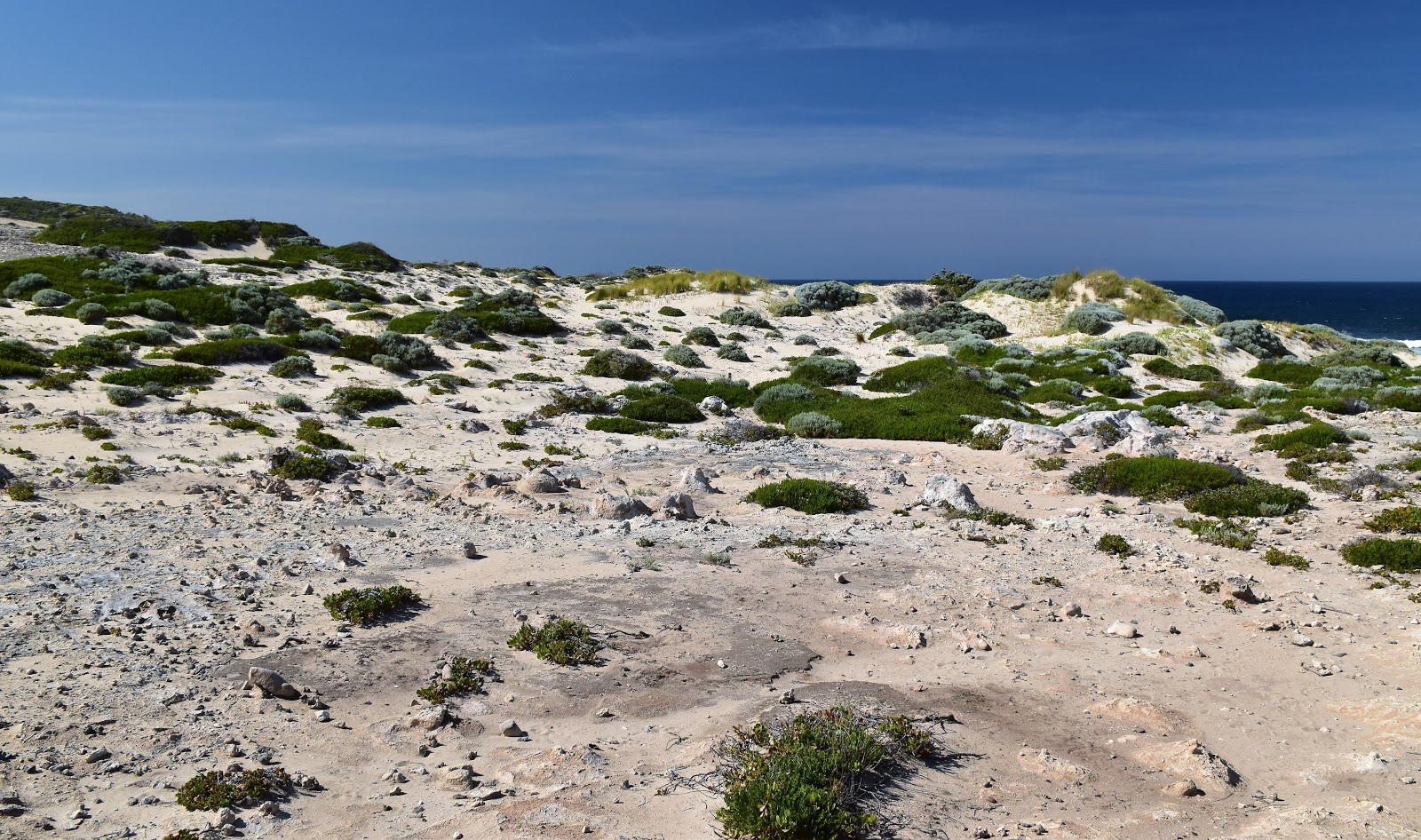
Now looking at my map I’d figured that I would of been traipsing around the hills on a series of old, sandy 4wd tracks and initially at least that was true. After meandering around awhile on the old 4wd tracks though the C2C branched off onto what looked like a reasonably new section of walking track. The walking track now wound its way around the coastal hills, contouring for the most part it meant that the walking was a lot better than I’d feared, with views out over the turquoise water of the Indian Ocean framed by the green coastal heath things were pretty good. Probably the highlight of this section was where the track weaved it’s way through a collection of limestone pinnacles that are standing like white sentinels on the hill side.
 |
My big inland detour was actually a lot better than I'd feared it might of been.
 |
There are some interesting limestone pinnacles along this inland section....
 |
| ....although the limestone can make for rough walking sometimes. |
|
|
Still after around 6.5 kilometres away from the coastline I was pretty happy to once again emerge from the scrub beside the ocean, even better news was that just down the beach was the distinctive limestone outcrop of Joeys Nose, whose nose I was now going to shelter under while I had lunch. I was now going to be walking the blinding white sands of Kilcarnup Beach south, most of the way to Prevelly. After a nice relaxing lunch I strode out (well shuffled really) onto the firm white sand and started my journey south along the beach….for around 5 minutes before I arrived at a beautiful little cove…it was time for a swim!
 |
Dropping down to Joeys Nose.
 |
I was able to pick up some welcome shade beneath Joeys Nose while eating my lunch.
 |
Eating lunch with a thousand tonnes of rock hanging over my head.
 |
I was going to be walking the length of Kilcarnup Beach....but first it was time for a swim.
 |
Kilcarnup Beach
 |
My kind of walking!
 |
| Kilcarnup Beach |
 |
| The beautiful white sand of Kilcarnup Beach.... I was concentrating furiously to make sure I didn't stray into pay per view territory with this selfie! |
|
|
|
|
|
|
Suitably refreshed after my swim I once again cleaned the sand off and pulled on my sweaty gear to continue my walk south along Kilcarnup Beach, although this time I didn’t even bother with boots. The beach made for surprisingly easy walking this afternoon and it wasn’t long at all before I spied the 4wd track that would be my exit from the end of the beach in the distance. I think the highlight of his section was probably wading in the shallows near the end of the beach as a Stingray cruised up and down the gutter looking for a feed, that was pretty sweet.
 |
Kilcarnup Beach was one of the better ones for walking with fairly firm sand.
 |
Kilcarnup Beach
 |
Kilcarnup Beach
 |
| There was a Stingray cruising the gutter at the southern end of Kilcarnup Beach. |
|
|
|
Climbing away from Kilcarnup Beach, now with boots back on, I initially followed a soft sandy 4wd track (surprise, surprise!) before branching off onto a stunning section of walking track. The walking track climbing over Cape Mentelle and giving me one view after another down into yet another stunning deserted cove. It didn’t seem that long and the mouth of Margaret River came into view infront of me, my days walk was almost over and it was only early afternoon - how good is this walking caper hey! Dropping down off Cape Mentelle I crossed over the sandbar blocking Margaret River from the ocean, wandered up the inlet a few minutes, dropped the pack and jumped in for another swim.
 |
Cape Mentelle
 |
The C2C heads around the cliff tops of Cape Mentelle...
 |
.... before dropping down to cross the Margaret River mouth.
 |
| Margaret River |
|
|
|
Margaret River enters the Indian Ocean at Prevelly so in theory my days walking was pretty well over, I just had to make it to the caravan park, how hard could that be? Yeah, well remember that this is a Feral walk…Now I knew that the caravan park was on Mitchell Drive, I even had a number, glancing at my GPS I worked out the quickest way to Mitchell Drive, all sweet. Arriving somewhere onto the middle of Mitchell Drive I checked the street numbers…. they were getting higher heading south so that’s the way I trudged in my thongs( remember I’d just been swimming) in the mid afternoon heat. After trudging along the hot footpath for 15 minutes heading south I encountered a problem, Mitchell Drive ended and I still hadn’t reached the caravan park…wtf! Pulling out my phone I fired it up, happy to have service I did a bit of googling and found that the caravan park was around 50 metres from the spot I’d initially emerged onto Mitchell Road - in the opposite direction! So I was a now a grumpy Feral walker who shuffled his way back along the baking hot mid afternoon streets of Prevelly, arriving at the caravan park after an extra couple of kilometres walking in the heat - like I said how good is this walking caper hey!
 |
The Margaret River was all the excuse I needed to strip off for another swim.
 |
Soaking in the tepid water of Margaret River at the end of another hard day:)
 |
| The Margaret River Yowie. |
|
|
I’d managed to secure an old renovated cabin at the Prevelley Caravan Park, these old fibro shacks are what you might class as the cheap and cheerful option - well cheerful anyway as with the going rate well north of $100 a night they weren’t that cheap. It was all about location here though with the shacks featuring glimpses of the shimmering Indian Ocean as well as being within a short stagger of the local shop and the café next door. My shack had a telly, a shower and a double bed, along with a verandah to die for. Air conditioning consisted of opening the front and back door to let the sea breeze blow through, although even on this unusually warm day that was enough to keep the temperature under control.
 |
Looking back down to the Margaret River Mouth Beach as I climbed up to Prevelly.
 |
Prevelly
 |
| There is a bit of public art around here. |
|
|
The Dirt.
I walked 22.5 kilometres today and climbed 401 metres on what I’d call a medium grade days walking. Over the 4 days of my C2C walk so far I’ve walked 94.2 kilometres and climbed 2,392 metres. Water was available in Gracetown, Meekadarabee Cave and the Ellensbrook Campsite (tanks). Accommodation is available in Prevelly, camping is at the Ellensbrook Campsite or Prevelly Caravan Park. The walking today was better than I’d feared it might of been, particularly the inland section. Kilcarmup Beach is stunning. I used the maps and notes out of the 8th edition of the Cape to Cape Guidebook by Jane Scott & Ray Forma as well as my GPS topo maps.
Relevant Posts.
Day 3, Cape to Cape Track, Leeuwin Naturaliste National Park, 2019.
 |
| I followed this track down to Mitchell Drive and turned right... I should of turned left! |
 |
| My fibro shack at the Prevelly Caravan Park was actually a really nice spot. |
 |
| My shack at the Prevelly Caravan Park was basic but comfortable. |


If you do it in spring or winter, you get to walk some distance inland because the river mouth is open. Prevelly is a lovely little town, although I thought that a dog was going to attack me. It was also the end of my walk, as I had walked for most of a day with sand in my shoe and ended up with a very impressive blister.
ReplyDelete