
High above Paddys Lake... yes, it was one of those days.
An early start was called for this morning as I still had a long walk before I got to my nights camp. There had been showers off and on overnight, however looking towards Black Bluff this morning I could see that the mountain was still covered in cloud. Setting off I clung to the hope that while I climbed the 800 metres the cloud would burn off. The climb up Brookes Track to Paddys Lake was a nice walk on a well graded track however when I broke out of the tree line just below Paddys Lake I knew I'd be in for a long day. The wind up here was blowing the rain horizontally and Paddys Lake was covered in white caps. Paddys Lake is one of the camping spots along the Black Bluff Range although in conditions like I had this morning then it wouldn't be a pleasant place to pitch a tent.

The PCT passed right by the front gate of my nights accommodation.

I crossed the River Leven first up this morning.

I was hoping that things would improve by the time I got up there.

Check out my hi tech phone.

I was still hoping that I might get lucky with the weather.
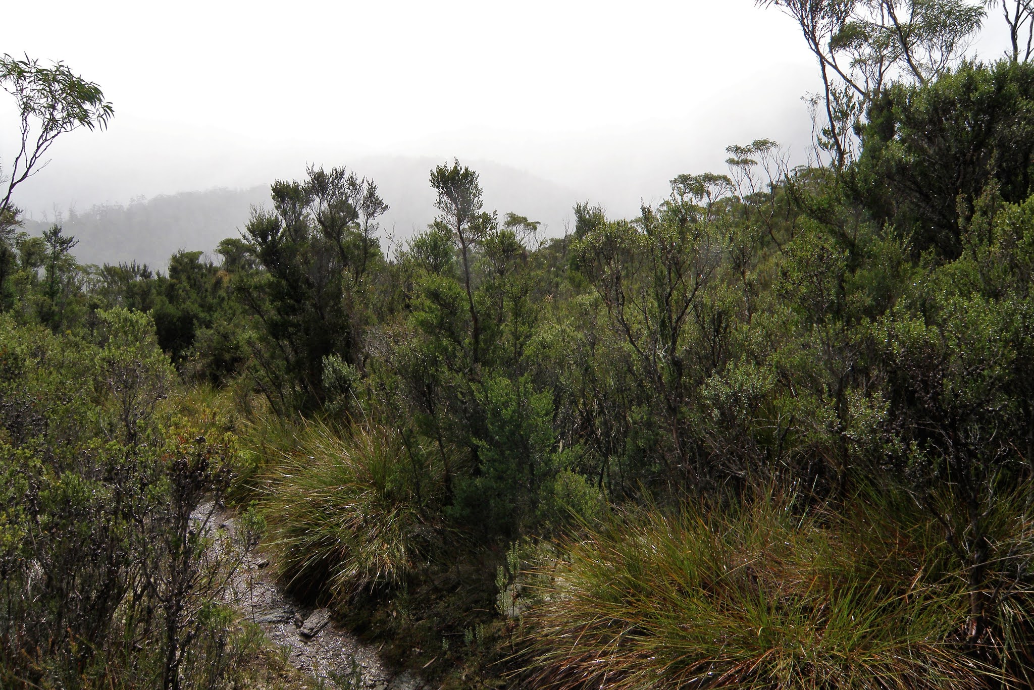
The climb up onto the Black Bluff Range was a pretty good one really.

Paddys Lake... it was about now that I realised I was I for a long day!

Surfs up on Paddys Lake!
Leaving Paddys Lake the side trip to Black Bluff was quickly ruled out and I set about getting across the Black Bluff Range. The PCT across the tops is staked and the visibility was OK, so I just kept my head down and ticked off the kilometres. About 30 minutes after leaving Paddys Lake I was at Duff Creek where I grabbed a drink and some food, just before arriving there I had crossed over the highest point on the track at just over 1200m. The tops are fairly flat however walking is still slower than normal due to having to push through low alpine scrub along with the occasional boggy sections, still with nothing in the way of any views on offer I was making pretty good progress.

The PCT climbing onto the Black Bluff Range.
Two kilometres after crossing Duff Creek I gained the crest of the range, which I would more or less follow all the way to Bare Mountain Camp. The crest provided slightly easier walking but slightly worse weather however I was still making reasonable time and I dropped down to Bare Mountain Camp in the early afternoon. Bare Mountain Camp was surprisingly sheltered considering it is situated just off the main ridge in a shallow valley. Safely out of the worst of the wind and rain I had some sustenance, texted Sam, filled in the log book, and considered my options. I was aiming for Fourways Camp which was going to be easily achieved in daylight, however I was getting a bit sick of the weather. I decided to walk to the West Coast Link Road and then make a decision whether to hitch to Cradle Mountain or keep walking.

The PCT on Black Bluff Range.
The walk to Prospect Mountain and along the ridge would normally provide great views of the Vale of Belvoir and the Vale River however all I could see was mist, it made for an atmospheric walk I suppose. Around 1hour after leaving Bare Mountain Camp, Belvoir Lookout materialised out of the gloom and I was at the West Coast Link Road. The rain seemed to get heavier as I reached the road, so my mind was made up for me, I would hitch into Cradle Mountain. So off I trudged in the direction of Cradle Mountain. I must have made a fairly forlorn sight walking along the road in my wet weather gear, muddy and wet, I had to walk at least 4 kilometres before someone took pity on me and offered me a lift although to be fair there wasn't a lot of traffic up here this afternoon, I probably only had a handful of vehicles pass me before someone stopped. Once safe and warm in the car it was only few minutes later I was at Cradle Mountain Camp ground.

Bare Mountain Camp offers a modicum of shelter along the exposed Black Bluff Range.
After organising a cabin I picked up my food drop and walked down to the information centre to pick up my permit for the Overland Track - which would be my on going journey. On the way back to the cabin I grabbed a pizza and then retired to my cabin to have a shower and re-organise my gear for tomorrow. As I dried my gear in front of the heater the rain continued, surely the weather would turn soon.

Climbing away from Bare Mountain Camp on the PCT... It was around now that I decided to head for Cradle Valley tonight and get out of the weather.
The Dirt.
I walked 19 kilometres today and climbed around 1150 metres on another hard days walking. Water was available fairly frequently on today's walk. Camping is normally at Paddys Lake and Bare Mountain however both sites are pretty exposed to the elements. The PCT itself is also a very exposed walk across the top of the Black Bluff Range. I walked 68.7 kilometres and climbed 2980 metres on what was a fairly hard walk on the PCT.
While I didn't manage to complete the whole PCT this time I walked enough of the track to get a fair idea of what it's about. The track makes for an interesting way to approach Cradle Valley and the Overland Track if you have got a bit of time and experience on your side I think. I'm actually planning on heading back down in the next couple of years (Corona Virus depending?) and walking the whole Penguin to Lake St Clair route again, this time taking a bit more time (and a better camera!). For this walk I used the House of Chapmans notes and maps out of their Cradle Mountain Lake St Clair & Walls of Jerusalem National Parks book as well as some on line stuff from the North West Walking Club who maintain the track.
Relevant Posts.


No comments:
Post a Comment