
I got some welcome shade at my turn around point beneath the Point Lonsdale Jetty.

The coastal scenery on this stroll is top notch.

I started off by crossing over the Barwon River.

Barwon Bluff
By the time I set off this morning it was already after 10am, however with low tide still quite a few hours away I wasn't overly keen to be slogging along the soft sand near the high tide line any earlier. I'd parked the ute on the Barwon Heads side of the Barwon River so my walk started of crossing the river on the long pedestrian bridge. Once across the bridge it was just a matter of dropping onto the sand and following the beach east for the next three hours. Initially the beach was pretty crowded with people this morning as I shuffled my way east towards the Ocean Grove Surf Lifesaving Club, although once passed Ocean Grove the people thinned out a fair bit and I found myself just sharing the sand with the occasional more determined walker.

Once on the sand I just turned left...

... and kept walking until I reached that lighthouse.

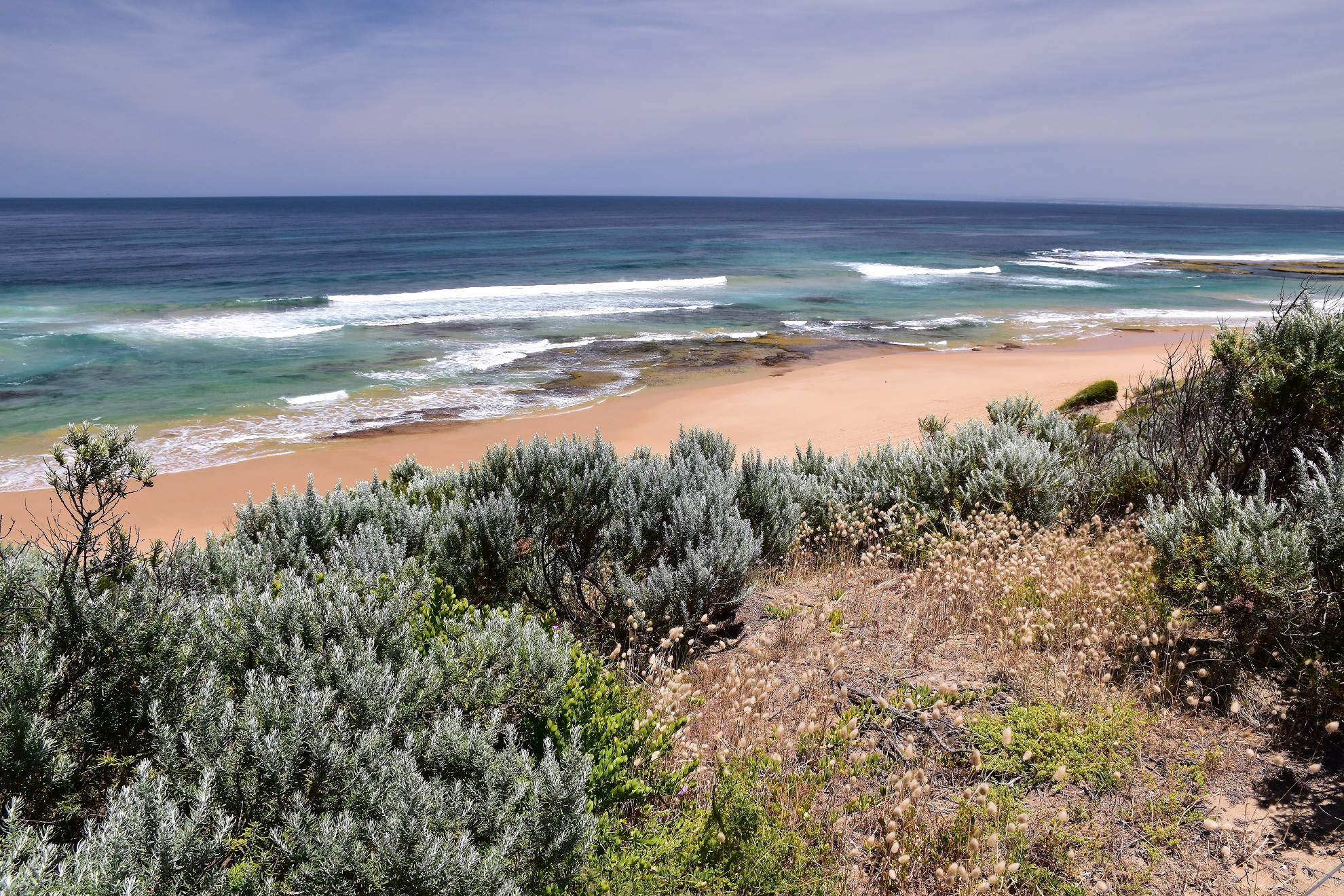
Looking back towards Barwon Bluff and Sandy Point.

Passing by the old retaining fence just before Ocean Grove.

Barwon Bluff is getting a little further away now.

I'd definitely jagged a great day for this walk.
Even though I was trudging along dealing with a middling tide the going was pretty good today, this beach features fairly firm sand and even walking near the high tide line it wasn't super hard. So anyway it wasn't really the sand that was slowing me down today but more the fact that I was just stopping to take a lot of photos and soaking up the wide open spaces after so long being locked up at home this year. The good (?) thing about this walk is that the turn around spot at the Point Lonsdale Lighthouse is in view for the whole distance and I was happy enough to see it getting closer and closer now. With some nautical navigational markers appearing as well as the occasional beach goer on the sand it meant that I'd arrived at the Point Lonsdale Back Beach, and less than 15 minutes later I meandered my way around Point Lonsdale.

Leaving Ocean Grove I left civilisation behind for a couple of hours.

In this Corona blighted year there wasn't as many ships as normal heading through the Port Phillip Bay Heads today.

I've missed these wide open spaces a lot during my lockdown.

Bass Strait was looking it's usual rough self - you could swim anywhere along the length of this walk however you'd really need to be a very good swimmer though.

The beach between Ocean Grove and Point Lonsdale Back Beach is mostly backed by coastal dunes.

The tide was a fair way out by now.

Point Lonsdale Back Beach was getting close now.

Approaching Point Lonsdale the navigational markers started.

Point Lonsdale Lighthouse.

Buckleys Cave (behind the grate below the lighthouse). It is thought William Buckley stayed here for awhile on his time on the run living with the local indigenous people in the early 1800's.

There are some extensive tidal rock shelves around Point Lonsdale that are good to explore around low tide.

The Point Lonsdale Jetty has just come into view.

Looking across The Rip towards Point Nepean.

Point Lonsdale.

The view of The Rip (Port Phillip Bay Heads) from the Point Lonsdale Lighthouse.

The view out to Bass Strait from one of the old fortifications at Point Lonsdale.

Point Nepean from Point Lonsdale.

Queenscliff from Point Lonsdale.

I followed the cliff top track back towards Point Lonsdale Back Beach.

Looking back towards Barwon Bluff - time for lunch I think.

There are a lot of these fortifications around Point Lonsdale.
Point Lonsdale Back Beach - my lunch view was sorted!

Hitting the sand again I turned right ...and kept walking.

What's that old bloke with the big camera looking at?

More of the reefs were exposed on the return walk.

Good times...


I wasn't totally alone on this remote middle section.

Looking out towards Bass Strait.

Easy and scenic low tide walking.
Once again the increasing numbers of beach goers spread out on the sand signalled my imminent arrival at the Ocean Grove Surf Club and I was soon weaving my way along dodging games of beach cricket and people learning to surf. Whereas I'd had the Point Lonsdale Lighthouse to guide me on my walk east on my journey back I had the looming bulk of Barwon Bluff to guide me home. After negotiating the beach crowds at Ocean Grove I only had another 30 minutes of shuffling along the sand before I arrived back at Barwon Heads at the spot where the Barwon River enters Bass Strait, my walk was almost over. Trudging across the soft sand I climbed up onto the pedestrian bridge again and crossed back over the river back to the ute. It was now time to head home, my journey around Port Phillip Bay back to Chateau Feral done with that euphoric feeling that I get after finishing a good walk... a feeling that I'd been missing for so many months this year.

Coastal Dunes between Point Lonsdale and Ocean Grove.

Hmm, I must be getting close to Ocean Grove Surf Club again.

Ocean Grove Beach.

Ocean Grove Beach with Barwon Bluff in the distance.

Ocean Grove Beach.
According to my GPS I walked around 24 kilometres and climbed around 150 metres (seems optimistic!) on what I'd call a medium-hard grade stroll. This walk has virtually no shelter along the length of it and the sand can be surprisingly hard on your feet - I know mine were feeling it by the time I got back to the ute. I used the House of Chapman's notes and map out of the Day Walks Melbourne book along with my GPS topos, you really couldn't go too far wrong on this stroll though. Barwon Heads can get very busy on weekends in the warmer weather so parking could be an issue if you start late like I did.
Relevant Posts.

Looking across the Barwon River to Barwon Bluff.

The Barwon River Bridge has just come into view.

Looking back over my shoulder as I leave the sand for the last time.

The Barwon River flowing out to Bass Strait... it was time to head home.


No comments:
Post a Comment