It's a wild old spot down on Macks Creek.
Looking for a bit of a socially distanced walk today my mind wandered over to the Grand Strzelecki Track. Last time I'd walked a loop of this track over Mt Tassie I didn't see another walker for the whole day. Wanting a different loop today I decided that the Macks Creek Loop might be the go, and after consulting the Grand Strzelecki Track website and seeing that my other option, the Tarra Valley Loop was closed due to some logging in the area, my mind was made up. With a decent amount of rain predicted to come through in the late morning I was parked up at the Tarra-Bulga National Park Visitor Centre in Balook and on my way by around 6:30am this morning.
Seven and a half hours later when I returned the temperature had climbed to 9˚!
The Yarra-Bulga National Park Visitor Centre was deserted when I set off this morning.
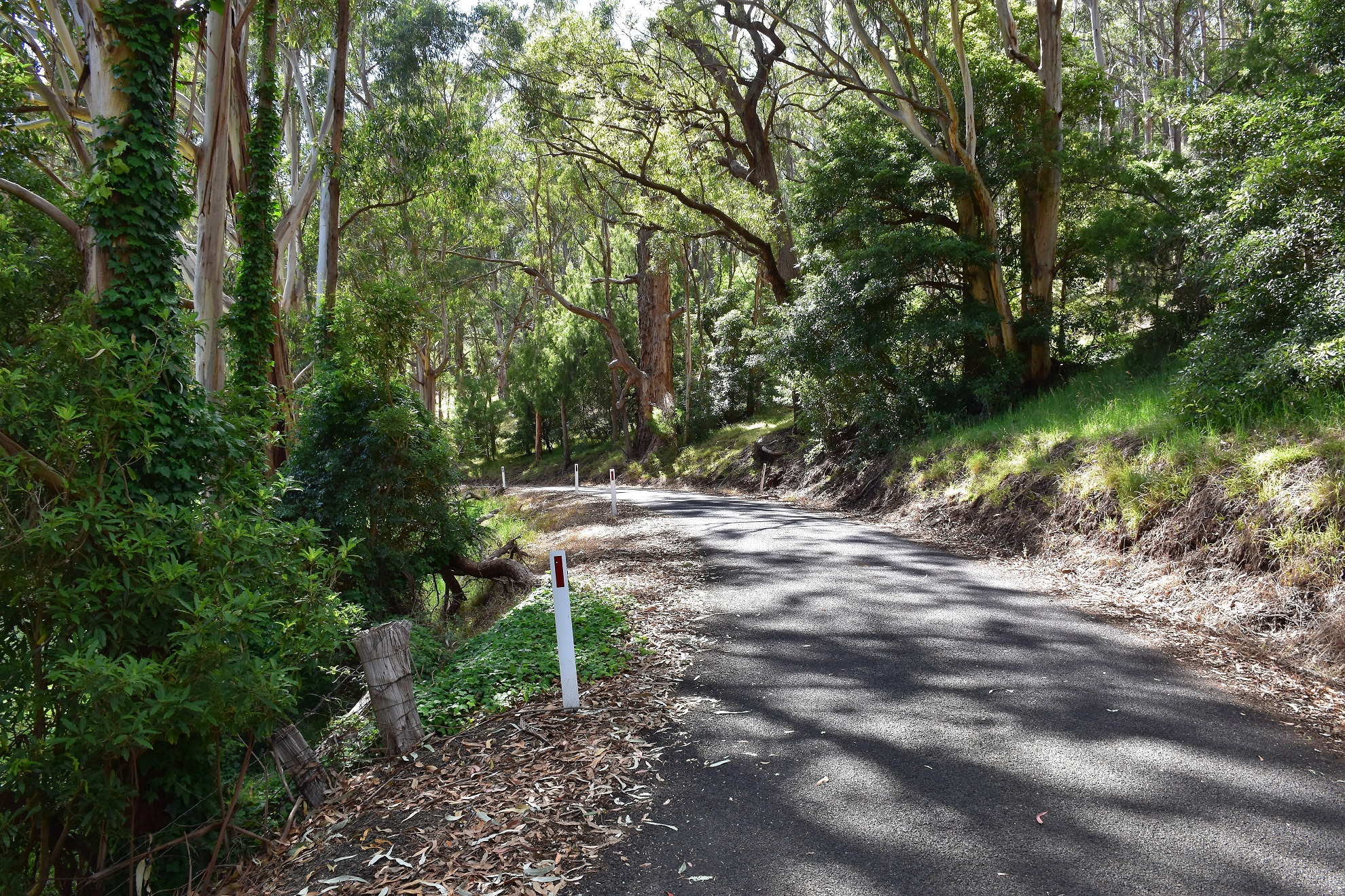
Some walkers make this into an overnight walk by camping down at Macks Creek Hall and others do a car shuffle and just walk down the hill from Balook to the Roberts Road Bridge over Macks Creek. With me walking with all my mates as usual then a car shuffle was out of the question and I wasn't overly keen on camping at the old Macks Creek Hall on Bulga Park Road. So taking all that into account I had a closer look at my map, the walk looked do-able in one day although it would make for a solid day out. So keeping in mind that I had a decent day out ahead of me I gave the Lyrebird Ridge / Forest Track detour a miss as I shuffled off this morning, I've walked those tracks before and while they are very nice I was thinking that I didn't really need the extra distance today. So anyway, heading off this morning I passed through the deserted Balook before picking up my track heading bush at the south end of town on Bulga Park Road. This initial section of my walk following a beautiful grassy track as it gently dropped through the stunning old growth forest of Tarra-Bulga National Park down the Old Yarram-Balook Road to meet Wild Cherry Track just before I arrived at Bulga Park Road again.
Heading off, the sun was just kissing the canopy above me.
Dropping down the soft and grassy Old Yarram Balook Road.
I alway's enjoy my visits to Tarra-Bulga National Park.
Wild Cherry Track headed pretty well east so I was walking into the rising sun now however really the canopy is so dense along here that I wasn't really suffering too much walking into the sun. Initially Wild Cherry Track descended gently along a spur although eventually when the country started to drop away steeply on either side of me, my spur dropped very steeply and suddenly down a section of the track called The Wall and into the Macks Creek valley. The descent down here isn't stupidly steep however trekking poles were definitely an advantage this morning and I'm thinking that in winter when the track is a little muddier then they would be very handy.
My descent route down to Macks Creek.
Beautiful early morning walking down Wild Cherry Track.
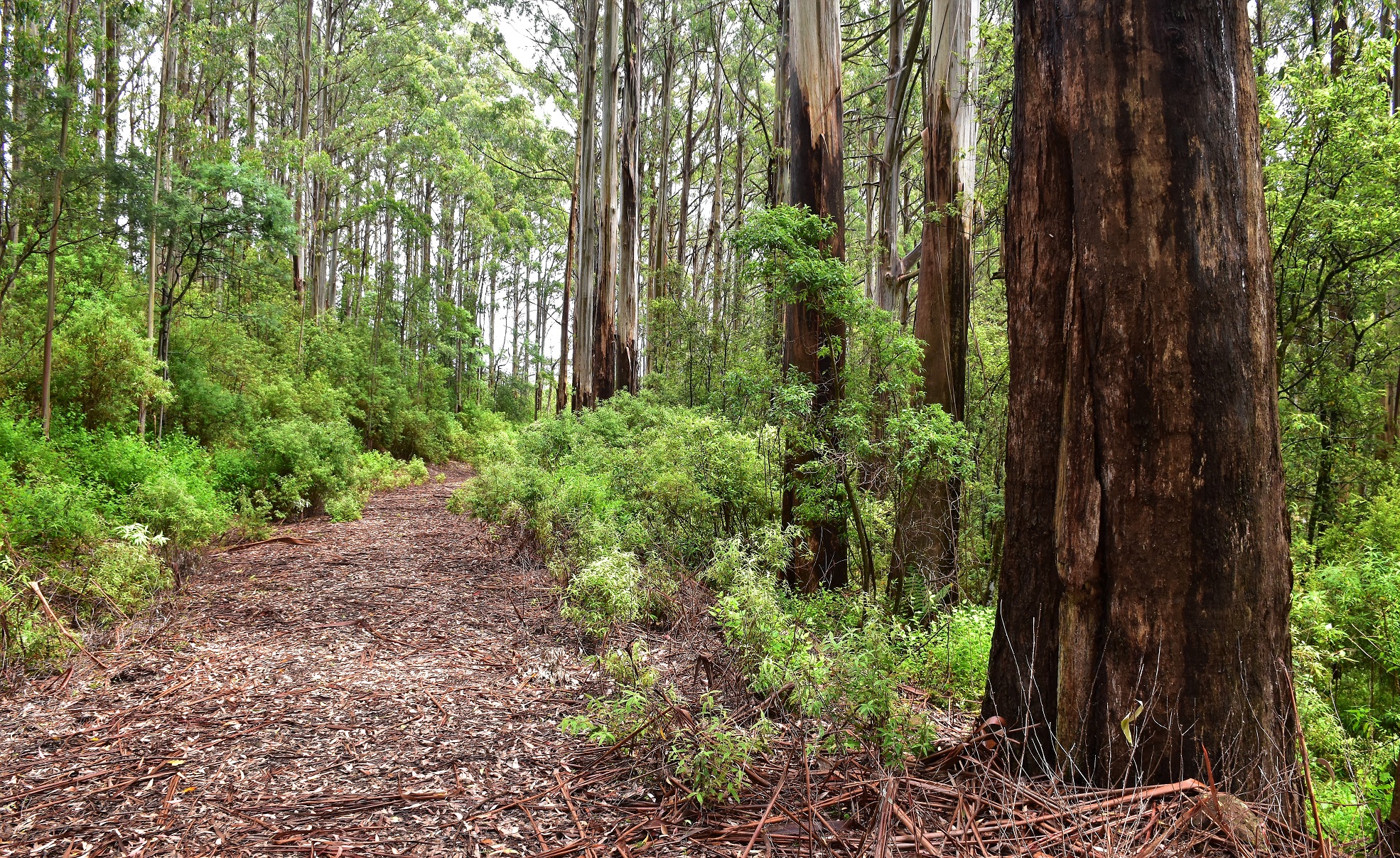
Mountain Ash Forest, Tarra-Bulga National Park.
The county is starting to drop away as I followed the spur down Wild Cherry Track.
I'm about to drop down The Wall on Wild Cherry Track.
I'd jagged a peach of a day... so far!
Descending The Wall on Wild Cherry Track I had a few of my favourite old man's obstacles to negotiate!
Wild Cherry Track, Tarra-Bulga National Park.
Once down at Macks Creek the day adventurous walking began. My first clue that things were going to ramp up a bit in the difficulty stakes was before I'd even made it the first crossing of Macks Creek as Wild Cherry Track basically disappeared in the lush creek side vegetation and I found myself pushing through the ringing wet waist high flora. Arriving at my first crossing of Macks Creek I dropped the pack and scrambled my way upstream a few metres to check out a small waterfall, my second clue that things were about to get a little tougher was that it looked like there had been a big flood come through here very recently and it had knocked around the creekside vegetation and consequently obliterated any sign of a pad in spots. Still, all was good really as I was after a little adventure and solitude. After picking up a bit of a pad I picked my way down Macks Creek for awhile, sometimes pushing through waist high scrub, sometimes climbing a little away from the creek. There are track markers and there is some walking infrastructure along here although Mother Nature is doing a good job of reclaiming the valley for herself really. Eventually I picked up a very old 4wd track which was pretty easy walking for a few minutes before I arrived at an old park gate and I plunged off into the valley again.

The first small waterfall down in the valley of Macks Creek.
Pushing through some of the high and wet vegetation down near Macks Creek required a little resilience.
Tarra-Bulga National Park down near Macks Creek.
Macks Creek.
I had some easy walking along this old 4wd track ... for a few minutes...
... before dropping down to the creek again.
Back down near the creek the walking once again got pretty slow as the track traversed either steeply angled slopes or overgrown creekside flats. At one stage along here I found myself on another old 4wd track and the walking was once again easy - to easy actually. As I started to climb a bit I also started to have my doubts that I was still on the correct track. With some plantation Radiator Pines starting to grow beside the track I stopped and had a good look at my map. I was sure I was in the wrong place (I think I was climbing a track called Gardiner Road) and I knew where I was meant to be and that was down on Macks Creek however what I hadn't seen was a track that would get me there. Retracing my steps back down the old 4wd track I got back to a spot where I was confident that I was once again on the correct track and started looking for an alternative track. Finding a small opening in the scrub off the side of the track I convinced myself that the slight grassy opening that plunged off the edge of the 4wd track could indeed be my ongoing route although the complete absence of a track marker, a sign post or indeed, a pad meant that I felt a little like a pioneer now.
I had to squeeze my fat guts under this one!
Don't miss this grassy opening plunging off the side of the old 4wd track - it's the route.
After dropping off the old 4wd track I eventually found another track marker.
Thankfully around twenty metres after dropping off the side of the 4wd track into the wall of scrub I found an old Strzelecki Track marker on a stake and things were sweet again as I followed the sharply sloped track back down to Macks Creek again. The next section of my Macks Creek walk was a very nice one as I passed by one stunning spot after another as the creek tumbled down the steep side valley passing Gardiner Falls. With the pad fading in and out and sometimes climbing very steeply high above the creek to get around sheer cliffs the walking required a fair bit of concentration however eventually I arrived at what I'm thinking is the Macks Creek crossing number 4 (I'm going off my map on that as I'd lost count a long time ago!). Whatever the name of this spot is it's a stunning spot, with a small waterfall backed by sheer cliffs up stream and a beautiful pool on a sweeping corner downstream it made for a great spot for a break this morning.
Gardiner Falls
Macks Creek below Gardiner Falls.
Macks Creek
I'm guessing that the track doesn't see a lot of foot traffic passing through here.
It was steep going in spots.
Up above Macks Creek again.
Looking downstream from my rock in the middle of the forth crossing of Macks Creek the view was pretty nice...
... although maybe bettered by the view up stream from crossing number four?
After a nice break on a sunny rock in the middle of the stream at crossing number 4, I grabbed my pack and shuffled off into the green wall again. The walking got a little easier for awhile now as I once again picked up an old 4wd track as I climbed a bit to come out onto the more major Bird Road on a hairpin bend. It looks like Bird Road maybe open to 4wd vehicles and it made for some easy walking as it dropped down to cross Macks Creek on a bridge. There is actually a bush camp on the south side of the bridge here, although it's right beside the 4wd track so you'll need to make up your own mind about putting up a tent here (I normally prefer to camp away from vehicle access). Once across the creek again I climbed Bird Road for couple of hundred metres before leaving it as it swung away from the creek, instead I followed a lesser 4wd track as it followed Macks Creek downstream. When the old 4wd track finished I once again followed a very, very rough pad downstream again. After a couple of false starts the track started its final steep climb out of the Macks Creek valley and up to meet Roberts Road. The route now contoured what was probably the steepest slopes so far and the partially benched track was once again slowly being reclaimed by nature so this section in particular required a bit of caution, at one stage the pad climbs over a sheer bluff many, many metres above the creek and you wouldn't be walking away if you slipped here.
I enjoyed an easier section as I climbed to meet Bird Road.
Macks Creek from the Bird Road Bridge.
There is a chance for a bush camp at the Bird Road Bridge... although its right beside the road.
Traversing the very steep slopes before the final climb up onto Roberts Road required a little caution.
Arriving onto Roberts Road the nature of the walk changed.
Arriving into the sunshine on Roberts Road the nature of my stroll changed completely now, the wild and claustrophobic creek valley now morphed into a walk along quiet roads with rural farmland and timber plantations never far away. Initially I dropped down Roberts Road to cross Macks Creek for the last time on the road bridge before following this quiet sealed road along the tree line on the south side of what was now a rural valley. After half an hour or so of pleasant enough walking I left Roberts Road at the furtherest extremity of today's stroll and climbed to the right up a rough and sandy track, which interestingly enough passed through a Banksia Forest before I came out on the gravel Bulga Park Road. Once on Bulga Park Road I shuffled my way up until I arrived at the old Macks Creek Hall. The old hall is the spot that most people camp at when making this into an overnight walk however for me this morning it made a pleasant spot to sit for awhile and have drink in the shade before I continued on my way back up to the ute.
My last crossing of Macks Creek was on the Roberts Road Bridge.
Macks Creek
Roberts Road made for some easy walking.
I climbed this sandy track up to meet Bulga Park Road. With the sandy soil came the Banksia's.
Macks Creek Hall
To be honest the next section of today's stroll was a little ordinary as I climbed up the gravel Bulga Park Road for about 4.4 kilometres. The road now climbing back up towards Balook as it passed through rural farmland initially and then a little higher up it was timber plantations. I was racing the rain a bit now as I'd talked to Sam who was back in Melbourne and she'd told me that it had been raining for a fair while there, so I knew it was just a matter of time until it reached me. Thankfully Bulga Park Road was a pretty quiet road and I was only passed by a few Timber Jinkers as they rattled down the mountain with their Jacobs Brakes reverberating around the hills. These drivers actually went out of their way to avoid showering me with dust as I shuffled up the road today, each time a truck came towards me they would throttle down and jump on the brakes to make my life a little more pleasant. Still, after an hour walking up Bulga Park Road I was pretty happy to pick up a faint track that led my into the bush where after a few metres I picked up the grassy Old Yarram-Bulook Road on the crest of a spur.
Bulga Park Road
Macks Creek runs through that valley - I was down there an hour ago.
I had more than a couple Timber Jinkers rattle past me as I trudged my way up Bulga Park Road. The drivers were pretty good though and did their best not to smother me in dust.
I got some rural views initially as I climbed up Bulga Park Road.
Leaving the rural farmland behind I climbed past extensive timber plantations.
I took this shot to try and illustrate how dark the sky was through the trees... with limited success!
After trudging up Bulga Park Road for around an hour I picked up this rough track and climbed up to meet the Old Yarram-Balook Road on the crest of a spur.
Now I was once again following an old closed road the walking was pretty good again as I continued my climb up to Balook. The rain that I'd been expecting now started to get a little more insistent. I managed to shuffle my way up the hill for another half an hour before the rain arrived in earnest and it was time to throw on my wet weather gear and stash my DSLR away for awhile. The good news for me was that the rain arrived as I was walking old 4wd tracks and not in the claustrophobic confines of the Macks Creek valley so at least I wasn't pushing through a wall of wet bush. After getting some distant views down towards Corner Inlet and the top of Wilsons Promontory the rain relented for awhile and I was able to stash the wet weather gear again.

The walking was pretty good again as I climbed up the Old Yarram-Balook Road.
I was now into the wet weather gear on/off - repeat, section of my stroll.
I'm thinking that this was a wet weather gear on time...
... and this was an off time again.
The good news in relation to the rain was that it didn't last long though and I spent the remaining hour of my walk either thinking I should put on my wet weather gear or wishing that I didn't have it on, yes it was one of those afternoons! Passing by the closed Diaper Track (the Tarra Valley Loop) on my left I looked down and could see the logging coupe that had closed that part of the walk for the next couple of weeks. Now I'm no fan of logging normally however if we are going to use timber products then plantation timber is the answer and that's what's going on down here, in fact the Grand Strzelecki Track not only traverses quite a bit of plantation land but the plantation owners also help with the maintenance of the track to some degree I think. After avoiding the logging coupe off to my left on Diaper Track I dropped down to cross over Bulga Park Road and re-entered Tarra-Bulga National Park again and almost immediately met my outward route, Native Cherry Track. With the rain now getting pretty persistent I retraced my walk back into Balook, the tiny town still appearing almost as deserted as it had been at 6:30am this morning. It was around 2pm when I shuffled the last few metres back into the car park at the Tarra-Bulga National Park Visitor Centre after around 7.5 hours of solid walking and I was a very contented walker as I pulled off my wet weather gear and my muddy boots and set off towards home.
I got some views south towards what I think is Corner Inlet.
Nice walking up Old Yarram-Balook Road. I was now passing in and out of Tarra-Bulga National Park.
Arriving at Diaper Track I turned right - the left fork is part of the Tarra Valley Loop of the Grand Strzlecki Track. The Tarra Valley Loop was closed while some of the timber was harvested along Diaper Track.
The circuit part of my stroll was now complete.
The Dirt.
According to my GPS I walked around 27.8 kilometres and climbed around 1027 metres on what is a hard day out. Not only does this walk involve a fair bit of climbing and descending along with decent amount of distance but there is also some pretty rough walking along Macks Creek. The track along Macks Creek (as of 15/01/21) shouldn't be under estimated, the going is very overgrown and a pretty vague in some spots. In other spots it climbs high above Macks Creek on very steep and slippery slopes. The crux when I went through was finding the spot to leave what I think was Gardiner Road (an old grassy 4wd track) and plunge off the side backdown to the creek again. The go here is if you find yourself getting too high above the creek and seeing some Radiata Pines then you've gone too far, the track is down a steep grassy opening in the scrub a couple of minutes after passing an old Macks Creek information sign on Gardiner Road. Once out of the Macks Creek Valley the walk is mostly along old closed roads so it's all pretty good, although you still need to concentrate on navigation. Speaking of navigation I used the Grand Strzelecki Track Map 5, Macks Creek Loop Map and I wouldn't try this walk without it, I also used my GPS topos. Now if you read this and think that this walk is a little crappy well you are entitled to your opinion, I actually really enjoyed this outing. If the Macks Creek section of the walk was on National Park land the track would be closed indefinitely as it would be deemed to be too risky, however I really enjoyed the challenging terrain and track this morning. There is nothing wrong with having to use my brain a little on a walk sometimes (for people who have done a bit of walking I'd compare the Macks Creek section to the Black River section on the AAWT in spots). With the Grand Strzelecki Track being largely a community funded and maintained track then they are never going to have the resources of some of the more well known tracks in our national parks, so maybe consider dropping by their website and buy their maps and help to keep this walking resource open... or if you live in the Latrobe Valley then I'm sure they'd welcome some volunteers to help with maintenance.
Relevant Posts.
My final climb up the Old Yarram-Balook Road into Balook.
There's a few historical sites around Balook. By the way CRB stands for Country Roads Board, for anyone under 100 that was the precursor of VicRoads.
The Balook CBD.
The Tarra-Bulga National Park Visitor Centre was still pretty quiet when I got back.


Thank you for the in depth review of the Macks creek loop. I'm more or less local to the area but even so info with pictures is very scarce.
ReplyDeleteThanks KW, I'm glad the blog was of some use to you.
Delete