
Twilight at Curra Brook.
Sam and I had already walked the Coast Track up in Royal National Park a couple of times before we headed up for this visit. It's no secret that this little national park on the southern outskirts of Sydney is a beautiful spot, so when I mentioned to Sam that I wouldn't mind trying to capture the Easter full moon lighting up the coastal cliffs on Curra Moors she quickly agreed to accompany me. So, on the Thursday before Easter back in 2012 we jumped in the car and took the delightful 850 kilometre drive up the Hume Highway. Turning off at Moss Vale and heading down the Macquarie Pass to Wollongong where we stayed the night before starting the walk the next day. Wollongong is a big industrial city so it's hard to believe that one of the most popular coastal walks in New South Wales would start just 30 kilometres up the coast.

Sam accompanied me on this stroll.

The view south from the start of the walk in Otford.

The southern end of the Coast Track.
After breakfast in Wollongong we made our way up the coast drive towards Sydney, crossing the impressive Seacliff Bridge at Coalcliff and then climbing up to Stanwell Park. I dropped Sam off with the packs at Otford lookout which was busy with tourists and beachgoers, we must have made a strange sight lugging our overnight packs out of the car amid the hustle and bustle of the tourists trying for the perfect photo op. Leaving Sam with the packs I back tracked a few kilometres to the Otford railway station, where I left the car. From the station I had a short but steep climb up to Lady Wakehurst Drive, avoiding the Otford Apple Pie Shop on the right I headed left along the road and was soon reunited with Sam and the packs.
Looking north along the Royal National Park from Otford.

I was keen... Sam less so!

The walk up here is mostly in sandstone country.

The Coast Track arcs inland a bit above Werrong Beach.

The Coast Track, Royal National Park.
After taking the obligatory start photo, we were off. Initially the track followed close to the cliff line which allowed plenty of views up and down the coast before we then headed inland a bit and climbed through some eucalyptus forest to the junction with Werrong Track. I was all for making the detour to the nudist beach at Werrong, but alas Sam had other ideas. We now undulated northwards on a sandy track, passing through light forest which included plenty of Grass Trees and Banksia. We also started to see our first Gymea Lilies although unfortunately they weren't flowering, when they are flowering the flowers on their 5 metre stems remind me of something out of Jurassic Park. Turning to the east we were soon at Werrong Point, the views from here include the golden sand of Werrong Beach far below and the Seacliff Bridge and the coast stretching all the way down to Wollongong. With the weather being pretty well a perfect, blue sky and mid 20˚ kind of day it was no hardship to stop for awhile a take in the view today.

Angophora trees are a feature of the southern reaches of the Coast Track.

The Coast Track, Royal National Park.

The Coast Track, Royal National Park.

Werrong Beach from Werrong Point.

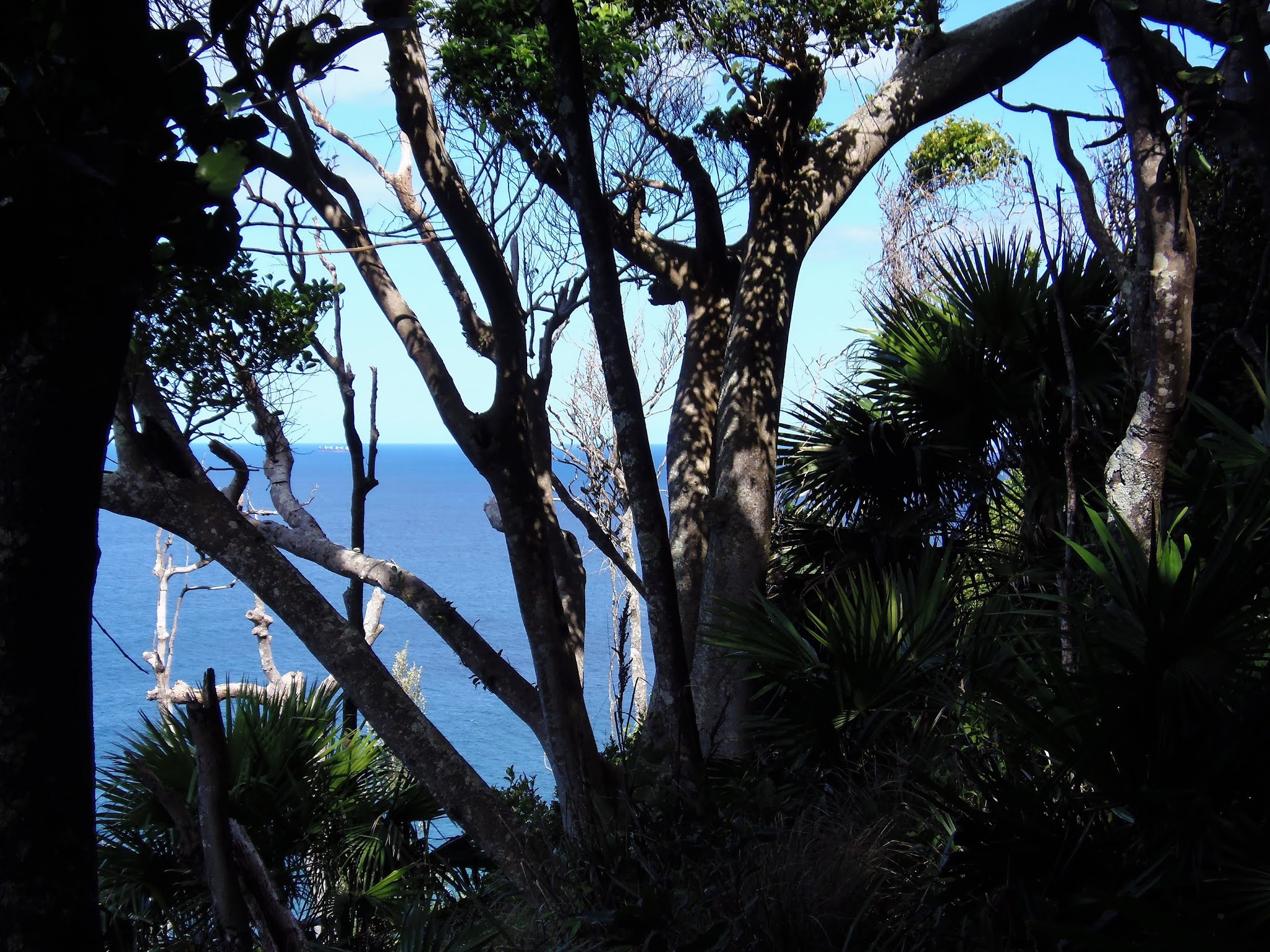
The coal ships were lined up off shore waiting to get into Port Kembla.

Looking south back down towards Coalcliff and the Sea Cliff Bridge.

Leaving Werrong Point the Coast Track started to drop down into the Plan Jungle.
After a bit of a rest it was time to head down into the Palm Jungle, the track descends steadily into the rainforest amongst the tree ferns and Cabbage Tree Palms. The track down here is well marked, the only issue is keeping on track when going around fallen trees and negotiating the odd boggy patch. Around 30 minutes after we left Werrong Point we came to a clearer area in the forest which gave us some views. This clearing looks like it has been used as a campsite over the years, although it was lunch that we enjoyed here today under in the shade under the palms.

We got some glimpses north through the canopy as we dropped into Palm Jungle.
Palm Jungle, Royal National Park.

Palm Jungle, Royal National Park.

The Coast Track in the Palm Jungle in the Royal National Park.

We enjoyed lunch in the shade at Palm Jungle.
After lunch Sam and I headed for Burning Palms. The track soon broke out of the rainforest onto coastal headlands covered in grass and was incredibly eroded in this section, at one stage I couldn't see Sam's head above the erosion trench she was walking in. While the track was pretty ordinary the positive about walking this grassy section was that we once again had extensive coastal views. The Coast Track now resembled a bit of a roller coaster ride, drop down in Burning Palms, climb over ridge, drop down into South Era, climb over another hill, drop down to North Era, climb again, drop down to Garie beach. We had passed by many private shacks to get to Garie however this was the first spot along our walk so far that had vehicle access and the crowds were a bit of a shock. We slowly made our way up the beach towards the Surf Club, passing around the fisherman, surfers, bikini babes, and many families having BBQ's.

Leaving the Palm Jungle the Coast Track crosses open grassland above Semi Detached Point.

Back in the day the Coast Track was pretty well an eroded trench along here.

Semi Detached Point, the Royal National Park.

Sam's dropping down to Burning Palms on the Coast Track.

Burning Palms Beach, Royal National Park.

Burning Palms, Royal National Park.

The Coast Track heading towards South Era.

South Era Beach, the Royal National Park.

Looking back towards South Era on the climb over to North Era on the Coast Track.

The Coast Track dropping down into North Era - this is the official campsite for the Coast Track nowadays.

There are some large aboriginal middens down at North Era Beach.
The Garie Surf Club provided the option to top up our water bottles, the official line here is that the water is unsafe to drink however more and more places are saying this now days, I guess to protect them from litigation. Anyway most times the water is fine, you just need to investigate a little to find where the water source is and then treat it accordingly. There is also a kiosk at Garie selling various sugar filled treats of which it would be rude not to partake.

The climb out of North Era over Thelma Head was fairly short but pretty solid.

Looking back down to North Era...

... and looking forward towards Garie Beach.

There is good road access to Garie.
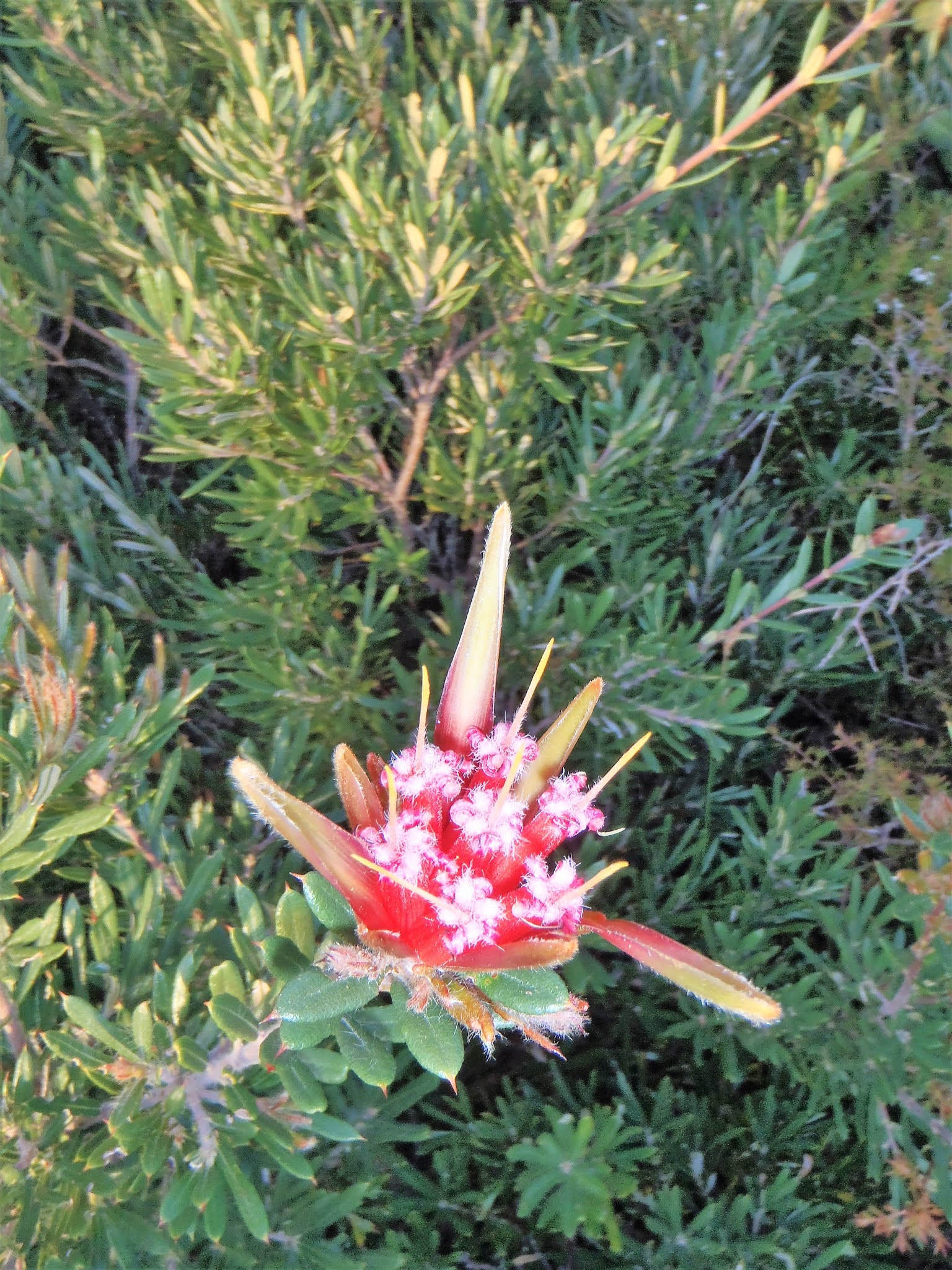
After leaving the Surf Club we trudged along the beach towards Garie North Head where we now entered the more wild part of the walk. The climb up Garie North Head onto Curra Moors is fairly steep, and feels especially so when carrying big packs. The reward for the climb this afternoon was that once on top of the cliffs we had kilometres of fairly easy walking with quite a few stunning views ahead of us. The track heads through coastal heathland with lots of Banksia, Tea-Trees, and Grass Trees, not to mention an abundance of wild flowers.

Garie Beach was a pretty busy spot this afternoon.

Climbing away from Garie Beach up onto Curra Moors the Coast Track passes by some nice sandstone outcrops.

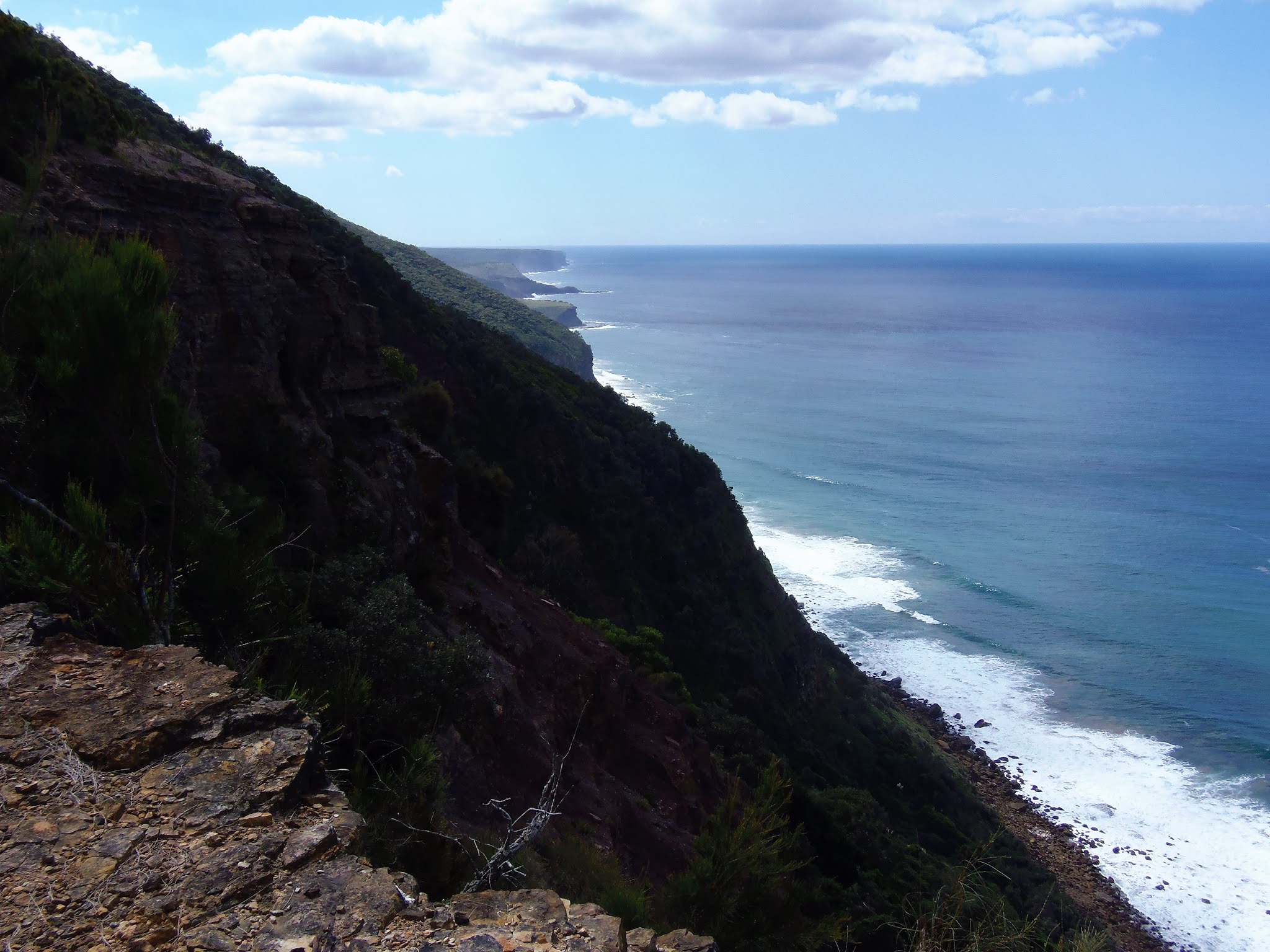
Late afternoon on Curra Moors.

Looking south from Curra Moors.


I'm thinking that a visit to Curra Moors in Spring might be the go one day.

Late afternoon on the Coast Track, Royal National Park.

The Coast Track on Curra Moors.

Curra Moors, Royal National Park.

The Coast Track on Curra Moors.
Around an hour after climbing Garie North Head we arrived at Curra Brook and the plan was that if we could find some flat bare ground then I wanted to stay here to catch the Easter full moon coming up over the ocean. After a bit of a look around I found nice stealth camp in the bushes and decided that it would be feasible to camp with minimal impact. Soon the tent was up and we settled into a little nook on the cliff tops to cook dinner and watch the moon come up.

Curra Moors, Royal National Park.

The Coast Track on Curra Moors.
Curra Moors, the Royal National Park.

Curra Brook, the Royal National Park - it looks like I'm wearing the latest in moisture wicking material.
The view here was amazing with two waterfalls dropping over sheer cliffs 80 metres into the surging surf. The big Easter full moon lighting up the ocean and cliffs almost like the sun. Dinner that night was spaghetti bol and freeze dried cheese cake under a million stars. After taking numerous photos it was off to bed, relieved to see that Sam's sleeping mat hadn't deflated as I had punctured it in the Stirling Range walk I did last Christmas. After a big week at work I only managed to get through about one chapter of my book before sleep overtook me tonight.

Curra Brook, Royal National Park.

The sandstone ledges beside Curra Brook made for a good kitchen.

Another Feral night... is it any wonder Sam doesn't walk with me that often.

The full moon is coming up over the Tasman Sea.
The Dirt.
We walked around 16 kilometres and climbed around 300 metres on what I'd class as an easy-medium grade days walking, for the most part the track was clear and well defined. Otford is on the Sydney suburban rail network so it's easy enough to get to the start of the track using public transport. Driving up from Melbourne we left our vehicle at the train station in Otford. Over the years there have been numerous camp spots along the length of the Royal National Park although it looks like now days the parks folk have settled on North Era as the official camp spot and it needs to be pre booked. As far as I know the old sites at Curracurrong and Curracurrang are closed, which is a shame as they were much nicer spots. The official parks advice is to treat all water in the park which is reasonable advice, although I picked up water at the Garie Surf Lifesaving Club today and didn't treat it. I threw a couple of tablets into the water I got from Curra Brook just to be safe.
Relevant Posts.

The Easter full moon rising over the Tasman Sea from the Royal National Park.

Moonlight lighting up Curra Brook before it tumbles off the cliffs.

Royal National Park by the full moon.


Hope all is well Feral. You have not delivered us your Thursday update, so i hope your ok.
ReplyDelete