Hi All, I'm currently bouncing around The Gulf country up in the deep north so I apologise if my posts are a little spasmodic - also for some reason Google won't let me reply to comments so if anyone leaves a comment over the next 6 weeks I may struggle to reply - it's not that I'm a self obsessed wanker!

Today was all about the cliffs really.
After a restful night listening to the waves crashing onto the rocks below us and the planes coming in and out of Sydney Airport, Saturday dawned fine and the good news was that it looked like the weather would hold for a few more hours yet. After a leisurely breakfast on the rocks admiring the sun rise view we were on our way again.

The sun is coming up over the Tasman Sea.

The small waterfall in the middle distance is Curracurrong Creek plunging off the escarpment.

The view from Curra Brook this morning.

Curra Brook

Early morning at Curra Brook.

Breakfast at Curra Brook... another classic Feral moment!

Curra Brook, Royal National Park.

Curra Brook, Royal National Park.

Curra Brook about to plunge into the Tasman Sea... I took a very similar shot last night with the full moon lighting up the water.
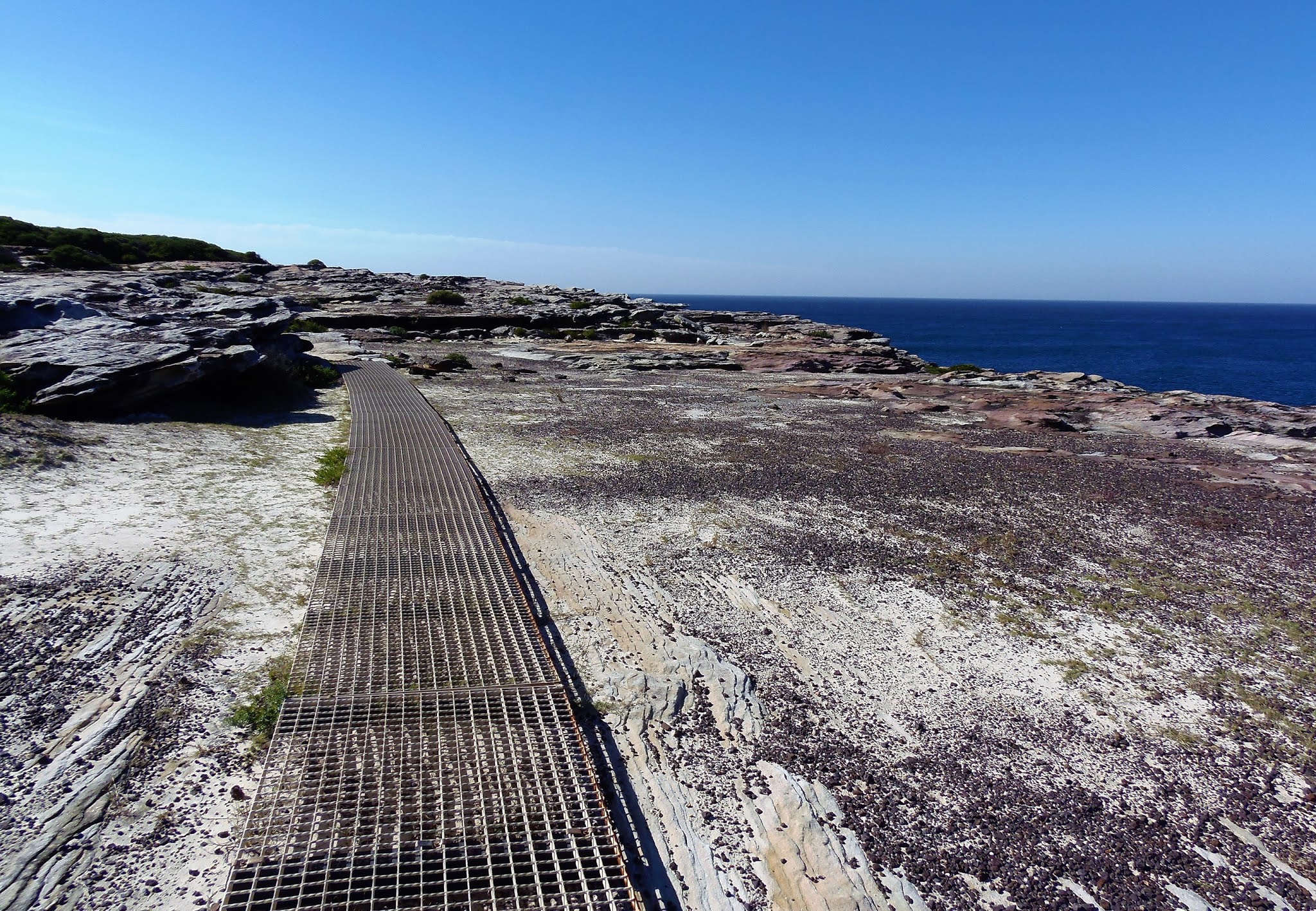
The Coast Track again headed north soon crossing Curracurrong Creek on a makeshift bridge and then staying in the general vicinity of the cliff tops. It was an easy walk over the moors to Curracurrang Creek and once again large sections of the track had steel boardwalk installed. By the time we got to Curracurrang I was looking forward to a swim so we made our way upstream to a small swimming hole although unfortunately I couldn't tempt Sam in. Curracurrang is a popular rock fishing spot and there were a few tents scattered through the scrub around the creek, this was the spot that Sam and I had camped on our first visit to the Royal National Park years previously and it is a magic spot, although the campsite is officially closed now.

Eagle Rock, Royal National Park.

Curracurrong Creek

Early morning on the Coast Track looking back towards Curracurrong Creek.

Curra Moors, Royal National Park.

The day started off fairly warm.

There was a lot of raised metal boardwalk back in the day.

Curracurrang Creek. On our first visit here decades ago this was the official campsite.

Curracurrang Creek, the Royal National Park.

Curracurrang Creek, the Royal National Park.

There are a few swimming spots along Curracurrang Creek.
From Curracurrang Creek the track climbed over a headland towards Wattamolla, at one stage we ended up on an abandoned section of track which provided 15 minutes of very rough and adventurous walking as we pushed through the scrub until we intersected with the correct track. Wattamolla is the second place along the walk where vehicles can access the coast so consequently it was fairly busy this morning. We were looking forward to a cold drink at the kiosk however unfortunately it appears to have closed down, so it was luke warm water for us today.

There is no shortage of places waiting to be explored in the Royal National Park.

We've just left Curracurrang Creek and are now heading for Wattamolla.

Curra Moors, the Royal National Park.
Heading to Wattamolla we got some more stunning views.

We got one last look back to Curra Moors before dropping into Wattamolla.
Leaving Wattamolla we crossed Coote Creek above the falls and headed into Eucalypt and Tea Tree forest as we slowly ascended towards Wottamolla Creek. I was looking forward to Wattamolla Creek as there is another great swimming hole at the spot where the Coast Track crosses the creek. We filled our water bottles at the creek and I took the opportunity for another swim in the scenic infinity pool. There was no getting Sam into the frigid water though, she was happy soaking her feet (and in the process picking up a leach). We enjoyed an early lunch here while I dried off on the rocks in the sun.

The Coast Track burrows through some Tea Tree after leaving Wattamolla.

The infinity pool on Wattamolla Creek.

It'd be rude not to have a swim here.
From Wattamolla Creek crossing the track struck out east to once again follow the cliffs northwards. We were now heading towards Little Marley Beach. Little Marley is probably the last opportunity for a swim before the end of the walk although having just had a swim we pushed on across Little Marley and then over the low headland and on to Marly Beach. It's generally not recommended to swim at Marley due to the surf and rips however for the adventurous it is possible to push over the dunes to Marley Lagoon where it may be possible to have a dip (although I've never actually done this). It was around here where we started to meet a lot more day trippers again which signalled that we were getting closer to the end of the walk.

The Coast Track now started a long and spectacular cliff top section.

The Coast Track, Royal National Park.

The Coast Track, Royal National Park.

The Coast Track, Royal National Park.

The Coast Track, Royal National Park.

The Coast Track slowly dropping down towards Marley Beach.

Little Marley in the middle ground with Marley in the distance.
After leaving Marley Beach we climbed up and around Marley Head, the wind had changed around now from a warm northerly to a cold and gusty southerly and the ocean was a sea of white caps. The good news was that the wind was behind us pushing us along however we had to be careful as the Coast Track hugged the cliff tops and a couple of gusts of wind had almost knocked Sam of her feet. The track from Marley to just past The Waterrun is stunningly scenic, especially if big cliffs and water views float your boat. We stopped numerous times to take photos or just take in the view. The track basically follows rock shelves along the top of the cliffs heading inland only to bypass steep gulleys. The only grunty section being when we dropped down to cross The Waterrun, which needed a short but steep and eroded climb out of.

There is a small inlet at Little Marley which might be worth a swim.

The Little Marley Beach is probably the last safe beach for a swim when heading north.

The Coast Track between Little Marley and Marley Beaches.

Crossing the low headland between Little Marley and Marley.

Marley Beach. This is around the spot where we started to meet a few day walkers coming in from Bundeena. There is a large lagoon behind the beach here that I'll check out one day.

Marley Beach, the Royal National Park.
Less than one kilometre after climbing out of The Waterrun the track heads away from the cliff tops for the last time. We walk up an old 4wd track just to the north of Jibbon Hill and within 15 minutes met up with a bitumen management road, turning right and coming to the park entry gate within a few minutes. Its now time for the 'after' photo and to put away the walking poles and gaiters before we walk through the back streets of Bundeena to the jetty. We zig zaged our way through the back streets, the hard surface giving our feet a hard time until we popped out at the R.S.L. near the jetty.

After leaving Marley Beach the Coast Track traverses another section of stunning cliffs.

The Coast Track, Royal National Park.

Today's wildlife encounter.

Royal National Park.

The Coast Track, Royal National Park.
With the walk now over we could take off the boots for the last time, we had 50 minutes before the next ferry across to Cronulla so I wandered up to the shop to buy us a cold drink and we sat under the gum trees above Bundeena Bay and finished off the last of our scroggin. The ferry trip to Crunulla was short but it was nice to see how the other half live and check out the multi million dollar cliff top houses in Burraneer on the way. Once disembarking from the ferry it was a 5 minute walk to Crunulla Railway Station where we caught a train to Sutherland and then a connection to Otford, relieved to see the car still sitting in the station car park. Throwing the packs in the back of the ute the hard part of the trip was over, it was now just a 900 kilometre trip home.

The Coast Track, Royal National Park.

At least Sam was still smiling!

There were a couple of damp spots around The Waterrun.

Leaving The Waterrun we had one last section of cliffs to traverse.

The Coast Track, Royal National Park.

The Coast Track, Royal National Park.
The Dirt.
We walked around 15 kilometres toady and climbed around 150 metres on what I'd call another easy-medium days walking. Over the two days of our Coast Walk adventure we walked around 31 kilometres and climbed 450 metres. We've done the Coast Track a few times over the years and it's a great little walk that is easily accessible by public transport from Sydney. The track is well defined if not a little eroded in places. The Coast Track is by no means a wilderness walk though, you pass through numerous little beach shack settlements in the first half of the walk and there are two vehicle access points, one at Garie and the other at Wattamolla. There's a kiosk at Garie, the kiosk at Wattamolla appears to have closed down. The YHA at Garie has closed so its either camp out or do the walk as a day walk which would be fairly easily achievable with an early start. The second half of the walk has a more remote feeling and I enjoy it more, especially the Curra Moors section. The official line on the walk is that the water is unsafe to drink, however with a little common sense and some purification there shouldn't be any problems. Telstra have reasonable coverage along most sections of the track.

The after photo at the track head in Bundeena.
We left a car at the car park at Otford railway station, however as with any car park there's a risk although thankfully we had no problems. The ferry from Bundeena to Cronulla runs hourly on weekends and public holidays and slightly less often during the week. The trains from Crunulla run very frequently, to get back to Otford it is necessary to change trains at Sutherland and get onto the south coast line. One thing to keep in mind is that not every train stops at Otford, only about one every 2 hours.

Bundeena Jetty
I used a CMA map of Royal National Park, edition 4, however this map is over 20 years old and I'm sure there would be more up to date maps available. Lonely Planet cover this walk in their Walking in Australia guides, and that and a compass is really all you need if you are experienced at walking in Australia. Finally, as I'm publishing this many, many years after completing the walk then it would definitely pay to check with the NSW Parks folks what conditions are like nowadays, I believe that there may have been some big changes in the park.
Relevant Posts.

Bundeena is only a short ferry ride from Cronulla.


No comments:
Post a Comment