French Island is somewhat well known for its Koala population.
Early morning at the almost empty Fairhaven Campsite.
That's Hastings on the other side of the bay...
... and that is looking down the Mornington Peninsula towards Sandy Point.
I had a feeling that the grey skies were going to make it easier to make some kilometres this morning than it had been last night, as I'd be mostly walking heathland and rural land now. Immediately after leaving camp I crossed the Coast Road and picked up a 4wd management track entering the heath signposted as the Wetlands Walk. My walk now followed a series of 4wd tracks as I slowly made my way inland towards The Pinnacles lookout. For the most part this section weaved around all over the place however the route was generally way marked (although the Alltrails gpx file was out in one spot) and The Pinnacles trig was also sometimes in view.
I was following the Wetlands Walk initially this morning.
The overcast conditions meant that sun rise was a bit of a non event.
Easy walking along the 4wd track.
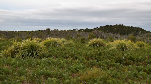
It was pretty well all heathland or rural land this morning.
This section of the stroll looks like it's been re-routed recently.
I'll mark this little variant on my map.
After following a very convoluted route I arrived up at The Pinnacles lookout to take in the view from the 66 metre high point. Despite the relatively modest height this lookout provided a pretty good view down towards Sandy Point in one direction and up towards the cloud covered Dandenong Ranges in the other direction. With the overhead conditions seemingly looking more threatening by the minute I decided not to linger too long up at The Pinnacles, instead I decided to push on a bit and try and get across to the small Tankerton store before I got wet.
The route has a variety of signposting - some new...
... and some not so new.
The big trip up at The Pinnacles lookout was often in view.
Sandy Point from The Pinnacles.
Apart from the national park there is also a fair bit of rural land on French Island.
The weather was looking pretty grim up towards the Dandenong Ranges.
There are a few of these old maps scattered about in case anyone gets seriously geographically embarrassed.
Dropping down Clump Road heading for Tankerton Road.
I was now passing through mostly rural land.
It was probably even darker than this photo depicts.
Thankfully the rain arrived just as I arrived at the Tankerton Store.
From the general store (which is also the petrol station, post office, bottle shop and café) I just had to walk another 3 kilometres down the gravel Tankerton Road to the pier and with a little over an hour to go before my ferry left, time wasn't much of a concern now. After checking out some some Cape Barron Geese grazing in a paddock (well if birds can graze?) I arrived down at the Western Port Bay shoreline with around thirty minutes to spare, so instead of heading straight to the pier I decided to drop down to water level and check out the Tankerton Creek mouth. Now the reason that I wanted to check out the creek mouth wasn't because I thought that it would be super scenic but more that fact that I wanted to see if it would of been feasible to ford the entrance of the creek rather than walk around to the road bridge as I had yesterday. After making my way through the Mangroves I arrived at the mouth of the small creek and while it did indeed look possible to ford the jury is still out a bit as the creek was flowing through some very soft ground and I wasn't keen to sink knee deep into stinking mud seeing that I was about to jump onto the ferry.
Heading down Tankerton Road I had some Cape Barron Geese to keep me amused...
... which was just as well as...
... the road itself was pretty ordinary.
Once on the coast I decided to drop down and check out the Tankerton Creek mouth.
After negotiating the mangroves without sinking up to my knees in mud...
... I decided against pushing my luck and testing out the ford of Tankerton Creek.
French Island Mangroves.
The Dirt.
According to my GPS I walked around 13.3 kilometres today and climbed about 122 metres on what was an easy stroll this morning. Todays walk was pretty well all along either 4wd tracks or quiet gravel roads and it was mostly well signposted and way marked - the Alltrails gpx file was out a bit near The Pinnacles although the current route is marked clearly enough on the ground. The shop at Tankerton opens at 9am on Saturdays and is a good spot for a stop, a bite to eat and drink (and to shelter from passing showers of rain). I used my Alltrails App along with my GPS topos for this stroll, the House of Chapman and the Daly's have also written up variations of the this walk although both books are out of print now I think.
Over the two days of my French Island walk I've walked around 18.8 kilometres and climbed about 142 metres on this easy walk according to my GPS. This little overnight walk was a great little outing, it's hard to think of another spot that I could go a camp out so close to Melbourne and yet feel slightly isolated at the same time.
Relevant Posts.
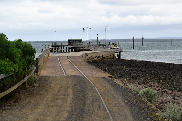
The locals leave their cars at the pier - some are even registered!
I arrived at the shelter on the end of the pier just as the next shower of rain scudded through.
Watching the captain of the ferry bring it in sideways in the wind was pretty impressive.
My Alltrails App and GPS were pretty close on this walk.


No comments:
Post a Comment