Sunday, June 18, 2023

Suckling Track to Whisky Track, Lerderderg Track, Lerderderg State Park - January 2023

The quiet 4wd Track walking continued this morning.

I followed Toe Rag Track for awhile - quite appropriate really.

Morning smoko was enjoyed down near the headwaters of the Werribee River.

Wombat State Forest.

At around 900 metres the historic Balt Camp was the walks high point.

There are some introduced trees near Balt Camp.

After leaving Balt Camp the Lerderderg Track started a long descent down to meet the Lerderderg River.

The Wombat State Park sections of the walk are normally more gentle than the Lerderderg State Park sections - although it still has it's moments!

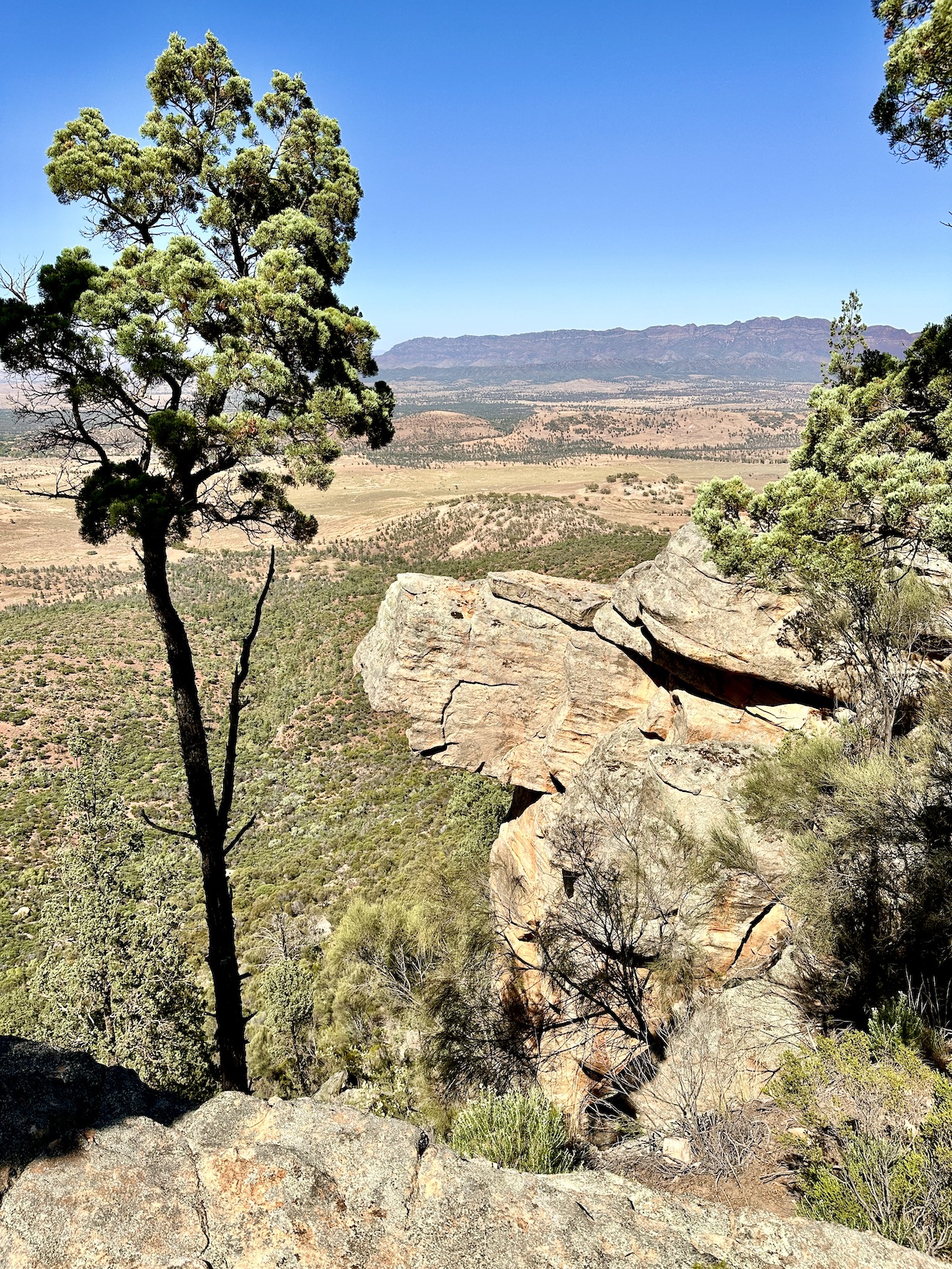
Making the most of what views that I could get.

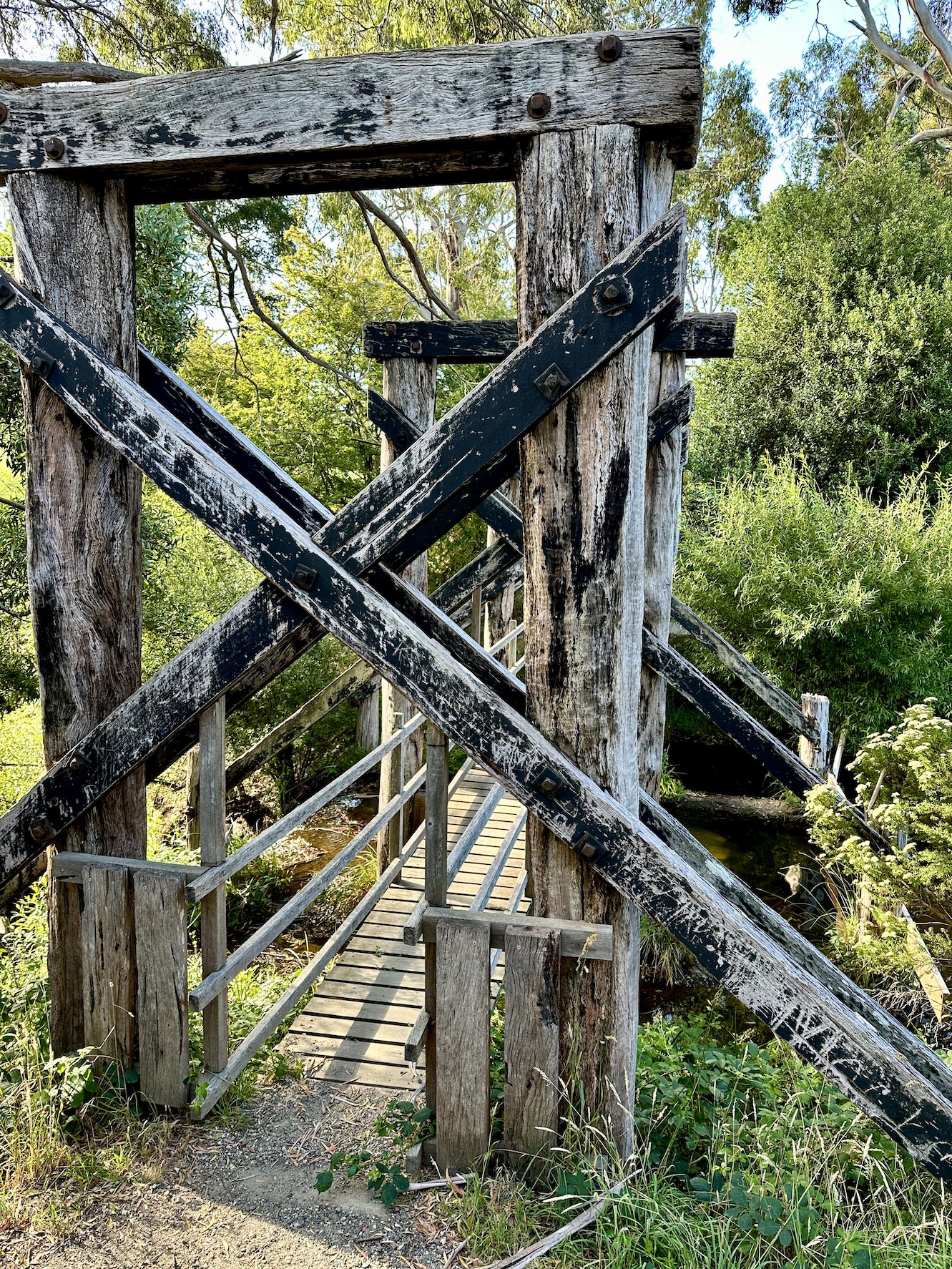
The last section of the walk into the Garden of St Erth was along an old water race.

I followed the mtb route into Blackwood as the walking track was closed.

The Feral Walker highly recommend a stop at the Post Office Cafe in Blackwood - especially if you are cranking out a 40 kilometre day!

Hiker trash indeed.

After leaving Blackwood I entered the Lerderderg State Park along Byers Back Track.

Byers Back Track.

A splash of colour in Lerderderg State Park.

Climbing Kangaroo Track in the early evening.

I camped just off Whisky Track tonight.

Yes, I'm reading for bed... 40 kilometres is a solid day for a fat, old bloke😉

The Dirt.
According to my AllTrails app I walked around 40.5 kilometres and climbed about 1022 metres on this hard day out. The Wombat State Forest section is slightly easier than the Lerderderg State Park section for the most part. The route into Blackwood along the Lerderderg River has been badly affected by wind storms and a fair bit of the track now appears to follow Lerderderg Road. Also the last section into Blackwood from the Garden of St Erth was also closed so I followed the bike route into town. The AllTrails route wasn't very accurate along the Byers Back Track section in Lerderderg State Park - it almost looked like a GPS had been flown down the gorge on a drone as the the GPX route was almost a straight line whereas the real track weaves in and out of numerous gullies. Leaving the Lerderderg River I climbed Websters Track - the old AllTrails route still shows the track going up Amblers Lane. The camp I used on Whisky Track is basic with no facilities or water, I carried water up from the Lerderderg River. Blackwood has a good pub (I was too early for a meal) and a great cafe called the Post Office Cafe - both good on a long day. I used my AllTrails app along with the Lerderderg Track topo map today.


Relevant Posts.

YouTube Video.


This was a big day out for me😂

Saturday, June 17, 2023

Daylesford to Suckling Track Camp, Lerderderg Track, Wombat State Forest - January 2023


The trail head for this one is pretty low key... it's in the bushes near the lake lookout on Bridport Street.

Leaving Daylesford was probably the trickiest navigation for the day.

The Lerderderg Track crosses this old railway bridge at Jubilee Lake on the way to Wombat State Forest.

Wombat Creek.

Walking the old railway formation in the early evening.


Once off the old railway formation I followed a series of these quiet 4wd tracks.

My bush camp off Suckling Track was a rough one however I still slept well after a pretty big day of work and travel.

The Dirt.
According to my AllTrails app I walked around 12.6 kilometres and climbed about 414 metres on what I'd call an easy days walking. The route out of Daylesford requires a bit of navigation as it isn't always way marked, once out of town things get easier. The camping off Suckling Track is just a flattish bit of ground on the bush - there are no facilities. I used my AllTrails app along with the Lerderderg Track topo map today - the map is fairly important as the AllTrails route wasn't always 100% accurate.

Relevant Posts.

YouTube Video.


Wednesday, June 14, 2023

Rawnsley Bluff - January 2023

That looks easy enough😬

After starting off fairly easily I soon got into the steep bit.

After getting the worst of the climb out of the way I checked out the side trip to the Wilpena Pound Lookout.

The Elder Range in the distance.

Back on the track and heading towards Rawnsley Bluff.

Rawnsley Bluff.

The view from Rawnsley Bluff.


Looking across the tops towards Wilpena Pound.


The white line in the distance is Lake Torrens.

Looking back down towards Rawnsley Park.

I'm heading back towards the spot where the track drops through a breach in the cliffline. 


Dropping off the plateau.

It was easy walking now back to the ute.


The Dirt.
According to AllTrails I walked around 10.7 kilometres and climbed about 536 metres on what I'd call a medium - hard grade walk. This walk is extremely steep and a little lose in spots so care needs to be taken. Once up on the plateau the walking is easy although when I went through the track was starting to get a bit scrubby in spots - it's still easy enough to follow, however it needs a little concentration. If considering this walk in the hotter months then try and set off close to sunrise, carrry plenty of water and don't be to proud to pull the pin and drop back down to the car park. I used my AllTrails map on the walk this morning.

Relevant Posts.

YouTube Video.


Time to head back for a swim!

And after the swim I've got some work to do!

Pelion Hut to Mt Ossa return, Overland Track - April 2010

Mt Oakleigh from the Pelion Hut heli pad. I think the mountain just visible in the mist in the distance is Cradle Mountain... ... the flat t...