 |
| Lake Tali Karng from Echo Point. |
Lake Tali Karng had almost mythical status in bushwalking circles when I was young, many times I'd sat around mountain huts or campsites and been entertained by stories of hardships and privation encountered on trips into this elusive mountain lake. Lake Tali Karng was formed around 1500 years ago when a landslide blocked The Valley Of Destruction causing the infant Wellington River to dam up behind it. While the lake is was well known to the local indigenous people, their beliefs meant that they were forbidden from actually visiting the lake. It wasn't discovered by Europeans until well into last century when an aboriginal stockman showed his employer where the lake lay. Back when we first visited the lake we normally camped at the western end of the lake but now days the local Gunaikurnai People have asked that people don't camp beside the lake for cultural reasons, the go now is to either camp up near the old Riggalls Hut Site if you've come in from McFarlane Saddle, or down in The Valley Of Destruction if your trekking in along The Wellington River.
Day 1 McFarlane Saddle to Lake Tali Karng via Gillios Track 15.5 kilometres
After leaving the MacFarlane Saddle car park we passed through a short section of snow gums before starting the crossing of the Wellington Plains, apart from Lake Tali Karng itself my main memory of this walk was of the extensive open grassy plains, both of walking across them and looking down on them from Spion Kopje the next day. Today though they made for fairly easy walking as we followed what looked like an old 4wd track towards Moroka Gap, bypassing the track leading across to Mt Wellington we gently dropped down to meet up with another track, the left hand fork leading to Millers Hut we went right instead towards the old Riggalls Hut Site.
 |
| Exploring the waterfall and creek at the eastern end of Lake Tali Karng. |
After a bit of a break at the grassy clearing that was all that remained of the old hut, we grabbed our packs and set off down Gillios Track to the Lake. As we were now well and truly back in the trees we didn't really get much of a view of Lake Tali Karng until we were a fair way down the seemingly endless switch backs of Gillios Track. Eventually the shimmering water of Lake Tali Karng materialised through the branches below us and with some relief to our knees we were soon down at water level, which on this visit was a fair bit higher than normal. The water was actually so high that a lot of the lakeside pad was well and truly under water so our trip out to the waterfall at the eastern end of the lake was a slow walk today. By the time we headed back to our lake side camp at the western end of the lake in the late afternoon the temperature had started to plummet, so it wasn't much of a hardship to crawl into the warm sleeping bags that night.
 | ||
The still waters of Lake Tali Karng.
|

Day 2 Lake Tali Karng to MacFarlane Saddle via Riggalls Spur Track and Spion Kopje
16 kilometres 31.5 kilometres total.
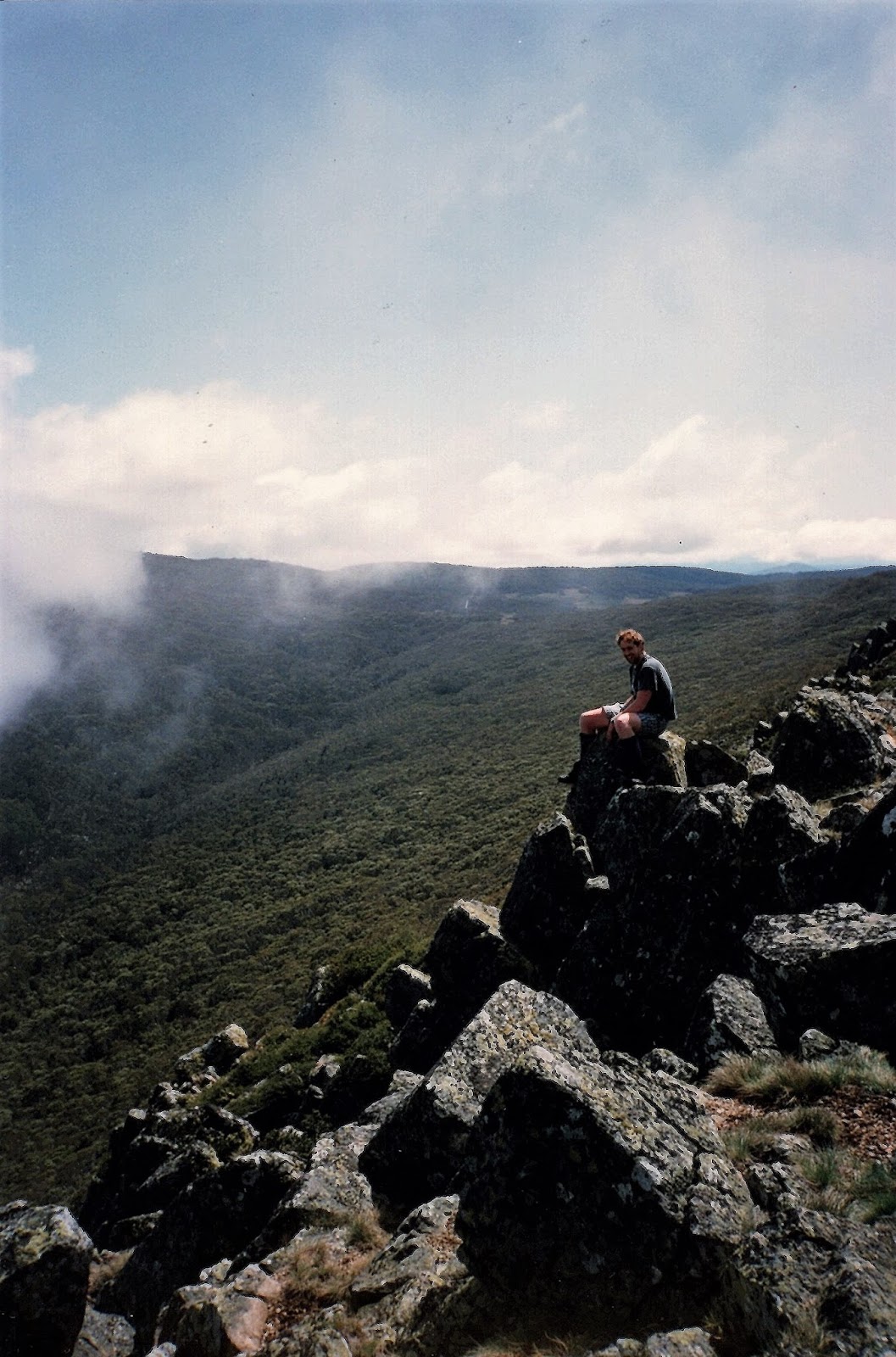
Now even though we were heading back to MacFarlane Saddle today we managed to avoid a retrace for the large part. Instead of tackling the loose and steep switchbacks of Gillios Track we instead chose to climb up Riggalls Spur Track. This track is both a lot easier and a lot more scenic than Gillios Track, culminating in the short side trip out to Echo Point with its grandstand views down to Lake Tali Karng and across to The Sentinels towering above the lake. After a bit of a break at the lookout we rejoined Riggalls Spur track and headed back to the old Riggalls Hut site.
 | ||
Lake Tali Karng from Echo Point.
|

Once back at the old hut site we headed along along the crest of the range towards Spion Kopje. I'm not sure about nowadays but back in 94' there was only a faint bushwalking pad fading in and out along the crest. After scrambling around the rocky summit and enjoying our last real grandstand view of the walk we set off once again towards the car park. Slowly descending away from the rocky ridge we met up with the Wellington Plains track a kilometre or so to the north of Moroka Gap. Once back on the Wellington Plains Track we retraced the remainder of yesterdays route back to the car, the grassy plains once again making for fairly easy walking. Once back at the car it was just a matter of climbing in and setting off on the very long journey back home, the long drive broken with the traditional stop at the Licola General Store for a pie and a cold drink.
 | ||
Spion Kopje
|
The Dirt.
We walked 31.5 kilometres over the two days on this medium grade walk. I don't have a metres climbed figure as this was way before GPS, actually even the distances are from old notes and maps so there is every possibility that they maybe out a bit. Like I eluded to in the first paragraph there a a few ways into the lake, the Wellington Plains route that we used is probably the easiest route. The Wellington River route is another slightly longer and harder route that is still pretty reasonable if the river isn't too high. Mt Margaret Track is another way into the lake although we're getting into fairly hard territory now. Finally, if you're a glutton for punishment and competent off track then you can approach the lake along Purgatory Spur through the Avon Wilderness, although the route is really only for very experienced groups. I'm not aware of any currently published notes for his walk, although back in the day Mr Tyrone T. Thomas wrote up the stroll.
Relevant Posts.


Hi there, the words "Indigenous" and "Aboriginal" need to be capitalised.
ReplyDelete