 |
| The climb up Long Point Track is steep and rough, but at least there are plenty of reasons to stop and take it all in. |
The Scenic Rim is a bit of a must do destination for a lot of Australian bushwalkers, with the Scenic Rim encompassing great walking icons like Springbrook and Lamington as well as Mount Barney and the Main Range it's an area that shouldn't be missed. Now that's all well and good, but for the Feral walker who's stuck in another drab Melbourne winter the Scenic Rim may as well be in Tahiti, as I've got about the same likelihood of visiting that tropical paradise as I have of walking the Scenic Rim at the moment. Or maybe not, you see we have our own Scenic Rim walk down here in Victoria in the scenic wonderland that is Lerderderg State Park. Yeah, just as our cousins up north have Sea World, we've got (had)
Wobbies World, they may have Mount Barney but we've got Mount Blackwood, so all in all I reckon we've got it covered.........maybe.
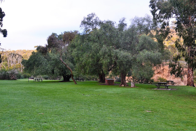 |
| Mackenzies Flat Picnic Area was a fairly chilly spot early this Saturday morning. |
I've been doing a lot of driving recently placing food drops and organising my up coming stroll on the AAWT, so when this Saturday rolled around I was pretty keen for a shorter drive to the trail head. Thankfully the Scenic Rim walk starts at the Mackenzies Flat Picnic Area which in is only a few kilometres out of Bacchus Marsh, which in turn is less than a two hours drive from home including the obligatory Saturday morning Maccas stop for toasties and a coffee. In fact I'd barely finished my coffee when I pulled into the surprisingly busy Mackenzie Flat car park on another very frigid Saturday morning. Pulling on my boots and resetting the GPS I was on my way by around 8:30 am today.
 |
| My first crossing of the Lerderderg River today, the early morning sun was just starting to light up the hills on the western side of the gorge. |
Now as is fairly normal for me I've actually done this walk before in one form or another, so there was no need to consult map or GPS this morning to make sure that I was heading the right way. Immediately after leaving Mackenzie Flat I crossed the gently flowing Lerderderg River, large stepping stones keeping my boots dry, before after 100 metres or so I re-crossed the river on stepping stones back onto the eastern side of the river. The track up the river along here follows an old water race so it's pretty easy which allowed me to relax and enjoy the early morning scenery, the sun starting to light up the western sides of the gorge. Unfortunately it's a little beyond my skill level with the camera to be able to manage the contrasting light levels, with me still in deep shade and the rocky bluffs to my west in bright sunshine it meant that either the bluffs we're washed out or it looked like midnight down in the forest where I was. After meandering along the old water race above the river for half an hour I arrived at Grahams Dam, encroaching rocky bluffs meant that I once again had to cross the river here, stepping stones keeping my boots dry again.
 |
 |
| Grahams Dam |
|
Grahams Dam is the spot that I would be returning to the river from the western rim of the gorge later this afternoon but for now I continued my journey up stream along the Lerderderg River, crossing once again back to the eastern side a few metres upstream from Grahams Dam. Now while I was still following the remains of an old water race the track after Grahams Dam is a little rougher, actually as a general rule the further you venture into Lerderderg Gorge the rougher things get, there is normally a fair trade off though as the scenery gets more rugged as well. Around a kilometre after leaving Grahams Dam I arrived at the sign posted Spur Track that would lead me out of the gorge and up to the eastern rim.
 |
After crossing back onto the east bank of the river after Grahams Dam the track gets a little rougher.
 |
 |
The bottom of the gorge was still a couple of hours from being touched by the sun.
|
|
|
Now all of the routes that I've ever used to climb out of Lerderderg Gorge are inevitably steep and Spur Track is no exception, hands are sometimes utilised on the loose scrambly sections for reassurance. Apart from the steepness of the climbs the other interesting feature of the spurs leading out of the gorge is how narrow a lot of them are, quite often you'll find yourself walking along a knife edged spur with views down to the meandering river below off both sides and the bottom of Spur Track is no different there. The good news is that the steepness combined with the narrowness of the spur meant that I didn't have to go far to start to get some great views back down into Lerderderg Gorge, perfect for me to stop and take a few photos while I allowed my red lining heart rate to come down a bit. The good news with Spur Track though is that the gradient eased the further from the river I got and the walking on the upper reaches of the track as it undulated over some knolls was superb, with the early morning sun painting the trees in a golden light. After much sweating I eventually emerged out of the scrub onto the old Lerderderg Tunnel Access Track.
 |
The start of Spur Track, the spur didn't get much wider until I'd climbed a fair distance from the river.
 |
Spur Track can be a little scrambly lower down.
 |
Higher up Spur Track the walking is superb, it looks like I'm finally about to break into the sun for the first time today.
|
|
|
As the name would suggest the Lerderderg Tunnel Access Track was cut through the mountains to facilitate the building of Lerderderg Weir and the tunnel that diverts the water away to the Merrimu Reservoir, so consequently my stroll down it was a fairly easy walk. Now while walking the Lerderderg Tunnel Access Track is a bit of a road bash there was still plenty to hold my interest this morning, the views down into the the gorge are quite extensive and as I got lower the concrete edifice that is the Lerderderg Weir started to come into view through the trees. I was also serenaded on my stroll down the road by the noisiest flock of cockatoos that I've ever experienced, the high pitched screeching of my feathered friends had me wishing that I'd bought some ear plugs.
 |
Lerderderg Tunnel Access Track makes for a very easy way down into gorge.
 |
They don't muck around keeping my 4wd mates out of here!
 |
The views down into the wild middle reaches of Lerderderg Gorge are very good from the Lerderderg Tunnel Access Track.
 |
There was no shortage of cockies on today's stroll.
 |
But bloody hell they were noisy.
 |
Lerderderg Tunnel Access Track
 |
| The day was turning into a pearler. |
|
|
|
|
|
|
Arriving at the empty weir I wandered over to a staircase on the side of the dam wall which allowed me access to the down stream side of the river. Once down off the wall I rock hopped fifty metres downstream before once again crossing the Lerderderg River on some stepping stones, again managing to keep my boots dry. The climb away from the weir up Long Point Track is very steep even by Lerderderg standards, the route climbs a very loose knife edged spur up and over a series of knolls, each of these rocky knolls provided great views along the gorge with the river snaking along below me, they also provided a great spot for me to stop for a bit of a lunch break today.
 |
The Lerderderg Weir, this is the upstream side and my climb back out of the gorge is going to be via the spur on the other side of the dam wall.
 |
I used these stairs to access the river bed below the dam.
 |
The lower side of the weir makes for the easiest spot to cross the river.
 |
There was a good flow in the river below the weir, I used these rocks to cross it again and keep my boots dry.
 |
The lower reaches of Long Point Track are very loose and slippery.

|
 |
| From Long Point Track. |
|
|
|
|
|
|
Suitably refreshed after my lunch break I continued on up Long Point Track, the gradient a little easier now. On meeting the Blackwood Ranges Track at the top of Long Point Track it marked the highest point of today's stroll, although at under 600 metres elevation it's hardly a giant mountain. I've walked Blackwood Ranges Track more times than I can remember over the years and my memories of it generally vary with the season, in summer it can be a hot, waterless beast that never seems to end, in winter it can be a pleasant roller coaster walk with far off views of rolling mountains, deep gorges and close up views of a profusion of native flora, thankfully today I experienced the later version.
 |
Looking back down to the weir from my lunch spot on Long Point Track.
 |
Higher up Long Point Track the gradient relents a little.
 |
I was serenaded by more cockatoos on my climb up Long Point Track.
 |
A rare down hill section on my climb up Long Point Track.
 |
 |
| There is a profusion of signs at the junction of Long Point Track and Blackwood Ranges Track, back in the ye olde days when I first walked up here there were only the cairns to help with navigation. |
|
|
|
|
|
It was mid afternoon by the time I met up with and started to descend Link Track Number 1, without wanting to sound too repetitive this is another steep little track. The upper sections of Link Track Number 1 allow for some fairly good views both up into Lerderderg Gorge (and directly into the sun this afternoon) and down towards the river flats around Bacchus Marsh (the light may have been better in this direction but the huge quarry has left a massive scar on the landscape). Lower down the slippery Link Track Number 1 I started to meet a few other walkers out doing the shorter circuit up Link Track Number 1 and then back down Link Track Number 2, this little circuit is only around 8 or 9 kilometres long but it's still pretty hard, by the time I reached the bottom of Link Track Number 1 I'd met more walkers than I'd seen for the rest of the day. The lower reaches of the spur I was following come out at Grahams Dam and once again the interlocking spurs that are a bit of a feature of Lerderderg Gorge meant that towards the base of the spur I was again able to check out the river below me on both sides of the precipitous spur.
 |
Blackwood Ranges Track can make for hot and hard walking in summer, but today it was almost perfect.
 |
 |
My descent down the very steep Link Track Number 1 allowed for some expansive views up into the gorge....it was a pity about the sun blowing the photos out!
 |
| The sun made it easier to get a photo in the other direction from Link Track Number 1, although the scenery down towards Bacchus Marsh left a little to be desired. |
|
|
|
Bottoming out at Grahams Dam I rejoined my morning route for the walk back to Mackenzies Flat Picnic Area. With the sun now having migrated it's way across the sky the retrace wasn't much of a hard ship this afternoon, the different light giving my plenty of excuses to stop and try and get a good photo. The final section back to the car park along the old water race was actually quite a pleasant way to wind down really, it was once again nice to be able to walk without watching my footing and just relax and enjoy the final few minutes on the track. After my final rock hop across the river I once again entered the Mackenzies Flat Picnic Ground, now while I said it was busy this morning then I'd have to say the place was really rocking now, the car park was overflowing down the access road so there must have been thirty plus cars parked there. Not that it worried me too much, I just pulled off my boots and headed off home for a nice hot shower, happy to be home at a reasonable hour on a Saturday for a change.
 |
I've just arrived back at Grahams Dam, there was now a little more of the rocky bluffs lit up by the sun than there had been when I passed by this morning.
 |
 |
The old water race back down to Mackenzie Flat made for a nice easy way to finish my walk, although I still had to squeeze my fat guts through this little chicane!
|
|
|
The Dirt.
Alright, I walked 17.4 kilometres at an average speed of 3.2 kph today and with 860 metres of climbing involved I'd rate this as a hard walk. This is a walk that I dug up out of one of Glenn Tempest's old books Daywalks Around Melbourne, it's walk number 31 in the book if you've got a copy. I also use the Meridian Map Lerderderg & Werribee Gorges 1:35,000 sheet when I walk in this area. Now while I may have taken the piss a little comparing this stroll the Queensland's Scenic Rim this is actually a pretty good walk, while it's nothing like it's Queensland namesake the rugged scenery and river views still offer up something special. This would be a good walk to do before venturing into the more remote middle sections of the gorge I think.
Relevant Posts.
 |
| Parks Vic have gone to a bit of trouble to make the section between Mackenzie Flat and Grahams Dam accessible to most people. |
 |
| Late afternoon on the lower reaches of the Lerderderg River. |
 |
| The eroded cliffs near Mackenzies Flat, the track up the gorge originally traversed below these cliffs and at one stage featured a roof to stop the punters from being sconed on the head from falling rocks. Now the track crosses to the west side of the river for 100 metre or so before re-crossing and picking up the old water race once past the hazard. |


No comments:
Post a Comment