 |
| The view back south along the tops of the Main Range from Bare Rock lookout, that's Mount Mitchell's East Peak poking up like a sharks fin. |
Way back in 2008 Sam and decided to head up to Mackay to visit a couple of friends, to break the journey a bit we decided to spend a few days in Brisbane on the way. So not wanting to waste the journey and not get in a walk or two, I decided that I'd do the Mt Cordeaux and Bare Rock Walk on my way to Brisbane. I've probably been past the trail head at least 100 times over the years as I made my way on another journey to Brisbane with my old man in the truck, although with the trail head being at the top of Cunninghams Gap I was normally more focussed on us getting safely down off the range in the truck than I was on walking. Anyway with no such worries today it was time to head off and check out Mt Cordeaux.
 |
| The Allen Cunningham cairn above Cunninghams Gap. |
Leaving the car park the track immediately climbs into thick rainforest and passes a memorial to Allen Cunningham who discovered the 755m pass in in the Main Range back in 1828. After checking out the old cairn I started my climb up through the thick green forest to Mt Cordeaux. Initially the sound of trucks grinding their way up or down towards Cunninghams Gap echoed through the trees, but as I slowly ascended the sound of the trucks gave way to the normal rainforest cacophony of birds along with all sorts of other hidden creatures that I could hear scurrying around. The climb up to Mt Cordeaux is pretty easy, well as easy as a climb of around 400 metres can be in the sub tropics anyway, the track is well defined, benched, and it gains height via some big lazy switchbacks (at least it did in 2008).
 |
Climbing up through the rain forest, the track was pretty well graded.
 |
 |
 |
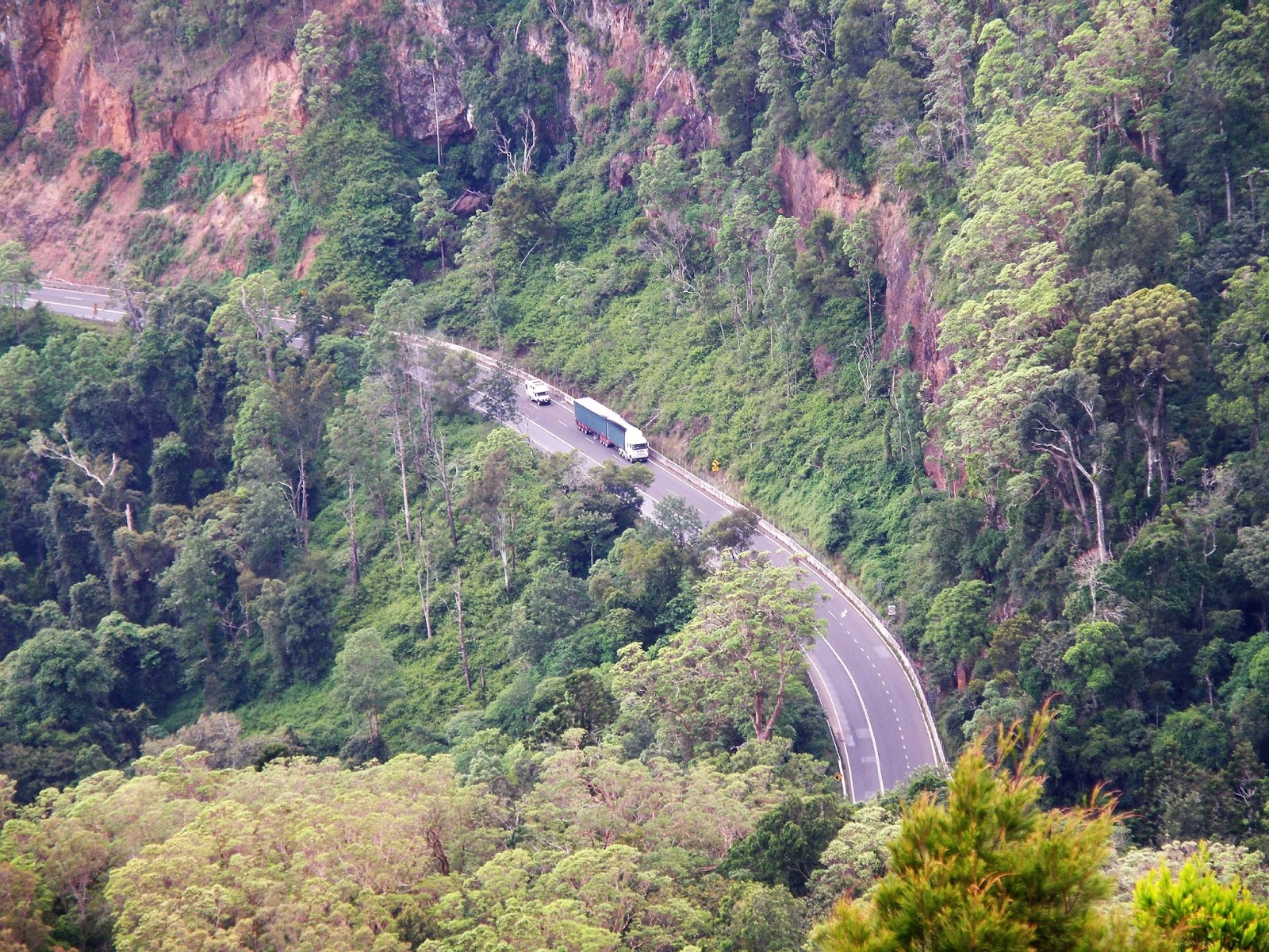
Looking down to the Cunningham Highway from the lookout above Cunninghams Gap, I've travelled this road hundreds of times in trucks over the years.
 |
| The Cunningham Highway descending from Cunninghams Gap, Mount Mitchell's East Peak towering above like a sentinel. |
|
|
|
|
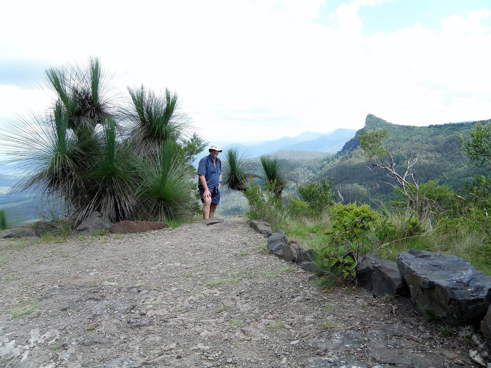
Now my walk today didn't actually take me to the top of Mt Cordeaux, actually as far as I know there isn't a track to the summit. Instead I took a short side trip out to a lookout below the cliffs that protect the summit, the lookout not only giving my a close up look at the bulk of Mt Cordeaux towering above me, but also out over the fertile low country towards Brisbane as well as Mount Mitchell on the other side of the gap.
 |
For really good rainforest shots you need to check out Ms Extreme's blog.
 |
The cliffs flanking Mount Cordeaux.
 |
The author at the Mount Cordeaux lookout.
 |
| Mount Cordeaux from the lookout. |
|
|
|
Leaving the Mount Cordeaux lookout I pushed on a bit (Sam was patiently waiting for me back at Cunninghams Gap), the trail now passes to the west of the Mount Cordeaux cliffs, descending a little to a high saddle in the rainforest before climbing once again fairly easily up to Bare Rock lookout. As the name would suggest Bare Rock lookout is an area of open rock, the lookout is just above the rainforest canopy and perched on the edge of the Scenic Rim so it provides a stunning view. Apart from the chance to see the distant high rise building of the Brisbane CBD glinting in the sun, the main interest is the view along the escarpment of the Scenic Rim, the sheer cliffs drawing the eye. After getting my breath back for a bit and taking it all in, it was time to retrace my route back to Cunninghams Gap and head into Brisbane.
 |
The view north along the volcanic Scenic Rim from Bare Rock lookout.
 |
Looking east from Bare Rock lookout.
 |
| The cliffs of the Scenic Rim. |
|
|
The Dirt.
I walked around 11 kilometres and climbed around 450 metre on this medium grade stroll, those figures are taken from old guide books and maps however so maybe aren't the most accurate I've ever used. Speaking of old guide books I used the notes and mud maps out of Tyrone Thomas' old book, 50 Walks Coffs Harbour Gold Coast Hinterland. Now this book was published way back in 1993 and is long since out of print so you may struggle to locate a copy. The walk has since been also written up by the Daly's in their Take A Walk in South-East Queensland book and also as far as Mount Cordeaux by Melanie Ball in her Top Walks in Australia book. As far as it all goes Melanie's notes and maps are the best ones. This is a very good walk, the views from the tops, along with the rugged scenery make it a must do walk I think.
Relevant Posts.
 |
| The author at the Bare Rock lookout, I was pretty shattered with the summer humidity in Queensland after driving up from Melbourne the night before. |


No comments:
Post a Comment