 |
| Views through the open forest are a bit of a feature of this walk. |
After finishing work early on this Friday morning and picking up some repaired walking gear over at Point Cook, I decided to motor up the Calder Freeway in search of bluer skies. Melbourne has now entered it’s grey and dreary period that will probably last until Spring I’m guessing, there are a few nice days in Melbourne over Winter but the likelihood of them corresponding with me having a day off is fairly slim I’ve found. After passing below Mt Macedon the ambient temperature gauge in the ute did actually creep up a couple of degrees and by the time the brooding bulk of Mt Alexander came into sight I was starting to see a bit of blue sky above my head as well. After a bit of mucking around trying to find the start of the walk, I eventually arrived at the small car park on McQuillans Road and set off under mostly blue sky.
 |
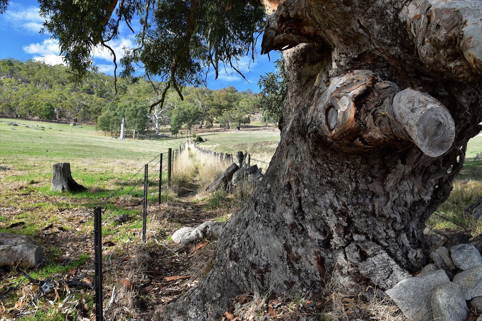
| Heading off from the McQuillans Road Car Park. |
A lot of the day walks in the Victorian Goldfields region utilise sections of the long distance Great Dividing Trail (GDT) and his walk is no different in that regards, so setting off from the ute I was straight onto a well marked route. The route of this walk starts off with a fair climb up to the tops of Mt Alexander and initially climbs a stile and passes between two paddocks which gives it a bit of a rural feeling, well a rural feeling whilst being serenaded by the industrial crushing sound emanating from the nearby granite quarry! After five minutes or so I climbed a second stile and entered the natural bushland of Mt Alexander Regional Park, which I’d be walking through until I’d return to this spot a lot later this afternoon.
 |
| Climbing up into Mt Alexander Regional Park. |
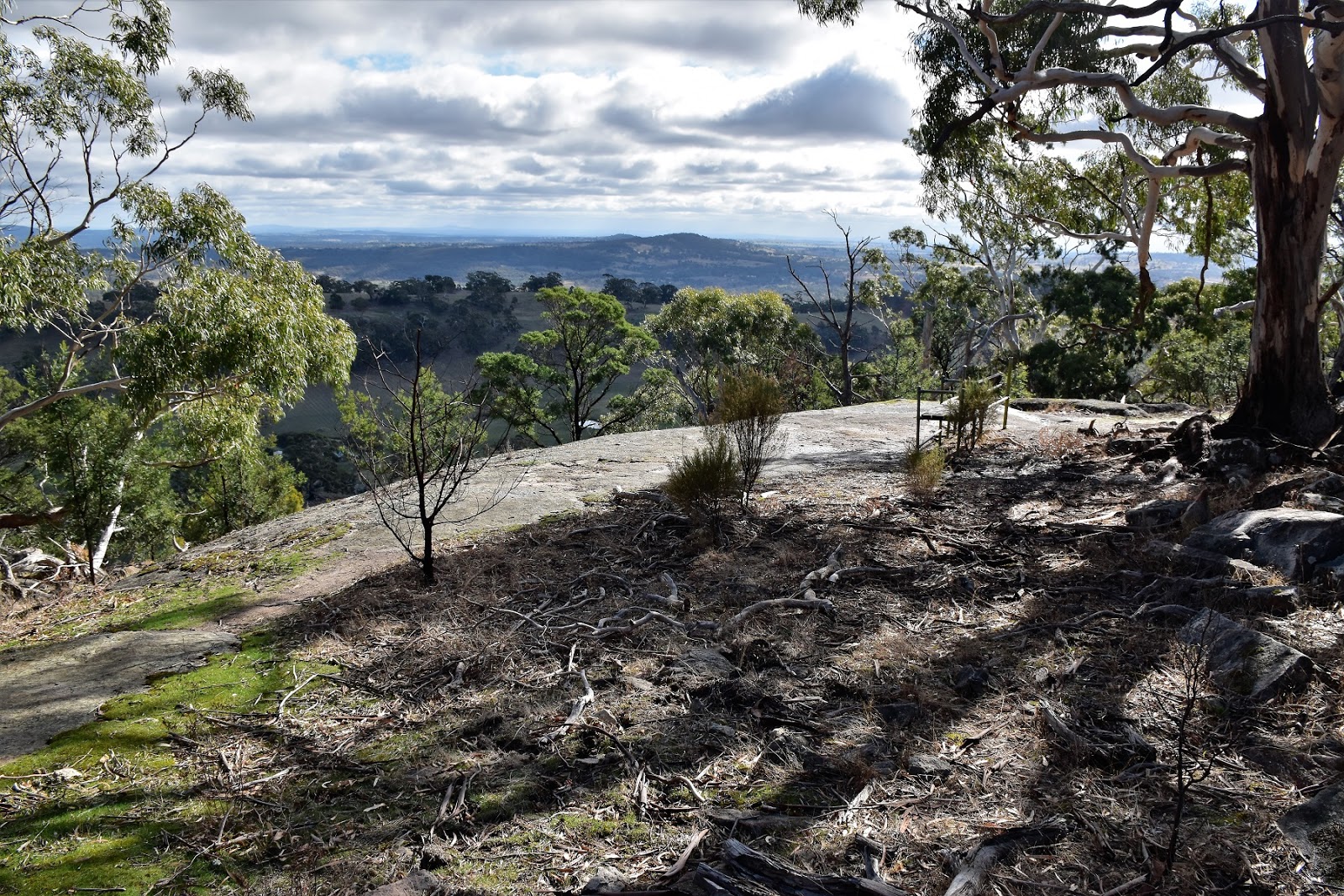
With the sound of the quarry slowly receding into the distance the pad climbed through the bush towards a natural rock lookout. The climb is pretty well contoured and never overly steep, the track builders have benched, stepped and zig zagged the route to make it pretty easy really. The only real issue up here is that occasionally the kangaroo pads criss crossing the open forest can be a little hard to distinguish from the correct pad, although to be honest it’s pretty straight forward as there is generally a track marker visible when needed. Arriving at the lookout this afternoon I took the standard photo, but thinking that I’d be back here in a few hours I didn’t linger too long as to be honest, the overhead conditions weren’t great for photos.
 |
Once in the forest the track climbs steadily up to a rocky lookout.
|
A few metres after leaving the lookout I passed by my return route to the right, continuing on I was still following the GDT. The track now starts a long traverse of the western slopes of Mt Alexander, rising and falling a fair bit as it makes it’s way north negotiating the increasingly rockier territory. The first couple of kilometres from the lookout to Dog Rocks are pretty reasonable though, while the track does rise and fall a bit it’s pretty easy going and anyway, the views through the open forest to the west are worth any effort required. With the granite rocks getting bigger and bigger it signalled my imminent arrival at Dog Rocks. This is a fairly well known rock climbing spot and today there was a group of school kids from Castlemaine out enjoying themselves, I couldn’t help but think that maybe if I’d been doing this stuff at school I might of lasted a little past year 10!
 |
Leaving the lookout the route divided, I was dropping down to cross this gully on the way to Dog Rocks.
 |
I'd managed to jag a pretty nice afternoon for today's stroll....so far.
 |
The views to the west feature for a lot of this walk.
 |
| Dog Rocks |
|
|
|
After chatting to the teachers and students for awhile I figured that I’d better get moving again if I didn’t want to be getting back to the ute in the dark. The next section of the walk is the roughest going of the day really, the track crossing increasingly steeper and rockier country as it makes it’s way north through Scorpian Rocks. Sam and I walked this circuit many, many years ago (before the GDT existed) and I remember have a lot of trouble staying on the pad along this bit, the open granite slabs and small grassy openings making it particularly hard to find the ongoing pad, nowadays all’s sweet though, with plenty of GDT markers about. After a bit of slow going around Scorpian Rocks the country opens up a bit and, with the communication towers crowning Mt Alexander now getting fairly close, the pad climbs easily crossing Joseph Young Drive heading the last few metres to the summit area.
 |
After leaving Dog Rocks the track crosses some steeper ground.
 |
Scorpion Rocks
|
|
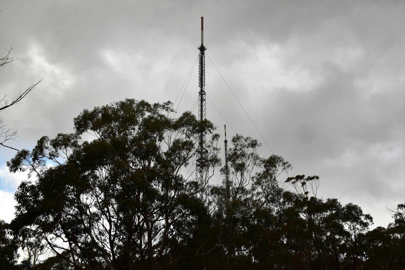
As I’ve already waffled on about the summit of Mt Alexander is crowned by some big communication towers which is a little unfortunate, although with a sealed road to the 725 metre summit we aren’y talking wilderness here. Moving away from the towers (and their generators) I headed over to Langs Lookout, this lookout is really just a perch on a large granite rock, there is nothing in the way of infrastructure or signage here. To find the lookout head past the towers for 50 metres across some large granite slabs, veer slightly downhill to the right, down onto a huge double decker bus sized rock, the lookout would be no more than 100 metres from the closest tower I’m thinking. Being a Feral walk as soon as I arrived at the lookout today it started to rain, so after taking a few snaps of the country to the north-east I put the camera away and got going again.
 |
Langs Lookout allows for a nice view to the North-East.
 |
| The only real showers of rain that I copped on the walk arrived at the same time that I arrived on the summit. |
|
Climbing away from the lookout I headed past the towers along the access road, a couple minutes later picking up the continuation of the GDT as it dropped down the eastern slopes of Mt Alexander. Thankfully the shower that had arrived at the summit of Mt Alexander at the same time as me had moved on by now and I was once again walking under weak sunlight, I even managed to get a photo of a rainbow to to the east as the rain passed by, sweet:) After dropping down the zig zagging track I met an old fire track, this was the spot that I left the GDT and started my loop back towards the ute. So anyway, after dropping off the side of Mt Alexander I now climbed the old fire track back up to meet the sealed, Joseph Young Drive near the crest of the ridge again, at least I was getting the stats up I suppose. Actually the walk up this old track is pretty good, there are a lot of kangaroos and native birds along here, and the open forest interspersed with slabs a rock make the walking very enjoyable.
 |
Leaving the summit my route dropped steeply down the eastern flanks of the mountain, the shower had passed me by now.
 |
 |
| Climbing back up to cross Joseph Young Drive the old 4wd track passes a couple of these huge rock slabs. |
|
|
Meeting the sealed Joseph Young Drive I crossed straight over and headed up and old un signposted track towards an abandoned granite quarry. Wandering up this old track I had a slightly unsettling experience. Shuffling my way around a corner I stumbled upon an old camp, now there is nothing unusual with that as on my walks I occasionally come across old abandoned camps in various forms. This one was a bit freaky though, there were two tents still standing, some clothes that had been wrapped up in a tarp had been uncovered and riffled through, but the really unsettling thing about it was that the camp had obviously been vacated in a big hurry, there was food half prepared, a tooth brush sitting on a log, a bush shower set up, washing on a make shift line. After a bit of ‘CSI Feral style’, I came to the conclusion that the camp had only been deserted for a few days. To be honest I was a little concerned that there may be a body in one of the tents (or somewhere nearby in the bush) so after taking a big breath I opened the first tent a few inches, no dead body but the a suitcase and other belongings which only made this abandoned camp even more of a mystery really. Opening the second tent I peered inside, this one had a mattress and bedding along with food, the socks and shoes outside the door only asking me more questions? After taking a GPS reading I poked around the immediate area a little bit before heading off again, but not before finding a small granite rock with it’s own adornment of glass skulls on it, hmmm!
 |
This abandoned camp was along an un signposted track in an old quarry, the camp had been vacated in a big hurry from what I could tell.
 |
 |
| Late afternoon in the old quarry, this place had a real strange feeling about it. |
|
|
With the sun now getting fairly low in the west and still having a fair walk to make it back to the ute I figured that I’d better get shuffling. Leaving the old fire track I dropped down a short off track section along the ridge line, the open forest making for a very nice little off piste interlude, although I still had the abandoned camp at the back of my mind. With Joseph Young Drive never that far away from me to the east it was just a matter of descending gently until the sealed roda came into view which I them dropped onto just before the small Dog Rocks car park. Once on the sealed road I wandered down it until I reached the turn off to Leanganook Picnic Area, my road bash only interrupted as I headed off to check out the black water of a small dam, trying with some success to get a photo of the reflections in the still, inky black water. I was interested in the dam not only for the photographic opportunities though, being close (ish) to the Leanganook Picnic Area I was keen to see if I’d be able to get drinking water here, in case I ever get a chance to walk the GDT one day.
 |
Leaving the quarry access track I started down a short off piste section of the walk, quite a nice section of today's stroll.
 |
 |
Back on Joseph Young Drive and heading down towards Leanganook Picnic Area.
 |
| The small 'bunyip' dam near Leanganook Picnic Area. |
|
|
|
It looks like Leanganook Picnic Area must feature in a ‘free bush camps’ book or something similar judging by the mob of Grey Nomads populating the area with their shiny 4wd’s, generators and flash caravans. Passing through the picnic area I picked up the track that would take me back to the first rocky lookout that I’d quickly passed through earlier today, the late afternoon sun now casting a nice soft golden light. Meeting my outward route a few metres short of the lookout I was now confident that I’d get back to the ute not only in daylight but, judging by the lack of ugly black clouds to the south west, I was pretty confident that I’d be dry as well.
 |
Late afternoon light heading back to the first rock lookout.
 |
| I've just re-joined my outward route. |
|
Retracing the last kilometre or so from the lookout to the end of the stroll wouldn’t be quick though, with the light now really good I mucked around taking photo after photo, each one I was sure would be a beauty (hmmm?). Eventually the pad descended back down to the open farmland, climbing the stile I scared away a mob of grazing kangaroos as I made my way the last few hundred metres back to the ute in the gathering gloom. Pulling off my boots I welcome the embrace of seat as I settled in for the two hour drive back home, pretty content with life after another nice walk.
 |
 |
I really enjoy walking in these type of late afternoon conditions.
|
|
I did his walk on Friday 18th May 2018. I reported the abandoned camp to the Bendigo Police Station on Saturday 19th May 2018 and gave them the GPS co-ordinates for the camp (Mt Alexander is actually in the Castlemaine jurisdiction apparently). As at the time of posting I haven’t heard anything back from the local coppers so I’m assuming everything was kosher…?
 |
I did this walk at the end of a long dry spell and the country certainly looked like it could do with a good drink.
|
The Dirt.
I walked 16.5 kilometres and climbed 472 metres on this medium grade stroll. I used Mr Tempest’s notes out of his
Victoria’s Goldfield Walks, the walk is described as 8.3 kilometres in Mr Tempest’s book which in assuming is a typo. Also, I couldn’t find the start of the the walk using Glen’s notes so I continued on along there Calder Freeway until and turned off towards Harcourt and then turned right onto the old Calder Highway. Once on the old highway it was only a few kilometres to reach McQuillans Road (the sign post is behind an over grown tree at the moment) which I followed to the small car park at just past the quarry. This walk use to be tough back in the day, the traverse along the western slopes of the mountain made it very hard to stay on the route (I’m talking more than a couple of decades ago) with this now being part of the GDT the walk is fairly easy to follow, although there is one short off piste section on the way back down to Leanganook Picnic Area which can easily be avoided if needed.
Relevant Posts.
Bendigo, 2018.
Bendigo, 2015.
Maldon, 2014.
 |
| Hey, Hey, the ute has just come into sight. |
 |
| Looking back towards Mt Alexander Regional Park as I finished another very nice little walk. |


No comments:
Post a Comment