 |
| It was a cold start to the day, but a beautiful afternoon. |
I’ve been suffering from a little ‘Man Flu’ this week, basically just trying to get through the working week without collapsing into bed. So with Saturday eventually rolling around you’d think it would of involved a nice sleep in and a weekend rugged up in front of idiot box, yeah you’d think that wouldn’t you….Instead I crawled out of be at 3:30am (no that’s not a typo) on a very frigid Melbourne winter morning, pulled on my walking gear and set off towards the distant Mt Arapiles. Settling into the heated seat I was amused on my drive this morning watching the ambient temperature read-out on my dash, for the record -4˚ was the coldest I saw, coincidently at the same time that I arrived at the Maccas at Ararat for an early breakfast. Arriving outside the Natimuk Golf Course Clubhouse, just after 8am, I locked the ute and set off into a positively balmy -2˚ morning.
 |
-2˚ and I'm crook as a dog, luckily I came prepared in shorts!
 |
| I started my stroll today from outside the Natimuk Golf Clubhouse. |
|
This walk basically circumnavigates in a clockwise direction the famous rock climbing area of Mt Arapiles. Setting off this morning I had a fairly easy start to the days walking as I wandered along Golf Links Road for a few hundred metres, with the golf corse on one side and rural land on the other it was a nice gentle warmup for the day ahead. Warmup maybe isn’t the correct word though, as arriving at the spot that I’d head bush into the Mt Arapiles-Tooan State Park I noticed that the large puddles on the track were covered in ice. While it was still bloody cold that didn’t mean that the condition were bad though, the sky was cobalt blue (well when I could see it through the fog) and the shafts of sunlight were lighting up the dry open forest in a golden light.
 |
There is a bit of a rural feel to this walk in spots.
 |
 |
Apart from being ridiculously cold it was a cracker of a day.
 |
Leaving Golf Links Road and heading into the scrub.
 |
| The puddles still had ice on them. |
|
|
|
|
My circuit had me walking around the ‘back’ of the park first, from this side of the Mt Arapiles Complex things look a little underwhelming when looking towards the mountain. Picking up a 4wd track heading north along the western boundary things soon started to pick up on the scenery front though, with Western Bluff towering above the trees. It was along here that I took a short detour to check out the Major Mitchell Cairn. Mitchell was the first known European explorer to climb the mountain when he camped here for three days on his expedition back in July 1836, the local Djurid Balud People lived in the area for thousands of years before the Europeans arrived though, the mountain no doubt providing shelter and resources for them. The ancestors of the original inhabitants still today live in the area and have a close connection with this park.
 |
Looking towards Mt Arapiles, the southern flanks of the mountain are a bit ho hum compared to what's to come on the northern flanks.
 |
 |
The towering cliffs of Western Bluff started to appear through the trees.
 |
The Major Mitchell Cairn.
 |
| Western Buff |
|
|
|
|
After a bit of a dog leg near a dry dam I curved around to the east and started heading along the northern boundary, my next objective Mitre Peak soon visible seemingly floating in a sea of fog across the green paddocks. Reaching a small easement between two paddocks I headed off on the short side trip and soon after crossing a sealed road I arrived at the Mitre Rock Carpark. Taking into account the frigid mid winter temperature Mitre Rock was a hive of activity this morning, although it did appear that most of the climbers were sticking to the sunlit northern crags. Feeling slightly out of place with my boots and pack around all the rock climbers, I headed around to the western side of the rock and climbed some way up a sloping rock slab. The good news was that apart from being in the sun, this slab allowed for some nice views down over the salty Mitre Lake and across to Little Desert National Park. Sitting in the sun watching the climbers and taking in the view life was pretty good.
 |
Mitre Peak, my next objective.
 |
Mitre Lake
 |
The route from Mt Arapiles to Mitre Peak runs along a narrow easement between farmland.
 |
Looking back to Mt Arapiles.
 |
Looking back towards Mt Arapiles from my perch on Mitre Peak.
 |
Mitre Peak was a pretty busy spot this morning.
 |
There was still a bit of fog around.
 |
| Mitre Lake |
|
|
|
|
|
|
|
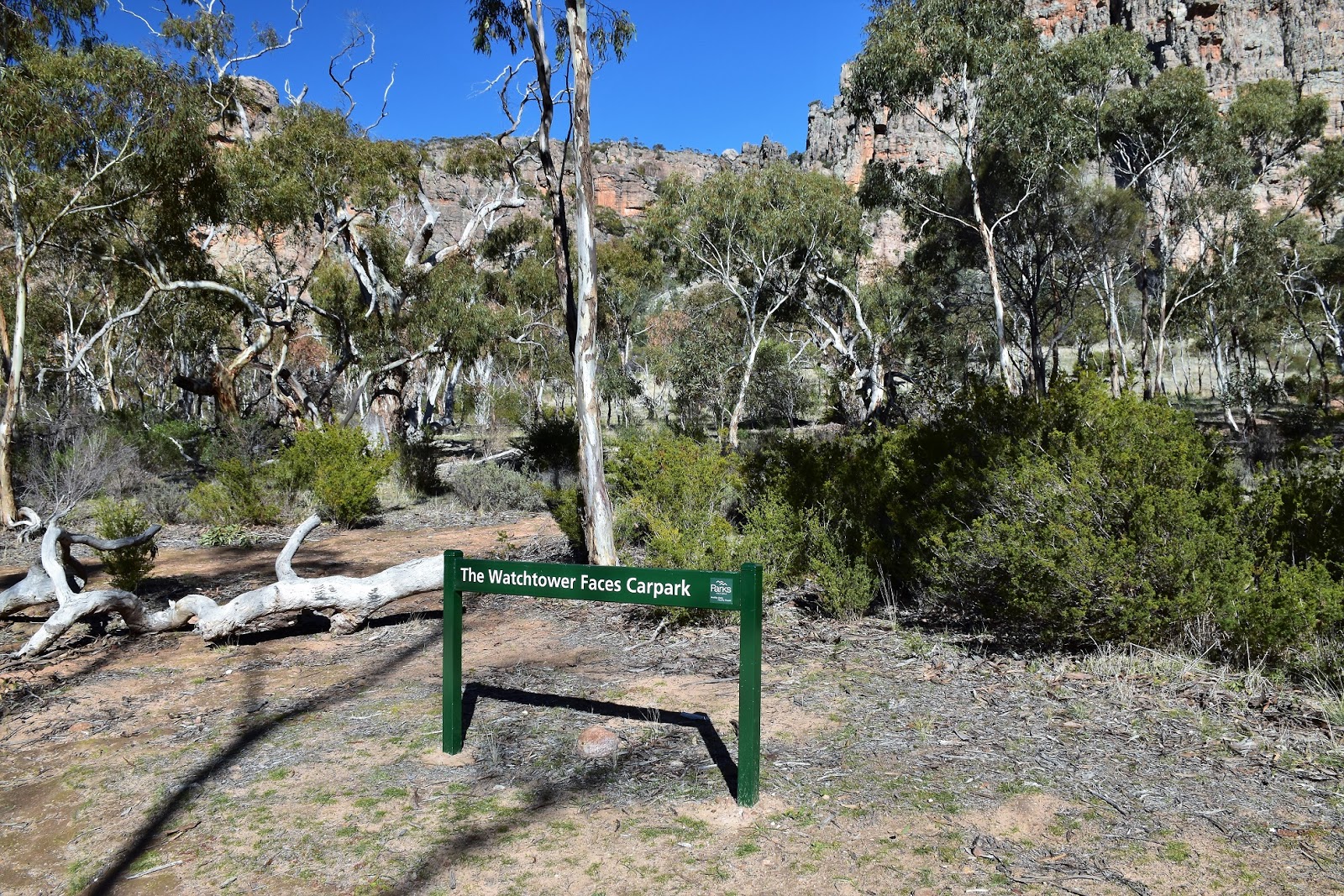
After warming up for awhile at Mitre Peak I shouldered my pack again and retraced my steps back towards the Mt Arapiles Complex. The cliffs on the north side of the mountain are a complete contrast to the gentle tree lined slopes on the south side that I’d been looking at earlier this morning. Meeting up with my route from this morning I continued on with my circumnavigation of the mountain, I was now following a dirt road that was more or less tracking along the base of the cliffs on the north east side of the mountain, looking for the spot that I’d leave the flat plain and climb to the summit. My notes were a little vague along here (my notes were over ten years old). To find the climbing gully I followed the dirt road, passed one informal climbers carpark until I arrived at the second car park that gives access to the Watchtower Faces.
 |
Leaving Mitre Peak I watched these climbers on the pinnacle for awhile.
 |
 |
I followed the Big Sky Bike Trail in spots today.
 |
I was now walking along the base of the north east facing cliff line looking for a climbing gully.
 |
| Head towards the cliffs from this carpark. |
|
|
|
|
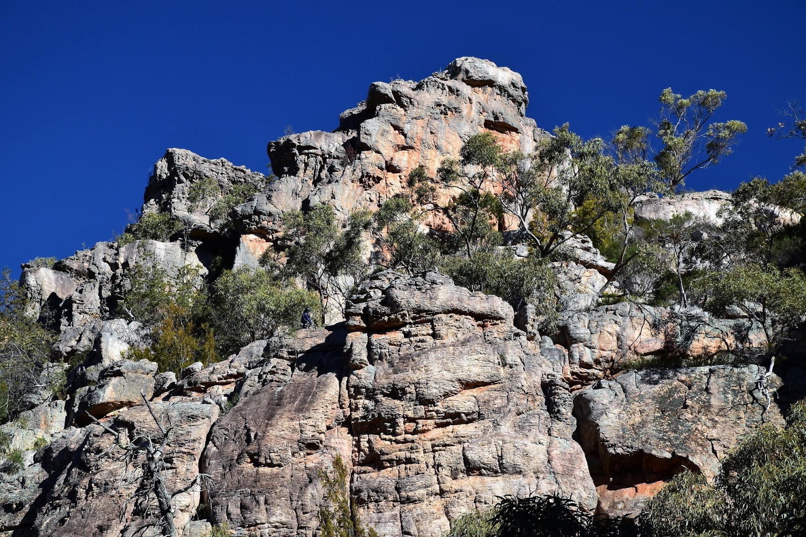
From the Watchtower Faces Carpark I climbed an old 4wd track towards the base of the cliffs, before contouring to the left a little on a rougher walking pad. The ‘go’ here is to aim for the gully that climbs to the right of a huge, free standing pinnacle of rock. It all sounds a bit complicated but you can’t miss the pinnacle (I’m sure it has some really cool rock climbing name, but hey I’m just an old walker;). Once the gully starts to steepen and close in, the way up is obvious, there are a lot of dry stone steps and the track stays pretty close to the towering cliffs on the north side of the gully. After a fairly steep climb (remember, I was a little crook today) I arrived at the end of the sealed mountain access road and took the short side trip up to the official Mt Arapiles Lookout. Like I said there is a sealed road to the summit so this lookout can be accessed fairly painlessly, if you are in the area it’s worth heading up too check it out I think. Being remote from the Grampians, Mt Arapiles punches above what it’s 365 metre height might have you imagining, no doubt helped by the fact it looks down across the almost billiard table flat Wimmera Plains.
 |
Approaching the base of the cliffs I headed left a little.
 |
I climbed the gully to the right of this huge rocky pinnacle.
 |
Squint and you might see some climbers on the rock, it'll give a sense of the scale to this place.
 |
There were plenty of reasons to stop on my climb....
 |
....and plenty of steps.
 |
| Mitre Peak and Mitre Lake from the Mt Arapiles Lookout. |
|
|
|
|
|
Leaving the Mt Arapiles Lookout I returned to the sealed access road and followed it for a couple of hundred metres before branching off towards the Bluff Lookout. Like the main lookout, Bluff Lookout gives a grandstand views across Victoria’s northern plains, sitting at the picnic table at the deserted lookout in the sun, the Callitris Pines gently moving in the breeze it almost felt as though I was in the outback. After a bite to eat and a bit of a drink I retraced my steps a little and picked up the signposted Central Gully Track (my notes call this Gorge Track). Like my climb the descent back down through the cliff line was fairly steep, but also like my climb it looks like there has been a bit of work done on the track to make things a bit easier.
 |
The top of Mt Arapiles is a bit plateau like.
 |
The Mt Stapylton Complex in the Grampians are the closest hills of any note I suppose.
 |
Bluff Lookout
 |
Dropping back down to the plains the scenery was now stunning.
|
|
|
|
Dropping down my progress was slowed a little as I stopped to take photos of the crags above me glowing in the afternoon sun, the longer I stopped and looked the more climbers that I could see clinging ant like to the vertical faces. I was now dropping down towards some Radiata Pines that mark the spot of Centenary Park, the main campground in the park. From what I know this spot is known just as The Pines in climbing circles, this is a place of reverence in Australia’s climbing culture with most of our well known climbers having spent time here.
 |
Heading down to The Pines camp, this spot is the holy grail of Australian rock climbing from what I understand.
|
Walking down through the large camp this afternoon, picking up accents from around the world, I was looking for the continuation of my journey. The walk continues from the bottom of the camp/picnic area (well that’s where I picked up the track anyway) next to a toilet block. I was now heading south along another old 4wd track, the cliffs of Mt Arapiles glowing in the afternoon sun over my right shoulder easily visible through the open forest.
 |
I picked up this track heading off beside the toilet block.
|
The walk was now coming to it’s end though as I passed the small outlier of Declaration Crag on my left. Crossing the sealed mountain access road I picked up the continuation of my walk along a walking track that snaked it’s way through the heath to eventually emerge onto Golf Links Road, turning west I gently eased my way back to the ute, enjoying a nice easy finish to my days stroll. Climbing into the ute and heading off on the long drive home, my body was feeling pretty second hand but my soul was feeling rejuvenated again.
 |
Declaration Crag
 |
| The last section of the stroll followed a walking track through low heath. |
|
The Dirt.
According to my GPS I walked 18.2 kilometres and climbed 424 metres on what I’d call a medium-hard walk. This is a bit of a funny walk in that for the most part it’s very easy, but the climb and descent of Mt Arapiles are both fairly steep. The scenery in parts of this walk reminds me of walking in some of our more arid regions. Sign posting on the walk is a little hit or miss, you definitely need some kind of map as there are a lot of twists and turns that aren’t signposted. Speaking of maps I used one of Mr Thomas’ old mud maps along with his notes and my GPS maps. Parks Vic have no doubt got some good stuff online as well.
Relevant Posts.
Desert Discovery Walk, Little Desert National Park, 2016.
Stapylton Ampitheatre, Grampians National Park, 2016.
Mount Wudjub-Guyun (Hollow Mountain) & Gulgurn Manja Rock Art, Grampians National Park, 2018.
 |
| Wandering back to the golf course along Golf Links Road was a pretty easy way to finish my walk. |
 |
| I found this map up at the lookout carpark, it's probably as good as any of the others. |


No comments:
Post a Comment