 |
The Surf Coast Walk.
 |
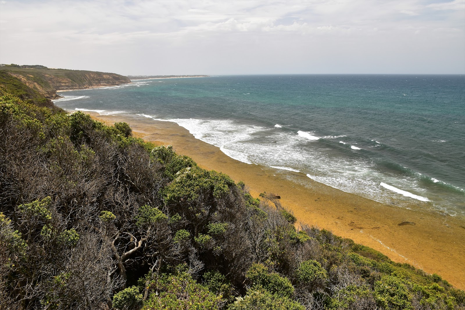
| Looking south along Half Moon Bay towards Bird Rock, I love this stuff! |
|
Once again, after finishing work this Friday I found myself on the wrong side of the city. Never wanting to waste an opportunity to fit in a stroll I decided to keep going and head down to Torquay and walk a small section of the Surf Coast Walk (SCW). That all sounds pretty normal I suppose, but there was one unusual feature of today’s stroll. Yep, when I set off the ambient temperature was well north of 40˚ with a predicted temperature in Melbourne of 44˚ (that’s a bit over 111 Fahrenheit for my cousins in America).
 |
| I started today's stroll at the Torquay Surf Life Saving Club. |
Climbing out of the ute the heat took my breath away for a minute or two as my lungs sucked in the searing hot, dry air. Finding a bit of shelter I stopped to reset my GPS and layer sunscreen over any exposed skin before shouldering my pack, which was a little heavier than normal with 3 litres of water in it, and then setting off along the coast towards the distant Bells Beach. I started this stroll at the Torquay Surf Lifesaving Club and immediately dropped down onto the beach and turned right, happy to be heading away from the huge crowds going various shades of pink on this fairly sheltered surf beach.
 |
| Looking back along the Torquay surf beach towards Point Danger. |
I’d timed this walk to do the beach section at low tide for two main reasons, the first one being that I could stop for a cooling dip at any time and the second one being that I needed low tide to get around Rocky Point at water level. With Rocky Point now right in front of me I meandered my way in and around a few rock stacks, mostly keeping my feet dry (not that it mattered as I was doing this walk in my Teva sandals). Rounding the point that is Rocky Point the long, wide expanse of Half Moon Bay opened up before me. I’d be following this beach for the kilometre and a half before climbing to the cliff tops.
 |
The aptly named Rocky Point provided my first obstacle for the day.
 |
| Rocky Point...at low tide. |
|
I had a bit of very good fortune now. In the distance I could see the a lot of dust getting thrown up from the cliffs down near Jan Juc which I thought was a bit unusual, a couple of minutes later I realised why all the dust was getting kicked up when I was hit in the face by a stiff southerly wind blowing through. With the southerly wind coming through the temperature plummeted to a more reasonable high 20˚ making walking a lot more pleasant. The rest of my stroll along the beach was fairly uneventful as I weaved my way through the beach goers, feeling a little overdressed in my long sleeve shirt and bushwalking gear. After passing beneath Jan Juc Surf Club the cliffs close in a bit, it pays to stay close to the water along here as the sandstone cliffs are very unstable, although it appears as though a lot of people aren’t aware of the danger above them as they sat in the shade beneath the cliffs.
 |
The southerly change blowing past Jan Juc along the cliffs.
 |
It was suddenly around 15˚ cooler.
 |
Looking out to Bass Strait from Half Moon Bay.
 |
It pays to stay away from the base of these cliffs.
 |
| Coastal cliffs, Half Moon Bay. |
|
|
|
|
With Bird Rock looming large it was time to leave the beach and climb up to the cliff tops, the last stairs are at 78W incase anyone follows me. Once on the tops I was walking the SCW, this track runs from east of Torquay all the way along the coast to Moggs Creek and makes for a fairly civilised multi night walk, with potential stops in Torquay, Angelsea and Aireys Inlet. Following the wide crushed granite path the only thing that slowed me down now was stopping and checking out the numerous lookouts, it seems like there is a lookout every few hundred metres along this section of the walk.
 |
Bird Rock
 |
Time to climb up to the Surf Coast Track.
 |
Striking out along the cliff tops on the Surf Coast Track.
 |
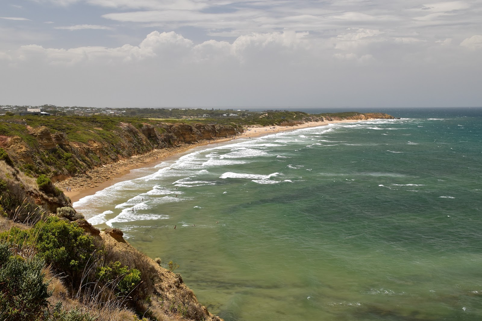
Looking down to Jan Juc Beach from one of the many lookouts along this section of the Surf Coast Walk.
 |
| There are a couple of reasons that I want to get back here.... |
|
|
|
|
After passing the Jan Juc shops the track continued to hug the cliffs, keeping to a narrow belt of public land between some flash houses and the cliff tops. This is a fairly flat walk (well when you’re not climbing up or down the cliffs) but along here the SCW undulates a little as it crosses a few gullies, but all in all it’s pretty cruisey walking and there is always the views to take your mind of any rises in the track. With the sound of traffic getting closer I knew that I was getting closer to Bells Beach Road and sure enough I was soon walking beside the road, fairly busy as usual with tourists and not surfers.
 |
The Surf Coast Walk follows a narrow section of public land between the cliff tops and the flash houses.
 |
The Surf Coast Walk
 |
Even with our hot dry weather, the coastal scrub was still looking good.
 |
| This little bloke seemed totally oblivious to the sweaty walker hovering over him. |
|
|
|
I now entered the Bells Beach Surfing Reserve and after getting the obligatory tourist snap of the entrance sign I shuffled on towards the beach access point. There are both a north and south access point to the small Bells Beach and today I headed down the southern most access point before dropping onto the sand. Like most of my visits to Bells there was bugger all swell here today, the local surfers all heading elsewhere for a surf this afternoon. Trudging up the soft sand for a few hundred metres I climbed the northern steps up towards a lookout, slightly perturbed to notice how many tourists where swimming in the shore break and not seeming to understand the water conditions. The northern exit also gives access to Winki Pop and while Bells Beach had numerous tourists on it the vastly prettier Winki Pop was populated by just one Long Boarder.
 |
Surfings sacred site.
 |
Bells Beach
 |
Coastal Tea Tree above Bells Beach.
 |
There is a big lookout above Bells Beach which I'm guessing is used to televise the Easter Classic.
 |
Bells Beach
 |
Bells Beach, that's the Surf Coast Walk continuing on up the headland.
 |
| Bells Beach...good advice. |
|
|
|
|
|
|
It was just a matter now of retracing my steps back to the top of the 78W steps, the view slightly different with my change of direction. After passing above Bird Rock I avoided my outward route and stayed on the SCW along the cliff tops, with the tide now coming in it was obvious that I’d timed my beach walk right today. I’ve never really surfed (although I do like to body surf) but I really do like watching surfers and there are generally lots of opportunities to watch the action along this bit of coastline, although with the waves pretty choppy this afternoon it was mainly the more inexperienced out now.
 |
Winkipop Beach
 |
Winkipop was largely deserted.
 |
All I had to do now was to retrace my route back to Rocky Point.
 |
Approaching Half Moon Bay again... the tide was now a fair way in.
 |
| There were some kids swimming at Bird Rock .... you'd want to know what you were doing I'm thinking. |
|
|
|
|
With Rocky Point now getting very close the SCT passed behind Jan Juc Surf Life Saving Club, headed inland a little to parallel the Torquay Golf Club for a few hundred metres before once again resuming the cliff top walk. This next section of the walk is a good one with the track cut into the cliff line, the beach now directly below me. The great walking continued all the way along to Rocky Point, although the soft sandy track was still hot enough to make me very glad that I still had my sandals on. Making the short side trip out to Rocky Point the Torquay Surf Life Saving Club and the end of my stroll was just front of me, my day was coming to its end.
 |
Ochre coloured cliffs near Jan Juc.
 |
The Surf Coast Walk dropping down to Jan Juc Surf Life Saving Club.
 |
Looking back down the wild coastline towards Bells Beach.
 |
There were a lot of surfers out in Half Moon Bay, although the surf was less than ideal.
 |
The Surf Coast Walk burrowing through the Tea Tree near the Torquay Golf Club.
 |
| This walk is well signposted. |
|
|
|
|
|
Standing on the lookout at the end of Rocky Point looking down at the surging Bass Strait it was obvious why I had to get around here near low tide earlier today, I would of been swimming if I’d wanted to get around the point at sea level now. Re-joining the SCT it dropped down to cross Spring Creek on a long section of boardwalk, happy to see schools of fish feeding in the shallow water. Leaving the boardwalk I was deposited back in the Surf Beach car park and the ute, my days walk now over. With the temperature now in the high 20˚s, it was certainly a lot more pleasant temperature wise now than it had been when I’d left 4 hours ago, that’s for sure.
 |
Great walking on the Surf Coast Walk approaching Rocky Point.
 |
Near Rocky Point.
 |
Rocky Point
 |
Rocky Point
 |
| The Torquay Surf Life Saving Club from Rocky Point. |
|
|
|
|
The Dirt.
According to my GPS I walked 12.1 kilometres and climbed 353 metres on this walk (I suspect the cliff top/beach walking plays havoc with the elevation on my GPS as my position only has to be a few metres out and the elevation could rise or fall 40 or 50 metres). This walk has been written up in one form or another by various walking guide book authors from Chapman and Thomas to more recently Julie Mundy, I carried the Chapman’s Day Walks Melbourne today. This is Easy- Medium grade walk I’m thinking, the tracks are all pretty strait forward and the sign posting is good, the only issue really are the beach sections as you need to make sure you do them at close to low tide.
Relevant Posts.
Point Addis, Great Otway National Park, 2014.
Angelsea to Point Addis, Great Otway National Park, 2018.
Angelsea Perimeter Walk-East, 2016.


No comments:
Post a Comment