As I finished off this walk today I jumped into the ute and heard the first reports coming through of the tragedy happening over in New Zealand. First of all I'd like to convey my sympathy and sorrow to all my Kiwi brothers and sisters, I've been trying to make sense of what is a senseless act all weekend, but I've come to the conclusion that there is no making sense of bigotry and madness. Secondly I need to state my sympathy and solidarity with all my Muslim brothers and sisters, whilst I definitely fall into the 'free thinker' category I think that there is no place for hatred and bigotry against any religion (or nationality, for that matter). Thirdly I think we all need to practise some tolerance, compassion and turn down the heat a little (especially some of our elected leaders), if that makes me a bleeding heart, well guilty as charged I say.
 |
Views are a real feature of this walk.
 |
| Conditions were somewhat variable today. |
|
With our mountains to the east of Melbourne still very marginal due to ongoing bush fires I once again had to cast around a bit looking for a walk this week. After consulting my guide books, Parks Vic’s up-date page and the BOM site I decided to head down to the Otway Ranges for a walk. Heading down late on Thursday night after work I spent the night at the Upper Gellibrand Camping Area, before packing up first thing in the morning and driving the remaining half hour to the start of the walk at Wild Dog Creek…in the rain.
 |
I took my time getting ready this morning, hoping that the rain would blow through.
 |
| Looking out into Bass Strait from Wild Dog Creek. |
|
It’s always hard setting off for a walk in the rain, so I mucked around a little this morning pulling my boots and gaiters on in the front seat of the ute, hoping that the showers would blow through. With only the lightest of rain still falling I emerged from the ute after 15 minutes or so, re-set the GPS and set off on my walk. To start with today I followed Wild Dog Road away from the coast, I’ve driven this road before so I knew that, unlike the Great Ocean Road which I had to cross over, I wouldn’t be dealing with too much traffic going up here. The bitumen Wild Dog Road follows the course of Wild Dog Creek up a valley before slowly starting to climb up into the surrounding hills.
 |
I picked up the quiet Wild Dog Road.
 |
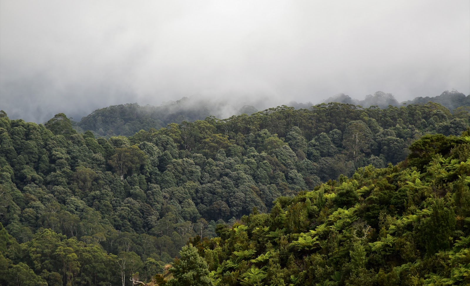
While the majority of this walk passes through rural land there is a short section of native bush near the start.
 |
| Wild Dog Creek |
|
|
As it would turn out today’s stroll featured ‘variable’ conditions and straight away things were pretty changeable when it came to the weather, depending on the direction that I looked the scene could have a ‘nice Autumn Day’ look to it or an ‘approaching armageddon’ look about it. All was pretty good though as I continued to climb fairly easily up Wild Dog Road before heading a bit more steeply up Busty Road.
 |
Wild Dog Road heads through this narrow gorge initially.
 |
Whilst I was walking under a weak sun I didn't have to look far to see rain.
 |
| I'm about to turn right onto Busty Road...and start a fairly relentless climb. |
|
|
Now even though I was climbing up into the Otway Ranges the scenery up here was more rural than wild temperate rainforest of which I normally think of when walking in the Otway Ranges. Still the open paddocks, baked golden grown at the end of a long hot summer made for interesting walking and the sparse tree cover allowed for some big long range views. Looking down the coast towards Apollo Bay the blue waters of Bass Strait appeared almost dead calm from up here, however looking a little further inland to the west the receding ridge lines of the Otway Ranges were covered in brooding dark clouds.
 |
Climbing Busty Road I passed a teepee?
 |
Looking down towards Apollo Bay. Bass Strait appeared almost dead calm from up here.
 |
Busty Road has some stunning views.
 |
It is actually pretty uplifting to see some rain.
 |
Busty Road
 |
There is a lot of rural farmland on this walk.
 |
| The weather to the west looked a little sub optimal! |
|
|
|
|
|
|
The bitumen Busty Road makes for surprisingly good walking as it climbed onto a ridge and then more or less followed the crest of this high ridge inland. I’d been really lucky so far on my walk in that whilst it appeared that sometimes I was surrounded by dark, menacing clouds I’d largely been walking under my own little ray of sunshine. With Busty Road changing from bitumen to gravel it looked like my luck with the weather soon to run out though, still climbing I veered right onto another quiet dirt road, this time Biddles Road and the rain did indeed arrive…oh well.
 |
Busty Road climbs a long way up from the coast.
 |
Busty Road
 |
Looking west from Busty Road.
 |
| I picked up Biddles Road on the right. |
|
|
|
Like Busty Road, Biddles Road more or less followed the crest of a spur, this one heading down towards the coast at Skenes Creek. Persevering for awhile with my DSLR I eventually had to cut my losses and stash it way in my dry bag, replacing it with my waterproof camera…and an umbrella. After passing by ‘Otway Herbs’, a garden which you could potentially go into to escape the elements for awhile I’m thinking, I soon arrived at a ‘road closed’ sign. This road closed sign is for vehicles but walkers are allowed to continue on down to the coast.
 |
The rain was closing in on me as I followed Biddles Road.
 |
Hmm...
 |
Time to stash the DSLR away I think.
 |
Biddles Road
 |
I was now starting to slowly drop back down to the coast, still passing through mostly rural land.
 |
| I dropped down this fire track to Skenes Creek. |
|
|
|
|
|
The fire track once again had my walking down the crest of a spur, initially the views were somewhat muted as the misty rain came down, but after 15 minutes or so I again found myself in a break in the weather. Corresponding with the improved overhead conditions my spur got quite acute which again gave me some stunning views along the coast, probably the best for the day actually. Looking east towards Lorne the ranges were still covered in a layer of dark brooding cloud while, seemingly below me the small town of Skenes Creek was bathed in sunshine, to the south west the safe harbour of Apollo Bay was also shimmering in the sunlight.
 |
The fire track actually climbed a little....
 |
....before the sun came back out and the track levelled off...
 |
| ...and then dropped, very steeply in parts, down to Skenes Creek. |
|
|
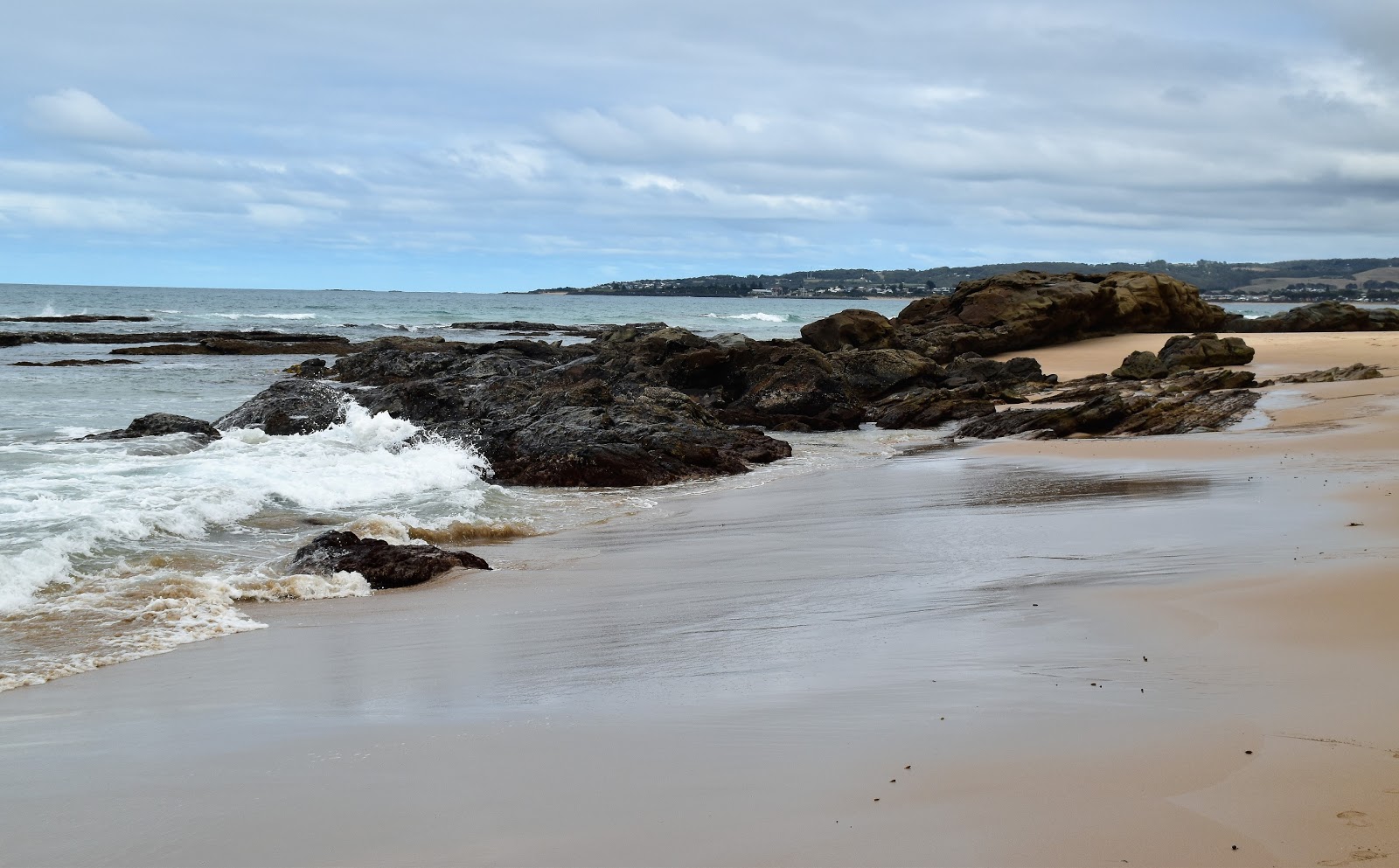
It’s was a good thing that this track provided some great views though as the views provided all the excuses I needed to stop and give my knees a bit of a break as I descended down what is very steep track. Eventually my steep descent eased off as I meandered my way into Skenes Creek and headed for the beach. I’d timed this section of the walk to more or less correspond with low tide today and arriving at the mouth of Skenes Creek I was happy to see plenty of dry real estate for me to walk down the coast along.
 |
Looking up the coast towards Lorne things were still a little inclement.
 |
The cleared farmland allowed for magnificent views out into Bass Strait.
 |
Apollo Bay
 |
| Skenes Creek |
|
|
|
Setting off along the coast in the direction of Apollo Bay the last few kilometres of my walk had me walking either rock shelves or fairly hard sand close to the waterline. While the sand walking was a fairly stock standard beach walk the rock shelves always tend to make for interesting walking and today was no different in that regards. With the tide almost dead low now there were plenty of rock pools to poke around as I ambled my way along the coast. While the Great Ocean Road is generally in sight for the length of this beach walk the actual coast line was surprisingly deserted, on my ramble I only bumped into 3 or 4 other walkers.
 |
Skenes Creek making it's way out into Bass Strait.
 |
I really enjoy walking these coastal rocks shelves.
 |
| Being low tide there was always something to check out. |
|
|
After crossing the barely open mouth of Wild Dog Creek the end of the walk was near. Walking the last few metres back to the ute I took a couple of photos along the wide sandy beach looking down towards Apollo Bay, the grey clouds not doing much for my photos again, I guess I’ll just have to return to get some nice photos!
 |
Looking along the coastline towards Apollo Bay.
|
The Dirt.
I walked 14.7 kilometres and climbed 439 metres on this medium grade stroll. Whilst this walk is definitely not a wilderness style of walk as it’s almost all either passes through rural farmland or along the coastline, I really enjoyed it. While the long range views are a real feature of the walk the exposed nature of much of the walk means that there isn’t much respite from the elements though. I used the notes out of
Walking the Otways which is published by the House of Chapman and used the
Otway Central 1:50,000 SV Maps sheet. I really enjoyed this stroll, if you are a bit jaded with native bush type walks then this is one to consider I think.
Relevant Posts.
Stevensons Falls, Otway Forest Park, 2017.
West Barwon Dam to Lake Elizabeth, Great Otway National Park, 2017.
Lorne Forest Walk, Great Otway National Park, 2017.
 |
| The mouth of Wild Dog Creek was barely open. |
 |
| This walk starts (and finishes) at the Great Ocean Road bridge over Wild Dog Creek. |


No comments:
Post a Comment