 |
| Coliban Channel |
Last Saturday I was looking for a walk that would allow me to have a swim to try a keep cool, today found me sloshing my way along a water race in the rain, yes you’ve got to love Victorian weather. With the weather south of the Great Dividing Range predicted to be on the damp side I’d headed up to Bendigo for this walk. This walk is one of those convoluted walks that follows numerous old tracks to form a circuit and arriving at the start point this morning it was obvious straight a way that I wasn’t following a designated track. At the designated start point in my notes on Callinan Lane I was greeted by a home made ‘no parking’ sign. Callinan Lane is bordered on one side by private hobby farms and on the other by Bendigo Regional Park and it appears that the local resident has got sick of the multitude of walkers parking on the street in front of his property. Now to say I was a little dubious of the legality of the ‘no parking’ edict would be an understatement, but seeing as I’d be gone for a few hours I decided to head along Cahills Road (a 4wd track) for a couple of hundred metres and take my chances leaving the ute in the scrub.
 |
| I started the walk close to where Cahills Road passes a large dam. |
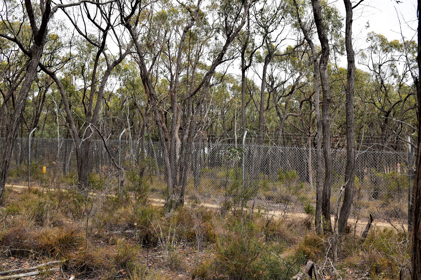
First off today I was heading west towards Sandhurst Reservoir along Cahills Road, now that all sounds pretty straightforward but in reality navigation along here was pretty vague. As I mentioned earlier Cahills Road is a 4wd track and it was almost indistinguishable from the myriad of other un-signposted 4wd tracks criss crossing Bendigo Regional Park. The go along here was if in doubt pick the track that looks to be heading in the most westerly direction, the occasional white post lining the road can help. After crossing what looks like an informal water race that appeared to have been dug to flow into some private land, I eventually arrived at the spot where I joined the Goldfields Track, navigation would now be a bit easier for awhile.
 |
Cahills Road heading through the dry forest.
 |
I crossed over this informal water race.
 |
Wherever it was going and whoever dug it out, it was flowing well this morning.
 |
Things are a little vague...I went left.
 |
Hey, hey, I'm still heading the right way.
 |
| Cahills Road almost touches rural farm land in one spot. |
|
|
|
|
|
After joining the Goldfields Track my navigational issues were over for awhile but I had another issue, yep now it was raining. Walking in the rain is a bit of a novelty this summer, a novelty that wore pretty thin pretty quickly as I trudged along the increasingly muddy track juggling my DSLR, walking poles and umbrella (yes, I use a trekking umbrella in warmer weather sometimes). After arriving at the fence for Sandhurst Reservoir I quickly realised that the water views that I’d been imagining would be just that…imagined! With no real views on offer I followed the fence line for a few minutes until I arrived at the historic Coliban Channel.
 |
Meeting Goldfields Track navigation would be easy for awhile.
 |
Sandhurst Reservoir through the trees.
 |
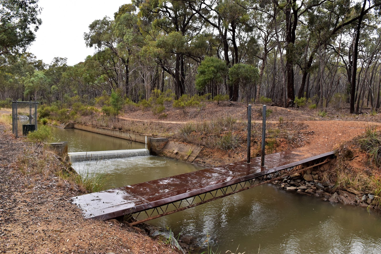
| I've arrived at Coliban Channel and the rain has arrived in earnest too. |
|
|
Sandhurst Reservoir and the Coliban Channel were both part an extensive system of inter linked water supply infrastrure projects that were built to supply the goldfields with water back in the 1870’s. Now days the access track beside the Coliban Channel provides for a very easy walking as it contours the hillsides in the Greater Bendigo National Park. While the walking was very easy the weather was pretty shitty, I was meandering my way around the hills in deteriorating conditions as the full South Westerly change came through. I’m thinking that this version of the water race isn’t the same as the 1870’s version of the water race, the old stone work and dry channel on the left of my access track being a bit of a give-away (well that and the fact that I’m pretty sure concrete wasn’t big back in the 1870’s!).
 |
The channel access track makes for very easy walking.
 |
The old stone work is impressive.
 |
As the rain came down I was looking for something to photograph.
 |
| Coliban Channel |
|
|
|
Just over an hour after it arrived the rain started to ease off a bit and I found myself walking along the channel under weak sun light, a situation that helped my Feral mojo no end. Arriving at the spot where the Goldfields Track crossed the Coliban Channel and headed off into the bush I kept left and dropped down to the sealed Mandurang South Road. Before dropping down to the road though I checked out a new looking tank at the junction of the Goldfields Track and the water race, now while people might not be overwhelmed with that riveting piece of information I was interested because one of the issues that has stopped me tackling the Goldfields Track in one go has been the scarcity of water. The new tank did have a tap and also some water so that was appositive feature, although the wisdom of spending money installing a water tank beside on open water race might be questioned.
 |
There is evidence of an old water race on the downhills side of the access track too, I'm guessing this is the remains of the original 1870's water race?
 |
Sun's out, Coliban Channel.
 |
The Goldfields Track heads off across the channel into the bush here. I'm not exactly sure who the water tank is for but it has a tap and it had water in it, so that's a good thing.
 |
| I followed the sealed Mandurang South Road for fifteen minutes or so. |
|
|
|
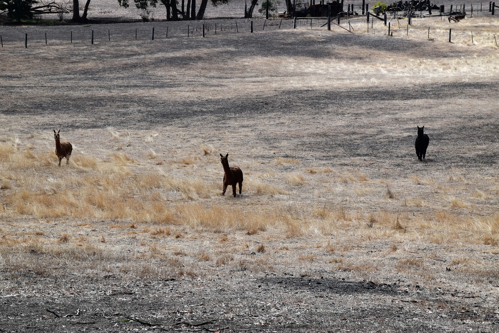
Turning north along Mandurang South Road I followed the bitumen road for fifteen minutes or so, entertained on my road bash by assorted animals in the paddocks, both native and introduced. Being off the Goldfields Track now I was now looking an un-signposted track that would head east into the scrub. Thankfully my track was easy enough to identify and I soon found myself crossing a heavily eroded gully before climbing very easily up to Kerr’s Road. Stopping for a bit of a break beside the dirt Kerr’s Road I checked out the first of what would be a series of large dams that I’d pass by scattered through the bush, any or all of these dams would make good wild swimming spots I think, although it was a bit cold for a swim today.
 |
There were plenty of animals grazing in the paddocks as trudged along Mandurang South Road.
 |
 |
Mandurang South Road
|
|
|
The walk was now a turn left-right-left type of walk so it paid to keep an eye on my map and notes, good advice and something that I didn’t manage to do! After passing my last big dam I arrived onto Mannix Lane and turned left, trudging down the dirt road past parched paddocks as I headed for what was meant to be Nankervis Road. Arriving at the sealed road something didn’t seem quite right though, I was way too far south. After a bit of head scratching I worked out that I’d zigged when I should of zagged back on Mannix Lane and now, instead of coming out on Nankervis Road I’d emerged from the bush onto Mandurang South Road a couple kilometre road bash from where I needed to be.
 |
I was looking for this un-name track heading off into the scrub.
 |
My old track dropped down to cross this eroded gully.
 |
| The first of the three dams that I'd walk past this afternoon, this one looked the best for swimming. |
|
|
I suppose the positive side of the day was that I got to check out a little more of Mandurang South Road than I’d imagined….thank god I wasn’t trudging along this bitumen road on a hot day! Eventually I rejoined my described walk at Diamond Hill Road and after crossing a dry floodway climbed up to meet Callinan Lane. I was now passing the hobby farms that I’d driven passed on my way in this morning so I knew today’s walk was almost over. Arriving at the ‘no parking’ sign I branched off right along Cahills Road, relieved almost immediately to spot the ute through the trees.
 |
The 2nd dam was the smallest (and had the lowest water level) and looked the least inviting for a swim....it'd still do me on a hot walk though!
 |
There is the occasional mine shaft in the scrub too.
 |
The third dam was the biggest, although the water level was down a bit.
 |
Another informal looking channel, this one also appearing to lead onto private land.
 |
Heading the wrong way down Mannix Lane I walked past this dry dam, the rural paddocks on today's stroll all looked very parched.
 |
| My un planned walk along Mandurang South Road wasn't a total loss. |
|
|
|
|
|
The Dirt.
I walked 18.5 kilometres and climbed 256 metres on today’s Easy-Medium grade stroll. If it wasn’t for the tricky navigation this would probably be a easy grade walk I’m thinking. Now talking about navigation this is a walk of two parts, the Goldfields Track section s very well marked and sign posted but the rest of the walk is largely un-marked and un-signposted. I suppose the good news in relation to navigation is that if you do find yourself off course a little, there are a multitude of tracks that you can use to get back on route. I was using Mr Tempest’s notes out of his
Victoria’s Goldfield Walks book, Mr Thomas has also written up walks through here. While this walk turned out to be a little more adventurous than I’d anticipated I think that you’d really have to love your history to travel a long way to do this walk, although the three big dams do look very promising for a swim on a hot day, so maybe I’ll be back.
Relevant Posts.
Bendigo, 2018.
Imagining Ned, Bendigo, 2015.
Mt Alexander, Mt Alexander Regional Park, 2018.
 |
| Reaching Diamond Hill Road I was back on my notes. This is a quintessential Aussie scene I reckon, a kangaroo sign and a bone dry floodway. |
 |
| Cahills Road branching off Callinan Lane to the right. The walk is described in my notes as starting on the left but the home made no parking sign changed my mind. |
 |
| Heading up Cahills Road the ute just come into view through the trees. |


No comments:
Post a Comment