 |
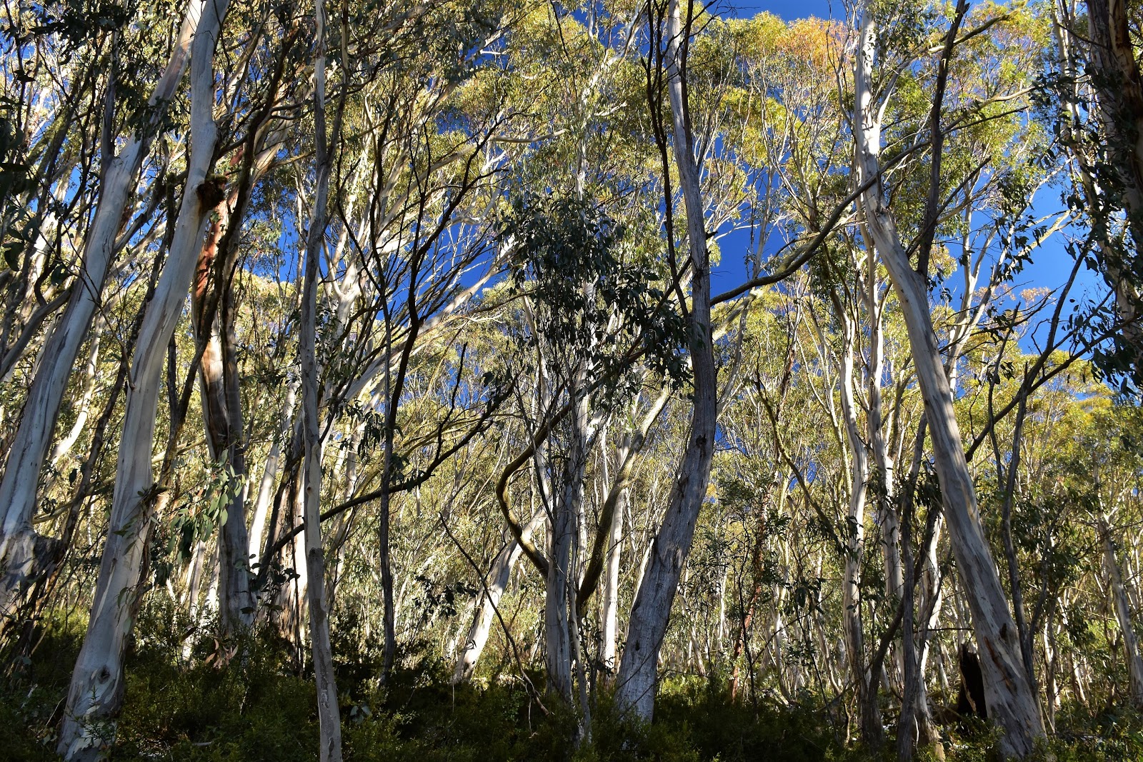
| Heading towards Mt Eadley Stoney from The Bluff...I got lucky today! |
I’d always wanted to climb The Bluff when there was a bit of snow around. The cliffs of The Bluff tend to draw the eye from a lot of the high points around here and I’d always wondered how hard it would be to get through those cliffs in the snow. With some good early season snow falls and a fairly good forecast I decided that today was the day. It’s a bit of an epic just to get to the start of this walk and by the time I'd arrived at the track head it was already after 10am. Now 10am wasn’t ideal really but I hadn’t mucked around this morning, I’d headed off from home just after 6am.
 |
| It was mid morning by the time I set off this morning. |
Setting off today there was a bit of snow down at the car park so I was already wondering how hard the climb through the cliffs was going to be. Before I’d get to the cliff line though I had a fair climb up a very steep spur and that was now occupying my mind. When it’s not covered in snow there is an obvious track up here so there aren’t many track markers around (none that I saw actually), today though with plenty of snow around things were a little more cryptic. To be honest though the track wasn’t too hard to follow today, the track was a river of water from the melting snow in spots but not too bad overall.
 |
Climbing The Bluff the track was mostly still visible beneath the snow.
 |
I didn't have to climb too far before I started to get some nice views.
 |
| Approaching the cliffs buttressing the summit. |
|
|
With the Snowgums getting smaller I approached the cliffs that buttress The Bluff. From a distance I think these cliffs resemble a layered wedding cake, especially when they are coated with snow as they were today. The snow was slowing me down a little bit now although for the most part I was still progressing well, actually the main reason that the snow was slowing me down was the fact that I was stopping so often to take photos. It had turned out to be a sensational day today and the combination of Snowgums, cliffs, snow and blue sky was about as good as it gets in my world…although maybe that says more about
my world than anything else!
 |
There was plenty to look at when I inevitably stopped to get my breath back.
 |
The last bit of steep stuff.
 |
| Once on top the snow cover was a little more substantial. |
|
|
I’m thinking that the north facing aspect of these cliffs means that the snow melts fairly quickly here, well the aspect and the fact that the nature of a ‘cliff’ means that there isn’t a lot for the snow to accumulate on. Anyway, whatever the reason, I was able to scramble my way up to the top pretty easily as most of the steepest pinches were largely free of snow. Arriving on the broad plateau like top though there was a fair bit of snow around. After walking towards the western most knoll for a few minutes and breaking through the surface a couple of times I decided to put on my snow shoes….well that and the fact that as I’d lugged them up here I may as well use them.
 |
I meandered my way across to the western most high point.
 |
I'm thinking that a lot of the snow that fell early in the week had been blown off the tops.
 |
| The view west from The Bluff, I'm guessing that the mountain with a dusting of snow in the distance is Mt Skene. |
|
|
Snowshoes today were a little marginal I think, sections of the summit ridge had been wind scoured which meant that in spots the snow cover was a little patchy. Trudging my way across the western most high point I took in the spectacular view of snow capped mountains all around me, a view that would be my standard for then next 3 or 4 hours. One of my unfulfilled ambitions in life is to attempt the AAWT in winter conditions so I always find myself gazing out to the mountains that the AAWT crosses when I find myself up in the alps in winter. With Mt McDonald, The Nobs, High Cone, Square Top, Mt Clear, King Billy No1 & 2, Mt Magdala, Mt Howitt, The Crosscut Saw, Mt Buggery and Mt Speculation filling about a third of my field of vision I had a lot to visualise today!
 |
Snowshoes were a little marginal today...still I'd lugged them up so I was gonna use them:)
 |
Heading towards the summit of The Bluff, it was a choose your own adventure type of walk.
 |
| Have I mentioned the weather? |
|
|
Leaving the western end of the summit ridge I shuffled my way back to the spot that I’d popped out onto the tops, then instead of dropping back down to the ute I continued on to the the summit of The Bluff. There is a pad across these tops but it was well and truly covered in snow today so I just picked the path of least resistance as I made my way towards the summit cairn. Now if anyone who reads my blogs rips the GPX track off my maps then you need to know that on my walk across the tops I mostly wasn’t following the track, it wasn’t until I was 5 minutes from Bluff Hut that the track emerged from under it’s covering of snow. After dodging a few twisted Snowgums and plugging through a few deeper snow drifts I arrived at the 1725 metre summit, time for lunch….and to send a couple of pics to mates stuck back at work in Melbourne….yeah, I’m a caring kind of guy!
 |
Approaching the summit cairn of The Bluff I had a few Snowgums and rocks to negotiate.
 |
The summit cairn on The Bluff.
 |
I'm heading that way next.
 |
The Cross Cut Saw and Mt Buggery in the middle distance, Mt Bogong, the Bogong High Plains and Mt Feathertop in the distance (if you squint).
 |
| Mt Magdala and Mt Howitt from The Bluff. |
|
|
|
|
With lunch consumed I set off along at the long high ridge towards my next objective, Mt Eadley Stoney. While Mt Eadley Stoney looked fairly close at hand I knew that I had a few things in front of me that would slow me down. The main issue slowing progress being that I’m old and fat, but the beautiful scenery also wasn’t going to help forward progress either. On a walk like this I may take 150 to 200 photos and while I (obviously) don’t take too much time on each shot it still adds up to a fair amount of time. Crunching my way east I stayed fairly close to the edge of the ridge both for the views and for the ease of navigation although I had to be a little careful as there was already a small cornice cantilevered off the cliff tops in a couple of spots.
 |
Mt Clear and Square Top across the other side of the Jamieson River Valley.
 |
It's nice to see that all the Snowgums didn't get torched in the 2007 fires.
 |
The track across the top was visible in a few spots....
 |
....but mostly it was easier for me just to make my own way.
 |
| I'd carried then up so I may as well use them. |
|
|
|
|
To get to Mt Eadley Stoney I had to drop down through a high saddle on the ridge called The Blowhole, in today’s completely benign conditions this was fairly pleasant place to stop for awhile and have a bit of a blow, however in more typical winter conditions I wouldn’t be lingering in this spot. The cleft like Blowhole is a little bit like a mini Hells Window over on Mt Magdala, with the Howqua Valley framed between the cliffs it’s a nice spot which makes you wonder why I didn’t get a photo there this afternoon. The Blowhole also marked the spot that I’d start to climb again up towards Mt Eadley Stoney, so after my short break I grabbed my pack and started shuffling my way upwards again.
 |
Heading across to Mt Eadley Stoney...there was plenty to see.
 |
There was a little bit of a cornice developing in some spots.
 |
Heading towards Mt Eadley Stoney...but first I had to drop into that high saddle, The Blowhole.
 |
Dropping into The Blowhole.
 |
| There are a few ancient Snowgums near The Blowhole. |
|
|
|
|
The track that runs between The Bluff and Bluff Hut actually by-passes the summit of Mt Eadley Stoney to the south a bit, but with everything covered with snow today I just aimed for the summit and headed off across the fairly steep flanks of the mountain. Snowshoes are pretty good going up, down or on the level, but they are hard on my joints going sideways across steep slopes, so with my knees starting to give me a bit of grief I was pretty happy to arrive at the summit…only to find out that it was a false summit, doh!
 |
Leaving The Blowhole I climbed towards Mt Eadley Stoney, firstly heading for this high point.
 |
There were no human footprints around but plenty of dog prints.
 |
Mt Eadley Stoney on a beautiful winter afternoon.
 |
Conditions were starting to get a bit icy in spots now.
 |
| Just me and my mates today. |
|
|
|
|
Leaving my false summit I dropped into another high saddle before climbing again. I now more or less stayed on the crest of the ridge through, so for the most part my joints weren’t screaming at me too badly. It was around 3 pm this afternoon when I finally arrived onto the 1684 metre summit of Mt Eadley Stoney. I’d been meandering my way around the tops for around 3 hours now and Mt Eadley Stoney was a fitting way to finish my ramble above the tree line. Like the views for most of the previous three hours the scene is pretty impressive from up here, Mt Buller and Mt Stirling across one valley, Mt Clear and Square Top another. Even better today I was able to get some long range views over the Cross Cut Saw to the distant Mt Feathertop and Mt Bogong, yes it was a cracker of a day.
 |
Looking down into the Howqua River Valley from Mt Eadley Stoney.
 |
The Bluff in the distance. It had taken me the best part of three hours to shuffle my way across to here today.
 |
The view east from Mt Eadley Stoney.
 |
Now we're talking! A dress circle view of Victoria's alpine country.
 |
King Billy No. 1 & 2.
 |
| Time to get going I think. |
|
|
|
|
|
Once again I spent awhile on the summit taking things in. After messaging Sam to tell her all was well and I’d be pretty late home, I grabbed my pack and set off down towards Bluff Hut. As I’ve already eluded to I’d largely just been meandering my way across the ridge line off track for the last few hours, in a couple of spots I had been able to notice a depression in the snow or a cairn that was a bit of a clue to where the track was, but for the most part there wasn’t much evidence of the it. Leaving Mt Eadley Stoney though I found a set of boot prints, it looked like someone had climbed up here from Bluff Hut in the last day or two so I was now able to follow the tracks in the snow all the way down to the hut, although in these beautiful conditions navigation was never going to be too hard. After following the boot tracks for awhile the track appeared as a snowy trench, it was easier for me to plough through the snow beside the trench for awhile but eventually I succumbed, dropped onto the track and removed my snowshoes. Five minutes later and I was down at the deserted Bluff Hut.
 |
One last look at The Bluff before I dropped into the trees.
 |
The track started to appear as a snowy trench.
 |
Bluff Hut.
 |
| Square Head Jinny from Bluff Track...I've got some plans for that spur in the centre of the photo....one day! |
|
|
|
Bluff Hut is fairly easily accessed by a 4wd track so it’s not a place I’d stay while the 4wd tracks are open but it does provide good shelter. The original hut burnt down in the 2007 bush fires and this newer version was built in in December of that year. Bluff Hut and the nearby Lovicks Hut are both reminders of the old cattleman’s history in this bit of Victoria, grazing started up here in the 1940’s. With daylight running out on me I didn’t linger too long at Bluff Hut this afternoon, after a quick bite to eat and a slug of water I grabbed the pack again and set off down Bluff Track. According to the Parks Vic website Bluff Track was meant to be locked up for winter, the muddy tracks in the snow made it obvious that 4wd’s were still going through though. My glass half full assessment was that the 4wd’s had made it slightly easier to negotiate the sections that were covered in snow.
 |
Late afternoon on Bluff Track, I've had worse walks.
 |
Bluff Track was officially closed but the gate was still open?
 |
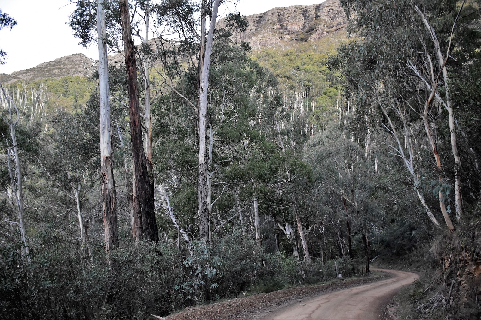
| Bluff Track. |
|
|
Bluff Track drops for a couple of kilometres to reach Bluff Link Road and I passed through the open/locked gate on the way down. Once on Bluff Link Road I started to mostly contour around below the towering cliffs of Mt Eadley Stoney and The Bluff. This section of the walk looks pretty average on paper and indeed it can be a bit of a road bash, however if you happen to be walking it in the late afternoon on a relatively clear day then the setting western sun can light up the cliffs in a stunning display. This afternoon I was very lucky to be walking it on such a day, while the forest canopy prevents a continuous view of the cliffs above, there are enough openings in the canopy to still allow plenty of views, enough to slow me down that much that I was pretty well guaranteed to get back to the ute in the dark. Incidentally if anyone looks at my photos and thinks that the photos of the cliffs don’t look that sweet don’t worry you’re not alone, I’m not happy with them either, I was struggling with the contrasting light levels a bit but the cliffs looked infinitely better to the naked eye I think. It was 5:30pm and pretty well dark when I did arrive back at the ute but it had been a great day out, it was time to settle in for the long drive home now.
 |
The scenery from Bluff Link Road was top notch this afternoon.
 |
Late afternoon on Bluff Link Road.
 |
Looking back up towards Mt Eadley Stoney from Bluff Link Road...my photos don't do this scenery justice I don't think.
 |
| What a stunning end to my days walking. |
|
|
|
The Dirt.
I walked 14.7 kilometres and climbed 808 metres on what I’d call a medium-hard grade days walking. With a bit of snow on the ground this is a very nice walk, although with around 6 kilometres that is mostly above the tree line it’s a walk that should be respected, the only shelter from the elements is at
Bluff Hut. There is a little bit of very easy scrambling to get through the cliff line protecting the summit of The Bluff but that is the only slightly technical part of the walk (assuming that snow isn’t covering the track across the top). Glen Van Der Knijff, Tyrone Thomas and the Daly’s have all featured this walk, or parts of it in their walking guide books. Having been up here quite a few times before I just used SV Maps Buller-Howitt Alpine Area 1:50,000 topo map today. Getting to the start of this walk is a bit of an adventure in itself, you can get to the small informal carpark just past Refrigerator Gap in a 2wd car but you’d want to take it pretty slow, and any decent snow fall will stop a 2wd pretty quickly.
Relevant Posts.
The Bluff Circuit, Alpine National Park, 2014.
Nobs Track to Chesters Yard, AAWT, Alpine National Park, 2017.
Chesters Yard to Vallejo Gantner Hut, AAWT, Alpine National Park, 2017.
 |
Looking back over my shoulder along Bluff Link Road.
 |
| It was getting pretty dark now...although that didn't stop me trying for yet another photo. |
|
 |
| I arrived back at the ute just on dark. |
 |
| The drive in and out of this place can be as adventurous as the walking sometimes. |


No comments:
Post a Comment