 |
| The view from Mt Howitt has a bit of an epic feel about it I think. |
It was a wet and windy old night last night at Chesters Yard, thankfully the camp is in a slight valley to the east of the ridge crest so I was a little sheltered from the worst of the wind. The meditative sound (well for me anyway;) of rain on the fly reminded me that things were a little crappy outside even if I could really only hear the wind as a distant roar in the trees closer to the ridge top. Being warm, dry and comfortable in the tent it was pretty hard this morning crawling out and putting on yesterday’s wet clothes again, although at least the rain had stopped by the time I emerged for breakfast. In case your thinking ‘why doesn’t this Feral bloke just put on some dry clothes?’ well the reality was really that I couldn’t of carried enough, generally on longish walks I’ll have a walking set of clothes to use during the day and a dry/clean set of clothes for camp, about the only items of clothing that I carried more than two of were socks. On the walks if it’s hot I can normally do a bit of washing every now and again and if it’s wet then everything tends to get rinsed out anyway…well that’s my theory but then again I do seem to do a lot of this stuff on my own…?
 |
| I managed a little bit of tent drying before leaving Chesters Yard this morning after a night of solid rain. |
Anyway after eating breakfast and packing up my still wet tent I was soon on my way again. The original plan for today was for a fairly short day, stopping for tonight at a saddle above Hellfire Creek to the east of Mt Magdala, however the weather was meant to deteriorate further over night and with snow predicted I’d decided to head a little further and make the short detour off the AAWT to stay at Vallejo Gantner Hut at Macalister Springs. That was all a fair bit in front of me though as I shuffled up the very wet and grassy old fire track towards a junction of tracks below King Billy No.2. With no need for water this morning it was a little ironic that I found it everywhere on the ridge top walk this morning, not only were there some quite wet spots along this ridge but the Snow Gums and small snow plains were very photogenic under what was now a blue sunny sky, which slowed me down a bit as well. After passing what looks like a pretty reliable spring just above the track I wandered into the broad saddle below King Billy No.2, this spot has five different routes or tracks converging on it so it could get a bit busy when the 4wd tracks open, it was deserted this morning though.
 |
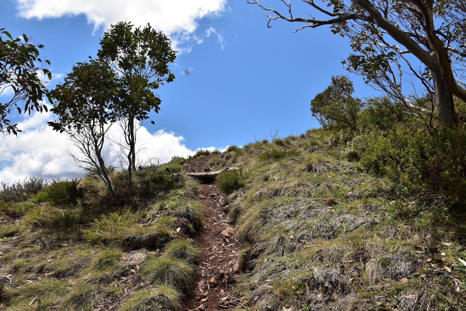
| The AAWT continues to follow old grassy fire track this morning. |
 |
There are plenty of nice Snow Gums along the AAWT this morning.
 |
King Billy No1 & 2, my next objective.

|
 |
| Crossing some of the small snow plains the old fire track was a little on the damp side this morning. |
|
|
|
After a bit of a break in the saddle while I did some running repairs on my trekking pole and checked out a AAWT sign that actually showed that I had progressed a few inches on my journey to Canberra, I started the first real climb of the day up to King Billy No.2. The climb up to King Billy No.2 from the saddle is reasonably steep but fairly short with the summit only around 100 metres higher than the saddle, it was high enough that I started to pass through a few lingering snow drifts though. I’d never actually been over the King Billy’s before so I was very pleasantly surprised as I climbed, the tops being fairy open allowing for some great far reaching views. After climbing over the 1696 metre summit of King Billy No.2 the AAWT drops down through a high saddle before climbing again up to the slightly higher King Billy No.1 at 1710 metres. Once on King Billy No.2 the AAWT across the King Billy’s is more a route than a track but the open country makes for superb walking in good weather, the snow plains, rocky bluffs and mature Snow Gums all adding to my sense of joie de vivre.
 |
Hey, hey, I've progressed a few inches on my way to Canberra!
 |
Some of my gear needed a few running repairs - where would I be without gaffer tape.
 |
I'd also blown a strap on my gaiter.
 |
I had to climb a few sections of snow on my way up King Billy No. 2.
 |
King Billy No. 2
 |
Looking back down towards Mt Clear, the AAWT follows this ridge line.
 |
Mt MacDonald from King Billy No.2.
 |
| That's The Bluff in the distance. |
|
|
|
|
|
|
|
Sitting out of the wind in the sun near the top of King Billy No.1 I was finding it a little hard to find the motivation to shoulder my pack and set off again, with Canberra getting no closer though eventually I started shuffling my way north again. Dropping off King Billy No.1 the AAWT heads down to briefly meet Bluff Track in a long gentle saddle. The walk down off King Billy No.1 is again more or less off track but the open Snow Gum forest makes for fairly easy navigation in fine weather and the character of the mature trees offer plenty in the way of photo ops. Almost as soon as the AAWT emerges from the Snow Gums onto Bluff Track it leaves it again heading down across more snow plains towards Mt Magdala.
 |
The tops of King Billy No.1 & 2 are a bit flatter than I'd imagined.
 |
There was no shortage of Snow Gums today, each one seems to have their own personality I reckon.
 |
Climbing up to King Billy No. 1.
 |
The summit cairn on King Billy No. 1.
 |
King Billy No. 1 gave me one of my first glimpses of the Crosscut Saw - tomorrows walk.
 |
Mt Magdala with Mt Howitt peaking out over the top from King Billy No. 1.
 |
| The AAWT is more or less off track as it drops down off King Billy No. 1 through these Snow Gums to meet Bluff Track, it's all good though! |
|
|
|
|
|
|
I’m starting to sound like a bit of a broken record here but once again this is superb walking, the AAWT dropping gently into a deep saddle below Mt Magdala, crossing numerous small snow plains on the way down while at the same time the views opening up back along the rocky ramparts of the range towards Helicopter Spur. Passing through the saddle I climbed up the ridge crest until I arrived at the cairn that marks the junction of the low and high routes across Mt Magdal, finding myself a nice Snow Gum just off the track I sat in the shade out of the wind and enjoyed lunch, perhaps savouring the views of the seemingly endless mountain ranges more than my vita wheats and peanut butter. With the weather co-operating today I decided that the high route over the top of Mt Magdala was the go this afternoon, so after re-fuelling I once again shouldered my pack and
staggered shuffled up the last steep climb towards the open summit of Mt Magdala, only to once again
collapse stop on top for another extended break.
 |
After around 20 metres on Bluff Track the AAWT leaves it and drops down towards a saddle west of Mt Magdala.
 |
The walk down to the saddle gets pretty close to the escarpment in spots.
 |
 |
The AAWT climbing towards Mt Magdala.
 |
| The pad on the left is the track that by passes the summit of Mt Magdala, I was heading to the right, up and over the top...it was lunch time first though! |
|
|
|
|
There is not a lot of shelter from the wind up on the summit of Mt Magdala, so after recovering from the climb lying on the snow grass I staggered to my feet and after taking the obligatory summit photo I set off along the AAWT once again. The AAWT was now dropping down to the spot that I’d initially planned on camping tonight but before reaching that particular high saddle I passed by what is probably one of the iconic views along the AAWT, Hells Window. Now the problem with these well known spots for me is that I’m always trying to find a fresh angle to get a photograph from, so arriving at Hells Window I stopped and clambered around the rocky bluffs trying to find something a little different - without a lot of success really. Resuming my journey I dropped down into the high saddle above Hellfire Creek, there was a reason that I’d wanted to spend a night here and that is it’s a beautiful spot, with distant mountains framed by mature Snow Gums and plenty of snow grass to pitch my tent on I’ll definitely be re-visiting this place.
 |
Taking in the view from Mt Magdala.... life was pretty sweet!
 |
Mt Howitt from Mt Magdala.
 |
If you look closely you can see the lower pad rounding the spur on a rock shelf.
 |
Hells Window, it's a little hard to get an original photo here.
 |
Looking back up towards the summit from near Hells Window.
 |
My original rough plan had me camping on this beautiful grassy saddle above Hellfire Creek.
|
|
|
|
|
|
The AAWT now heads towards the imposing Big Hill, although thankfully the track sidles this hill a little as it makes it’s way towards Mt Howitt. Traversing Big Hill just to the south of the crest was probably the scrubbiest walking of the day today but really it was all pretty good, the AAWT is all pretty well marked and straightforward. The distance for the day mightn’t show it but I was getting pretty tired by now so reaching the last saddle before my final climb for the day over Mt Howitt I once again dropped the pack on the soft grass under some Snow Gums. Turning on the phone while I re-hydrated I was happy once again to get a text out to Sam, at the same time checking out the BOM site which only confirmed the weather forecast that I’d heard on the small radio I was carrying. It was a little hard to believe while I was lazing in the sun under the Snow Gums but the forecast for the next couple of days was for snow showers, hmmm.
 |
After resting in one last saddle it was time to climb Mt Howitt.
 |
| The last climb up to Mt Howitt is across open snow grass. |
|
After my little break I climbed the last few metres up, across the open snow plains to the summit of Mt Howitt, at 1738 metres Mt Howitt was the highest mountain that I’d climbed so far on my journey north on the AAWT. I’ve been up here a handful of times over the years and barring a total white out, I always describe the view from up here as epic. The summit of Mt Howitt and the surrounding mountain ranges even look pretty good brooding under cloud, something that doesn’t always translate well in a photo but it seems to work up here. With the top of Mt Howitt being another of those flat almost plateau like Australian mountains it takes a bit of walking around to get the best views, the views today enhanced by some more lingering snow drifts. My day was almost over now, after giving my SD card a good workout I grabbed the pack and set off towards my nights refuge at Vallejo Gantner Hut, leaving the AAWT for the final kilometre and a bit as I traversed above the Devils Staircase dropping down to the hut.
 |
Mt Howitt was the highest mountain so far on my AAWT adventure.
 |
The jagged Razor and Viking in the middle distance, I'd be climbing them in a couple of days on what is arguably the toughest section on the whole AAWT.
 |
Tomorrow's walk would be across this ridge, The Crosscut Saw.
 |
The Crosscut Saw in the foreground with Mt Speculation to the right a bit further away.
 |
| The view from Mt Howitt over West Peak and back along the ridge leading to The Bluff. |
|
|
|
|
The nice to stay at, but hard to say
Vallejo Gantner Hut is at a spot called Macalister Springs. This is really the only hut or refuge that is relatively close to the AAWT along the whole Walhalla to Mt Hotham section of the walk. There is plenty of camping in the area immediately around this hut which was built in 1971 and water is available from the spring in the small valley below the hut. The hut is slightly unusual for Australia in that it is an A frame design and it features a centrally situated fire place. Being only around 5 kilometres from Howitt Road it can get pretty busy when the roads open but I was on my own up here tonight. After spreading all my gear around to dry everything out before the predicted crappy weather would arrive I explored around the hut a bit. Probably the best view in the vicinity of the hut is from the tiolet, yep while sitting on the throne you get a magnificent view through almost floor to ceiling windows of the surrounding bluffs, which speaking from experience look especially good near sunset! Speaking of sunset there are also some nice views from a rocky knoll beside the hut, the Snow Gums around the hut glowing yellow in the setting sun. Tonight was probably the first night on my journey up the AAWT that I managed to stay awake after dark I’m thinking, eventually crawling into the hut’s loft to look at the stars through the windows over my head as I drifted off to sleep.
 |
Dropping off Mt Howitt I left the AAWT and made the relatively short side trip down to Macalister Springs.
 |
Vallejo Gantner Hut at Macalister Springs, the only refuge close to the AAWT on the stretch from Walhalla to Mt Hotham.
 |
| With some more dodgy weather on it's way I was keen to dry some gear out. |
|
|
The Dirt.
I walked 13 kilometres and climbed 935 metres on another hard days walking. After 11 days the stats for my AAWT adventure are 176 kilometres with 8665 metres of climbing. Water was available from a spring just above the AAWT before arriving at the saddle below King Billy No.2, there is also water available below the saddle east of Mt Magdala from Hellfire Creek although I didn’t drop down to it today, water for camp was available from Macalister Springs a fifty metres or so from the hut. There are many camping spots again today, you are only really limited by the availability of water and how much shelter you need from the elements. Navigation today was pretty straightforward, the section over the King Billy’s being more or less off piste but having a few markers or cairns where needed. I got a Telstra signal on Mt Magdala and in the last small saddle before climbing to Mt Howitt, I’m thinking that the phone would of worked more often as I wasn’t that far from Mt Buller but I didn’t turn it on - I couldn’t get a signal at Vallejo Gantner Hut tonight though. I used Mr Chapman’s notes and maps as well as carrying the SV Maps
Buller-Howitt Alpine Area 1:50,000 sheet and Rooftop’s
Jamieson-Licola Adventure Map in case I need an overview.
Relevant Posts.
 |
The view from the long drop here is pretty special.
 |
It gets even better at sunset.
 |
| The Snow Gums around the hut look pretty good at sunset too. |
|
|
 |
| The view from my loft, this was definitely a step up after the last couple of nights in the tent in the rain. |


I read your blog, you give informative information about high quality tent. I was searching for this particular information for a very long. Finally I got best article for my research.
ReplyDeleteHigh Quality Tent