 |
The Lottery West Federation Walkway was a bit of a highlight.
|
This is another stroll from our enforced, bushfire related stay, over in Western Australia last Christmas. After another day of watching the news and monitoring numerous websites to get a handle on how the various bush fires burning around the country were effecting our friends, family and the environment I really needed to get out for a bit of mental health time to clear my head a bit. Luckily most of the Western Australian fires were burning a fair way from where we were safely ensconced in Scarborough, although we could still see and smell smoke sometimes.
 |
Heading towards the first lookout....Kings Park is a mixture of manicured suburban parkland and native bush.
 |
Apart from the nature the views are a real feature of this stroll.
|
|
Anyway, I decided to head in towards Perth and visit the superb Kings Park this afternoon. So after parking the ute in the car park at The Pines Picnic Ground I set off towards the Visitor Centre and crossed Fraser Avenue. I now got my first of those picture postcard views that most people would of seen of the Perth CBD skyline, the views to the city from up here are beautiful. I now made my way south along the edge of the escarpment down to the Botanic Gardens. Once in the gardens I continued more or less following the escarpment south west, stopping to check out the Boab Tree at Mt Eliza Lookout before heading out onto what is arguably the highlight of the walk along an elevated boardwalk and bridge.
 |
I was basically walking along the east facing escarpment above the Swan River.
 |
The light over in Western Australia is generally superb.
 |
I was now meandering my way through the Western Australia Botanical Gardens - although I was mostly making things up as I went along as far as following my notes and map went.
 |
The gardens feature a few Boab Trees.
 |
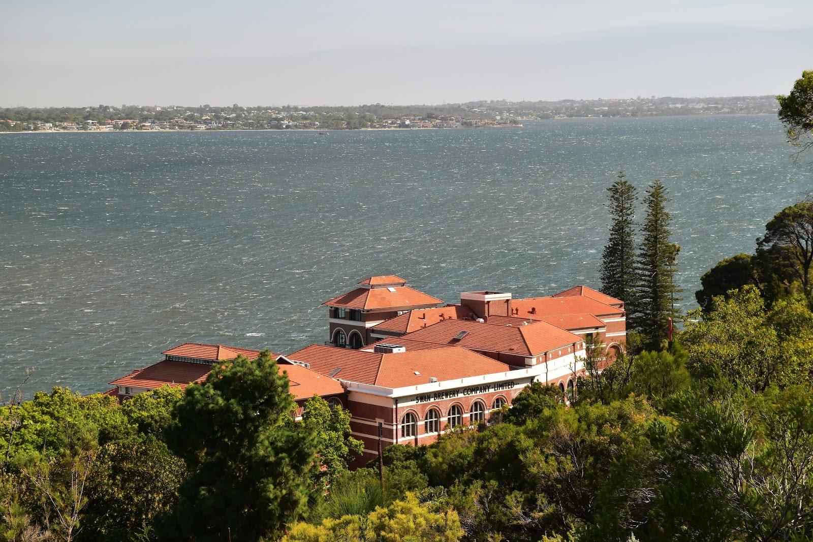
Looking down again, this time over the old Swan Brewery Building and out over a fairly breezy Swan River.
 |
That reminds me.... I must be due to head back up to the Kimberly soon.
 |
| The Western Australian Botanical Garden. |
|
|
|
|
|
|
This walkway is called the Lotterywest Federation Walkway and it took me through the canopy for awhile before crossing over a high arched bridge, the combination of aged rusted metal and glass blending in very well with the surrounding Botanical Gardens. Leaving the walkway I headed in the general direction of Forest Drive before doubling back to reach the substantial DNA Tower. This tower apparently got it's name from it's resemblance to the double helix of a DNA molecule....yeah I knew it reminded me of something! Climbing to the top of the tower gave me another great view although this time it was mostly west towards the Indian Ocean and into the late afternoon sun. Looking east I did get a bit of a view, although slightly depressingly it was of bushfire smoke from a new blaze that had just sprung up in Perth's eastern suburbs.
 |
The Lottery West Federation Walkway.
 |
South Perth from the walkway.
 |
Heading towards the DNA Tower I entered native bush and would be mostly in the native scrub until I was almost back at the ute in a couple of hours.
 |
The DNA Tower.
 |
Looking west from the tower along the Broadwalk (my ongoing route). A new bushfire has just sprung up in the eastern suburbs and the smoke is starting to filter across.
 |
| My last glimpse of the Perth CBD on this walk. |
|
|
|
|
|
From the DNA Tower I followed a wide grassy avenue due west through some fairly natural looking scrub, crossing Lovekin Drive on my way to the substantial May Drive Parkland. This spot features a lake complete with a children's adventure playground on an island in the middle of it, as well as a café and picnic facilities. By now it was getting fairly late in the day so it wasn't a picnic or the café that was interesting me, it was more whether I'd get back to the ute before dark really. From the picnic area on May Drive I followed the drive north east for awhile to reach the Saw Avenue Picnic Area before branching off left into some more native bush.
 |
There were a lot of birds around this afternoon. I didn't see anything bigger although the park looks like it might be home to some Kangaroos.
 |
The May Drive Parkland - this would be a nice spot for the kids.
 |
The locals put on a synchronised swimming exhibition for me.
 |
| Heading through the May Drive Parkland towards May Drive. |
|
|
|
I was now making my way towards the Lottery West Family Area along the western side of Kings Park and the only thing slowing me down now was the need to stop and photograph the scrub that was bathed in bushfire tinted golden sunlight. By the time I wandered through the Lottery West Family Area all the families had gone home for the day, however it was a nice spot to kick back for a couple of minutes and consult my map. The walk was pretty well coming to it's end now, after stopping to consult my map I then proceeded to head off in the wrong direction, still I got to check out the tennis club before eventually emerging from the bush and spying the ute in the distance so it all worked out OK.
 |
May Drive wasn't bad walking.
 |
Saw Avenue Picnic Area.
 |
The bushfire smoke combined with the setting sun was bathing everything in a golden light.
 |
| I went right here (near Thomas Avenue), there is no sign. |
|
|
|
The Dirt.
I walked 7.8 kilometres and climbed 405 metres on this easy stroll. I used the notes and map out of Woodslane's book
Perth's Best Bush, Coast & City Walks although I have to admit I sometimes play a little fast and loose when it comes following these notes, who'd of guessed that reading the notes after finishing the walk isn't the way to do it? I'm guessing that there is a good map of Kings Park available somewhere on the inter web although with my visit here being fairly well un-planned the map in the guide book and my GPS maps were all that I had today. For anyone who lives in or visits Perth then I reckon Kings Park should be a must do spot to visit, my little stroll this afternoon barely scratched the surface on what's to offer.
Relevant Posts.
Pelican Point Walk, Matilda Bay Reserve, 2020.
Fremantle Walk, 2019.
Cape to Cape Walk, Day 1, 2019.
 |
| Late afternoon in Kings Park. |
 |
| I dropped down the south side of the tennis club. |
 |
| Time to head back to the hotel. |


No comments:
Post a Comment