 |
This walk can feel surprisingly wild considering how close to the Melbourne CBD that I was.
 |
Dights Falls
|
|
It was a public holiday in Melbourne this weekend so that meant one thing... I'd stay close to home and try avoid us much of the unfolding chaos around me as possible. So not wanting to head too far afield on roads choked with people who only escape the suburbs a couple of times a year, I decided to do an suburban walk. My theory being that the suburbs should be a little quieter than normal, yes I know that my theory was a little thin, some may say even anorexic! So late on this early Autumn afternoon I pulled up at the sprawling Studley Park Carpark, locked the ute, re-set the GPS and set off.
 |
There is a choice of car parks down at Studley Park.
|
Before starting the circuit part of my walk I made the short walk through the punters picnicking on the lawn above the Yarra River to head across and check out the historical Studely Park Boathouse. The boathouse is now home to a very nice restaurant/café and would of made a nice spot for a coffee if I'd felt that was inclined, instead today I was satisfied with a photo from just outside the grounds....a wedding photographer eyeing me suspiciously as I pointed the DSLR their way. With a photo of the boathouse bagged I set off on my walk proper, meandering my way back to and then crossing the Yarra River on the substantial Kanes Bridge, a bridge which was built back in 1935 after a flood washed away a slightly lower structure.
 |
Studley Park Boathouse.
 |
Kanes Bridge
|
|
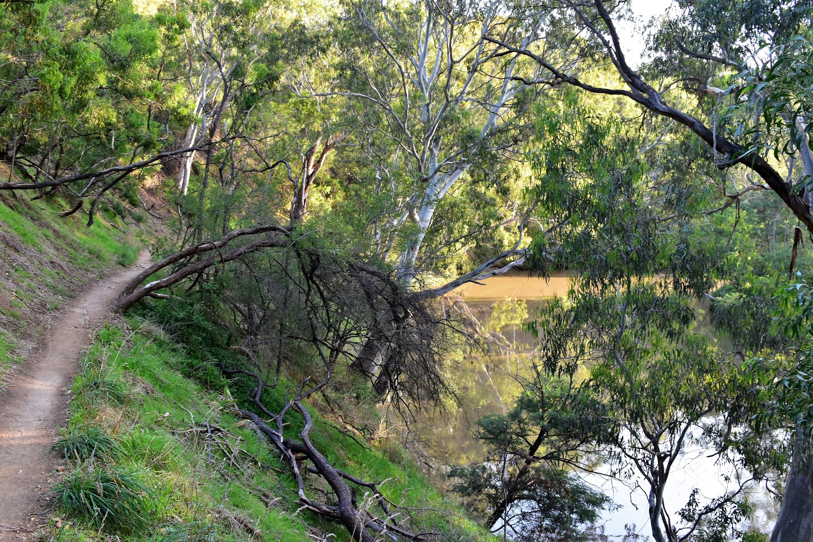
Once on the north side of the coffee coloured Yarra River I turned left and followed the river downstream for the next half hour or so. Already I was starting to think that my wafer thin theory was paying dividends this afternoon, as soon as I'd left the area surrounding the boathouse the crowds had dropped away to almost nothing, and as I made my way along the bank of the river towards Deep Rock Picnic Area I was only bumping into the occasional person out walking their dog or local going for a jog. Deep Rock is the old home to the Deep Rock Swimming Club from 1905 to the 1940's, back in 1918 a reputed 70,000 people gathered here to watch a world record dive from the cliffs opposite.
 |
Across the river I was heading towards Dights Falls.
 |
The track stays fairly close to the river along here.
 |
Studley Park Boathouse
 |
Yarra River
 |
There has been a lot of un-seasonal rain in Melbourne over the last six weeks.
 |
| Deep Rock |
|
|
|
|
|
Leaving the Deep Rock Picnic Area I continued my journey downstream to my next point of interest at Dights Falls. Apart from hoping that this walk wouldn't be too busy this afternoon I was also keen to check out Dights Falls as Melbourne had had more than a moths worth of rainfall over the previous week so I was hoping that they would be pumping...and they were. There was as issue though, yes the falls were barricaded off due to some upgrading work going on, hmm. Not to be deterred I made my way through the maze of safety fencing as close as possible and then climbed onto an information sign to get a half reasonable photo of this man made feature. With a big volume of water cascading down the the falls I was able to enjoy the antics of some white water kayakers as they practiced their skills, although eventually my feet started to complain about standing on the sharp edge of the sign and it was time to head off again.
 |
The best shot that I could get of Dights Fall this afternoon.
 |
To get any photos I had to balance on top of an information sign to look over the top of the 7 foot safety fence.
 |
| The kayakers were out and about this afternoon below Dights Falls. |
|
|
My route now had me heading back a few metres to pass beneath the Eastern Freeway at the spot where Merri Creek enters the Yarra River. I was now walking up the Merri Creek Valley along a section of the normally very busy Main Yarra Trail (a shared bicycle/walking trail). This trail is generally a fairly busy spot however once again I was pretty well on my own this afternoon, only getting passed by a couple of bikes as I made my way up to the Merri Creek Lookout Platform. This lookout not only provides for a nice view up and down the Merri Creek Valley but also a bit further afield to the towering buildings in Melbourne's CBD glinting in the late afternoon sun. Almost as soon as I left the lookout I also left the Main Yarra Trail to cross some open parkland, pass through a small gate and pick up the quiet Fairlea Road.
 |
Passing beneath the Eastern Freeway I was now following the Main Yarra Trail.
 |
The Main Yarra Trail was virtually deserted today.
 |
| Looking back down the Merri Creek Valley towards Melbourne's CBD. |
|
|
This next bit of the walk is a little bit uninspiring I think, my route now passing by some suburban sporting fields as I made my way from Merri Creek back to The Yarra River. After passing by some fly-fishing pools (I kid you not) I picked up the continuation of my walk dropping down to the Yarra River close to the Eastern Freeway. Once back down beside the river I followed a rougher track north upstream towards the Fairfield Park & Boathouse Tea Gardens. This section of the walk, actually the rest of the walk is a little rougher in general than it had been so far. Passing beneath the Pipe Bridge and checking out a small blue stone amphitheatre where there was a small dance party going on before doubling back and crossing the interesting Pipe Bridge.
 |
I passed out this little gate, crossed the road and picked up Fairlea Road.
 |
This section was a little uninspiring.
 |
There are some grand old buildings around Kew.
 |
I shuffled my way past the Fly Fishing ponds...
 |
| ... and dropped down the track beside the Eastern Freeway. |
|
|
|
|
After crossing the Yarra River again I doubled back to follow a rough pad back downstream. This bit of the walk is actually pretty rough with the narrow track benched into the sides of some steep slopes, the river sometimes a long way below however just as often lapping at the track. The other thing you need to keep in mind is that this section of the walk is also used by my Mountain Bike brothers and sisters so I needed to keep an eye out for them. As you would of expected the views up and down the river are good along here, views that were only enhanced by the late afternoon sun. Soon after passing beneath the Eastern Freeway again I started to walk beneath a large colony of Fruit Bats. These are the Fruit Bats that were relocated from the Melbourne Botanical Gardens a few years ago, apparently they blasted the Fruit Bats up the river using sound to annoy the bats and move them along....I've heard that it was K Pop although that maybe a Feral Fact;)
 |
Back down beside the Yarra River again.
 |
The Yarra River near the Fairfield Boathouse - this was as far up stream as I got this afternoon.
 |
The locals were out enjoying the pleasant evening.
 |
Fairfield Boathouse
 |
Fairfield Boathouse
 |
The Pipe Bridge.
 |
The next section of the walk is surprisingly rough and close to the river in spots.
 |
There are a few reminders that I was in the suburbs.
 |
This section of the walk is shared with Mountain Bikers.
 |
Passing beneath the Eastern Freeway again.
 |
Approaching the Fruit Bat colony this afternoon.
 |
| Apart from the noise you'll know you've arrived at the Fruit Bat colony by the smell. |
|
|
|
|
|
|
|
|
|
|
|
Leaving the bat colony I arrived at Bellbird Picnic Area and while that fact is riveting enough the main reason that I mention it was that there was a glitch in my walk here (it wouldn't be a Feral walk without an issue). Proceeding downstream through the picnic area I arrived at a gate with a big no entry warning sign on it, hmm, time for plan B. Retracing my route a couple of hundred metres I decided to climb up the picnic ground entry road away from the river a bit up onto the Yarra Boulevard. Once up on Yarra Boulevard I continued my journey downstream, the quirt road not only making for easy walking but also allowing for some nice views, both down to the river and further afield to the CBD.
 |
Red Breasted Parrot.
 |
Some of these bats have a wingspan of a metre.
 |
 |
 |
| My walk climbed up a bit to arrive at the Bellbird Picnic Area. |
|
|
|
|
While the walking was pretty good along Yarra Boulevard I was keen to find a spot to drop back down closer to water level though. After passing some private property squeezed between the river and Yarra Boulevard I found an un-signposted track dropping steeply down the slopes. Dropping steeply my track passed an Angophora Tree, a refugee from Sydney. Once back down at river level I soon arrived at another gate complete with another warning sign saying that this track was also closed due to severe flood damage. Judging by the well warn track it was obvious that most people had been using a little discretion here, so I did the responsible thing and decided to push on a bit a see if the track was doable, with the Yarra Boulevard up the hill a bit I was hardly going to get into too much trouble. To be honest the going was a little rough in a couple of spots where floods had scoured new waterfalls from the rock face which I had to pick my way across, in a couple of other spots I had the turgid brown water of the Yarra River lapping at my feet as well. Over all though things were pretty good and with the sun now sliding beneath the horizon I arrived back at Kanes Bridge which signalled the end of this afternoon's stroll.
 |
Time for plan B.
 |
Leaving Bellbird Picnic Area I followed the Yarra Boulevard for awhile.
 |
Walking Yarra Boulevard wasn't without it's highlights.
 |
More Red Breasted Parrots.
 |
Leaving Yarra Boulevard I dropped down this un-signposted track.
 |
| If anyone ever follows my footsteps then this Angophora Tree is the tell that you are on the right track. |
|
|
|
|
|
The Dirt.
I walked 11.9 kilometres and climbed 106 metres on today's Easy-Medium grade stroll. It turned out that my cunning plan to avoid the long weekend crowds actually paid off this afternoon, while the walk wasn't deserted there really weren't very many people about. The second half of this walk can be surprisingly rough in spots and can feel a lot more remote than it actually is. Both Studley Park and Fairfield Boathouses would make very nice spots for a bite to eat or drink. This walk has been published by both Tyrone Thomas and Melanie Ball in various books over the years, I used the map and notes out of Melanie's book Top Walks in Australia this afternoon.
Relevant Posts.
 |
| Hmmm... |
 |
| Things were a little rough - but not too bad. |
 |
| I wonder whether Parks Vic will ever maintain this section of the walk again. |
 |
| Back at Kanes Bridge - time to head home. |


Thanks for sharing that , quite informative overview , down the road so need tk teybit out tomorrow thanks again
ReplyDelete