Yackandandah
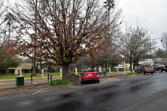
Yackandandah is a small town in regional Victoria that I've never visited before, being a little off the main drag its charms had eluded me. I'd always imagined a very small historic town with not a lot in the way of attractions apart from the a few historical sites. Maybe I should of looked harder because it didn't take me long after arriving in town this afternoon to realise that this vibrant little town has a fair bit to offer. and was a lot more substantial than I'd imagined. After parking the ute on Wellsford Street beside the Soldiers Memorial Park I set off into what was a fairly gloomy afternoon to explore a little.
I started my little stroll a the Soldiers Memorial Park...
... successfully avoided drinking my cheque by the bar at the Star Hotel (with apologies to Don Walker).
After heading south down Wellsford Street I crossed over Yackandandah Creek on the bridge and then turned right onto the walking track that headed west along the creek. The first section of the walk skirting the Yachandandah Sporting Precinct (yes, Yackandandah is way bigger than I'd thought... I'm thinking it may help being in a marginal electorate too...although that's a Feral fact!) Heading out of town along the creek under a gun metal grey sky with the deciduous trees largely bare of their leaves, things were a little on the melancholy side this afternoon. Now the notes I was using suggested that I would be following a pristine creek along here however in reality things aren't exactly pristine, the creek and it's surrounds have been largely altered by man with lots of introduced trees and blackberries, numerous water races and sluicing gullies and even the creek's course itself has been altered by man. Having said that it's was still nice walking, just not something I'd call pristine.
The walk up Yackandandah Creek started off fairly easy.
Yackandandah Creek
Conditions were a little inclement this afternoon.
The area around Yackandandah Creek has been altered a lot by mining.
Fifteen minutes after leaving Wellsford Street I arrived at the Yachandandah Gorge, this is the spot where the old miners diverted the Yackandandah Creek to run through this man made gorge so they could mine the old creek bed. Now that sounds a little ho hum but it is actually a beautiful spot and also very interesting in a historical sense, the old miners must of really been determined to get at that gold as cutting this gorge through the granite back in 1859 must of been an epic achievement. With a bit of misty rain passing through and with the rocks having a grip co-efficient similar to wet soap I had to be very careful rock hopping around here this afternoon, however it's a beautiful spot to explore. After crossing the creek my track climbed around the gorge before once again dropping back down to water level on the up stream side, there is a lookout here although the view into the gorge from the downstream area is better in my opinion.
Cutting the water race through the granite with hand tools must of been back breaking work back in the mid 1800's.
The man made Yackandandah Gorge. Yackandandah Creek was diverted through here so the old miners could access the diverted section of the creek bed.
A few metres after dropping back down to creek level after climbing around the gorge the track divided, avoiding the stile on the left I took the right fork and climbed up to meet the gravel Bells Flat Road. Once on the quiet road it was just a matter of shuffling my way back into town, firstly along the road before crossing the creek and re-joining my outward walking track. This walk is really a figure 8 job so I now wandered back up through town, passed by the ute which was looking a little tempting in the afternoon gloom. I now climbed north up Wellsford Street as I headed for the hills on the north side of town.
After leaving Yackandandah Creek I followed Bells Flat Road back towards town for a few minutes before dropping down these stairs back to the creek side path.
I climbed back through town along Wellsford Street.
I was now following the Valley View Walk... apparently, yes the only indication that I was actually on the Valley View Walk was from my notes and a tourist brochure that I'd picked up, I didn't see any signposting on the ground at all. Not that a lack of track marking really mattered as I was mostly on quiet roads as first I climbed Wellsford Street, then Thorson Lane where my walk topped out with some nice views back down over town. When Thorson Lane re-entered town I zig zagged my way down to meet Isaacs Avenue and started to head back into the centre of town. I was thinking that I'd have a pretty ho hum stroll back to the ute along the road however this was actually a good bit of the walk, after passing through Isaacs Park I dropped down a staircase into a deep gully and walked along a boardwalk, a gently trickling creek keeping my company.
Leaving town again I was following the Valley View Walk...apparently. There is no signage or track marking as far as I could see.
Climbing up Thorson Lane I reached this un-signposted 4 way intersection - I stayed on the main gravel road heading up hill.
Looking down over Yackandandah. I'm guessing this is why its called the Valley View Walk.
After climbing the side of the valley for awhile I dropped back into town.
Isaacs Avenue
Mid winter and the introduced trees have mostly lost their leaves.
I left Isaacs Park via the stair case at the bottom of the park.
Arriving at the local skate park the rest of my easy afternoons stroll was completed in the rain unfortunately, although somewhat fortuitously now that I was heading back into town I was able to get a fair bit of shelter. After a short side trip to check out a replica of an old miners hut (which provided a bit of shelter from the now constant light rain) I climbed back up to Isaacs Avenue beside a historic stone bridge that dates back to 1859. My walk was now coming to its end now as I mixed with the tourists and locals as I walked up the main shopping strip, there are numerous old heritage buildings along here and in a different, non Corona time I'd like to spend a bit of time checking out buildings and the different businesses.
After leaving Isaacs Park my walk followed this gully for a few minutes.
This was a nice section of the walk - the town was mostly hidden above me.
The replica miners hut provided a bit of shelter from the light rain that was now falling.
The old bridge on Isaacs Avenue dates back to 1859.
The Dirt.
According to my GPS I walked 6.7 kilometres and climbed 128 metres on this easy walk. This walk is interesting enough if history floats your boat and the numerous cafés and shops also have something to offer. That said, a grey and rainy afternoon with Corona restrictions still affecting the access to the businesses it probably wasn't the ideal time to visit Yackandandah.... but what do you do, its taken me more than 50 years to find myself in the area! I used the notes out of Woodslanes Best Walk of Victoria's High Country by Craig Sheather as well a little tourist brochure called Short Walk with a Story which I think is put out by the local Indigo Council.
Relevant Posts.
I'd like to come back to Yackandandah once the Corona crises is over and we all feel a little better about mingling in shops and cafés.
Yackandandah - the rain has arrived in earnest now.
Arriving back at the Soldiers Memorial Park... time to head home.


No comments:
Post a Comment