This post was written the week before Melbourne launched into Covid lockdown #4... little did I know!
Early morning on Kananook Creek.
I started this stroll opposite Keast Park beside the Nepean Highway.
Jumping into the ute I set off on the 5 minute drive to the spot where I'd planned to start this stroll at Keast Park in Carrum, although after checking out the time limited parking restrictions I decided to park outside the park on the Nepean Highway instead. It was around 8:30am by the time I finally shouldered my pack and shuffled off north along the Nepean Highway this morning, initially following the footpath for a few minutes before picking up the a track that passed beneath the railway line on a shared path. Once underneath the railway line I pretty well immediately left the concrete shared path and walked another short stretch of footpath along Eel Race Road to reach Kananook Creek. Kananook Creek doesn't exactly scream great walking destination however this little creek in Melbourne's fairly densely populated south eastern suburbs actually is a nice little oasis of fairly natural bush.
I used the flash new shared path to pass beneath the railway line...
... and then followed the suburban Eel Race Road for a couple of minutes...
... to arrive at Kananook Creek.
My aim now was to walk the creek side walking track south until I arrived at Long Island near Frankston, from there the plan was to walk back via either the beach or the Seaford Foreshore Walking Track. I've walked sections of the Kananook Creek Walking Trail before however I've never joined all the dots so this mornings stroll was going to be a little exploratory. Setting off south along the sandy creek side track all was fairly familiar initially as I was walking a section of the track that I did last year during lockdown. This first section of the walk undulates a little and mostly keeps fairly close to the creek which allowed me to get some nice photos of the mist rising off the still water on what was sunny, however extremely cold morning.
The good walking started now as I followed the Kananook Creek Walking Trail downstream.
The Kananook Creek Walking Trail.
The sandy track passes through tunnels of Tea Tree in spots.
After 15 minutes or so the Kananook Creek Walking Trail crosses over the railway line and I suddenly found myself on the concrete shared path again, this shared path is a fairly recent edition to the area as it was built during Melbourne's big level crossing removal program. With the concrete path being fairly new I wasn't exactly sure how much of the old sandy walking track had survived although thankfully almost as soon as I'd joined the new shared path I spotted the old path disappearing into the scrub. From here all the way south until I crossed over Seaford Road the walking alternated between long sections along the old sandy track near the creek and shorter sections along the new concrete shared path which was generally closer to the railway line.
After crossing the railway line I followed the shared path for a few metres before branching off to the right onto the old track here.
Like I said tunnels of Tea Tree.
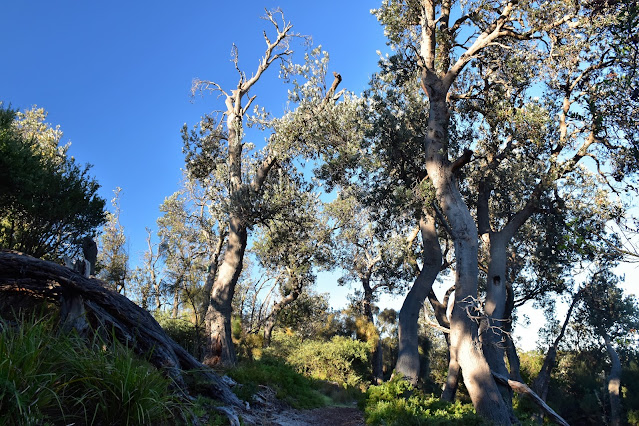
It wasn't all Tea Tree this morning - there are a lot of old Banksia along here as well.
The Kananook Creek Walking Trail.
Approaching the Seaford Station I passed by this big old electrical sub station - yes, it's that kind of walk!
Getting closer to Seaford Station I re-joined the shared path again for a short distance.
Crossing over Seaford Road the shared path branched off to the south east a little however I continued south along the creek side path on a fairly long section where the walking track didn't cross any roads. Eventually my creek side walk came to an abrupt end as I emerged from my Tea Tree and Banksia tunnel next to the busy Nepean Highway and I now faced the crux of the walk - yes, I had to cross the busy highway! At something I like to think was jog, however in reality was more of a shuffle, I safely navigated my way across the busy highway and re-entered the bush near the Long Island Tennis Club before making my way onto the beach.
Kananook Creek - Seaford.
The Kananook Creek Walking Trail.
Kananook Creek - Seaford.
Kananook Creek - Seaford.
The Kananook Creek Walking Trail.
Once on the beach it was time for morning smoko. I now had a choice of routes to get back up to the ute, I could either walk the beach or I could follow the Seaford Foreshore Trail through the foreshore vegetation. Looking at the beach it appeared that I'd hit it almost at high tide and I wasn't overly excited about trudging the whole 6 kilometres up the soft sand so I decided on a bit of a hybrid route - I'd walk the beach up to the Seaford Pier and then I'd head inland and pick up the Seaford Foreshore Trail for the rest of the distance. Now I'd like to say that the beach walk was a good one... but I'd be bullshitting! This beach walk was a reminder to why walking Melbourne's bay beaches can be a little hit or miss, the corse grained sand was soft and there was little in the way of any firm spots for me to trudge along. Yes, and trudge I did! By the time I'd made it up to the Seaford Pier I was pretty well over my beach walk this morning, while the scenery was very nice and it was a cracker of a day I'd just had enough of the soft crappy sand.
I'm about to hit the beach and turn right.
The Melbourne CBD skyline from Long Island Beach.
Hmmm... this doesn't look promising. Melbourne's bay beaches are sometimes a little hit or miss when it comes to walking along them... and it looks like I missed this morning!
Looking south towards Olivers Hill.
Port Phillip Bay was looking nice this morning.
Reaching the Seaford Pier I climbed up through the beachside café to join up with the inland route. The Seaford Foreshore Trail now meandered it's way north, mostly beneath a dense canopy of Tea Trees and for the most part this was a nice walk - kinda makes me wonder why I didn't just walk this track all the way from Long Island. While the busy Nepean Highway is only a few metres away through the trees the walking along this track is actually fairly peaceful, it was only the occasional truck or motor bike that intruded on my revelry. After passing over a couple of beach access tracks I soon emerged from my green tunnel into the wide open grassy expanse of Keast Park and my mornings stroll was effectively over. Making my way through the car park I crossed the Nepean Highway again, re-setting the GPS at my finish point I jumped in the ute and headed off on the five minute drive home.
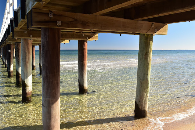
I left the beach when I reached the Seaford Pier.
From the Seaford Pier up to Keast Park I walked the Seaford Foreshore Trail.
Casuarinas on the Seaford Foreshore Trail.
There are some big old Banksias along here too.
The Dirt.
According to my GPS I walked around 11.8 kilometres and climbed about 66 metres on what I'd call an easy-medium grade walk. This walk was OK, it wasn't great and it wasn't crap, it was OK. The Kananook Creek Trail is a nice one, the track crossed the occasional road and it would of been possible to duck off the track for a coffee or a meal. Unless the tide is pretty low or anyone wanted to swim then I'd give the beach section a miss and just return to Keast Park along the Seaford Foreshore Trail, once again a coffee is possible on this leg at the Seaford Pier. I jumped on Google Maps before setting off and used my GPS topos on the walk this morning, as far as I know there are no published notes for this walk.
Relevant Posts.


Very informative. Thanks Feral
ReplyDelete