
Lake Wartook from Mt Gar - I'd be climbing onto the range to the left of the lake to camp later this afternoon.

Alright... time to go.

Things started off fairly easily.
The Grampians, or Gariwerd to use its indigenous name, are a series of sandstone ranges rising out of the pancake flat Wimmera Plains in western Victoria. They are reasonably high by Australian standards and look impressive rising from the surrounding flat land. Normally there is an almost unlimited amount of walking, climbing and riding options in the Grampians National Park however the area was ravaged by huge fires and then a couple of years later massive floods tore through the park which pretty well closed everything down. Whole sections of mountains were washed away along with a lot of roads, bridges, and tracks. At the time of this visit the massive park was starting to re-open and nature was slowly regenerating.

I stashed my pack at Wind Cave while I made the short side trip out to Tilwinda Falls.
Once again I was up early and on the road, the main reason for the early start was to get through Melbourne before peak hour (which even back in 2012 went for about 3 hours in Melbourne). I'd cleared the western extremities of the city by 6 am and was able to kick back and enjoy the sun rising on the drive up as I passed by Ballarat. After a stop at the golden arches in Ararat for brekky it was on to Halls Gap. I arrived at the Grampians National Park office just as they were opening and after jumping through a few hoops had my permit for the night. Next stop was the bakery to pick up a couple of rolls for lunch, stashing them in my pack I was off up the Flat Rock Road nursing a coffee and enjoying my last easy kilometres in the ute as the dirt road rumbled by under the tyres.
Troopers Creek was fairly deserted when I pulled in. I'd timed the walk for the day before our school holidays started hoping to avoid the crowds so I was happy not to see too many cars. After a quick check of my pack I pulled on the boots and gaiters, took the start photo and was on my way. As usual I only got a few meters before I decided that I had to go back and check that I'd locked the ute and as usual the ute was locked, hmmm.... I'm getting old!
The track from the car park heads directly for the Mt Difficult Range cliff line however first I wanted to visit Tilwinda Falls, so after getting to the track junction at Wind Cave after walking less than ten minutes, I stashed my pack and headed off towards the falls. The falls themselves required a bit of scrambling to see them at their best, the route was mostly on the south side or occasionally rock hopping up the creek itself. Try as I might (well, I put in a moderate effort before apathy got the better of me again!) I couldn't catch the scene adequately in a photo, so after trying from a few different spots I decided it was time to head back to my pack.

It was a little hard getting a decent photo of Tilwunda Falls this morning.

Back in the day the easiest way to approach the base of Tilwinda Falls was to rock hop up Troopers Creek.

The pad linking Tilwinda Falls and Wind Cave was a little less used than some of the others.

Back at Wind Cave... the hard work was about to begin.

Hmm...

After leaving Wind Cave to old track climbed solidly up to the base of Mt Difficult Range cliffs.
Once reunited with my pack back at Wind Cave I continued up the steepening track towards the Mt Difficult Range cliff line, by the time I'd reached the cliffs I'd shed most of my layers and was well and truly warmed up. The track basically heads north along the base of the cliffs waiting for a break before heading towards the summit. The route along the cliffs has its gymnastic moments, climbing under, over, and around huge boulders, but any effort is made up for by the view down into the valley of Troopers Creek and north towards the crags of Mt Stapylton. About two thirds of the way along the traverse I came to a waterfall cascading down. This creek is the headwaters of Troopers Creek and provided a good excuse to stop for a drink and to take in the view. Not long after leaving the creek after scrambling over a few more large rock slabs I reached the break in the cliff line where I zig zagged up onto the main Mt Difficult Range ridge and within thirty minutes I was at the Mt Difficult Camping Area (now closed).

Traversing the base of the cliffs gave me some nice views. That's Asses Ears in the distance.

Eventually I'd reach the crest of the range... although it would be awhile yet.

The rocky ramparts of the Mt Difficult Range.

I'm still traversing the cliff line.

The old track along the base of the cliffs was a little rough in spots however it was still easy enough to follow.

Tilwinda Cave

The old track was a little ledgy...

... and scrambly in spots.

The headwaters of Troopers Creek dropping off the Mt Difficult Range.

Troopers Creek

My best angle!
The camp site at Mt Difficult has no facilities, and from what I can see no easily attainable water. It does, however provide a sheltered place to camp if you want to catch sunrise or sunset from the summit. It also provides plenty of places to stash my pack (making sure it's done up securely as my young nephew once had his supply of chocolate ransacked by Currawongs up here, on the first day of a four day walk which led to untold privations and hardship). So with my small daypack with lunch, water and camera I had an easy scramble through the rocks to the cairn and trig on the Mt Difficult (Gar) summit. The large cairn provided the perfect sheltered spot for lunch while taking in the 360˚ view. Lake Wartook looked particularly good as last time I was up here it had been almost empty and now it was brimming with water. To the north was Mt Stapylton, to the south was Asses Ears, to the west was Mt Arapiles rising from the flat plains and to the east across the Mackenzie River basin was the continuation of the Mt Difficult Range.

The old Mt Difficult Camp. There was nothing up here apart for some flat ground, no easy water and no toilet... maybe that's why Parks Vic closed it?

The view south along the Mt Difficult Range from the Mt Difficult (Gar) Summit.

Asses Ears from Mt Difficult.

The Mt Difficult Range actually looks like a big horseshoe from above as it wraps around Lake Wartook.

Lunch was enjoyed at the Mt Difficult (Gar) Trig.

Finding the route down into the valley from the old Mt Difficult Camp was a little tricky in spots.

The Mackenzie River was looking very second hand after the fires and floods down here.

The Mckenzie River post fire and floods back in 2012.

Climbing back up onto the crest of the Mt Difficult Range I met the old Boroka Track - this was a great track that is now being up-graded for the Grampians Peaks Trail.

Once I was back up on the crest of the Mt Difficult Range the walking was very nice again.

Heading north west into the low afternoon sun as I followed the Mt Difficult Range.

The Mt Difficult Range near Deep Creek.

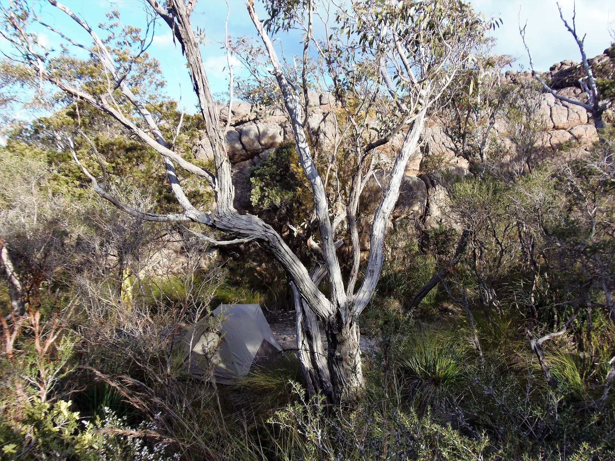
My Deep Creek Camp.
This was a great little camp site in a tiny little gorge with a pretty little creek (the headwaters of Deep Creek) running past the front of my tent and small cliffs providing ample shelter. After pitching the tent I scrambled a couple of minutes back up the track to a rocky platform with great views, this was my kitchen and dining room. My rocky platform made for a great place to not only eat dinner but also watch the sunset over the Wimmera Plains. As the sun went down Lake Lonsdale seemed to glow in the distance while the bluffs around me turned a fiery red. When the sun finally dropped below the horizon the temperature plummeted with it and I was soon cocooned in my tent, enjoying an early night of reading while listening to the footy on ABC local radio.
This old camp up on the headwaters of Deep Creek was a bit of a favourite, there was only room for one or two tents, it had nice water and was fairly protected.

A short climb from camp and I had some nice rock slabs to enjoy dinner on.
The Dirt.
I walked around 12 kilometres and climbed around 950 metres on what I'd call a Medium grade days walking. While never being super steep there was enough climbing today that it kept the heart rate up. The track itself was fairly rough in spots and it paid to be keeping an eye on navigation when the track crossed long sections of rock slabs. Water was easily available from the headwaters of Troopers Creek on the climb up Mt Difficult, the headwaters of the Mackenzie River down near Lake Wartook and at camp on the headwaters of Deep Creek. Once again, keep in mind that a lot of the camps and tracks are closed now. Before doing this walk I picked up a permit from the Grampians National Park HQ in Halls Gap. I used an old Northern Grampians Vic Map 1:25000 - I'm not sure if it's still in print however SV Maps have a good Northern Grampians topo now days. Lots of people have published notes for sections of this walk including Tyrone Thomas, John and Lyn Daly, and the Chapmans in Lonely Planet.
Relevant Posts.

I enjoyed a relaxing dinner watching the sun go down.

Lake Lonsdale at sunset.


No comments:
Post a Comment