
The old Mt Gar track wasn't without it's highlights.

I set off from the brand new Troopers Creek Camp nice and early this morning.
With a temperature forecasted to reach the high 20˚ today I was keen to be on my way pretty early this morning. Parking my ute at the new Troopers Creek Campground I grabbed my pack and shuffled off south down the quiet Roses Gap Road towards the site of the old Troopers Creek Camp just as the sun was just peeking over the crest of the Mt Difficult Range, over my left shoulder. Roses Gap Road made for a nice warm up for the day ahead although by the time I arrived at the old camp I was pretty ready to head bush and get off the hard surface. The old Troopers Creek Camp has been bulldozed and is being revegetated and the start of the old track up Mt Gar wasn't obvious initially, although after wading into the regrowth and then tracking south a few minutes I soon found the old pad.

Initially I followed Roses Gap Road south beside the Mt Difficult Range - if you look really closely the Mt Gar Trig is just about visible on the skyline.

Walking Roses Gap Road first up this morning.

The old Troopers Creek Camp is opposite this information sign on the other side of Roses Gap Road.

Apart from some bare ground there is nothing left of the old camp.

Once inside the tree line the old track was pretty obvious ... initially!
I'd been thinking that this first section, as it slowly climbed towards the looming ramparts of the Mt Difficult Range, would of been the most scrubby - how wrong I was! Once I'd located the old track the going was really easy along here, for the most part the track was still fairly clear and easy to follow. The going was still pretty good when Wind Cave appeared ahead of me and I was starting to get a little cocky now as I knew I'd soon be mostly on rock and I assumed that the regrowth there would be less... hmm. After giving the side trip to Tilwinda Falls a miss I continued up the old Mt Gar Track, however instead of the scrub getting thinner quite the opposite happened - as the old track got increasingly rockier and steeper it also got scrubbier and more indistinct. Now I was not really in any danger of getting too far geographically embarrassed along here as I was climbing very steeply up to meet a shelf that I knew ran along the middle of the Mt Difficult Range cliff line - still I was keeping a close eye out for clues in the form of cairns, old steps and the occasional old faded painted track markers.

Fairly easy going as I approached the cliffs.

The closer I got to the cliffs the more scrubby the old track became...

... there were clues though.

It's a fairly steep and rough climb up to the shelf that I'd be traversing next.
After negotiating numerous fallen dead trees and managing to pretty well stay on the old track I arrived at the spot where the old track swings north along a rough shelf in the cliffs. I now knew that I'd be walking this shelf for the next hour or so and once again I was thinking that the going would be pretty easy when it came to the scrub... and once again I was totally wrong, yep I'm on a roll here! While the bare rock sections along the shelf were pretty much as I remembered them the sandier sections in between the rock sections were once again pretty scrubby. Now you are not going to get lost along here as in one direction you'd be stepping into space while in the other direction you are butting up against a soaring sandstone wall - it's pretty much either north or south along here.

Once on the shelf section the scenery ramped up a bit... the walking was pretty slow though due to the re-growth.

Early morning on the old Mt Gar Track.

I was basically traversing along the base of these cliffs...

... quite often with another line of cliffs below me.

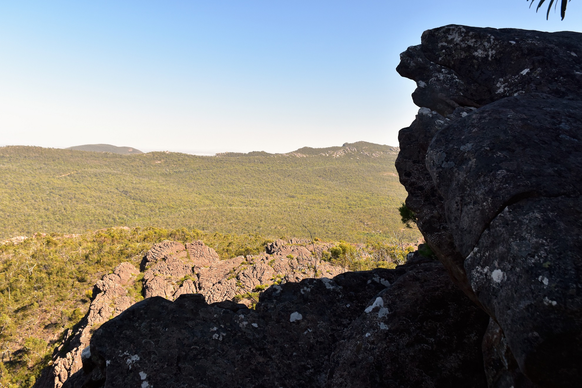
Mt Difficult Range.

Mt Difficult Range

I was still walking in the shade this morning as I was on the west side of the cliffs.

I was also pushing through a lot of big spiders webs.
Now I've waffled on about the scrub but what I haven't really mentioned was the scenery, this is another of those spots that my year 10 vocabulary can't really do justice to. In between climbing over dead trees and pushing through scratchy scrub I was able to stop and check out the jagged peaks tearing at the blue sky above me. With age not on my side and the old track quickly returning to nature I'll probably never get to walk this route again, so I was lucky to have such a beautiful day to take in the amazing scenery and get some decent photos to jog my memory in the future.

Mt Difficult Range

I wasn't thinking that the shelf section would be scrubby - I was wrong!

While it would be hard to get lost along here it still made for fairly slow walking.

Mt Difficult Range

It might not look it however I was having a great day out!

There were some reasonable scrub free sections.

The shelf / ledge gets fairly airy in a couple of spots...

... however I always had the scenery...

... and the scrambling to take my mind off the drops.
The sun was getting closer to me.

The headwaters of Troopers Creek flow down through this gully - although being at the end of summer the creek was bone dry up here this morning.

I've just arrived at the gully I need to climb.
Now I'd found the gully however there wasn't much resembling a track left, still after a bit of scouting around I managed to find some old dry stone steps being reclaimed by nature. I was keen to find the old track not so much for navigation but more for the fact that it made for marginally easier walking through the notorious Grampians scrub and climbing this gully only reinforced that. Before I managed to locate the old track I'd pushed through maybe 15 metres of scrub and already managed to draw blood on both thighs. Once back on the track the going was still far from easy up here, although as I climbed higher above the surrounding cliffs the scrub eased off a bit and I found myself walking some long sections of bare rock climbing more easily towards Mt Gar. This somewhat convoluted section even required a bit of concentration back in the day, so it was no real surprise to me that things were pretty vague today, although I knew that I was getting very close to Mt Gar to Longpoint West Track so I wasn't overly concerned and sure enough after pushing through one final belt of scrub I found the old stainless steel signpost and I was back on a track.

Climbing the gully I started to see a few Grass Trees.

Once again I was looking for clues... mainly as the old route generally provided the best way through the scrub. In this case I found some of the old dry stone steps buried in the scrub.

Climbing what I call the gully section.

These stacks pretty well mark the top of the gully.

Once out of the gully the views opened up again...

... and I got my first glimpse down towards Lake Wartook.

Thankfully after one last section of scrub...

... I spotted the old signpost...

... and I was back on a real track (the Longpoint West Track).
Now the days walking wasn't done yet though, I'd probably only walked about a third of the distance that I'd need to cover. A few metres after joining the Longpoint West Track I reached the turn off for the climb up to Mt Gar and as I was still feeling relatively fresh and it wasn't yet lunchtime I figured that I'd climb up for a bit of a look (it's almost a tradition after all!). The summit track heads off from the old Mt Gar Camp, although nowadays the site has been revegetated and the pack opening Currawongs have also moved on to find a feed somewhere else. While there were no mischievous Currawongs any more there was a couple of Peregrine Falcons and also a couple of Wedgetail Eagles soaring on the thermals around the summit trig. The summit of Mt Gar made for a good spot to stop for awhile, my eyes drawn to the usual blue waters of Lake Wartook glistening in the sun as well as the jagged ridgeline of the Mt Difficult Range heading off in both directions - what was new though was the site of the new Grampians Peaks Trail (GPT) snaking it's way up the mountain range, yes it appears as though it's not only the Great Wall of China that can be seen from space now. It's not only the track that stands out from the summit either, the new Mt Gar Camp is also visible in the trees sitting on a shelf around a kilometre away. Now I'm not necessarily for or against all this it's really just an observation on how things have changed here, most walkers will have there own thoughts and opinions about the new GPT and I can see both the positives along with the negatives.

Around a minute after meeting the track I left it again for the walk up to the Mt Gar Summit.

The Mt Gar climb had a bit to keep me interested.

The summit is looking a lot closer now.

There were a couple of Peregrine Falcons soaring around up here.

Mt Gar trig.

Lake Wartook from Mt Gar.

Looking down towards Roses Gap from Mt Gar - that's the GPT / Briggs Bluff track snaking it's way down the mountain.

The new Gar Camp from the summit of Mt Gar - I'm heading down there to check it out next.

Arriving at the new camp I wandered out to the cliff edge to check things out.
After a descent break on the summit I grabbed the pack and set off down towards the new Mt Gar Camp for a closer look. The Mt Gar summit walk is a side trip from the GPT so there has been a bit of work done on the old track however the going was still reasonably rough in spots. Arriving at the new camp I dropped my pack in the communal shelter and had a bit of a poke around the somewhat sprawling site. The camp is situated along a shelf around 10 metres from the cliff edge and stretches out for around 100 metres I guess. At the top end (Mt Gar end) there are some flash huts that come complete with mattresses and bunks, moving down there is a platform with some outdoor furniture, next up come the camping platforms that look like they would be OK for two small tents (or one Triplex!), on the edge of the cliffs there are four lounges bolted into the rock. Moving further down I was back at the communal shelter that comes with furniture, multiple USB ports and a huge water tank (and they'll need it). Heading further down the shelf I think there maybe more camping platforms and then finally there is a big composting dunny, while this was all very impressive I'm a little concerned that people are going to be forced to use these facilities (and they aren't cheap) as Parks Vic is planning on banning wild camping in the park.

And just like that I was down at the new Grampians Peaks Trail Gar Camp.

The highest point had these flash huts...

... that had bunks and mattresses in them.

There's a nice outdoor area.

The camping platforms could probably fit two small tents - or my Triplex!

There are sun lounges bolted to the rock along the cliff edges - book your seat for sunsets I'm thinking!

Inside the communal shelter.

At the lower end of the camp there is a fairly substantial long drop.
After a reasonably long break I set off again on my long loop. I was now going to be following the new GPT pretty much all the way back down to the ute at Troopers Creek Camp. The first section of GPT follows the old track all the way down past Mud Hut Creek and up to the Briggs Bluff turnoff and this section of track is very exposed, so on what was a pretty warm afternoon now I was pretty happy to arrive at the copse of mature trees around the Briggs Bluff turnoff which gave me some respite from the sun. Interestingly (well, for me anyway) the old track along here really hasn't been prettied up much for the GPT, there were a few extra dry stone steps however apart from that it was all pretty low key up here. Leaving the Briggs Bluff turnoff the GPT tracks along the base of a cliff line for awhile before dropping down on to another broad shelf and this is where you can start to see the money that has been poured into the GPT.

I was now following the GPT - the going is still fairly rough however the route is better way marked.

This section of the GPT utilises the old Briggs Bluff to Mt Gar track.

High up on the Mt Difficult Range.

Things got a little overgrown along the GPT down near the old Mud Hut Creek camp.

Approaching the Briggs Bluff turnoff I started to get some shade.
After avoiding the old Briggs Bluff route the GPT swings south and soon drops down through an impressive chasm along a section of dry stones steps before almost immediately dropping down a long sloping ledge and leaving the new Briggs Bluff Track. Still following the GPT I was now walking a section called the Waterfalls of Gar section although being at the end of summer I wasn't surprised that there was no water coming down this afternoon. While there was no water along here there were a lot of impressive cliffs to check out and once again it was easy to see where the money went on the new track as it negotiated the rugged topography. With the late afternoon sun in my eyes I soon arrived at the turn off to the Troopers Creek Camp and left the GPT, ten minutes later I was pulling my boots off back at the ute and starting the long drive home after what had been a sensational walk.

Dropping down the GPT from the Briggs Bluff turnoff - the scenery is pretty epic along here.

Easy going on the GPT.

The GPT with Mt Gar up on the left.

Dropping down the GPT towards Troopers Creek.

The GPT.

Looking back up to the Mt Difficult Range.

The GPT negotiating another cliff line.
The Dirt.
According to my GPS I walked around 17.5 kilometres and climbed about 769 metres on what I'd call a hard walk (interestingly my phone app came is a little less and to be honest I think it's more accurate that my Garmin). Now I've got to say this is a ball tearer of a walk, this was one of the first tracks that I ever walked in the Grampians back in the day, so it's obviously got some good memories for me... however, the old Mt Gar track is getting pretty tough now and unless you are used to pushing through the scratchy Grampians scrub then it's probably a good idea to give it a miss unfortunately. The Grampians Peaks Trail section of the walk is a mix of the old Briggs Bluff / Mt Difficult Range Tracks along with quite a bit of new track, and compared to the old Mt Gar section of the stroll the new track is pretty cruisey. One thing to be aware of up here is that the country is very exposed to the elements (both heat and cold) so be a bit careful with that - I saw numerous people suffering on the bare rock sections today and even gave a litre of water to an older couple who were obviously struggling in the heat. I used the Northern Grampians topo map today along with an Alltrails map that I created and my GPS topos. Sections of this walk have been written up be almost every bushwalking author going I reckon, although most are now out of date.
Relevant Posts.

I was now dropping down a section of the GPT that is called the Waterfalls of Gar Walk - although with it being summer in the Grampians all the waterfalls were dry - the cliff faces are still very impressive though, especially as it was late in the afternoon.

Late afternoon on the GPT.

I'll have to get back up here in winter to check out these waterfalls I think.

Heading into the late afternoon sun as I approached Troopers Creek Camp.

Heading home after another big day out!


An excellent trip report !
ReplyDeleteA big thank you for this report, I've done several overnighters in and around Mt Difficult over recent years, but never this 'old' route up from original Troopers Creek. I've been very curious about having a go at it but cautious due to lack of familiarity with the old track and it's lack of use. With your notes/report here, I'd almost be tempted to give it a go. Many thanks BP
ReplyDelete