
Climbing away from Young's Hut to meet the AAWT late in the day.

There is plenty of parking at the Brandy Creek Trail Head although I think that it maybe within the Mt Hotham Resort Boundary, so I'm not sure about leaving a car here in the ski season.
First up on this walk I had to drop around 4 kilometres down the Brandy Creek Track all the way to the Cobungra River. My descent was broken with a short side trip to check out the old Brandy Creek Gold Mine Diggings, like a lot of Victoria this area was extensively mined back in the day and I'd see a fair bit of evidence of the gold mining heritage over the two days that I was on this walk. Once I'd checked out the old sluicing scars I continued dropping down Brandy Creek Track to arrive at the Cobungra River around an hour after leaving the ute.

Dropping down Brandy Creek Track - the day was already looking promising.

Looking across to the southern end of the Bogong High Plains - hopefully I'd be up there is a few hours.

I took the short detour to check out the old Brandy Creek Gold Mine Diggings.
The Brandy Creek Mine Diggings.
Leaving the old mine I continued dropping down Brandy Creek Track to the Cobungra River.

Hmm... this looks serious!
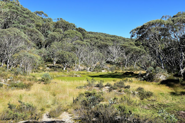
Once down on the river flats I had to follow the Cobungra River up stream for around a kilometre and the going was actually pretty hard along here. The old vehicle track had long returned to nature along the flats and I found myself sometimes pushing through chest high grass, although thankfully when I crossed over onto the eastern bank of the river I found a reasonable pad to follow all the way to the base of Paling Spur. There is a really nice camping spot at the bottom of Paling Spur and with Swindlers Creek and the Cobungra River merging nearby I think this would make a great spot to spend the night - although it was way to early to call stumps today.

The Cobungra River Valley.

The walking up the river flats was surprisingly slow in spots...

... particularly when the grass got to chest height.

I crossed the the east side of the river here (if you squint you may see a track marker on the tree on the east bank) and the walking got a lot easier.

The Cobungra River.

There is a nice camp at the base of Paling Spur that isn't without it's attractions.
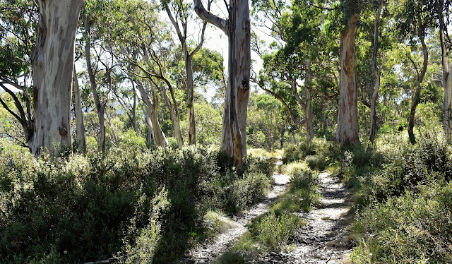
After a bit of a break I shouldered my pack again and set off on what I figured would be the hardest walking of the day - the climb of Paling Spur. Now I wasn't too sure exactly what to expect here, I'd heard everything from an off track horror to light to moderate scrub with an intermittent pad. Setting off I found Paling Spur was steep, however not stupidly so, so reasonable progress was made - well reasonable considering that I'm still carrying about an extra 10kg of Covid conditioning around my gut! In other good news the scrub wasn't too bad and more often than not I actually had a decent pad to follow, while I couldn't always see my feet there was definitely a pad. After 40 minutes or so the climbing eased off a bit and Paling Spur started to swing from an easterly to east-nor-east bearing and at the same time the pad that I'd been following morphed into something more substantial, yes this section of the track had enjoyed a bit of a hair cut with a whipper snipper making it very easy walking. With the gradient easing off and the track clear the last section of Paling Spur was pretty cruisey really, and all was pretty good in my Feral world until I broke out onto the most southern section of the Bogong High Plains - and my pad disappeared.

Alright, it's time to start climbing. This is the start of the pad up Paling Spur.

Lower down (on the steeper section) I was pushing through this stuff - there was mostly an obvious pad though.

The higher I got the better defined the pad became.

The gradient on the upper sections of Paling Spur eases off a lot and the walking is sensational.

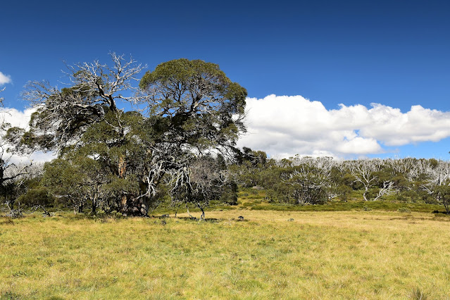
I've just emerged from the tree line which pretty much marks the start of the route down Paling Spur. The big gnarly Snowgum would be a handy navigational aid if heading down.
After passing by a huge old Snowgum (which would make an excellent navigational landmark if trying to pick up the pad heading down Paling Spur) I set off across the rolling plains to try and find Young's Hut. Between me and Young's Hut there was a fair bit of country to negotiate and while there was a pad (actually there were many pads) it faded in and out fairly regularly. I'm thinking that I was mostly following horse pads across here, well judging by the piles of horse shit anyway. I'm also thinking that while there were obviously brumby tracks (and some of the wetter areas had been messed up a bit which suggests brumbies) most of the pads that I was following must of been created by recreational riders as more often than not they were heading in the direction that I needed to be heading - from the top of Paling Spur over towards Young's Hut.

Easy walking across the southern end of the Bogong High Plains.

There was quite often a faint pad to follow.

I arced around to the west a bit as I headed towards Young's Hut.

There were belts of thicker scrub however they were all pretty easy to get around or to go through.
Whatever created these pads it made my job a little easier and I was able to make some pretty good progress across the high plains. Looking at my map before leaving home I figured that I'd need to swing a little arc to the west as I made my way up to Young's Hut to avoid some steeper country (and a bit of scrub, as it turned out) and luckily for me my horse riding mates seemed to have had the same idea. I was easily able to find a pad heading in the direction that I needed to go and avoiding the worst of the scrub was pretty easy, actually the scrub across here was fairly light anyway. To avoid the worst of the scrub I overshot the shortest route down to Youngs Hut and picked up the pole line on the crest of a spur from where I almost doubled back on myself and dropped the ten minutes down to the hut.

Southern High Plains walking.

I'm thinking that these pads were made by recreational horse riders and not brumbies - judging by the fact that while there was sometimes numerous pads they were all mostly heading in the direction of either Young's Hut or the main pole line across the Bogong High Plains... oh, and judging by the tracks the horses had horse shoes on them.

I'm about to swing east and drop down to Young's Hut.

Young's Hut.

The view from Young's Hut is a sweet one!
This old hut is in a beautiful shallow valley, with water 100 metres away in the valley and some nice grass to camp on I was sorely tempted to stop here for the night... however it was only 4pm. So after resting on the grass in front of the hut for awhile I somewhat reluctantly shouldered my pack again and set off. I had a rough plan to camp somewhere beside the AAWT just before it arrived at the Basalt Temple, so not only was I climbing again but now I was climbing with and extra 3 litres of water on board. After retracing my way along the sparse pole line I continued on climbing onto the edge of the Bogong High Plains proper, now I say 'the edge' as I sidled a little and picked up the AAWT a little to the west of where the two pole lines actually intersect on the high plains.

After filling up my water containers in this valley below the hut, I set off for the AAWT.

I was now climbing again as I followed the old Young's Hut pole line up to the AAWT.

The clouds occasionally looked a little ominous however I stayed dry.

Still climbing towards the AAWT.
Once on the AAWT and dropping along the pole line towards Dibbins Hut I started to look in earnest for somewhere to camp. There are plenty of open areas amongst the Snowgums up here, although finding both a modicum of shelter and some fairly level ground required a little scouting around. Ten minutes or so after picking up the AAWT pole line I managed to find a small and fairly level grassy terrace beneath the Snowgums and home for the night was sorted. After getting the tent up I was able to enjoy dinner sitting on the grass in the late evening sunlight, I even had a fallen tree to use as a back rest - life was pretty good. With the sun dipping below the western horizon I wasn't lingering outside tonight though, I was in the quilt and snoozing well before 9pm tonight - yep, it had been a long day - but a great day!

I left the Young's Hut pole line and sidled the edge of the high plains before hitting the AAWT.

The pole line on the skyline is the where the AAWT drops off the Bogong High Plains on it's descent down to the Cobungra River - the rough walking was almost over.

I dropped down into the Snowgums along the AAWT until I found a flattish spot to camp.

Suddenly navigation was all pretty easy.

The light up here was sensational tonight.
The Dirt.
According to my GPS I walked around 17 kilometres and climbed about 716 metres on what I'd call a medium-hard grade days walking - the reason that I've rated like that was that there was a fair bit of navigation required along with some scrub. Obviously water was available down on the Cobungra River however it was also reasonably easy to access in a couple of spots across the southern sections of the high plains, I filled up my water for camp in the valley below Youngs Hut as there was no water near my camp up on the AAWT (keep in mind when I did this walk we were at the tail end of a very wet summer). I used the Rooftop's Bright-Bogong-Hotham Forest Activities Map along with my GPS topos and a topo map I produced on my Alltrails App on today's stroll.
Relevant Posts.
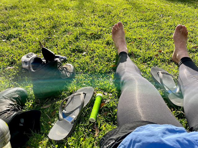
I was pretty happy to finally get the boots off tonight. After two years of lockdowns I've got a bit soft!

Tents up...dinners cooking...life was pretty good!

Now, before someone tells me that this isn't the actual Basalt Temple well I'm aware of that. The Basalt Temple was the nearest landmark to my camp, so near enough was good enough I thought.

It's almost tent o'clock I think.


Glorious. Such a stunning part of the Vic Alps. Great ski touring too. That campsite is better than basalt temple anyway, too rocky there. I'm full of responsibility currently and your blog is both keeping me sane and making my soul ache for the hills.
ReplyDeleteI'm glad my old blog is giving you some enjoyment! Yes, this was a really nice walk... I'm actually thinking of heading back up soon and revisiting it for my vlog. Thanks for dropping by.
DeleteWhen I have time again to get back out into the hills (caring for grandpa these days) I'll probably see you out there one day. I often find myself revisiting your blogs especially AAWT ones to pass the time, great writing and photography. OTOH it's kind of self torture not being able to be out in our Alps and reading about it 😅
ReplyDeleteGreat report and pics, have this route on the to do list this Spring
ReplyDeletevery nice, plan to do the walk in a couple of weeks
ReplyDeleteGood writeup, thankyou :) VK3UFO with a 4WD and Starlink deep in the bush in east Gippsland.
ReplyDelete