
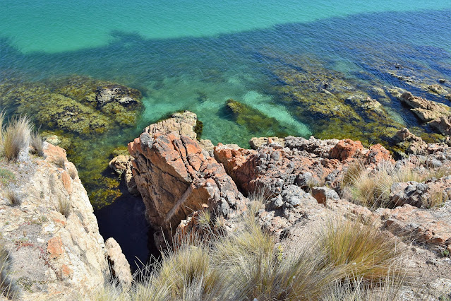
Walking this coastline was incredibly rough and slow, however the scenery was top shelf as well - it's a little hard to believe that this is in Port Phillip Bay.
This is yet another walk that I've looked at over the years, however I've never actually got off my arse and had a go at it. When I say have a go at it I mean it, because I wasn't even sure if the walk as I wanted to do it was even possible. You see I wanted to have a go at walking at sea level, or as near as practicable from Safety Beach up to Mt Martha Beach and I'd never come across any information of people doing this before. While it would be easy enough to walk the Esplanade between the two beaches, the busy narrow road wasn't really what I was looking for this morning. Anyway, after completing a few chores down in Mornington I was fortunate that Sam was able to drop me off at 9:30am down at Safety Beach near the Safety Beach Sailing Club.

Safety Beach made a nice place to start my days walk.

I figured that this monument made a reasonable spot to officially start today's stroll - mainly because it was across the road from where Sam dropped my off!
Setting off north along the coast I had the first of what would turn out to be many obstacles to negotiate, the crossing of the Martha Cove Inlet. Now there is no bridge here, and fording the inlet is definitely out of the question - what there is though is a tunnel beneath the inlet. Yes, when the property developers got the green light to develop this part of Safety Beach part of the deal was that they would build tunnel beneath the inlet both for walkers and also vehicles on the Esplanade. Once I'd passed beneath the Martha Cove Inlet I immediately arrived at Tassells Cove, I now had the option of staying on a cliff top gravel path or sticking to my original plan of staying at sea level as often as possible - so sea level it was.

The days first obstacle was the Martha Cove Inlet...

... yes, I won't be wading this one...

... thankfully there was an option...
.... yep, I could walk beneath the inlet.

I even got to check myself out on telly.

Tassells Cove.

Tassells Cove.

Looking ahead from Tassells Cove I was glad I was walking in my tevas.
I'd decided to walk in my tevas today and straight away it proved to be a good choice as even at a nearly low tide I was wading. The next bit of coastline heads in north-westerly direction and in spots the cliffs run right up to the water even at low tide. Initially the walking was a mixture of submerged rock shelfs with the occasional rocky beaches, however after crossing a bigger rocky beach (which has formal access track to the Esplanade above) the walking was mostly along various different configurations of ankle braking rocks (remember I was in sandals), yep life was pretty good really!

Even at almost low tide there was no chance of staying dry on this walk.


Looking back towards Tassells Cove, progress was being made - slowly.

I had a beautiful day for this stroll.


Mt Martha coastline, Port Phillip Bay.

I crossed this small pebble beach around 30 minutes after leaving Tassells Cove - there is actually an official access track from the Esplanade that drops down to this beach.

After crossing this small beach I was making my way around the headland in the distance.
While life was good my progress was a lot slower than I'm planned. Before leaving I'd done a bit of googling and looking at aerial photos of the coast however I really hadn't been able to find out much. While I knew of a couple of official access tracks from the Esplanade to the water level I couldn't tell what the actual coast was like, in spots it looked like there was a reasonable amount of rocky real estate to walk on so I hoped that meant that I'd get the occasional rock shelf or similar to walk along. Rounding the western most point the coast now swung onto a north-nor-east bearing and any hopes of some easier (and quicker) walking quickly evaporated. The coastline now mostly consisted the sharply tilted rocks and the only real relief that I got was when I had to negotiate the reasonably frequent deep gulches.

More slow going.


Rounding the headland the cliffs eased off a bit however I found myself walking quite a bit of tilted and jagged rocks.


Occasionally I climbed a bit to make some forward progress.

That's Arthurs Seat in the distance.

Port Phillip Bay.
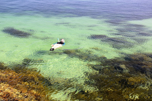
It looks like there is some great diving along here.

Hey, hey, a rare easy section.
While my progress was super slow the scenery was making up for my lack of forward progress, everytime I stopped to give my aching feet a bit of a break I was presented with yet another stunning scene. The coast along here is perfect for snorkelling although accessing without a boat would be fairly tough for most of the distance I'm thinking, still I was making plenty of mental notes of places that I want to return too.


Eventually I reached a gulch that looked a lot harder to cross, there was no easy way up and around it, it's sides were almost vertical and the water looked deep, hmm. Scrambling down the side I eased myself into the water which strait away was lapping at the bottom of my pack. The plan was now to walk out the gulch towards the ocean to a spot where I could climbed up the rocks on the far side, yes that all sounds reasonable....except this is a Feral walk! While the bay had been dead calm all morning as soon as I was belly button deep in the water a metre swell rolled into my little gulch...fuuck me!! So I now found myself desperately scrambling on the rock as I was buffeted by series of waves that had seemingly came out of nowhere. After getting smashed I eventually clambered back up onto dry land and reassessed the situation, I was now wet to my chest, my pack was wet although thankfully I'd been able to get my DSLR up onto dry land so that was more or less dry and the important gear in my pack was also dry as it was in dry bags. Sitting down in the sun to dry out a bit I tried to work out what the fuck had just happened - a little before I'd arrived at the gulch I'd photographed the Spirit of Tasmania sailing down the bay a few kilometres off shore and I'm thinking that just as I eased myself into the deep water in the gulch there ships bow waves arrived at the coast, yes if I didn't have bad luck I'd have no luck at all!
The easier walking didn't last long.
I was now starting to come across a few gulches that I had to cross.
I thought this gulch might stop me...
...however after climbing in...
... I was able to walk a narrow submerged ledge.
I was able to climb around this one.

It all looks pretty easy, doesn't it?

This one was pretty easy to cross.

This one looked a bit more serious...

Although I was able to climb around it.

Some lucky punters heading out of the bay on their way to Tassie.

This gulch stopped me (along with an ill timed wake).

At least I had a nice view to take in while I dried off on the rocks after my aborted attempt to cross the gulch.

Eventually I burrows my way through the scrub up to meet the Esplanade.

After getting around the gulch I walked a hybrid route of the Esplanade, the cliff tops and the rocky coast.

I still had a long way to go to reach the safety of the Mt Martha Beach - it's around the headland in the distance.

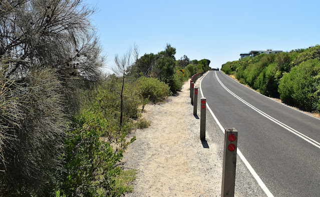
Walking the Esplanade required a lot of caution - on the plus side though the views were good.

Back down at water level again - I still think that it's hard to believe that this is Port Phillip Bay in Melbourne.
After a final fifteen minute road walk I arrived at a spot that I'd been looking forward to visiting for awhile - The Pillars. To check out The Pillars I once again headed into the coastal scrub along informal paths, although this time I didn't drop down to sea level instead enjoying this cliff jumping spot from the top of the cliffs. Today was a fairly warm day so it was no real surprise to see quite a few of the local teenagers out for their adrenalin rush. Leaving The Pillars I eventually emerged out of the bush onto the Esplanade again and followed the road around towards Martha Cliffs, even from the road the views here are top class I think.

That's The Pillars in the distance. I've always wanted to check out this cliff jumping spot.

The Pillars.

The Pillars.

Leaving The Pillars I was able to walk the cliff top for awhile...
...before walking the Esplanade again.
Rounding the headland south of Mt Martha, the white sand and turquoise water of Mt Martha Beach started to come into view through the trees. I now dropped off the road again and picked up a very old walking track that contoured above the cliff tops, but below the road. Meeting up with a sealed walking track I dropped down to the beautiful beach and the days hard walking was over. Shuffling across the hot sand I waded into the cool clear water, my sore feet immediately thanking me as I removed my sandals and felt the sand under my feet. The rest of the walk was completed wading along the shallows of the Mt Martha Beach until I arrived at the Mt Martha Yacht Club where I left the beach and finished off today's stroll.

Rounding the last headland before Mt Martha beach the great views continued.

The boats in the middle distance are anchored off The Pillars.

Mt Martha Beach has just come into view.

I picked up a very old track that contoured the slopes bellow the Esplanade as I headed for the beach.

Mt Martha Beach.

Mt Martha Beach - I might try walking the rocks from here to The Pillars... next time!
The Dirt.
According to my Alltrails App I walked around 8.2 kilometres and climbed about 72 metres on what I'd call a hard walk. I set off today to see if it was possible to walk between Safety Beach and Mt Martha and to be honest I still don't really know, what I do know is that if attempting it as sea level then you'd better be prepared to get wet...very wet. The biggest problem as I see it is that the walking is so slow that (for me) it was pretty well impossible to do the complete distance on a low tide. Walking the Esplanade is not for the faint hearted either as there is bugger all shoulder to walk along and the road is fairly busy. While the walking was tough the scenery was top class I thought, this is easily the best coastal scenery anywhere in Port Phillip Bay. I really wonder if anyone has looked at the feasibility of constructing a walking track along this bit of the coast, it seems a shame that the best of Port Phillip Bay is really only for fairly intrepid fisherman, divers and crazy walkers - this coast would make for a top class daywalk with both ends linked by public transport. I used my Alltrails App and my GPS topos today, as far as I know the walk as I did hasn't been published elsewhere either on-line or in print.
Relevant Posts.

There is a lot of expensive real estate down here...

... even these beach boxes go for a fortune.

Walking Mt Martha Beach was a nice way to wind down as I finished my stroll.

I officially finished my days stroll at the Mt Martha Yacht Club.

I didn't get a GPS trace for the whole route on my Garmin. This Alltrails map is the only record of my complete walk.


No comments:
Post a Comment