 |
| South Selwyn |
The showers continued on and off for most of my night up at Barry Saddle but thankfully by the time I was ready to emerge from the tent things had improved a bit. While I was having breakfast I wandered around the grassy opening hanging up various pieces of kit on the trees, I find that no matter how good my gear is and how careful I am, after two or three days of rain and showers things start to get a bit damp. So anyway, with a bit of drying action going on and some blue sky above it was a pretty relaxed start to the day today. The other factor that had me procrastinating a little was that after the last five days of great walking today I would start my traverse of the lower and less scenic Barry Mountains, not only were these mountains slightly less scenic but the AAWT largely utilises fire tracks for a lot of it’s journey.
 |
| I had a fairly relax start to the day, today. |
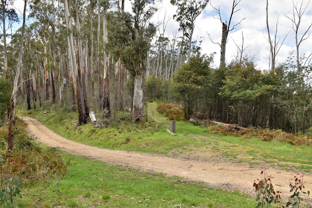
Leaving Barry Saddle I followed another older fire track, this one having recently had some kind of vehicle along it so it was pretty well scrub free. The AAWT slowly gained height first up this morning as I headed up to a junction with the substantial Harry Shepherds Track, the open forest near the ridge line giving my a few nice glimpses through the trees of the cloud slowly lifting on the surrounding mountains. On meeting Harry Shepherds Track on a broad saddle, the AAWT turns east along it for a few hundred metres, I think this track is now called Van Dammes Track though. After a few hundred metres along Harry Sheperd/Van Dammes Track the AAWT heads bush along the old alignment of Selwyn Track.
 |
Following the old fire track away from Barry Saddle I even got a bit of sun.
|
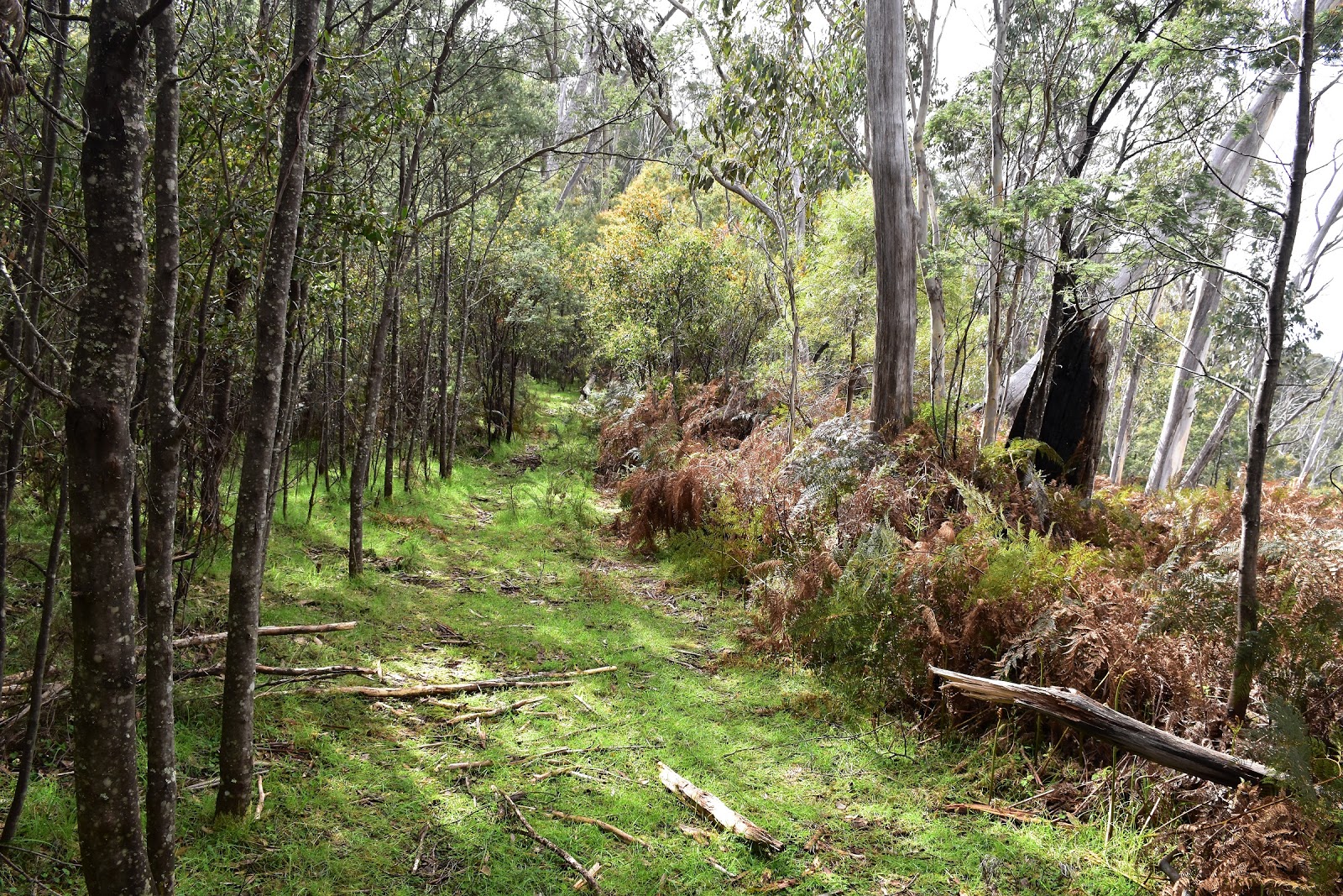
Even though technically I was still on an old fire track the AAWT is fairly tough going, easily the toughest walking for the day. The old track has more or less returned to nature and the only give away that I was indeed on the old track sometimes was a bit of benching here or there along with the occasional old cut log. The scrub varied from easy -
how good is this walking caper scrub - to,
oh f*#k, am I ever going to escape from this green hell type of scrub. Not to worry, forward progress was still happening and the sun was out so life wasn’t too bad really. The hardest vegetation to negotiate actually wasn’t the regrowth saplings that sometimes covered the track along here, no it was actually the bracken that had been knocked flat by winter snow I presume, the bracken would just act like trip wires as it was all intertwined at shin level, the only way through was to employ a kind of Feral goose step to largely keep my feet above them, not the easiest style of walking considering that the terrain wasn’t flat and I had 20 kilograms hanging off my back. There is actually a little navigational issue along this section of Selwyn Track too, as Selwyn Track starts to descend fairly steeply east down through some fairly open forest it’s important to keep an eye out for where the route of the AAWT takes a sudden 90˚ turn to the north and starts to sidle a bit, it’s pretty vague along here and it would be easy to miss and continue on down the hill.
 |
Selwyn Track, walking through this bracken was the worst stuff.
 |
Keeping an eye out for clues on Selwyn Track.
 |
It wasn't all hard going along Selwyn Track though.
 |
I could make out the benching on some sections.
 |
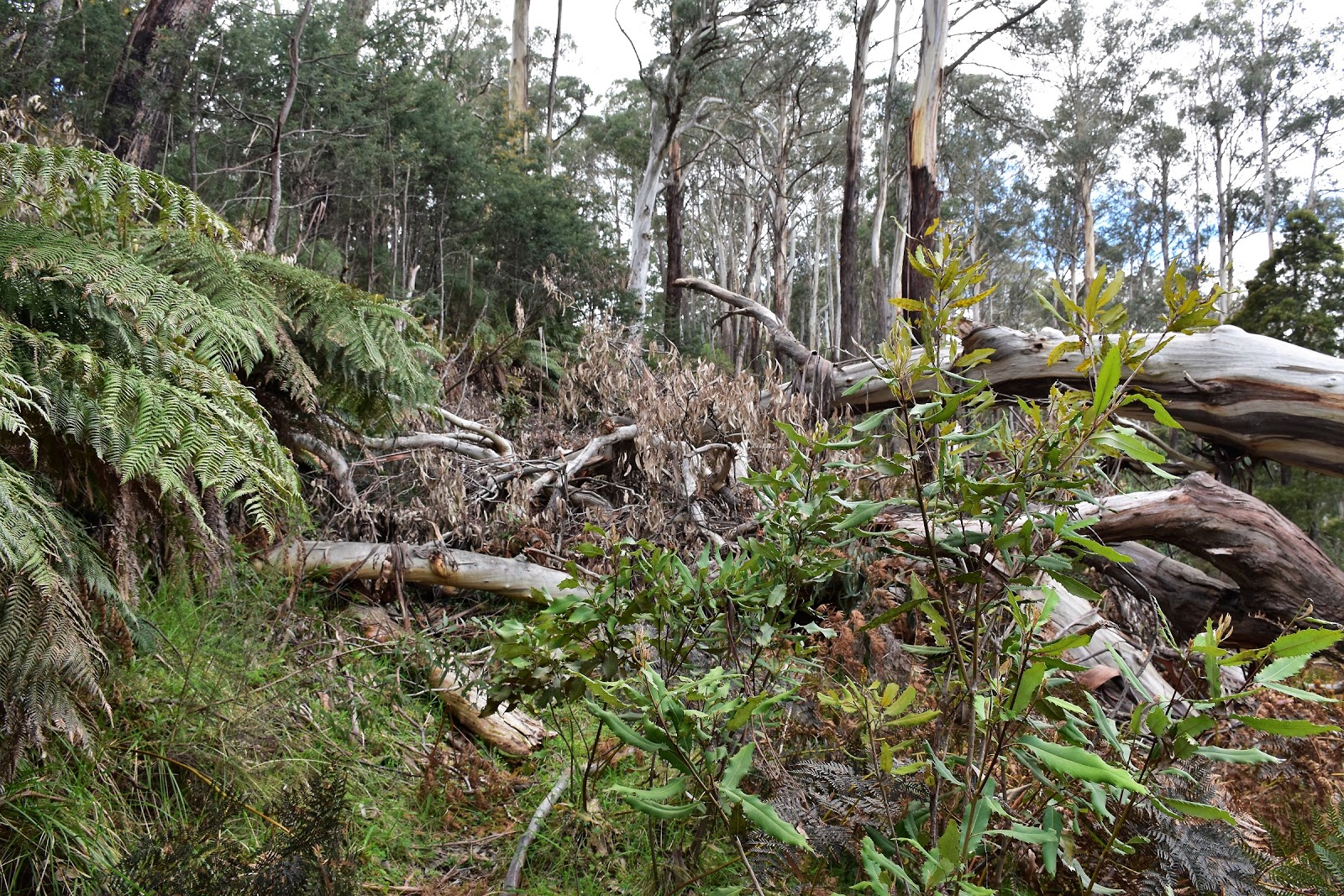
Have I ever mentioned how much I love negotiating fallen trees?
|
|
|
|
|
With East Riley Road visible down the slopes below me, Selwyn Track crossed one last knoll and dropped past a very welcome water tank to deposited me out of the scrub on the saddle that divides East Buffalo Road and East Riley Road. After a fairly tough mornings walking and with very good water available from the tank, this open saddle was a good spot for lunch today. Sitting on the grass under the blue sky eating my vita wheats and peanut butter life was pretty sweet again, although with the vita wheats that I’d had stashed back at Mt Speculation having gotten wet I was on a bit of an enforced diet until I got to Mt Hotham, relying on my left overs from way back at Champion Spur, some unkind people might actually suggest that a diet for the Feral walker may have been a good thing;)
 |
Dropping down Selwyn Track towards the water tank above East Riley Road.
 |
There are a few of these tanks scattered along the Barry Mountains section of the AAWT, they are all very welcome!
 |
East Riley Road is just visible down the hill through the scrub from the water tank.
 |
| This'll do me for lunch. |
|
|
|
With lunch over I set off again on my ongoing journey along the spine of the Barry Mountains along Selwyn Track. The good news for me though was that Selwyn Track was now wide and clear, although it is rarely flat, the track rising and falling continually as I made my way along towards the intersection with West Humffray Track. Once again, after crossing straight over West Humffray Track I resumed my roller coaster walk along Selwyn Track, I suppose that the good news is that with Selwyn Track virtually heading along the very crest of The Great Dividing Range I was catching a few glimpses through the trees of the surrounding country every now and again.
 |
After crossing Van Dammes Track, Selwyn Track makes for easy walking, although there is a lot of ups and downs.
 |
 |
 |
| The AAWT dropping down to cross West Humffray Track. |
|
|
|
It was getting late in the afternoon when I finally arrived at the cairn that marked the spot the AAWT left Selwyn Track and started to climb an untracked ridge up to South Selwyn. I’d had this last climb in my mind for most of the day, mentally preparing myself for one last bush bash to finish off the day, so it probably goes without saying but this last off track section was in reality the best walking of the day. Where mentally I’d been picturing myself pushing through a wall of regrowth in reality the scrub was light and open, even allowing for a few views as I climbed. While the whole climb from Selwyn Track is less than 200 metres it is fairly steep so I was glad to stop every now and again for a breather, closer to the summit I started passing through more and more large boulders so that helped on the scenery side of things as well.
 |
 |
For the most part the Barry Mountains are fairly low and timbered.
 |
 |
| The AAWT leaves Selwyn Track here and climbs fairly solidly off piste up to South Selwyn. |
|
|
|
Meandering my way across the broad rocky 1398 metre summit of South Selwyn I spied the water tank I’d been keeping an eye out for, this was my camp for the night. After getting the tent up I was once again able to get a bit of gear dry, with the showers having been passing through last night when I was over at Barry Saddle I can’t claim today as my third rain free day on the AAWT, but it was close to it. South Selwyn made for a very nice campsite, with plenty of flattish grassy spots, open forest and a tank to supply water it was a nice spot to relax for the remainder of the afternoon, I even managed to get a mobile signal so was able to text Sam. For one of the few times so far on the AAWT I stayed out of the tent long enough to watch the sun go down, yeah I’m a hardcore walker!
 |
The climb was way better than I'd feared it might of been.
 |
The late afternoon sun was lighting up the forest as I got near the summit.
 |
| There are a lot of large boulders scattered around the summit of South Selwyn. |
|
|
The Dirt.
I walked 17 kilometres and climbed 1330 metres today on what was another hard day on the AAWT. The Barry Mountains might not be that high but there is a lot of up and downs involved in traversing them. My stats on my 14 days on the AAWT so far are 218 kilometres along with 11,585 metres of ascent. After leaving Barry Saddle the only easy water is from the tank on Selwyn Track fifty metres west off East Buffalo Road around 9 kilometres into the day. The next easy water is at camp from the tank on South Selwyn. Camping wise it’s really limited to camping right beside a fire track until you head up South Selwyn, the camping on the timbered summit of this mountain is really good though. Navigation today is pretty straightforward mostly, although the section of Selwyn Track from Van Dammes Track to East Riley Road is overgrown and hard to follow in spots, so expect fairly slow walking. Be particularly careful to find the 90˚ turn that I mentioned earlier. I got a Telstra mobile signal from the summit of South Selwyn today. I used Mr Chapman’s notes and maps again as well as carrying Rooftop’s Jamieson - Licola Adventure Map for an overview.
Relevant Posts.
 |
| My South Selwyn camp was a good one. |
 |
| There is a deep hole (maybe an old mine shaft?) covered in forest litter on the summit so be a bit careful wandering around. |
 |
| I actually managed to stay up until dark tonight, I was really goin' hardcore! |


No comments:
Post a Comment