 |
| Mt Feathertop from Twins Track this afternoon. |
My night up on South Selwyn was a very pleasant camp. Being well away from any tracks meant that there was no chance a rogue 4wd would rattle past in the middle of the night, the only company that I up there were a few stag deers barking somewhere nearby. My luck with the weather held for the second morning in a row too, and I packed up camp under a nice blue sky. With a fairly long day in front of me today I didn’t muck around much this morning either, I was on my was just after 8am, well that’s early for me anyway!
 |
The walk down to the saddle off South Selwyn this morning was along a very old fire track.
 |
| After hitting Mt Selwyn Road the AAWT heads straight across it and immediately heads up Mt Selwyn. |
|
Dropping off South Selwyn the AAWT picks up a very old fire track alignment, the very old scrubby track dropping fairly steeply down into a saddle to meet up with the substantial Mt Selwyn Road. As is the case quite often on the AAWT on it’s crossing of the Barry Mountains, the AAWT headed straight across the road and proceeded to climb very steeply up another fire track along the ridge top. This is the access track to the summit of the 1424 metre Mt Selwyn, a slightly higher mountain than my camp last night on South Selwyn. My main memory climbing up here was not of the steep climb (they are ‘dime a dozen’ on the AAWT) but of having the crap scared out of me by a barking deer that must have been right beside the track in the scrub, still it kick started my heart for the day ahead I suppose.
 |
| Mt Selwyn gave me my best views since leaving The Viking. |
Mt Selwyn gave me my best view since leaving The Viking a couple of days ago. Pleasingly Mt Hotham was now looking very close at hand as I had a rendezvous planned with Sam there in a couple of days. It was not really Mt Hotham that demanded my attention though, it was the alpine summit of Mt Feathertop that really stood out, the beautiful mountain still flanked with a fair bit of snow. After taking in the views from Mt Selwyn for awhile eventually I figured that I’d better head off again, that hot shower (and cold beer!) waiting for me at Mt Hotham were beckoning me. The drop off Mt Selwyn on the AAWT is another of those off piste jobs, although once I made sure I was on the right spur it wasn’t an overly tough bush bash as I dropped a couple of hundred metres down to meet up with Dingo Creek Track, only the lower sections of the descent getting very scrubby.
 |
Tomorrow's destination, Mt Hotham.
 |
Looking back to The Razor and The Viking, Mt Howitt is cloaked in cloud on the left.
 |
Dropping off Mt Selwyn the AAWT is more or less off track again.
 |
 |
I've just arrived out of this scrub onto Dingo Creek Track.
|
|
|
|
|
Dingo Creek Track is another 4wd track and it was along here that I had another human interaction. Shuffling along with my broken Feral gait I heard the familiar sound of a 4wd growling its way up a steep hill somewhere behind me, sure enough after a few minutes it appeared over a knoll behind me. As is fairy common in these spots they stopped for a bit of a chat, I had only had three conversations with other people since leaving Walhalla so I was up for a bit of a chat too, well three conversations if you don’t count talking to Sam on the phone occasionally, or more worryingly - talking to myself! These two blokes were Vic Forestry workers and as it was the Thursday before Melbourne Cup Day they were up in the high country opening the 4wd tracks that had been closed over winter. After chatting about different tracks and spots in the area for awhile I asked them about the water tank over near The Twins that I was heading to, thinking that as these guys were basically land mangers they’d be able to tell me whether the tank was on the ridge or closer to the 4wd track. I was a little surprised to find that, while they knew that the AAWT went through the area they didn’t know anything about water tanks scattered along the route. Maybe this could explain why the walking track sections across the Barry Mountains are the worst maintained on the whole AAWT?
 |
| Of course the AAWT would go over the top, there was no AAWT marker here but there was a piece of flagging tape. |
 |
| At least the high route had some nice views. |
Anyway the blokes were nice guys and it was good to see some smiling faces. Saying our goodbyes they rumbled off towards their next gate over near The Twins, I shouldered my pack and headed in the same direction only at a lot slower speed. After a couple of kilometres the AAWT leaves Dingo Creek Track to follow as lesser track left…you guessed it…up and over steep knoll. This track wasn’t marked when I went through so you need to watch the map a bit, if you keep following Dingo Creek Track you can eventually meet up with the AAWT again but it’ll add a 2 or 3 kilometres to the day (although looking at the map you may pick up water if you go this way). I was going up and over of course and it was steep little climb, at least a ‘two photo stop climb’ if I’m remembering accurately! Dropping off the knoll the AAWT heads down as steeply as it went up to meet the substantial gravel Selwyn Road in a saddle, this is the spot you’d rejoin if you missed the track over the top. There is also a AAWT signpost in this saddle giving kilometres to both Canberra and back to Walhalla, they were a little different to my figures but then again I had walk a few side trips and diversions.
 |
Progress was still being made!
|
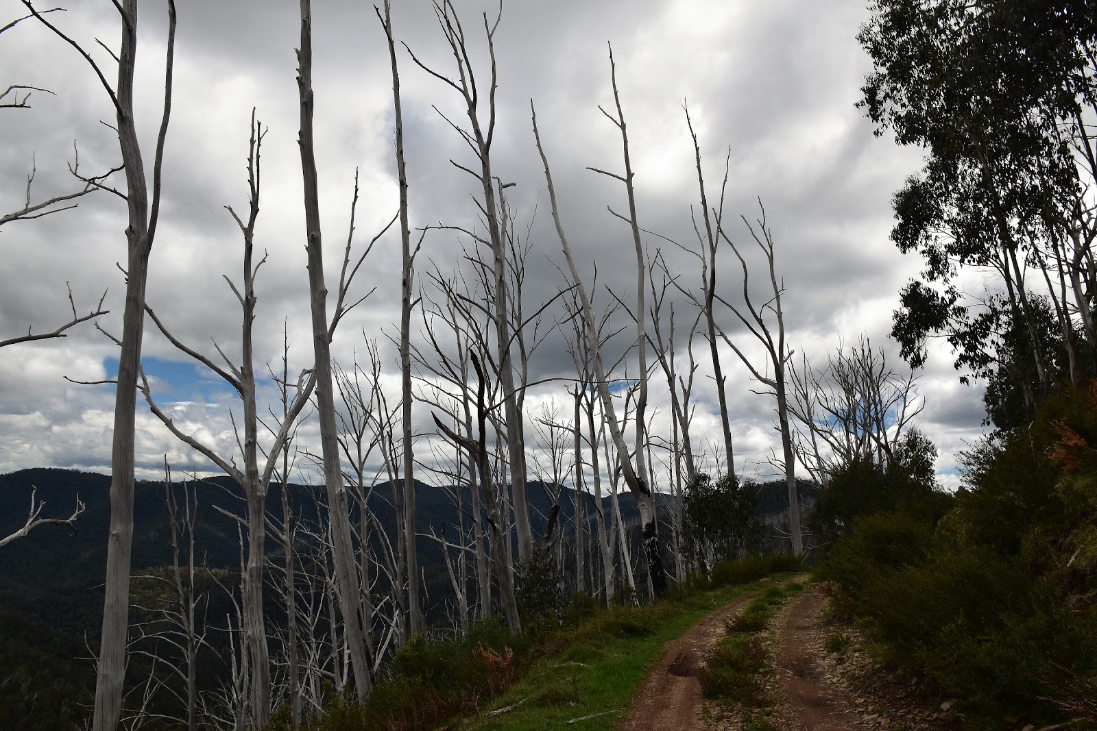
I was now heading along Twins Track, a track that I’d get very familiar with over the next few hours. Twins Track was one of the tracks my mates were out opening up and soon after setting off along it I passed through the now open gate, the good news (I suppose) was that they were also clearing the track of fallen trees as they went, so at least there was no gymnastic walking involved along here. For a road bash Twins Track wasn’t too bad really, once again the track stayed very close to the ridge crest and the views through the stubble like dead trees were now getting quite good, the higher mountains to the east constantly catching my eye and drawing my forward.
 |
I would get pretty familiar with Twins Track today.
 |
Twins Track.
|
|
There was some slightly concerning developments though as I inched my way along Twins Track, to the south west I could see a big bank of black clouds building up, these didn’t look like your ‘it’ll only be a few showers’ type of clouds, nope these like more like ‘better build an ark’ type of clouds, hmmm. With the over head conditions being what they were I decided to forgo the side trip out to Mt Murray, pencilling in a return visit for this spot. Meandering my way along Twins Track a bit further, I arrived at the spot where the AAWT again heads bush up the ridge line near the site of the old Murrays Hut. Dropping my pack for awhile I sat against a log having a drink and a bite to eat while I contemplated my next move, once again I had choices. Normally the best option would be to follow the scrubby AAWT along the crest of the ridge but the in coming dark clouds were giving me reason to reassess the situation. Staggering to my feet from my prone position I wandered into the scrub for a few metres along the AAWT without my pack, the pad was indeed scrubby and it also had it’s fair share of trees down as well, from what I could see. When the first rain squall hit me I didn’t need anymore convincing, I’d be giving the ridge a miss and continuing on with my road bash.
 |
I suppose that if you are going to be walking a fire track then Twins Track isn't a bad track to walk....
 |
This doesn't look great.
 |
The first showers hit me here, the Murray Hut Site is down the hill a bit.
 |
| The AAWT heads bush again near Murray Hut Site, with the weather turning ugly I decided to stay on Twins Track today. |
|
|
|
With a bit of a sense of resignation I returned and grabbed my pack, while the walk along Twins Track didn’t look overly exciting at least I’d be relatively safe from the worst of the elements. While the fire track may have been a safer option it wasn’t a shorter choice, winding in and out of the gullies at it sidled the ridge line. Now sidle might not actually be the best description for this section of track either, I was expecting a fairly flat amble around to meet the AAWT again in the saddle below TheTwins but on the ground Twins Track actually descended and then climbed far more than I’d thought it would (but then again I was pretty well shagged out so maybe I was imagining it?). The clouds that had been building up started to deliver their load as I made my undulating journey along here, thankfully it wasn’t total armageddon but it was heavy enough to have grab my gortex and pack cover out.
 |
 |
There was a couple of opportunities to refill my water bottle along Twins Track after passing Murray Hut Site.
 |
With the AAWT going over the top and Twins Track sidling the tops I though that it would be flat - I thought wrong!
 |
| Mt Hotham is looking a lot closer now. |
|
|
|
With Twins Track arriving at the long saddle to the west of The Twins I scrambled a few metres up onto the crest of the ridge and rejoined the route of the AAWT, with the weather still officially crap I was on the crest to locate a water tank, not for the views. After meandering along the crest for a hundred metres or so I spied my water tank in the grey gloom, these tanks definitely make the Barry Mountains traverse a lot easier than it must of been back in the day. Filling up my water bottles I dropped the twenty metres or so back down onto Twins Track and resumed my road bash. The weather was now getting into the seriously bad rating and I was starting to look for somewhere with a bit of shelter to pitch the tent for the night, but with the crest providing no real shelter and the side to the mountain that the track was sidling being close to the vertical my options were a little limited at the moment.
 |
Hmmm....
 |
 |
Still on Twins Track.
|
|
|
I was now on Twins Track bypassing The Twins, the track making a big arc around the summit area. Shuffling along in the rain with a renewed sense of urgency now I rounded a corner and bumped into a couple of deer hunters out scoping deer in their 4wd (remember the tracks opened today). Stopping for a bit of a chat they tempted me with a ride up to Mt Hotham, now while the temptations of a warm dry room, a steak and a beer did hold a certain appeal, I knew that if I didn’t walk it then it would nag away at me all the way to Canberra. So after thanking them for the offer and sussing out a few options that they knew of where I could pitch the tent in these dodgy conditions, we parted ways. The alternative route along Twins Track swings a long way north of the summit before doubling back to meet the AAWT again on another high saddle, it was here were the the two routes rejoined that I made camp tonight, being on the lee side of The Twins I was a little protected from the wind but it’s a pretty exposed spot really. My big plastic bag came in handy again tonight as I set up camp keeping my gear fairly dry. Needless to say there was no lingering around outside watching the sun set tonight, after dinner it was straight to into the tent after what had been another long and hard day on the AAWT.
 |
I climbed up onto the ridge crest west of The Twins to look for The Twins water tank.
 |
The Twins tank is right at the start of the climb from the west up onto The Twins.
 |
| Looking towards The Twins from the saddle. |
|
|
The Dirt.
I walked 24 kilometres today and climbed 1410 metres on another hard day. My stats after 15 days on the AAWT are 242 kilometres along with 12,995 metres of climbing. Water today was available from a seep beside Twins Road after leaving the Murrays Hut Site, the tank in the saddle on the AAWT to the west of The Twins and a creek cascading down across Twins Track off the side of The Twins. Camping wise there are quite a few options although if you need some shelter then probably the best option is near the Murray Hut Site. The ridge crest has many options but they are generally pretty exposed. Navigation is pretty straight forward today, the only really off piste section is a couple of kilometres down off Mt Selwyn although once you know that you are on the right spur it’s pretty easy to follow. The walking track section from Murrays Hut Site looked pretty rough and scrubby but I can’t confirm that due me going along Twins Track because of the weather. By the time I thought of trying my phone today it was pissing down so I didn’t dig it out of the dry bag, I suspect that I would of had a signal at my camp (Mt Hotham isn’t far away as the crow flies). I used Mr Chapman’s notes and maps again as well as carrying Rooftop’s Jamieson - Licola Adventure Map for an overview.
Relevant Posts.
AAWT, First day, October 2017.
AAWT, Previous day, November 2017.
 |
A late afternoon view north off Twins Track.
 |
| My camp east of The Twins wasn't the most sheltered spot I've ever pitched a tent, but it did me for the night. |
|
 |
| Tent o'clock came early tonight. |


No comments:
Post a Comment