I'd like to wish everyone good health and a happy and safe New Year, I hope to see you out in the bush somewhere.
 |
| I got lucky today. |
Crawling out of the tent this morning I immediately sensed that something wasn’t quite right, scratching my nuts and rubbing the sleep out of my eyes it slowly dawned on me that I was standing beneath a beautiful blue sky, with barely even a fluffy white cloud to be seen. This was particularly good news today as the AAWT would take me over the first treeless summit on my journey north, I’d been up here six months ago on another beautiful day so I had a fair idea that I’d be in for some good views again today. After my usual tent drying routine which involves me shuffling my fly around chasing the sun, I was packed up on on my way by around 9am, a fairly early start for me.
 |
A bit of tent drying action under the blue sky this morning.
 |
| Even under the blue sky I still managed to pick up a leach. |
|
To start off the day today the AAWT climbs up Mt Sunday Road for a couple of kilometres to saddle where the AAWT again heads bush. It was on this fairly easy climb that I crossed two good rills of clear water flowing across the road, now as I’ve carried on about on the blog I had experienced a bit of inclement weather over the last few days so I’m not 100% sure how reliable these little streams are, but they looked more reliable than the gully on Low Saddle Road that I’d got my water from last night. After my nice little warm up along Mt Sunday Road I arrived at the saddle where the AAWT started up a looong spur towards Mt MacDonald. Last time I was up here I’d come up from the Jamieson River via the North Ridge, this was a pretty tough walk as I had to push through a lot of scrub until I gained a bit of height on the spur, so I was fairly interested in what the AAWT route would have in store for me this morning.
 |
| The AAWT climbs Mt Sunday Road for a couple of kilometres to start the day. |
Passing another sign warning walkers that they should have good remote area navigation skills I pushed on regardless again. The climb up here is fairly steep and more or less off-piste so I was sometimes pushing through a bit of scrub which only made things tougher. While the AAWT is off-piste up here it’s not really that hard to follow, after a couple of hundred metres I was climbing a fairly pronounced spur so I just really had to keep climbing and stay on the high ground. The higher I climbed up here the better the walking became, as the scrub thinned out a little I found myself sidling big, mossy rock ribs. Not only did the large rocks make for more interesting walking but the more open vegetation allowed me to get some good views of the surrounding country, something that I hadn’t seen much of over the last couple of days.
 |
Leaving Mt Sunday Road the AAWT follows a more or less un-tracked spur all the way to Mt MacDonald.
 |
Lower down the spur was a bit scrubby.
 |
 |
| Getting higher on the spur towards Mt MacDonald the AAWT makes it's way around or across a lot of rock, it's rough but great walking. |
|
|
|
By late morning, with the views now opening up and the sun out I decided that it was time for a bit of a breather. Sitting on a rocky knoll in the sun chilling out a bit I suddenly thought that I heard a rustling noise. Looking around for an animal I was surprised to see a walker heading down towards me, I hadn’t met another walker on the AAWT yet. Greeting each other like long lost friends we started to compare notes, it turns out that my new friend (I didn’t catch his name) had been walking the AAWT a day or two in front of me (I’d seen his foot prints back in the snow at Mt Baw Baw), unfortunately the weather and the terrain had caused him a few problems. From what I can gather his GPS was struggling with the cloud and storms (mine was too) and he had missed the spot to leave the ridge running down off Mt MacDonald and mistakenly descended into very rough country towards the Jamieson River. After a rough night camped in less than optimal conditions he’d managed to retrace his steps, get back on the AAWT and was now heading back to Low Saddle to be picked up be his partner and heading home after his scare. It was great to finally meet another AAWT walker though and we spent a very pleasant twenty minutes in the sun chatting about the trials and tribulations of our trips so far.
 |
The views were opening up as I climbed into the rockier country.
 |
I'm thinking that's the ridge that I walked in the cloud yesterday.
 |
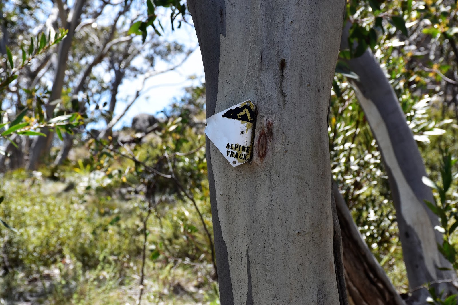
There are a combination of the occasional track marker or cairns along here. Navigation is pretty straight forward though as far as off piste walking goes.
|
|
|
Feeling good after a bit of a break and a chat I grabbed my pack and set off up the continuation of my long climb towards Mt MacDonald, the AAWT now slowly turning from north to east, all the time keeping to the crest though so navigation isn’t really an issue here. I was now starting to get close to the tree line and I was walking through a few grassy openings which along with the large rock slabs meant that walking was very pleasant, even though it was effectively still off-piste. Following a few cairns I sidled the western peak of Mt MacDonald, the terraced rocky slabs making life a bit easier. After dropping into a saddle I slowly meandered my way up my last climb to the cairn at the top of Mt MacDonald, dropping my pack all was pretty sweet in my Feral world, it was even better after I got a text away to Sam.
 |
Contouring a little bit using rock ribs and natural openings as I headed around the west peak.
 |
That's Mt MacDonald in front of me.
 |
Mt MaDonald, what a beautiful day...
 |
| Across the Jamieson River Valley The Bluff loomed large. |
|
|
|
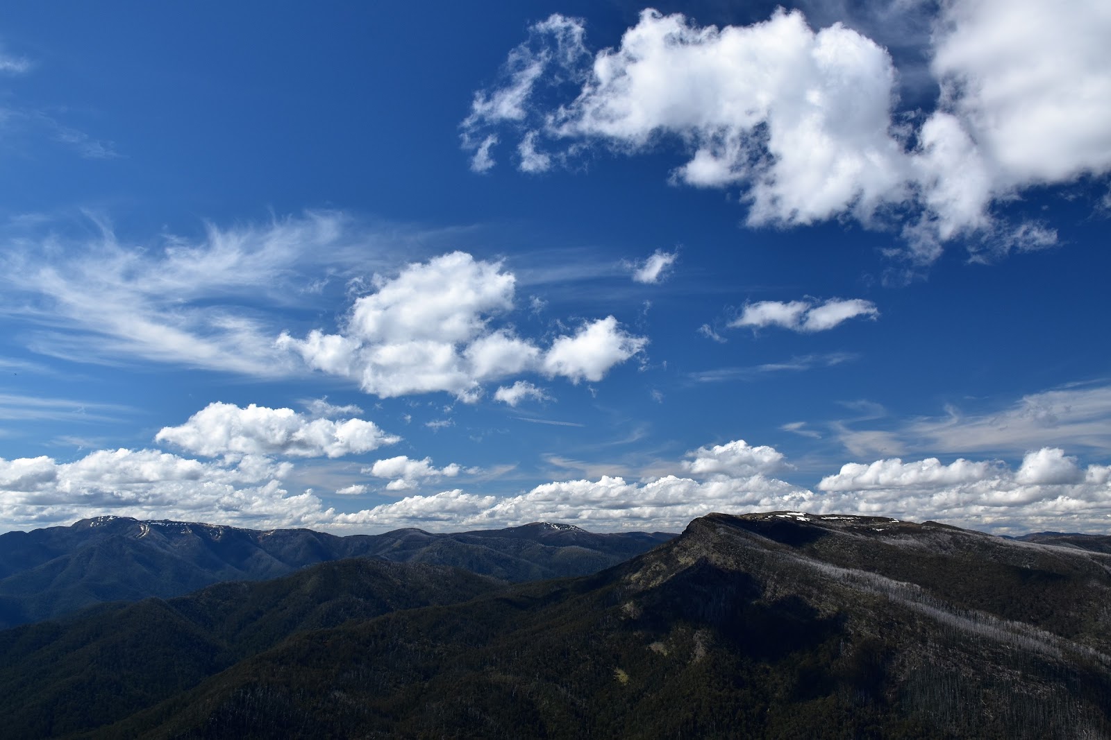
The view from the top of Mt MacDonald was probably the best so far on my AAWT adventure, but being the first summit so far on the walk that is above the tree line I suppose you’d expect that. After taking in the 360˚ views of wild valleys and craggy peaks while I rested for a bit it was eventually time to shoulder my pack and set off down the ridge towards Nobs Track. I knew from experience that the walk from here to my camp wasn’t all that far and it all looks fairly easy on paper but on the ground the walking is reasonably slow. As the AAWT descends down the ridge to the east you have to carefully pick your way across a lot of rock slabs, some of them on reasonably acute angles, at the same time staying as close to the crest as possible. Dropping below the tilting rock bands the AAWT then has a bit of light scrub to negotiate, although by the time I reached the scrub there was generally a rough pad to follow. The good news is that even if the walking is a little slow there are plenty of reasons to stop and take in some more of the beautiful views, the hulking bulk of The Bluff being particularly prominent.
 |
My descent ridge of Mt MacDonald.
 |
The Bluff in the middle distance with Mt Buller on the left in the distance.
 |
 |
| The ridge that the AAWT uses to descend Mt MacDonald is fairly acute in spots. |
|
|
|
Dropping down the ridge I was looking for the spot to leave the crest and drop down a very old track towards Nobs Track. This spot is marked with a couple of cairns and is on a knoll with a few Snow Gums where the ridge is swinging around to the north. Once it’s located the old track drops fairly steeply in an east-south-easterly direction, the pad being fairly easy to follow with only a couple bands of thicker scrub to hinder my progress a bit. Emerging from the scrub onto the wide Nobs Track I almost immediately found an open grassy saddle to camp at. The main reason I was camping here was that it gave me my best chance of finding water for awhile. After setting up camp I grabbed my water bottles and set off west down Nobs Track in search of something to drink, like Low Saddle I was probably lucky in that there had been a fair bit of rain around so I only had to walk to the first gully after Nobs Track swung north to pick up some water, also like Low Saddle with a few blackberries and a bit of mud it wasn’t pretty. I went to bed that night happy to have enjoyed my second day on the AAWT without rain, although with the wind whipping through the trees that night I wasn’t sure that my luck was going to last to long.
 |
It all looks pretty easy looking back from here....
 |
 |
Dropping down the ridge is a bit rough but the scenery makes up for the extra effort I think.
 |
| This is the crucial spot to identify when coming down off Mt MacDonald heading north. This is the knoll with it's cairns that marks the spot to leave the ridge and head down an old fire track to meet Nobs Track. |
|
|
|
The Dirt.
I walked 11 kilometres and climbed 815 metres on what is another hard walk today. Over the 9 days on the AAWT so far the stats are 147 kilometres along with 6820 metres of ascent. I found water today in two spots flowing across Mt Sunday Road, from there to camp there is no reliable surface water, from camp I dropped down Nobs Track until I found water in a gully around a kilometre down the track. The camping situation today is a little thin, I suppose you could find enough flat ground to pitch a tent going up, over and down Mt MacDonald but you’ll be lumping your water up. Reaching Nobs Track there are a fews options, I chose the first grassy spot under some Snow Gums in a saddle on the ridge, mainly because it was probably the closest camp to water. Navigation sounds fairly daunting on paper but on the ground it’s not too bad. The climb up the spur to Mt MacDonald is more or less trackless, but for the most part the forest is fairly open a the crest of the spur makes navigation fairly easy. The crux of the day navigation wise is probably to pick the spot to drop off the crest of the ridge heading down off Mt MacDonald towards Nobs Track, it’s fairly obvious in good weather but would be more problematic in cloud (this is where my friend from earlier in the day had problems I think). I was still using John Chapman’s notes and maps as well as now carrying SV maps 1:50000 Buller-Howitt Alpine Area sheet along with Rooftop’s Jamieson - Licola Adventure Map for an over view. Communication wise today the mobile worked every time I turned it on (the top of Mt MacDonald and at camp on Nobs Track), with the AAWT now being relatively close to Mt Buller I was no doubt getting a signal from their tower.
Relevant Post.
AAWT Day 1, October 2017.
AAWT, Previous day, October 2017.
Mt MacDonald, Alpine National Park, 2017.
 |
| The old track that drops down to meet Nobs Track passes through a couple of scrubby sections but is pretty easy to follow. |
 |
| My camp on Nobs Track, almost at the spot the AAWT comes in from Mt MacDonald. |


No comments:
Post a Comment