 |
| The first half of the day featured plenty of Murray River views. |
 |
| Lake Mournpall at dusk. |
After yesterday’s fairly solid day I slept pretty well last night. Waking this morning I peered out of the tent to see the Murray River flowing by under a reasonable looking sky. The really good news this morning was that the temperature seemed a lot cooler than it had been yesterday, although it was only 7:30am I suppose. After a nice breakfast sitting in the weak sun whilst I wound up for the day, it was time to pack up and set off. My pack today was a couple of kilograms heavier than yesterday as I now had 5 litres of water on board where as I’d started yesterday with only 3 litres on my back.
 |
The view out of my tent this morning was promising.
 |
| The view at breakfast. |
|
My notes suggested that I had around 24 kilometres infront of me today but setting off along the rough tracks lining the Murray River I was a little dubious, I’ve driven a lot of the tracks between here and where I’d leave the Murray River at Florence Annie Track and I was thinking that the author may have underestimated things a little, that nagging doubt was the reason that I’d decided to lug an extra couple of kilograms of water along today. Not to worry, apart from the extra weight everything was pretty good in my Feral world as I meandered my way generally north around Ki Bend, passing a couple of groups camping along the river before my track eventually popped my out onto River Track for an short section.
 |
I'd mostly be following a series of these informal track for the first half of the day.
 |
Looking along the Murray River downstream towards Jinkers Bend.
 |
Looking back upstream to Ki Bend and one of it's beaches.
 |
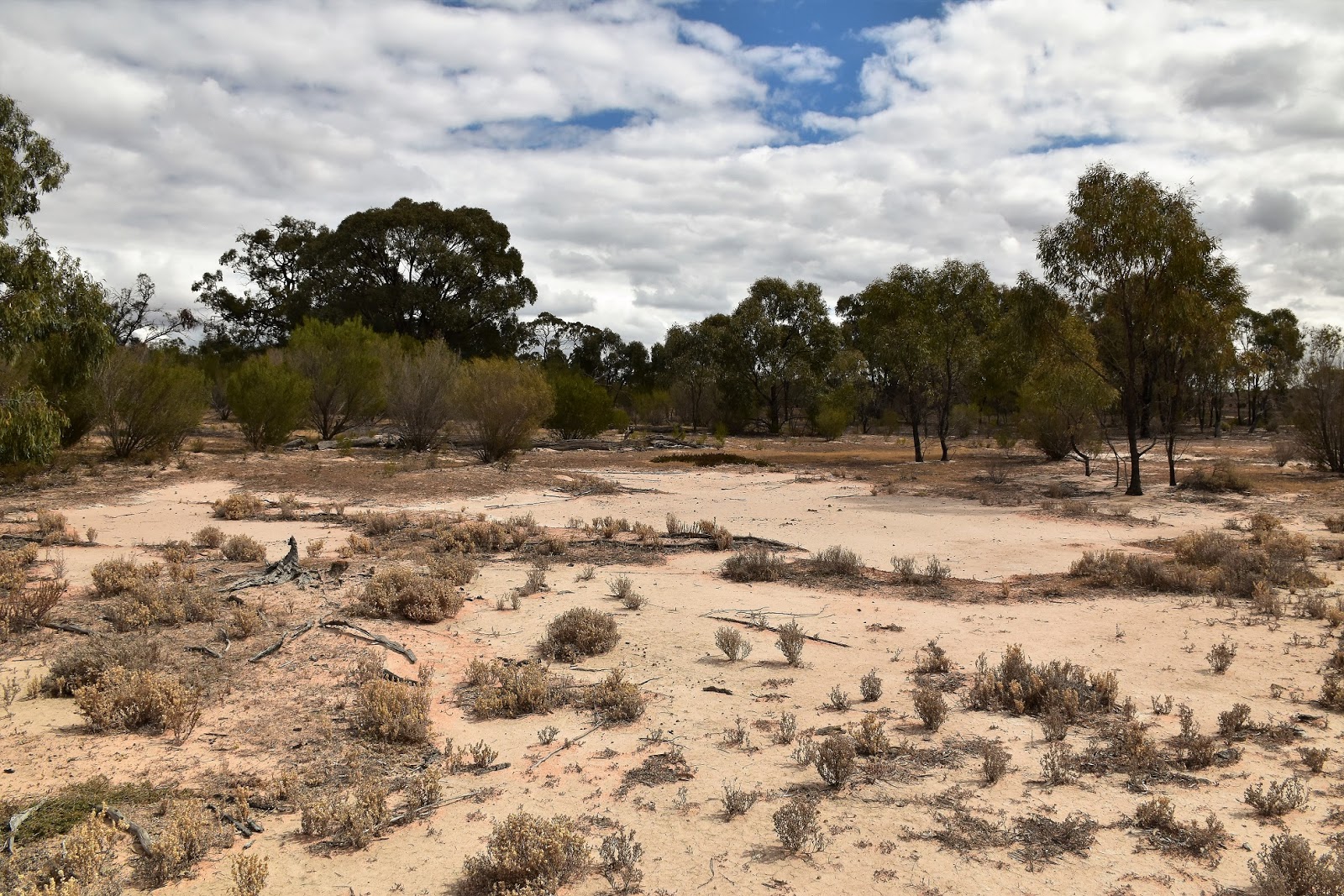
I was walking through the national park on my side of the Murray River but there was some irrigation land on the New South Wales side of the water.
 |
It looks like it's been a fair while since these wetlands beside the river have had a decent drink.

|
 |
| After slowly making my way around Ki Bend I popped out onto the River Track for a few hundred metres. |
|
|
|
|
|
|
My stroll up River Track only lasted for a few hundred metres before I headed back towards the brown water of the Murray River, I was now heading firstly for Jinkers Bend and then a little further north, Firemans Bend. Like last nights camp at Ki Bend, Jinkers Bend features a lot of nice sandy beaches to camp along. Apart from the beaches the Red Gums around the northern end of Jinkers Bend are also some of the biggest a gnarliest on the walk I think, I stopped to take a photo of one old tree that must have been at least 3 metres across at it’s base, although in hindsight I should have placed my pack against the tree to give the photo a bit of scale I’m thinking.
 |
Leaving the River Track I headed towards Jinkers Bend, the red sand closed in a bit along here.
 |
You could short cut the walk a bit by going left here....I went right.
 |
Small salt pan behind Jinkers Bend.
 |
Jinkers Bend
 |
The Red Gums in this part of the park ooze character.
 |
Heading towards Firemans Bend.
 |
| This old Red Gum must be close to 3 metres across I'm thinking. |
|
|
|
|
|
|
Apart from the Red Gums the other change in the country along here was that the red sand dunes seem to be closing in on the river a bit. After negotiating the tracks around Firemans Bend I eventually emerged again onto River Road for a twenty minute stretch up to Florence Annie Track, the Murray River views taking my mind off the hard surface of River Road. It was well into the afternoon by the time I’d made my way up here and my suspicions about distance were now more or less confirmed, looking at the map I still had a long way to go and I wouldn’t be pulling into Lake Mournpall until close to dark by the look of things.
 |
Back in the red sand, heading towards River Track.
 |
My last few minutes along River Track allowed me a few more looks at the Murray River.
 |
River Track.
 |
| Time to start my journey back towards the lakes in the middle of the park. |
|
|
|
Florence Annie Track is a 4wd management track and it would be my route away from the Murray River and back towards the lakes in the centre of the park. Initially Florence Annie Track had me crossing long sections of flood plains as I made my way west towards Lake Cantala. Stopping for a bit of a breather on an old log I pulled out my map for a bit of a squiz, looking at my map it appeared that I could lop around 4 or 5 kilometres off todays walk with a bit of off track action, with the day now looking like it was going to be well north of a 30 kilometre day I was keen on the short cut, besides off piste walking in the desert country is pretty pleasant normally.
 |
I'm guessing these are to pick up people illegally driving on these closed track, not walkers shuffling through.
 |
Initially Florence Annie Track crossed mostly flood plains.
 |
| Having a bit of a breather beside Florence Annie Track I decided that I'd shorten up the day a little with some off track walking later in the day. Oh yeah, and the weather was suddenly looking a little more threatening....but it still looked sweet! |
|
|
The over head conditions now had changed a bit too, the day had started cooler than yesterday but it looked like a southerly cool change had blown through as not only was the temperature cool but there was a brisk south westerly wind blowing under a brooding overcast sky now. Approaching the power line that dissects the park again, I was also once again in red sand dune country, the local wildlife once again becoming quite prolific. After a relatively short northerly section near the power lines Florence Annie Track again started off westerly and I was soon back on the flood plains.
 |
There was a lot of wildlife around once I left River Track.
 |
 |
Approaching the power lines on Florence Annie Track, I'd passed underneath the lines yesterday afternoon on Chalka Creek Track.
 |
The red sand dune country was a little harder to walk through than the flood plain country, but it was still pretty reasonable.
 |
Emus on Florence Annie Track.
 |
Lake Cantala
 |
| Lake Cantala |
|
|
|
|
|
|
Reaching Kulkyne Track I turned left, the Red Gums of Chalka Creek now closing in on my right. Kulkyne Track is another closed management 4wd track so it made for pretty good walking this afternoon, with my whole distance down Kulkyne Track across black soil flood plains I just made my way along using the track as a guide really, it was sometimes quicker and easier to head across the plains than worry about following the track exactly. Reaching Red Gum Track (another closed management 4wd track) I followed it across Bitterang Crossing on Chalka Creek to quickly arrive onto Bitterang Track.
 |
Once way from the river the tracks are surprisingly well sign posted up at Hattah-Kulkyne National Park.
 |
Following Kulkyne Track along the Chalka Creek flood plain...the nature of the country made it pretty easy to improvise a bit when it came to the actual route I was following.
 |
| Red Gum Track at the Bitterang Crossing of Chalka Creek. |
|
|
Bitterang Track is open to 4wd vehicles but like yesterdays walk along the similar Chalka Creek Track, I didn’t see any vehicles today. Bitterang Track struck off south, initially I was walking across the flood plains bordering Chalka Creek again before heading up into some red sand dunes country as I approached the Kangaroo fence again. Getting through the Kangaroo fence needs to be thought out a little if you planning any off track walking here, the fence is around 2 metres high for the most part, so the only real options for getting through are where the tracks go through, at least if the gates are locked in these spots they are generally low enough to climb over.
 |
Bitterang Track is open to 4wd's but it was all quiet this afternoon.
 |
Conditions were definitely on the overcast side now and the wind was strong and cold.
 |
| Crossing back through the Kangaroo Fence on Bitterang Track. |
|
|
It was almost 5pm when I passed through the fence this afternoon and I now started off on the best part of todays stroll, an off track walk across to the site of the old Mournpall Homestead. Heading bush in a south westerly direction I was aiming for a thin strip of land separating Lake Yelwell and Lake Yerang. Thankfully for the most part the scrub was pretty light across here and it wasn’t very long before the shimmering water of Lake Yelwell was visible through the trees on my right, deciding that at the sandy shoreline was probably going to be better walking than the scrub I dropped down onto the shore, rousing flocks of water birds in the process. I’m guessing Lake Yelwell is a fairly infrequently visited spot but today, with the late afternoon sun casting everything in a soft, golden light it was a pretty special spot really, so good that I even considered stopping here for the night.
 |
Heading towards Lake Yelwell, as far as off track walking goes this is about as good as it gets I'm thinking.
 |
There was plenty of bird life on Lake Yelwell this afternoon.
 |
Lake Yelwell, I seriously considered camping here (I'm not sure of the exact legality of that though?).
 |
| Very late in the afternoon at Lake Yelwell. |
|
|
|
The off piste walking continues as I crossed a slightly damp creek that connects Lake Yerang and Lake Yelwell, before climbing up onto a low dune. After shuffling my way west a little further the verdant green trees, that are about all that’s left of the old Mournpall Homestead, came into view. The old homestead marked the spot that I join up with the Lake Mounpall Walk, from here to camp I’d be once again be following a walking track, well more or less. Striking off west into the setting sun I arrived at the western shoreline of Lake Mournpall to be greeted by a very brisk breeze blowing in off the water, I’d also been considering camping here but the very cool breeze soon got that idea out of my head.
 |
I had to cross this creek that separates Lake Yelwell and Lake Yerang.
 |
 |
More easy off piste strolling as I headed for the old Mournpall Homestead site.
 |
| The green trees in the back ground are about all that's left of the old homestead from what I can see. The track markers are telling me that I've joined the Lake Mournpall Walking Track. |
|
|
|
All that was left of my day now to walk half way around the shoreline of Lake Mournpall, the track here stays a little away from the shoreline but unless the water level is very high then it’s generally better to walk the sandy shore. Thankfully the closer I got to camp the more protected the lake shore got from the wind and by the time I staggered into the lake Mournpall Campground at around 6:30 pm the wind wasn’t a problem, but it was bloody cold. Needless to say after such a big day I didn’t linger too long tonight, getting the tent up quick smart. Wandering over to the tank near the toilet I was happy to find it had water in it, I’d saved a couple of litres just in case, but now I wouldn’t have to ration for the rest of the walk which was a good thing in my eyes. Dinner tonight was freeze dried sweet and sour lamb followed by freeze dried cheesecake, yep I was living the life alright! Retiring to my sleeping bag to listen to my little AM radio I was pretty content with life again, even accounting for my sore shoulders and feet.
 |
Lake Yerang
 |
Heading west into the setting sun towards Lake Mournpall.
 |
Lake Mournpall, it's generally easy to follow the sandy lake shore along here.
 |
| It was pretty late in the day by the time I started walking around Lake Mournpall. |
|
|
|
The Dirt.
Well my notes were kilometres out today, instead of 24 kilometres I walked 32 kilometres and climbed around 365 metres and I chopped around 5 kilometres off the described walk with my off track excursion. Over the two days of my walk so far I’ve shuffled 58 kilometres and climbed 665 metres. Only really because of the length of today’s walk I’d class the day as a hard days walking. The tracks along the Murray River are not very often sign posted and come and go a bit but so long as you stay between the more major River Track and the Murray River you can’t really go too far wrong when it comes to navigation. Like wise the off track section from Bitterang Track to the old Mournpall Homestead is pretty straight forward so long as you can read a compass or GPS. I carried water for the day as all the surfaced water would need a fair amount of treatment before consuming it I would think, the Lake Mournpall Campground has a couple of tanks near the toilets that should have water in them. Speaking of the Lake Mournpall Campground it’s one of the camps that needs to be pre booked before arrival. I used the Meridian’s
Hattah-Kulkyne Map, along with the Parks Vic notes and the notes and map out of 2001 edition of Lonely Planet’s
Walking in Australia.
Relevant Posts.
Day 1 of this walk, Hattah-Kulkyne National Park, 2018.
Hattah~Kulkyne Drive, Hattah~Kulkyne National Park, 2018.


No comments:
Post a Comment