 |
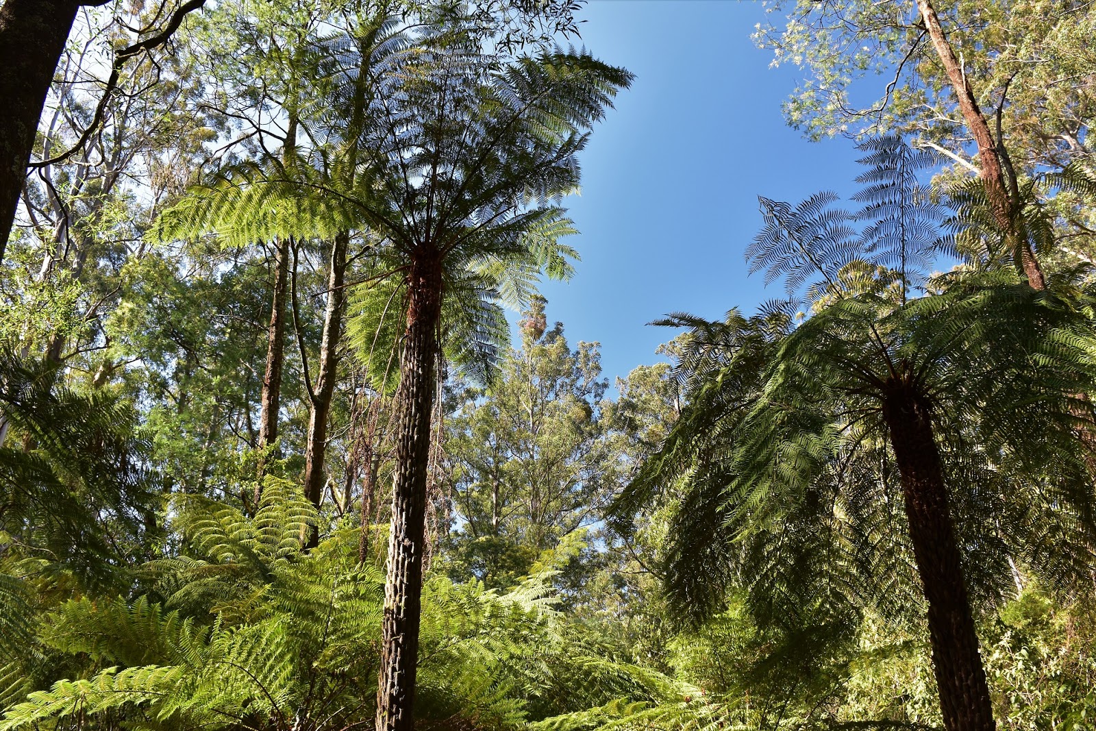
| The Mountain Ash are a feature of this walk. |
I was looking for a walk close to home this weekend after having been on a big road trip up to Hattah~Kulkyne National Park last week. Apart from maybe the Mornington Peninsula then I’d have to say the Dandenong Ranges are my go to destination for nice walking close to home, so it made sense to head up there today. The Sherbrooke Forest area of the Dandenong Ranges National Park is one of the best spots and the tourists know it, Grants Picnic Ground at the start of my walk is generally always pretty busy with buses and this morning was no exception, the good news is that you generally don’t have to move far from the picnic ground before the crowds drop right off.
 |
| Grants Picnic Ground |
Parking the ute I set off down the picnic ground access road to find my walking track, now I suppose it reflects on my fairly casual walking style but I managed to pick up the wrong track. Finding myself walking back in the direction of the ute I twigged that something wasn’t quite right and decided to pull out my map and notes, hmm, it seems I was meant to be heading bush on the other side of the café. Braving the tour buses and their human cargo I eventually found the start of my track and headed off into the wall of green.
 |
Heading off on today's stroll.....along the wrong track.
 |
The scenery was nice enough though.
 |
| Passing the café and the tourist buses I was on the right track now. |
|
|
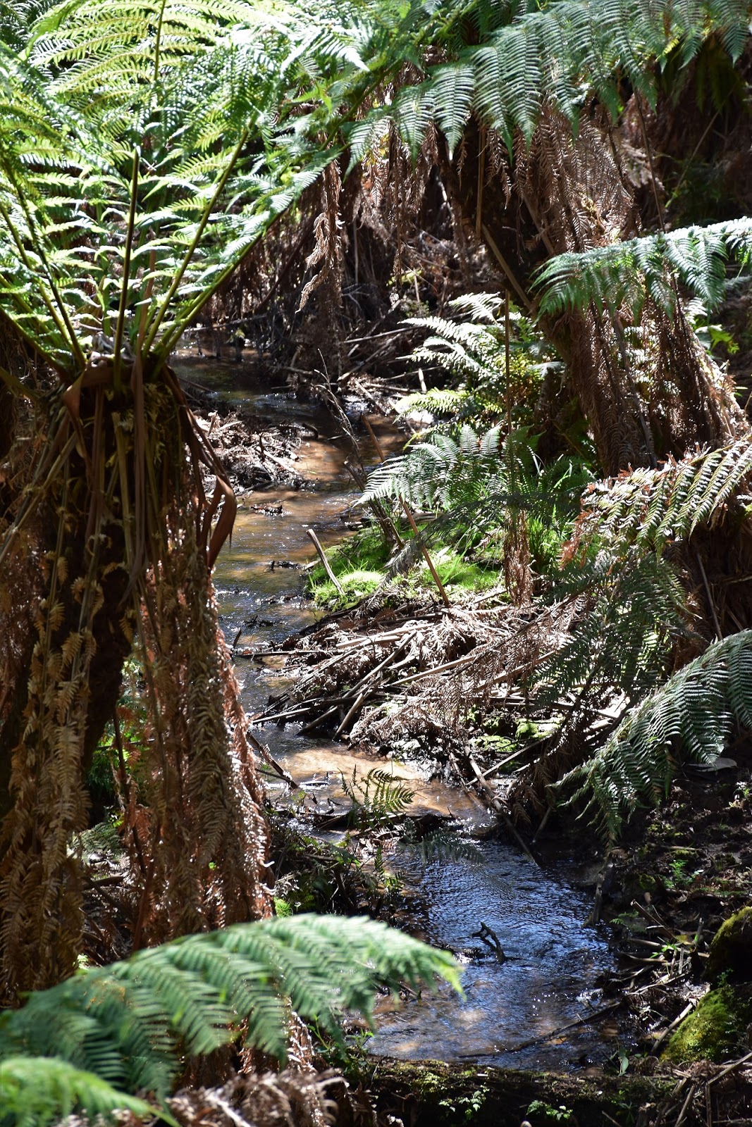
I followed Lyrebird Track for only a few metres before I dropped down Hardys Gully Nature Trail for a nice little detour, the bush along here is typical of the Sherbrooke Forest area in that there are plenty of huge mature Mountain Ash trees along with a very lush understory that features plenty of large ferns and bracken. After a few hundred metres, Hardys Gully Nature Trail rejoined Lyrebird Track and I dropped down to cross Hardys Creek where my walk achieved ‘peak green’ I think.
 |
Lyrebird Track
 |
Hardys Gully Nature Trail makes for a nice little detour.
 |
Mountain Ash
 |
| Crossing Hardys Creek on Lyrebird Track I think I achieved peak green. |
|
|
|
Climbing away from Hardys Creek I joined Neumann Track and the forest slowly started to dry out and open up a bit. I’d seen numerous Rosellas, Honey Eaters and Kookaburras on my walk so far but it was while climbing up Neumann Track that I had my most notable birdlife encounter today when a Lyrebird scratching around beside the track startled me, unfortunately I couldn’t get a decent photo though. After twenty minutes or so of fairly relaxed climbing along Neumann Track I walked passed a nice grassy opening that looked like the perfect spot for a picnic and then turned onto Paddy Track and started to descend.
 |
The forest opened up a bit as I climbed Neumann Track.
 |
This looks like a great spot for a picnic.
|
|
The drop down Paddy Track is actually a little steep in a couple of spots, although with the ground very dry on this visit (worryingly dry actually) I didn’t have any real mud to contend with. I was now heading down to a spot called
Jack the Miners, I’ve been here before and often wondered at the somewhat unusual name for this spot. Well after an intensive two minutes of research on google I may have an answer, I’m thinking that Jack the Miner is named after an old prospector called Jack (who’d of thought!) Emerald. Unfortunately old Jack was murdered back in 1858 but he worked the area around here before his demise, the nearby township of Emerald is also named in his honour. Nowadays Jack the Miners is a nice little grassy opening in the forest with Hardys Creek trickling through it.
 |
Dropping down, now I'm on Paddy Track.
 |
 |
 |
| Hardy Creek down at Jack the Miners. |
|
|
|
Jack the Miners also marked the lowest spot on my stroll today and after passing over a smaller gully the track did indeed start heading up. The steepest bit of the climb back up to Grants Picnic Ground is the very first climb up Welch Track, once I’d met up with Coles Ridge Road the climbing is pretty easy. Coles Ridge Road is also the only spot where today’s walk touches the suburbs as I passed by the outskirts of Belgrave. Coles Ridge Road is a wide fire break and back in the day was the main road to Kallista, nowadays it’s nice walking, the wide grassy verges are a good spot to see wildlife. The open track also allows a slightly better view of the surrounding forest as sometimes on the narrow walking tracks you are immersed in a wall of green and can’t see the forest for the trees, if you know what I mean.
 |
After crossing this small gully Welch Track climbed fairly steeply up to meet Coles Ridge Road.
 |
| The wide fire break that is Coles Ridge Road passing by some of the houses of Belgrave. |
|
Shuffling my way uphill Coles Ridge Road levelled out and all to soon really I found myself entering the extreme southern end of the Grants Picnic Ground Carpark, with the ute soon in sight my walk was over, I’m going to crank out a longer walk up here one day. Pulling off my boots it was time to head off on today’s next job, yeah I’m in the process of trying to get onto the NBN, wish me luck!….if Goin’ Feral suddenly gets a bit quiet for awhile you’ll know why.
 |
Coles Ridge Road
 |
| I'd managed to get great weather again today. |
|
The Dirt.
According to my GPS I walked 7.8 kilometres and climbed around 254 metres on this easy walk. I used Glenn Tempest’s notes and map out of his book Daywalks Around Melbourne. Parks Vic have also got a lot of free stuff online. Grants Picnic Ground has a small café as well as plenty of BBQ’s and picnic tables, it’s also famous (relatively) for the native bird feeding, they even have enclosure set aside for it (probably for the safety of our overseas guests more so than the birds, I’m thinking). This is a nice little walk if you find yourself up in the Dandenong Ranges with a couple of hours to spare, the towering Mountain Ash are a real feature on this stroll.
Relevant Posts.


No comments:
Post a Comment