
My wildlife highlight of the day actually occurred when I returned to the ute after finishing the walk.

I parked at this little suburban park in Eley Road this morning.

I followed a short section of sealed shared path as I cut across towards Station Street.
Now the reason that I'm waffling on about grey skies is that really I needed everything going for me this morning on this stroll as it's a little short on scenic highlights. Setting off from Eley Road I walked a short section of sealed shared path to cross Gardiners Creek on Station Street, unsurprisingly seeing that I was in a small park in the middle of Melbourne's eastern suburbs this first section had a very urban feel about it. Once on the north side of Gardiners Creek I set off downstream along another shared path, although this one was gravel. This section downstream runs between Gardiners Creek and the suburban houses of Burwood for the most part, although mostly the houses were far enough away from the track that they were fairly unobtrusive.

After crossing Gardiners Creek on Station Street I picked up this shred path heading down stream along the north bank.

Wetlands on Gardiners Creek, Burwood.

Gardiners Creek

Sunrise this morning wasn't giving me much really.
With sunrise giving me nothing this morning I was shuffling along looking for pretty well anything that I thought might help with my photos, so when I arrived at my turn around point at the Burwood Highway I was happy enough to find a graffiti covered bridge, yes it wasn't much, but it was...something. After scrambling down the creek bank to get a photo of the bridge I set off back upstream, now walking the southern side of the creek. This section of the walk is wedged between Gardiners Creek and the huge Deakin University and makes for probably the best walking on this little excursion, not only does suburbia feel a little further away but there is also an impressive pedestrian bridge spanning the creek along here that links the uni with the student accomodation on the other side of the creek, yes it didn't take much to impress me this morning!
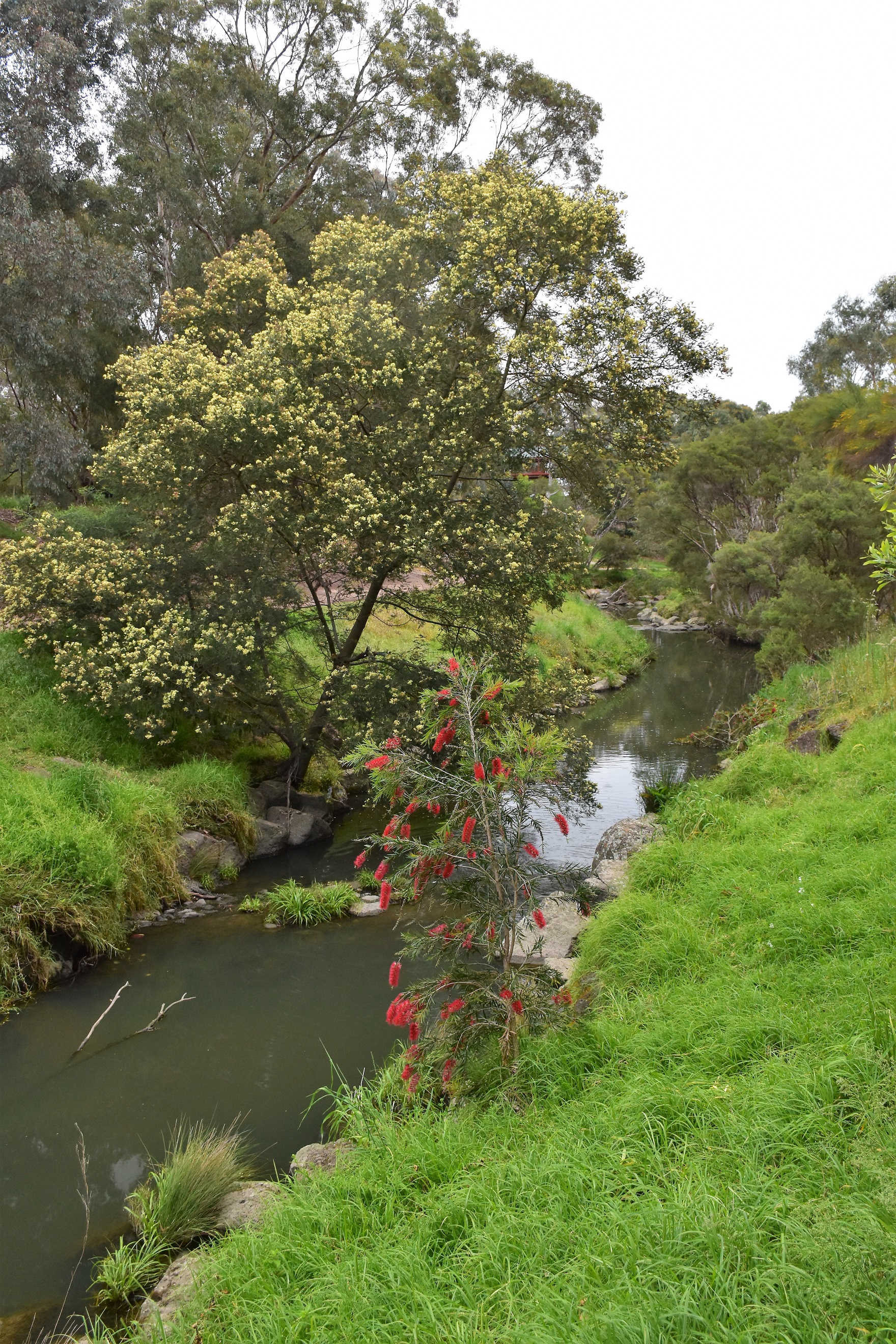
Grevillea and Wattles added a bit of colour this morning.

Gardiners Creek emerging from beneath the Burwood Highway Bridge - yes, I was struggling!

Heading back towards the ute - along the southern bank now.
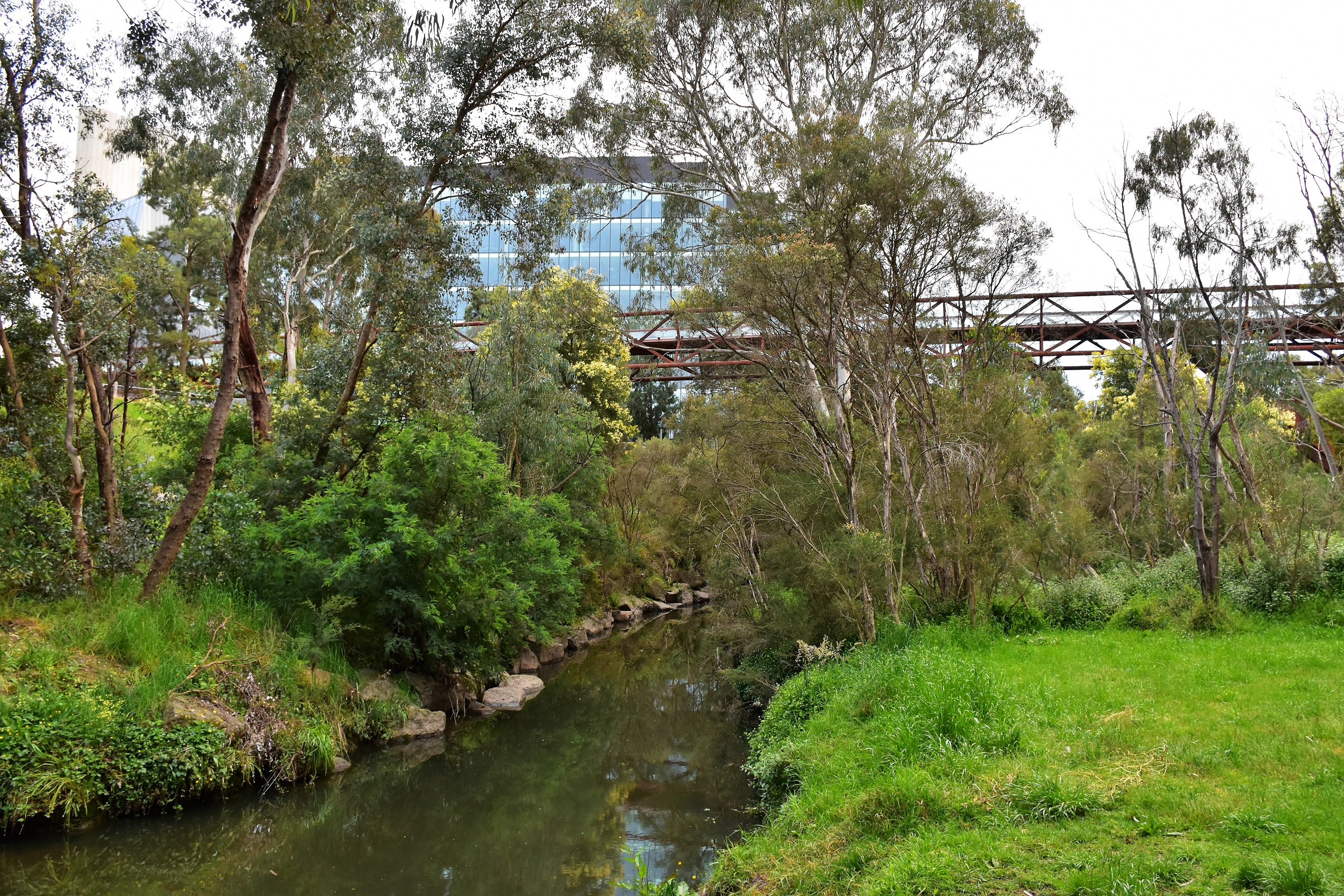
I was walking beside Deakin University now.

This large bridge spans Gardiners Creek linking student accommodation to Deakin University Campus... the highlights were coming thick and fast this morning!
After passing beneath the pedestrian bridge I continued meandering my was back towards the ute, the shared path splits occasionally on this leg of the walk however I always kept to the left (creekside) pad. After making my way past the Bennetswood Bowling Club Car Park I rejoin my outward route as I crossed Station Street, before strolling the last few minutes back to Eley Road and my waiting ute. Somewhat ironically I got arguably my best sunrise photos of the morning here as the sun broke through the clouds above some suburban Burwood houses. Keeping the ironic theme going I also had my best wildlife encounter as I arrived back at thew ute to find a family of Rainbow Lorikeet's feeding in the trees next to the ute.

Heading back up towards Station Street the path divided a couple of times - I stayed left near the creek each time.

Gardiners Creek

Good times....?

The sun rise over suburban Burwood.

Retracing the last few hundred metres back to the ute along the sealed path.
The Dirt.
According to my GPS I walked around 4.3 kilometres and climbed around 25 metres on this easy stroll. This walk is on shared paths for the complete distance and doesn't have any steps so I'm thinking that this loop would be suitable for wheelchairs or strollers. Parking could be an issue on this walk when Deakin University is open, the spot where I parked this morning had a 3 hour limit (which is more than enough for this walk). I used a set of Tyrone Thomas' old notes and mud map out of his book 40 Bushland & Park Walks In Metropolitan Melbourne, along with my GPS topos - although Google Maps will get people through easily enough.
Relevant Posts.

Back at the still pretty well deserted Eley Road. The walk was done and dusted by around 8am this morning.

Before heading home I checked out this noisy family who had made themselves at home in this suburban park.

The young ones were very curious.


No comments:
Post a Comment