
The view over breakfast wasn't too bad...
I enjoyed a very comfortable night up on Mt Kooyoora last night. Last night was the first opportunity that I'd had to try out my new Zpacks tent along with my new Tier Gear quilt and I was more than happy with the performance of both these pieces of new kit. I'd been a little concerned that condensation may have been an issue in the single skin tent however last night it wasn't a problem. I'll hold my final judgement a little longer on my tent though because I'm guessing that a coolish night with a light breeze would be almost the optimal conditions for this type of tent...we'll see how it goes in some decent rain or humidity. My quilt had me questioning why that I'd waited so long to make the change from a sleeping bag, the extra flexibility and comfort was very noticeable to me.

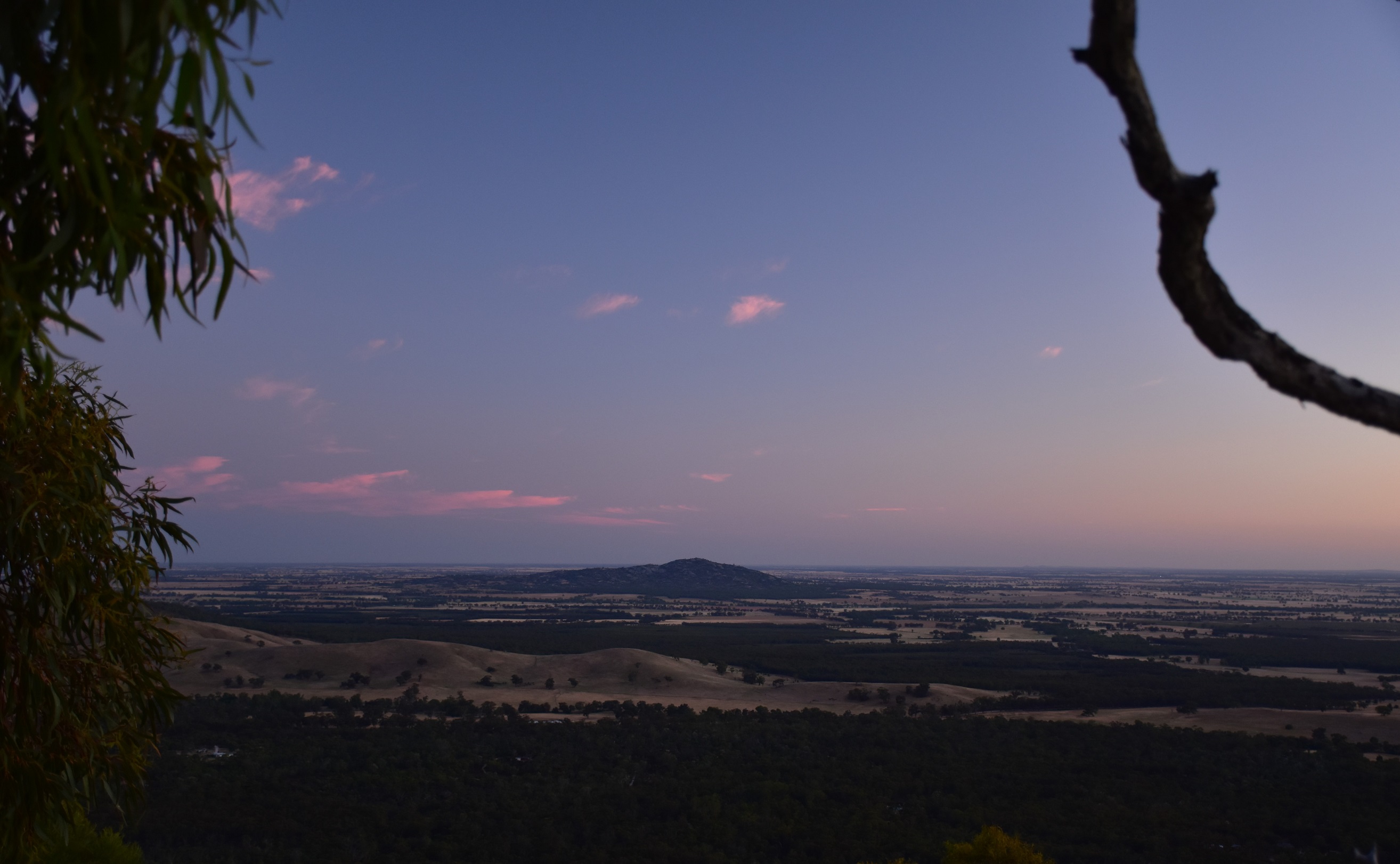
The sun was just lightening the eastern horizon when I emerged from my tent this morning.
Looking north from Mt Kooyoora towards Mt Korong.

My night up on Mt Kooyoora had been a comfortable stay.
With the sun lightening the eastern horizon I emerged from my Dyneema cocoon to take in the morning. Breakfast was enjoyed perched on a rock watching the colours change as the sun slowly inched its way higher. Even though I was mucking about taking photos and generally piss farting around I was still packed up and leaving camp before 8am this morning, helped by the fact that my new tent was quick to put up and even quicker to pack it away. After shoehorning all my gear into my other new piece of kit on this stroll, my HMG Windrider pack, I meandered off west along the long summit ridge line.

Looking south across Kooyoora State Park from Mt Kooyoora.

It was looking like it was going to be a cracker of a day.

Early morning looking north west from Mt Kooyoora.

It was time to put the camera away for awhile and do some walking.
I was now basically heading along a high ridge that runs more or less westerly from the Mt Kooyoora summit. Initially I dropped a little to the south-west to bypass some big granite cliffs before following the ridge down into a high saddle between Mt Kooyoora and West Peak. Now that all sounds easy enough and indeed every time I visualise one of these off track strolls I always seem to see myself frolicking my way across gently undulating open country. Unfortunately just like a lot of other fantasies the reality is never as pleasant. While the descent into the saddle was by no means the toughest off piste walking that I've ever done there was enough scrub around to keep me on my toes picking the route of the least resistance.

Following the ridge line west the walking was pretty good as far as off track walking goes.

I was dropping into a saddle...

... before climbing onto West Peak.

The views to the north from the ridge were extensive.
The climb to West Peak from the saddle was a good one as the country opened up a bit and the scrub thinned out a bit. The good news this morning was that there are pretty well constant long range views either south across the rocky Kooyoora State Park or north across the golden paddocks towards Mt Korong. Less than an hour after leaving the summit I clambered onto the rock slab crowning the West Peak and it was time for smoko. I haven't mentioned it yet however the weather today was pretty well perfect for walking and sitting up here on my rocky platform basking in the warm sun my recent time in Iso seemed a long way away.

Climbing from the saddle towards West Peak.

Looking back towards Mt Kooyoora. I'd skirted around those cliffs buttressing the north side of the mountain.

There are some gnarly old trees up here...

... clinging to life.

Looking south from West Peak. I'd skirt around that cleared land in another couple of hours.

West Peak. There's a small cave below the rock that crowns the summit here.

Looking back towards Mt Kooyoora from West Peak.

Dropping off West Peak the walking got a little steeper and scrubbier for a little while.

Once down the steepest bit below West Peak my spur opened up a bit.

I passed by the famous But Plug Rock as I descended West Spur.

This is what I imagine when I decide to go walking off piste - it rarely works out this good though.

More granite slabs on West Spur.

West Spur gets very broad towards the bottom so it pays to keep an eye on your navigation.

Shuffling passed Magic Mushroom Rock towards the bottom of West Spur.

West Spur, Kooyoora State Park.
Reaching Mt Kooyoora Track I followed it south for half an hour to meet up with Mount View Road, well I should of met Mount View Road. Instead I got a little cocky and when I spied a dirt track in roughly the spot where Mount View Track should be I cut across country to intersect with the dirt track, and all was good for a few minutes until I came to a gate blocking the track... hmm, I'd picked up a farm access track that runs almost parallel with Mount View Road. Oh well, not to worry, a short off track section later and I was indeed on Mount View Track and now heading east. Unlike Mt Kooyoora Track Mount View Road was open to vehicles although I wasn't exactly bothered by traffic this morning, I spent around an hour either trudging along, or sitting beside Mount View Road and only had two 4wd's rattle past.

I've just sighted Mt Kooyoora Track through the trees.

Nice easy walking along Mt Kooyoora Track.

Mt Kooyoora Track wasn't without it's attractions.

I swung off Mt Kooyoora Track to pick this track up thinking it was Mount View Road... I was wrong!...

... arriving at the cleared land I realised my error. A short off piste walk south...

.... and I picked up the real Mount View Road.
I'd decided to freelance a little now, instead of heading straight back towards Melville Caves Camp and the ute I swung south along a very old a fairly faint 4wd track. This grassy track took me south, dropping fairly easily as I passed to the west of the huge rocks around Melville Caves which were easily visible in the distance. After passing through some very nice country my old track started to swing around to the east and head towards the park access road, although with the country still being fairly open and the gradient fairly gentle I once again headed off across country to intersect the access road a bit closer to Melville Caves, scaring a few roos and thousands of cockies along the way.

Taking in the view north towards Mt Kooyoora as I trudged along Mount View Road.

Morning smoko was enjoyed beside Mount View Road.

Leaving Mount View Road I picked up this very old, faint and un-named 4wd track that headed south.

My old track skirted around Melville Caves to the west.
Once I'd met up with the sealed access road I swung left and climbed fairly gently up towards the large Melville Caves Picnic Area. Arriving at the picnic area I suddenly found myself confronted with a heaving mass of humanity as it appeared that big mobs of punters were out enjoying the first Saturday of freedom in months. Over the two days of my walk up until now I'd seen only 5 other people... and they were all at a distance from me, so suddenly seeing so many people was a little confronting. Bypassing the picnicking punters I was now going to climb up to Melville Caves before dropping back to the ute in the camping ground, however arriving at the start of the track I found that Parks Vic had the track closed.
Leaving my old closed track I struck out east across country again to meet up with the park access road.

More nice off piste walking. Kooyoora State Park.

Meeting up with the sealed park access road I climbed it for a short distance up to the Melville Caves Picnic Area.

My ongoing track up to Melville Caves looked... problematic!
Now it would of easily been possible to skirt the plastic barrier and make my merry way up the closed track, however being the law abiding compliant citizen that I am (cough) I decided to give it a miss. Instead I shuffled up the park access track a few more metres until I arrived at an old walking track that started behind a concrete tank and climbed this old track up to the Melville Caves Lookout instead. My walk was pretty well over now and I spent a few minutes poking around the huge boulders that make up Melville Caves. After checking out the caves I dropped down to the Melville Caves Carpark along the tourist walking track before ambling the last few metres of my walk back down to the camp ground and the waiting ute.
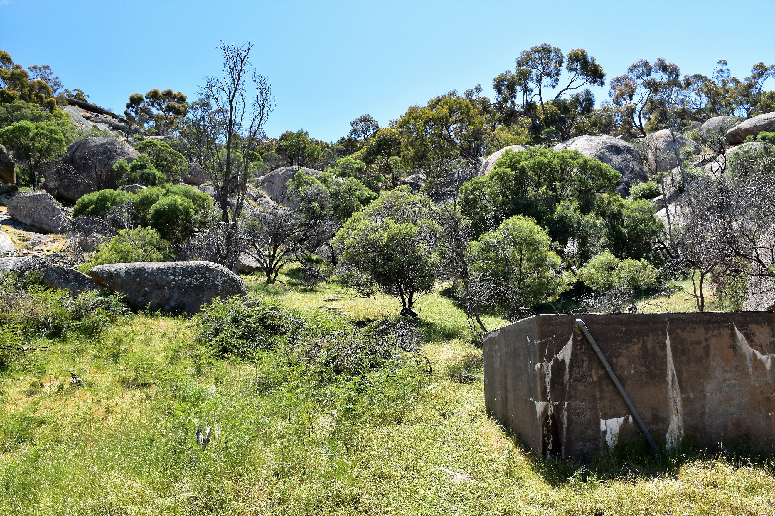
While the main walking track was closed off I was able to pick up the old track which heads off behind the tank.

It looks like there is a bit of a spring here.

The old track made for a solid climb up to Melville Caves.

I was heading up to the lookout on the top of the rocks (squint and you might see it).

The rocky Kooyoora State Park.
According to my GPS I walked around 12.3 kilometres and climbed 333 metres on today's medium grade stroll. The first 3 kilometres today was totally off track and the section heading south along the old 4wd track that heads off Mount View Road is fairly faint in spots, the short cut east across to the park access road was also totally off piste. Having said all that the off track walking up here is pretty good really, sure there is a little bit of scratchy scrub about I needed to negotiate some steep country in a few spots but overall it was generally very pleasant. Likewise the 4wd track section are better than maybe imagined as they were virtually traffic free. It was only really when I hit the park access road that I started to encounter other people, the picnic ground and camp[ground being particularly busy today.
Over the two days of this stroll I walked 17.3 kilometres and climbed 557 metres according to my GPS. While it could be argued that this walk doesn't have the wow factor that some walks have, what this walk does have is peacefulness and remoteness. Walking at the end of months of Corona lockdown it was only really the more touristy area around Melville Caves that was busy. There is no reliable ground water on this walk so the safest bet is to bring your H2O, after rain it would be possible to get water in a few rock pools and seeps. I used a combination of Mr Tempest and Mr Thomas' notes and mud maps on this stroll as well as my GPS topos.
Relevant Posts.

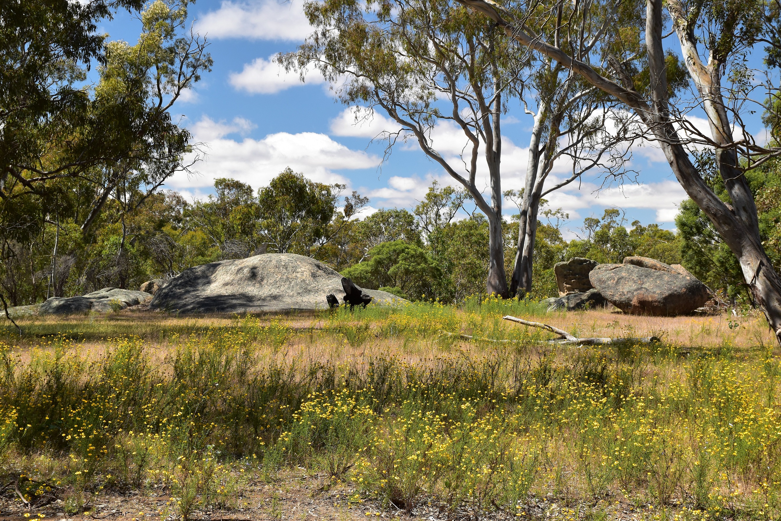
The Melville Caves area of the park features a lot of these big rocks, it's worth spending some time checking them out especially if you have kids with you.

Dropping down the Melville Caves tourist track to the car park.

Shuffling the last few metres of my stroll towards the now very busy Melville Caves Camp Ground.


No comments:
Post a Comment