I was off to another early start this morning.
There is some 4 hour time limited parking just off the Great Ocean Road on Morley Avenue at Wye River.
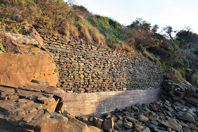
With this Saturday's low tide in Wye River predicted to be around 8am it was another early start this morning, yes I'd left home at 4am this morning - no wonder I do most of this stuff on my own. It was just after 7am when I locked the ute and set off today on what was an absolutely stunning late Autumn morning. Dropping onto the sand opposite the Wye River general store I re-set the GPS and shuffled off up the coast towards Jamieson River. My initial progress was slowed a little as I was walking into the rising sun and not wanting to waste the beautiful golden light I was giving the camera a fair workout. After crossing the ankle deep Wye River I rock hoped my way around the small headland that separates the small Wye River settlement with the even smaller Separation Creek township. This first headland was a fairly easy rock hop at low tide, the main interest for me on this section was the old and slightly agricultural looking retaining wall that still supports the Great Ocean Road a few metres above me.
Wye River cast in an early morning glow.
Wye River was an ankle deep crossing this morning.
The Wye River Beach.
The retaining wall supporting the Great Ocean Road looks a little agricultural to my eyes.
Walking directly into the rising sun made taking photos a little challenging sometimes.
Splashing my way across Separation Creek I continued my coastal ramble, thankfully my perfunctory research on Google Earth paid off and I found myself walking some very pleasant coastline now. The walking was mostly along fairly flat rock shelfs mixed in with the occasional small beach or rocky sections. Actually the only slightly negative thing this morning was that as I was walking directly into the rising sun it was making it a little challenging taking snaps of the route in front of me. While the busy Great Ocean Road was never far away from me up the hill, for the most part the traffic noise was fairly muted.
Separation Creek wasn't a difficult crossing this morning.
Bass Strait was looking fairly benign today.
There are a lot of these unusual shaped rocks along this section of the coast.
Easy rock shelf walking.
Nice walking as I approached Godfrey Creek.
The hills along the coast here are still recovering from the big 2015 bushfire.
There are a few nice little beaches along the coastal section of the stroll.
W.B.Godfrey Shipwreck.
W.B.Godfrey Shipwreck.
Making my way back onto dry land after checking out the shipwreck - I'm guessing that this was probably the lowest of low tides this morning.
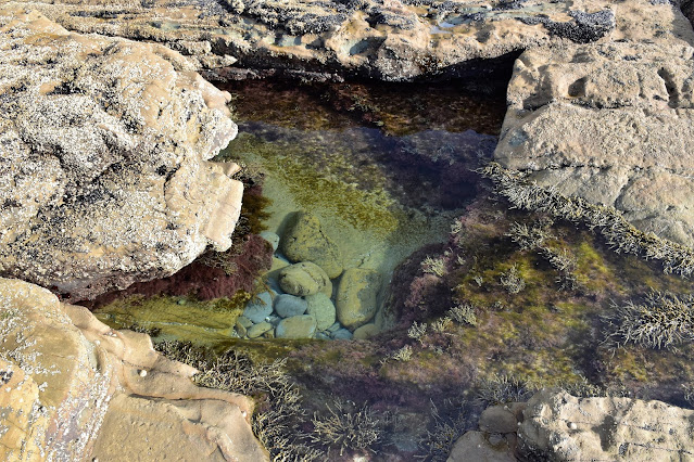
The low tide meant that there was plenty of rock pools to check out.
Heading off from the shipwreck I now started walking the bit of the stroll that I'd done a couple of weeks ago, firstly continuing on north to Artillery Rocks before walking the last short section of coast up to Jamieson Creek. From sea level at the mouth of Jamieson Creek the view north along the rugged coast and cliffs around Mt Defiance are particularly impressive, it is a section of coast that I've also walked although that was a lot more serious walk than the one I was on this morning. After passing beneath the Great Ocean Road using the Jameson Creek bridge I joined Jamieson Track and climbed up to the still closed Jamieson Creek Camping Area for morning smoko.
I'm guessing this maybe how Artillery Rocks got its name?
Jamieson Creek has just come into view.
Jamieson Creek mouth.
Mt Defiance.
Jamieson Creek breaking out into Bass Strait.
It was now time to head for the hills.
There is a surprising number of Wallabies on the inland section of this walk.
Once again I had all the flash facilities at Jamieson Creek Camping Area to myself as I enjoyed a break this morning whilst sitting in the sun enjoying the beautiful views along the coast and out to Bass Strait. Suitably fortified after a couple of bananas and a swig of luke warm water I shouldered the pack again and set off to explore the Jamieson Walking Track. As I'd been here a couple of weeks ago the first section of my walk south to Godfrey Track didn't hold any surprises for me this morning, however after crossing over Godfrey Track things were all new to me. As I suspected this new walking track mostly contours the slopes of the Otway Ranges above the Great Ocean Road and like the coastal section of the walk the busy road was generally far enough away that most of the traffic noise was unobtrusive.
Morning smoko was enjoyed at the Jamieson Creek Camping Area.
The bushfires didn't quite make it up the coast to the Jamieson Creek Camping Area.
Jamieson Walking Track.
It wasn't too long before Jamieson Walking Track started passing through the bushfire zone.
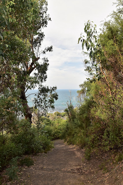
The bush along here is recovering fairly well from the big 2015 bushfires although it will be quite a few more years before all the evidence of those fires has been reclaimed by nature. My glass half full assessment of this was that at least the somewhat stunted bush allowed for a lot more water views. After crossing Wye Road I set off along the last section of Jamieson Walking Track as I headed for Separation Creek. This last section of track is arguably the best as the views seemed to be a little more common - culminating in a very good view down to the beach at Separation Creek below me.
The bushfire stunted growth did allow for some nice views.
The Jamieson Walking Track mostly contours the hills.
Jamieson Walking Track.
Jamieson Walking Track.
I always appreciate a good bench seat!
Dropping down to Separation Creek I now had the headland before Wye River to negotiate. With Jamison Walking Track finishing at Separation Creek I shuffled a few minutes along the side of the Great Ocean Road, crossing the creek on the road bridge. Once over Separation Creek I turned right up Stanway Drive for a few metres before picking up the signposted start of Paddy's Path on my left. Paddy's Path is named in honour of Paddy Harrington and old time bushman who did a lot of community work in the area back in the day. Paddy's Path climbs around the headland that separates the small villages of Separation Creek and Wye River and was a really nice section of my walk. Like the view that I'd got of Separation Creek from the end of Jamieson Walking Track the view down to Wye River from Paddy's Track was a very good one. With the beach and the river below me I dropped down along the last few metres of Paddys Path, crossed the Wye River bridge beside the Great Ocean Road and shuffled my way back to the ute. Pulling my sweaty gear off I reflected on what had been a nice walk, for me the coastal section was still the highlight (you don't see a shipwreck on every walk you do!) however the views that I got from the Jamieson Walking Track were also quite good, I'm thinking in another year or two when the bush has regenerated a bit more this section will be even better.
Looking down to Separation Creek from the Jamieson Walking Track.
Finding the start of Paddy's Path required a little intuition.
Approaching Wye River along Paddy's Path.
The Dirt.
According to my GPS I walked around 13.4 kilometres and climbed about 315 metres on what I'd call a medium grade walk. While there is no big climbs or navigational conundrums on this walk the coastal section requires respect, I'm thinking that it should be doable on middling to low tides although you also need to be watching for waves washing over the rock shelfs, particularly if there is a decent swell running in Bass Strait. Depending on tides you could start this walk either at Wye River or Jamieson Creek however it is probably best to walk anti clockwise (as I did) as finding the start of the Jamieson Walking Track in Separation Creek could prove a little tricky. I used my GPS topos today and Meridian's Great Otway National Park topo, although I did a bit of investigation on Google Earth before I left as Jamieson Walking Track isn't mapped yet. As far as I know there are no published notes for this walk.
Relevant Posts.


No comments:
Post a Comment