The more things change...the more things stay the f%#king same!
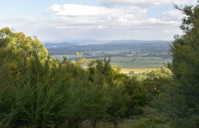
This walk gave me some nice views down to the Yarra Valley.
That was at lunchtime on the 12th February, by the time I'd got home from the surgeon my plans for some decent time in the bush had already been scuppered - yes, Melbourne was going into Covid Lockdown number 3, fuuuuck me! Anyway after screaming at the telly (it helped) I settled down a bit, like last year we were going to be limited to a 5 kilometre radius from home with a generous two hours allowed outside for exercise, yep I was pretty well fucked again I was thinking. Sitting there watching the press conference drag on I had a flicker of an idea, I didn't have to be locked up until midnight... I still had 9 hours to drive somewhere, go for a stroll and then get home again. So anyway that's how I found myself locking the ute and setting off into the Warramate Hills Nature Conservation Reserve late this afternoon.
There's room for a few vehicles at the trail head.
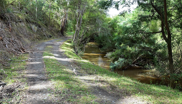
I've been to this reserve once before, quite a few years ago, and from what I can recall the walk to the top of Steel Hill was a reasonably solid walk so that's where I set off for this afternoon. Somewhat counter intuitively my route actually dropped a little to start with as the old 4wd track descended to follow the fairly substantial Woori Yallock Creek downstream for awhile. This section of walk is quite damp and features probably the most substantially sized trees along the stroll. As I've already eluded too Woori Yallock Creek s quite a substantial creek here and for a minute I thought that I was looking at the Yarra River, although a quick look at my map told me that Woori Yallock Creek and the Yarra River actually intersect a 100 metres or so further downstream.
You have to like your trees if you walk here.
Almost immediately my 4wd track dropped down towards Woori Yallock Creek.
The Manna Gums (I think) down by the creek are the most substantial trees on the walk.
Woori Yallock Creek had a healthy flow this afternoon.
My track stayed close to the creek for around a kilometre before starting a solid climb.
This looks like a five photo climb.
Thankfully there were a few things to stop and photograph.
Looking across the Yarra Valley toward Mt Donna Buang.
Third photo stop - progress was still being made.
Once up on the ridge line between Briarty Hill and Steel Hill the walking was very nice.
The trees block out most of the views from Steel Hill.
Steel Hill Trig, it was time for a break.
Steel Hill was the spot where I'd turn around and start my journey back to the ute tonight however before setting off I enjoyed a quick break on the freshly mowed grass beneath a shady eucalyptus. Savouring the feeling, smells and sights tonight I was filled with anxiety and apprehension again, I hadn't fared well last year being locked up for so many months and here we were going back into lockdown again. Maybe my Melbourne friends will understand where I'm coming from...? All good things come to an end though and unless I wanted to be night hiking (and I did consider it!) I figured that I'd better get my fat arse into gear and make a mile back to the ute. To liven things up a bit on my return journey I decided to take a bit of exploratory route. After retracing the ridge line back past the Briarty Hill turnoff the track arrived at a bit of an open grassy clearing to the right of the track (there was a small telecommunication post around here when I went through). Leaving my outward route I headed across to the open area where not only could I get some more Yarra Valley views but also I was able to pick up and old, slightly overgrown 4wd track dropping steeply down a spur to the south-east. The old track got progressively rougher and more overgrown as I descended however it also featured a lot of views across towards the Dandenong Ranges so life was pretty good really.
I enjoyed my peaceful interlude up here tonight.
By the time I set off back down the sun was getting fairly low...
... which made for some nice views.
Open forest on the slopes of Briarty Hill.
A small clearing and this dead tree provide a good reference point for the spot I left my ascent route and started to freelance a bit.
I got some nice views south as I dropped down the overgrown track.
My alternative actually provided the most floral diversity on the walk.
By the time I reached the bottom of the spur my pad was very faint.
I hit this track and turned right.
Warramate Hills Nature Conservation Reserve.
The Dirt.
According to my GPS I walked around 10.1 kilometres and climbed about 482 metres on what I'd call a medium grade stroll. The Warramate Hills are not really a destination that pops up on most walkers radar (something that I look for in a lot of my walks) however if you are looking for a decent walk that'll raise the heart rate a bit while still being very close to Melbourne then it's with considering this little park. There are a few things to think about before going for a stroll here, the first one is that from what I can see there is no track signage at all and along with that the mapping (both electronic and on paper) is a little hit and miss when it comes to the tracks here. Ironically enough the most accurate map that I found was one of Tyrone Thomas' mud maps out of his 150 Walks in Victoria book which dates back to the start of 2006. I followed Tyrones notes upon to the summit however freelanced a bit on the way down today. I also used my GPS topos which were handy on what turned into almost an off piste stroll on my descent.
Relevant Posts.


No comments:
Post a Comment