
I was up on the summit just before the rising sun showed itself from behind Mt Bogong.


I was lucky with the weather again today.

Mt Feathertop sunrise.

I was up early again this morning, just as the sun started to lighten the eastern sky I emerged from the tent to pull on my boots and make the climb up to the Mt Feathertop summit. It's a steep but relatively straightforward climb up to the summit (when there isn't snow or ice on the ground) and it didn't cause me much drama this morning. Mt Feathertop is one of those mountains that feature what all old and fat bushwalkers dread, false summits. Yep, after puffing my way up hill I was mildly chuffed see the summit just ahead of me only to see the next slightly higher summit a fair walk away, a process that I repeated a couple of times. Eventually I did reach the high point and settled down on the lee side of the summit to enjoy mother natures light show. The sun rising from behind the distant Mt Bogong and lighting up the Bogong High Plains in a nice golden glow. Looking away from the rising sun I could see the Ovens Valley cloaked in fog as it snaked away into the distance along with many rugged spurs dropping down into the deep valleys around me, some familiar to me and some waiting to be explored.

Mt Feathertop sunrise.

MUMC Hut - it doesn't look that far;)

The Ovens Valley was still cloaked in fog.

After watching the sun make it's appearance I slowly retraced my mornings steps back down to the tent for breakfast, the descent slowed by the usual issue of me stopping frequently to take what I was thinking would be some great photos - although as usual I was somewhat optimistic! Back at the tent I enjoyed brekky lying on the snow grass beside the tent as I braced myself for the ordeal ahead, yes the days next objective was the descent down the super steep North West Spur. It was around 9am by the time I'd had brekky, packed up camp and set off on my journey back down to the ute.

The morning sun has just hit Mt Buffalo.

The view over brekky was a good one.

I'd be contouring the side of Mt Feathertop to pick up that spur - after brekky.

Brekky was enjoyed laying beside the tent on the snow grass.

That's Molly Hill on the left - it was time to pack up and start the days hard work.
Picking up the start of the North West Spur Track a couple of minutes from camp I started walking what is one of my favourite sections of walking track in Victoria. The North West Spur Track from the base of Mt Feathertop to MUMC Hut is a stunning length of walking track as firstly the slightly benched track contours across an exceedingly steep gully on the side of Mt Feathertop before following the crest of an acute ridge across to the hut. After walking for a few minutes I reached what is probably the most reliable water up here at a spot where a spring emerges above the track from the side of the mountain. Topping up with some water I was soon on my way again, initially doing a little more contouring before breaking out onto the ridge top. Once on the crest of the ridge I could once again see the green dome of MUMC Hut in the distance however it was a good half an hour before I arrived at the hut for morning smoko, although my pace was once again slowed by the views.

That's the North West Spur (in the middle distance).


This spring on the North West Spur Track on the side of Mt Feathertop is probably the most reliable water point in the area.

The North West Spur Track traversing the gully before reaching the crest of North West Spur.

This higher section of North West Spur is really nice walking.

Bungalow Spur from North West Spur.
MUMC Hut is one of the more comfortable huts in the High Country however today I didn't even bother going inside, instead I enjoyed my morning smoko sitting on the huts staircase enjoying the late Autumn sun while a gazed across to the brooding Mt Feathertop. Eventually I could procrastinate no longer though and I shouldered the pack again and set off on the knee crunching part of this walk, the descent down the North West Spur. The North West Spur Track is sometimes called the Tom Keen Walking Track and this track is one of the steeper tracks in this part of the Victorian High Country. Initially at least though the going wasn't too bad as I dropped down the slightly overgrown walking track crossing some beautiful snow grass plains as I descended, however soon after the pad swung from the north to the north west I entered the trees and things got steep.

MUMC Hut.

I enjoyed morning smoko sitting in the sun on the steps.

Alright... here we go.

The initial drop down North West Spur was a little scrubby in spots...

... however pretty good for the most part.
Without much in the way of rocks to brace my feet on and virtually no switchbacks until I was almost down at bottom this is a tough descent on feet, knees and in my case anyway, quads. Having said all that if you take your time it's all doable, I'm not exactly an ultramarathon athlete and I managed to ease my way down to the ute in around 3 hours from MUMC Hut. So far on this two day walk I'd only come across a school group and a couple of day walkers yesterday heading down hill on Bungalow Spur and it was only when I was half way down the North West Spur that I met the next

The bush on the North West Spur seems to be recovering a lot better than over on Bungalow Spur.

I'm wondering if the bushfires weren't as hot over here?

Nice walking on North West Spur.

I wonder if this is the old tree that use to have the Steep Descent sign on it?

The level sections are that rare that I thought that I'd take a photo!
After climbing Bungalow Spur yesterday it was interesting to observe how the bush was regenerating over here on the North West Spur, to my untrained eyes it looked as though the fire wasn't as intense on this spur as the bush, in particular the Alpine Ash appear to be in a lot better shape on the North West Spur. Eventually the North West Spur Track started a long section of switchbacks down a very steep section of the spur, this was an exciting development as I knew that the pain in my quads would soon be over. Sure enough the sound of rushing water started to reach me and it wasn't too much longer before I arrived down at the beautiful cascading creek. This creek is a tributary of Stony Creek and it is a welcome oasis after the drop down (or before the climb) of North West Spur.

Those trees below me are slowly getting bigger.

There is very little in the way of switch backs for most of North West Spur...

... until almost at the bottom. The switch backs are a reasonable sign that the worst of the descent is almost over.

This small tributary for Stony Creek makes a good spot to rest after the descent - or fill your water bottles before the ascent.
After resting at the creek for a couple of minutes I set off back towards the ute again. Unfortunately the track now climbed up over the end of another spur, although thankfully the climb was over fairly quickly and the North West Spur Track now followed a fairly well benched route as it contoured above Stony Creek. After ten minutes of nice easy walking my track eventually dropped down to ford the creek (there is a log twenty metres downstream if the creek is too high) before climbing a little to meet my outward route at the base of Bungalow Spur. Back in reasonably familiar territory now the rest of the stroll went pretty quickly as I meandered my way back passed the private properties and businesses. It was around 2pm when I arrived back at the ute this afternoon so the walk from camp ended up taking me around 5 hours, although I didn't really push that hard. After stripping off my smelly clothes I enjoyed a bit of a cold bush shower beside the ute before pulling on some clean clothes and setting off on the long drive home.

Somewhat depressingly after crossing the creek the North West Spur Track climbing a bit.

I'm about to break out into the sun again... and the climbing is pretty well finished.

North West Spur Track contouring around the hills above Stony Creek.

North West Spur Walking Track.
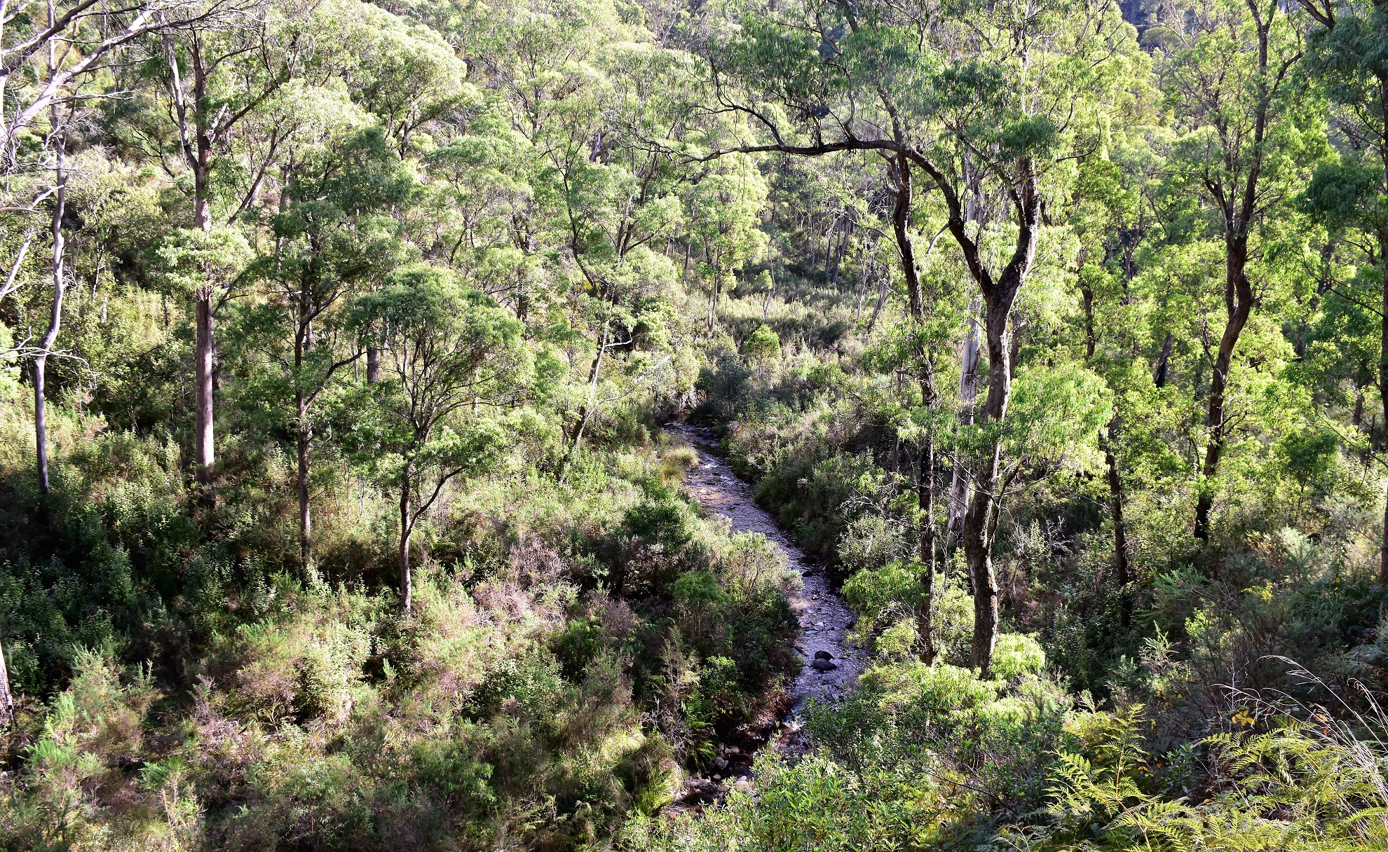
Stony Creek from the North West Spur Track.

There's a log to facilitate a dry crossing of Stony Creek in winter.

Having re-joined my outward route from yesterday I climbed back up to the semi rural land.
The Dirt.
According to my GPS I walked around 12.9 kilometres and climbed about 320 metres on what I'd call a hard days walking. It's not the scrub or the navigation that make today tough, the reason this walk will stay in your memory is the steepness and relentlessness of the descent down the North West Spur. While maybe not quite as steep as Diamantina Spur the descent down North West Spur is fairly relentless and I'm thinking it drops a fair bit more than Diamantina (although it's been a few decades since I've been down Diamantina too!). I used some of Tyrone Tomas' old notes and mud maps along with Rooftop's Bright-Bogong-Hotham Forest Activities Map and my GPS topos on this stroll.
Over the two days I was out on this little adventure I walked around 25.3 kilometres and climbed about 1,624 metres on what was a fairly extreme walk. Whilst today was hard enough it was really the off track section up the lower section of Bungalow Spur yesterday that ramped up the degree of difficulty a bit. The lower off piste section of Bungalow Spur can be avoided by picking up the Bungalow Spur Walking Track east of Harrietville however it requires a car shuffle or a reasonable road bash to avoid it. Even if using the road/walking track option this is still a fairy hard walk I think.
Relevant Posts.

There is a lot of old mining history around Harrietville - this open shaft is beside the walking track near Stony Creek.

The walking back down near the Trout Farm was certainly a contrast from earlier.

Stony Creek.

I'm thinking that this is the spot where the Trout Farm draw their water for their ponds?

Alright... time for a wash and a change of clothes...

... before settling in for the long journey home.


No comments:
Post a Comment