Sunday, May 9, 2021

Lake Cullulleraine Circuit Walk - December 2020

The Wedge-tailed Eagles were a feature of this walk.

Up until this morning the most time that I'd spent at Lake Cullulleraine had been a few minutes at the roadhouse on the Sturt Highway as I motored east or west across the country. I did know that there was a fresh water lake there however I wasn't sure if the lake always had water in it. Knowing that I'd be in the area for awhile this time I jumped on to the inter web and did a little research. Well it turned out that not only was the lake permanent (fed by a channel from the nearby Murray River) but there was a circuit walk around the lake along with opportunities for swimming... it was time for a visit.

I arrived fairly early for this mornings stroll.

The walking track system is well signposted and way marked mostly.


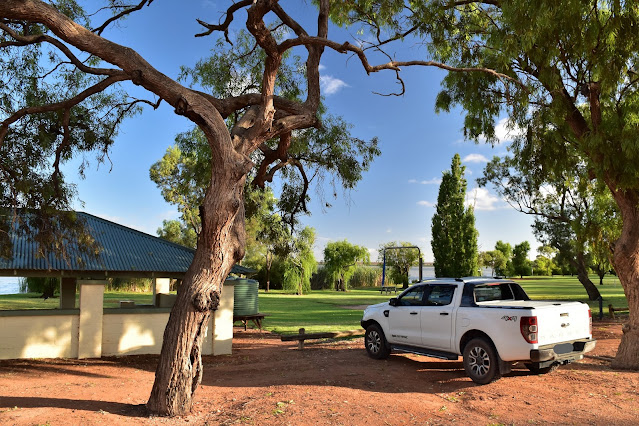
After leaving Sam at our apartment in Mildura I motored west this morning, arriving at the very well appointed Johansen Reserve Picnic Area on the southern shore of the lake well before 8am. Apart from the actual lake, Lake Cullulleraine is also a small town which features a few houses, a couple of Caravan Parks, a Roadhouse and quite a few irrigation pumping stations, although at this early hour on a Tuesday morning the place was pretty well deserted. After re-setting the GPS I set off from the picnic area and started my anti-clockwise circumnavigation of the lake.

Lake Cullulleraine

I walked counter clockwise around the lake.

With a cold wind blowing off the water, conditions were decidedly frigid this morning (a very, very unusual thing up in this part of the state in summer) so I was happy enough to keep shuffling along. After passing through a caravan park and the sailing club I left the well manicured green grass behind and started walking the arid red dirt scrub that I'd be passing through for the next couple of hours. The track around the lake is well defined, signposted and track marked, and so long as I kept the water on my left then navigation wasn't going to be an issue this morning. My route stayed fairly close to the water, however half an hour after leaving the ute I had to avoid a short cut that headed overland and cut out a section of the walk around a peninsula.

It wasn't just Wedgetail Eagles this morning.

Yes, it was a nice walk... although maybe not that nice!

Lake Cullulleraine is an irrigation lake... so there are water pumping stations scatted around the shoreline.

Things felt a little more like the Outback after I passed by the pumping station.

There were plenty of Roos around this morning.

I avoided the Short Cut Track and took the longer route.

Saltbush and red sand... this is Australia!

After avoiding the short cut I walked a fairly soft section of the track as I trudged around the southern shore of the peninsula, although conveniently for me every time I was getting a bit tired of the soft walking I'd find something to stop and take a photo of... the birds, and in particular the Wedge-tailed Eagles were plentiful on the walk. After passing the other end of the short cut I continued north for awhile to eventually reach the bridge over the lake inlet channel. This spot is the northern most point of the walk and with it's handy picnic table and shady trees it would make a nice spot for lunch I reckon.

Looking back across Lake Cullulleraine to the picnic area.

Wedge-tailed Eagle.

Conditions were a little soft under foot in spots.

Lake Cullulleraine Walking Track.

The northern shoreline of Lake Cullulleraine.

There is the occasional picnic table scattered around this walk.

The Lake Cullulleraine Walking Track.

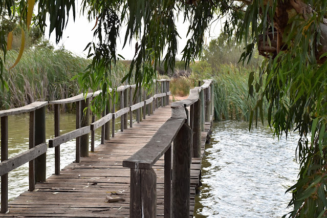
I'm about to cross over the Lake Cullulleraine inlet channel.


While it wasn't that hot today I still enjoyed walking this northern part of the stroll as the bigger trees around here added a bit of contrast to the salt bush and reeds that featured on much of the walk. I was now slowly making my way back around towards the settled area of the lake again and after cutting over a small peninsula I was suddenly back in civilisation - in this case another caravan park. This caravan park had some very flash cabins and must be the upwardly mobile area of Lake Cullulleraine I'm thinking.

I'm thinking that swimming maybe a possibility in the inlet channel - although I didn't try it out and the entry and exit maybe a little inelegant.

I think that the picnic table near the inlet bridge would make the best spot for a break along this walk.

The Lake Cullulleraine Walking Track.

After leaving the inlet channel I was soon back in the arid Saltbush country.

Lake Cullulleraine Walking Track.

Lake Cullulleraine.

More Wedgies - I actually spotted a couple of Sea Eagles at one point however I couldn't get a half decent photo of them.

Lake Cullulleraine.

Whenever the track got close to the shoreline the vegetation got more substantial.

Lake Cullulleraine Walking Track.

Lake Cullulleraine.


Once again the track kept pretty well to the waterline as I passed through the caravan park, with plenty of places to swim and points to anchor your boat I'm thinking this must be a popular spot in the school holidays. Once through the caravan park I had another section through more native types of scrub again as I continued on, passing the big Millewa Irrigation Pumping Station and a few derelict old windmills along the way. When the green grass of Johanson Reserve came into view my mornings stroll was pretty well over. Shuffling over to the ute I saved the GPS track, jumped in and headed back to Mildura to reunite with Sam - pencilling in Lake Cullulleraine as a likely spot for a swim on my next trans continental summer journey.

Big sky country... the Sturt Highway tracks along the tree line in the distance.

There is some indigenous history on offer up here too.

Approaching the Bushmans Rest Caravan Park I was back in the big smoke. 

Bushmans Rest Caravan Park.

Bushmans Rest Caravan Park - looks pretty swish to me!


The Dirt.
According to my GPS I walked around 10.4 kilometres (which seems about right) and climbed about 132 metres (which seems a little optimistic) on this easy stroll. This is a walk in two parts really. The southern section is pretty settled, with caravan parks and lots of green grass. The northern section is more your arid Australian country with plenty of Saltbush and red sand. Needless to say I enjoyed the northern section the most. The tracks this morning were all well marked and maintained although they sometimes were a bit soft underfoot, no worries today however on a stinking hot day or after some big rain they may be a pain. There are a few (signposted) picnic tables scattered around the length of this walk and any of them would be a good spot for a break I think - the one near the lake inlet bridge was arguably the best I thought. Swimming looked good around the caravan parks and picnic area on the southern shore of the lake and could be possible near the bridge over the inlet channel, for the rest of the walk it would be difficult to access the water due to reeds. If I have any twitchers that read my waffle then Lake Cullulleraine is definitely for you, I took a few photos of the big ticket birds like the Wedge Tail Eagles however there were many, many more birds flittering about that I didn't photograph. I found a map for this walk on-line and as far as I'm aware there are no published walking notes for this walk. The online map and my GPS maps got me through this morning.

Relevant Posts.


Yet another Wedge-tailed Eagle.

My last eagle shot - I promise!

Between the two Cravan Parks I had another stretch of bush.

Lake Cullulleraine windmill.

Believe it or not it was a little cool for me to go for a swim this morning.

Arriving back at the Johansen Reserve it was time to head back to Mildura.


1 comment:

Pelion Hut to Mt Ossa return, Overland Track - April 2010

Mt Oakleigh from the Pelion Hut heli pad. I think the mountain just visible in the mist in the distance is Cradle Mountain... ... the flat t...