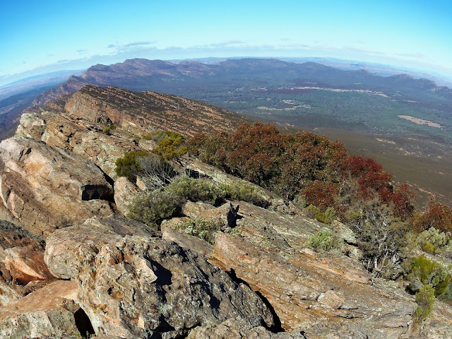
Looking back across Wilpena Pound from St Mary Peak.
After a cosy night wrapped up in my sleeping bag in the tent I eventually emerged this morning to a freezing day. With my fingers stinging I hung the icy tent fly and ground sheet strategically around the camp site to try and dry them in the weak sun, thawed my fingers out a bit as I cooked up some porridge and finished it off with a hot chocolate. Then the morning ritual of packing what seems like an inordinate amount of gear into my pack, somehow against my better judgement it all still fitted in. As I shouldered my pack to head up to Tanderra Saddle it was noticeably lighter than yesterday, I'd carried 6 litres of water in here yesterday and was now down to 2 litres.
The track up to Tanderra Saddle has been re-aligned since I last walked up here and now is more contoured as it climbs the flanks of Mt Boorong towards Tanderra Saddle. The good news now was that as I gained height the trees became a little lower which in turn allowed the sun to warm me up a bit, at the same time it also started to melt the ice that had formed on puddles on the track overnight. About one hour after leaving camp I was stashing my pack in the trees and getting ready for the side trip up St Mary Peak.
Tanderra Saddle
St Mary Peak from Tanderra Saddle - I'm heading up there next.
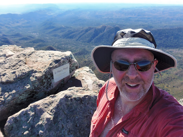
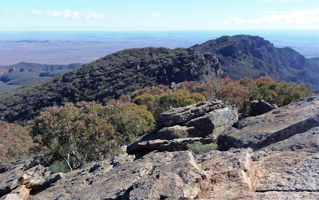
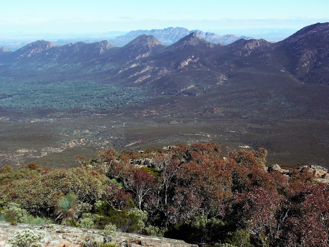
The track up St Mary Peak has also been re-aligned since I was last up here, it now hooks around to the south west to avoid the worst of the cliffs before heading up to the summit. The old track just went straight up through the cliffs and I can vaguely remember a pretty airy traverse along a rock ledge with a piece of fencing wire for protection. The new track skirts around some bluffs before steeply scrambling to the summit. At 1171 metres St Mary Peak is the highest point in the Flinders Rangers and as expected the views are great. Taking in the scene below me I was able to look back to where I'd camped last night down in Wilpena Pound and I also had a great view of Edeowie Gorge. It's the view down the Bunyeroo Valley that was really taking my breath away however (well that and the fact that I'd just climbed the highest mountain in the Flinders Ranges!) although the sun was making it difficult to get a good photo this morning.
It's a beautiful climb.
Climbing up through the buttresses.
That's the Bunyeroo Valley behind me.
Edowie Gorge from St Mary Peak.
Looking out towards Lake Torrens from St Mary Peak.
I spent around an hour on the peak wandering around the summit area taking in the view, I also used the opportunity to ring Sam and let her know that I was OK (she was sitting in a café with our friend Belinda - it seemed a world away from where I was). After retracing the track down to Tanderra Saddle I grabbed my pack and headed down what is called the Scarp Track. The Scarp Track is steep and loose and involved scrambling in a couple of places, it's beautiful walking however and the rock made me think of the "Flinstones". A couple of slips and a bit of swearing later the descent ended as abruptly as it started and now I started an undulating walk along the outside wall of the pound. The track crosses numerous small gullys and is an easy walk, there was plenty of goats and kangaroos to keep me company today and the native pines completed the scene. Just over an hour after descending the outside wall of the pound I met the out bound track along Wilpena Creek and a couple of minutes later I was enjoying a cold drink and a warm pie outside the café at the visitor centre.
Bunyeroo Valley
Last nights camp was on the edge of those trees down in Wilpena Pound.
Dropping back down to Tanderra Saddle. I climbed the track up the flank of Mt Boorong from Cooinda Camp this morning.
Edowie Gorge
Dropping back down to Tanderra Saddle.
After relaxing at the café for awhile it was time to grab the ute and check back into the resort. After a long shower I set about sorting through my gear and getting my stuff ready for the Gammon Rangers, which was tomorrows adventure. Once again I spent a pleasant night in front of the fire, having a couple of beers and tucking into a counter meal, savouring the contrast between bushwalking and the real world.
Tanderra Saddle
Dropping down Scarp Track.
Dropping down the wall of the pound and heading back to Wilpena Resort for a shower.
The last section of my walk was a fairly pleasant amble through some native pines.
The Dirt.
I walked around 10 kilometres and climbed about 650 metres on what I'd call a medium grade days walking. Over the 2 days of this walk I'd walked 32 kilometres and climbed 1000 metres on what is a medium grade overnight walk, if omitting the Edowie Gorge and St Mary Peak side trip then this would be a very easy overnight walk. This was the second time I've done this walk, the time before this was about 20 years earlier. The walking is mostly on good tracks although the Edeowie Gorge section gets rougher the further into the gorge you go, however in my opinion the spectacular scenery makes up for any hardship. The track up St Mary Peak is steep with a couple of scrambles but easily doable. The designated overnight camp site at Cooinda Camp is basic with just a patch of flat dirt. Water can sometimes be found 5-600m down the Edeowie Gorge track in North Wilpena Creek to the north of the track. I wouldn't rely on the rock hole as the water in the bigger lower pool looked a bit average and the shallow upper pools wouldn't last long after rain.
Before walking you need to get a permit to camp from the visitor centre which will cost about $5 (2012), there is a small store next to the visitor centre which sells basic supplies and some take away. On the walk I used the Landsmap 1:50000 Wilpena sheet, for track notes I used John and Monica Chapman's notes from Bushwalking in Australia, the walk is also written up in reverse in Lonely Planet's Walking in Australia. To be honest though if you are not going to drop into Edeowie Gorge then the park notes are probably adequate.
I've stayed at different places over the years on my trips here, on this occasion I stayed at the resort which was a convenient, although expensive option. They seem to cater towards the senior bus tours, however the staff are friendly and the food is good so it's a nice spot to stop for a night or two. Rawnsley Park is also worth considering as they have a wider range of accommodation and prices. You can camp at both the Wilpena Resort and Rawnsley Park if anyone is after a cheaper option.
Relevant Posts.
A pie and a coke... now it's time for a long shower!


No comments:
Post a Comment