
Lockdown # 5 done and dusted and it was time to enjoy some quality mental health time out in the bush. This is early this morning on the Anglesea River.

The weather forecast was less than ideal this morning - the reality was something different.
After pulling on my boots and re-setting the GPS I set off from the corner of the adventure playground nearest the Anglesea River. My walk this morning had me heading east along a section of the long distance Surf Coast Walk and this bit of walk was sensational today. First up I followed the good walking track along the shore of the Anglesea River Inlet as I made my way out to the beach, sharing the track with a couple of early morning dog walkers. Arriving onto the Anglesea Beach the views up and down the coast suddenly opened up. The views south towards Point Roadknight being particularly nice as the red cliffs were lit up by the early morning sun, the view in the other direction was also pretty sweet although I was looking straight into the low sun so it made things a little tough to photograph.

I started the walk near the adventure playground beside the Anglesea River.

Moonah forest beside the Anglesea River.

The Anglesea River section of the Surf Coast Walk is a little prone to flooding.

Heading along the Surf Coast Walk towards the (closed) mouth of the Anglesea River.

The view west towards Point Roadknight was pretty sweet this morning.

The view east wasn't too bad either... although I was struggling with the sun a bit.
Heading around the small point at the mouth of the Anglesea River (well, on the rare occasions that it actually flows through to the sea) I walked the beach for a couple of minutes and climbed the access track up towards the caravan park...and that was the extent of my beach walking on this stroll. Once up the access track the Surf Coasts Walk follows fenced track between the caravan park and the cliff tops as it heads east away from town. After leaving the town behind the Surf Coast Walk climbs across some nice heathland and then follows a long section of boardwalk, judging by my limited experience here this makes a good spot to see the local population of Eastern Grey Kangaroos. Due to the unstable cliffs along the coast here the ocean views a little more fleeting and rare than maybe imagined however these cliff tops still make for nice walking.

This old Moonah tree near the beach access track is a stunner.

The Surf Coast Walk climbing away from Anglesea.

There is no shortage of Roos around Anglesea.

Early morning on the coastal heathland.
Continuing may way east the Surf Coast Walk continued to climb as the coastal cliffs got higher, the heathland now pretty well having given way to dry open Eucalyptus forest. There were a few more opportunities along here to access the cliff tops along informal pads although I'm not exactly sure of the legality of that, the way I looked at it was that if the cliffs were fenced off then I didn't access the tops however if there was no fence then I figured that I could sneak up for a look - whatever the legalities these cliff tops demand caution as a lot of times they are undercut and they mostly consist of soft red clays.

The Surf Coast walk mostly stays away from the very edge of the soft cliffs along here - although there are some occasional Bass Strait views.

That's Point Roadknight in the middle distance.

I'd left the Moonah trees behind and was now in dry Eucalyptus forest.

Looking back down towards Anglesea - this was about as far to the east that I'd walk today.

The Surf Coast Walk continues on down to Point Addis - I was heading inland now though.

After one last view I back tracked a few minutes and left the Surf Coast Walk as I picked up Hirst Road. To be honest the rest of the walk pales a bit compared to the the Surf Coast Walk as I now started a fairly convoluted route around the Eumeralla Scout Camp and out to the Great Ocean Road. Initially I followed Hirst Road for awhile before picking up an old (un-signposted) closed road that I climbed for ten minutes to the spot where an un-signposted walking track headed north towards a dam - except that the un-signposted walking track was signposted as a mountain bike track. Now I'd been sharing a lot of the tracks with mountain bikes this morning however they had pretty well all been old 4wd tracks, this was a single track and to be honest I wasn't sure whether I should be walking along it or not? Once again I set off not really knowing the legalities of the situation although it wasn't really the legal situation that was the issue, it was more that I didn't want to get cleaned up by one of my mountain bike brothers or sisters. Thankfully the sight lines along here were pretty good as I had 5 or 6 bikes come through, however I was able to easily step off the track when they came through.

The Hirst Road turnoff was well signposted.

Hirst Road.

Leaving Hirst Road I picked up this old closed 4wd track.

After climbing the 4wd track for a little bit I arrived at my walking track... to find it signposted as a mountain bike track... hmm.

I'm not exactly sure whether I was allowed to be walking on this single track however whatever the legal case it made for some nice walking as I climbed up towards a large dam.
Arriving at a big dam I crossed the retaining wall and climbed a rough track up to meet the Great Ocean Road. I was now going to more of less follow the Great Ocean Road for a couple of kilometres towards Anglesea using bush track near the road however once again I found myself on a single track mountain bike route, hmm. The biggest issue on this bit of single track was that I was going to struggle to hear the mountain bikers coming due to the traffic noise from the nearby Great Ocean Road so when the chance presented itself I crossed the Great Ocean Road (near Coalmine Road) and walked some quite tracks on the north side of the road. Reaching Firebreak Track I left the Great Ocean Road and dropped down to meet Camp Road before making my way down to the Anglesea River along another fairly uninspiring section of the stroll.

This big dam is a handy navigational aid.

I followed a short section of the old Great Ocean Road alignment...

... before crossing the road and following some quieter tracks on the western side of Great Ocean Road.

Most of this bush recovers well after fires.
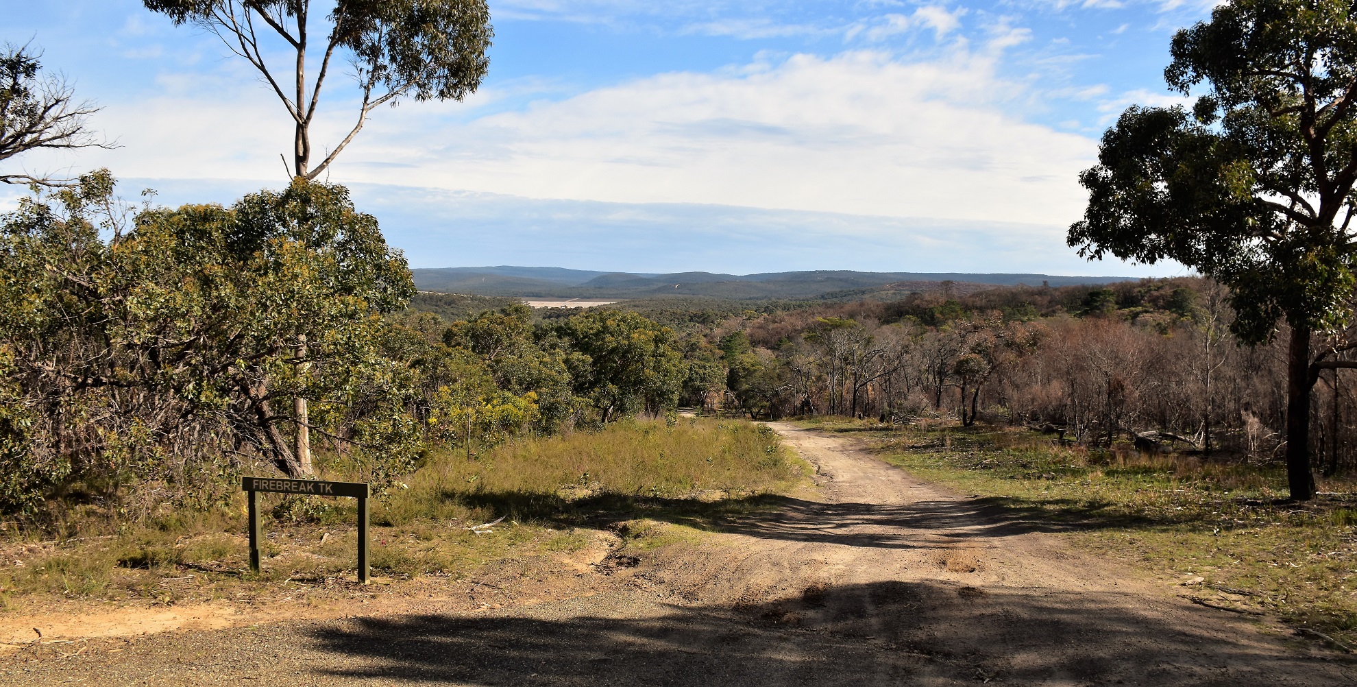
I dropped down Firebreak Track to meet Camp Road.

The section of my route from Camp Road to the Anglesea River was a little sub-optimal.
Once I arrived in the vicinity of the Anglesea River I joined up with the route for the snappily titled Anglesea Perimeter East Walk. I've walked the Anglesea Perimeter East Walk before so I was now back in reasonably familiar territory as I shuffled my way back into town. Soon enough my route emerged from the scrub and I found myself shuffling through the outskirts of Anglesea beside the Anglesea River however instead of following my described route notes back to the ute I crossed over the river and adjacent wetlands on a series of bridges to arrive at Coogoorah Park (this is a great park for children). Once on the west side of the river I followed some quite roads, walking tracks and boardwalks for 15 minutes before arriving back at the Great Ocean Road at the spot where it crossed the Anglesea River. Crossing over the road and the river I arrived back at the adventure playground where I'd set off from a few hours ago, my feet a lot sorer and my muscles aching a bit however pretty content to have finally got in another walk after out latest lockdown.

Anglesea Perimeter East Walk - I walked this track a couple of years ago.

I've arrived at the outskirts of Anglesea.

Anglesea River.

Anglesea River.
The Dirt.
According to my GPS I walked around 15.8 kilometres and climbed about 323 metres on what I'd call a medium grade days walking. This walk is really a walk in two parts, the first part along the Surf Coast Walk makes for some really nice walking - the second inland part, not so much! This inland route utilises a lot of tracks that are also being used by the local mountain bike community and while my two wheeled friends were all friendly I'm not exactly sure whether or not I should be walking some of these tracks? I used the notes and mud map out of the House of Chapmans Walking The Otways on this stroll along with my GPS topos.
Relevant Posts.

I freelanced a little off my route notes and crossed over the river to Coogoorah Park.

The Great Ocean Road (and the end of my walk) has just come into view.


No comments:
Post a Comment