
Today's destination.

I parked at the almost deserted Ten Mile Car Park this morning.

There is a nice spring behind that dirty bank of snow - a lot of people come up here to fill up drinking water containers.
After leaving work this morning I splashed my way through Melbourne's eastern suburbs in the rain, arriving at the almost deserted Ten Mile Car Park at around 11am. Ten Mile is normally a less busy spot to park and from here I was planning on walking back down the Donna Buang Road for around a kilometre and a half as I figured that I'd get that road bash out of the way first. I'd read a few comments on Alltrails whinging about this section, complaining that it was dangerous and there was little verge to walk along so I wasn't expecting much. Maybe it was because of my already low expectations but I found the road to be OK, there was a very wide grassy shoulder to walk down (on the downhill side of the road), the snow and mist added a bit to the scene and there was bugger all traffic really. Still, after I turned off and started the climb up to Mt Victoria I have to say that the walking did improve.

Initially I dropped down the Donna Buang Road for around twenty minutes.

The road walking had enough going for it to keep my interested...

... although I was happy enough to arrive at the 4wd track that I'd be climbing towards Mt Victoria.
I was now climbing a 4wd track through the mist and rain, at a fraction over 1000m metres the point where I left the Mt Donna Buang Road and started climbing up towards Mt Victoria was the lowest point of the walk and the there was no settled snow down here. After passing beneath some communication towers the 4wd track morphed into a walking track and I found myself slowly arcing round to the north and climbing onto the long ridge that runs between Mt Victoria and Mt Donna Buang. With patches of snow once again appearing I reached the Mt Victoria Summit sign, this is a forested summit and with it pretty well engulfed in cloud there was no hope of any views this morning.

I'd dropped below the snow line now.

After passing beneath the communication towers on the slopes of Mt Victoria the 4wd track morphed into a walking track.

Climbing Mt Victoria.

Shortly after the snow started to appear again...

... I arrived on Mt Victoria.

The forest up here hasn't been burnt for many years and it makes for a pretty walk.

The snow cover was weighing down the ferns a bit, however the track was still easy enough to follow.

Easy climbing up the ridge between Mt Victoria and Mt Donna Buang.

The ferns have been squashed by the recent heavy snow falls.

Alright - time for the side trip up to Mt Donna Buang.
The last section from the Ten Mile turnoff up to Mt Donna Buang featured the steepest climbing of the walk and also arguably the nicest forest and definitely the deepest snow. The weather now was also getting a little crappy with some cold sleety rain falling so it was making it fairly tough to take any photos with the DSLR, the rain was also starting to wet out my jacket a bit so I wasn't lingering along here now. After stopping to admire a fairly anatomically correct snow woman I headed the last few metres up to the summit area via the mountain's tobogganing area, arriving at the socked in carpark and lookout tower to find it all pretty busy.

The track climbed a bit steeper on the last section up to Mt Donna Buang...

... and the snow got a bit deeper.

Hmm... I must be getting closer to civilisation😃

Unfortunately I was mostly walking in sleety rain today - for some reason I still look fairly happy!

After walking past the almost deserted tobogganing area...

... I climbed the stairs...
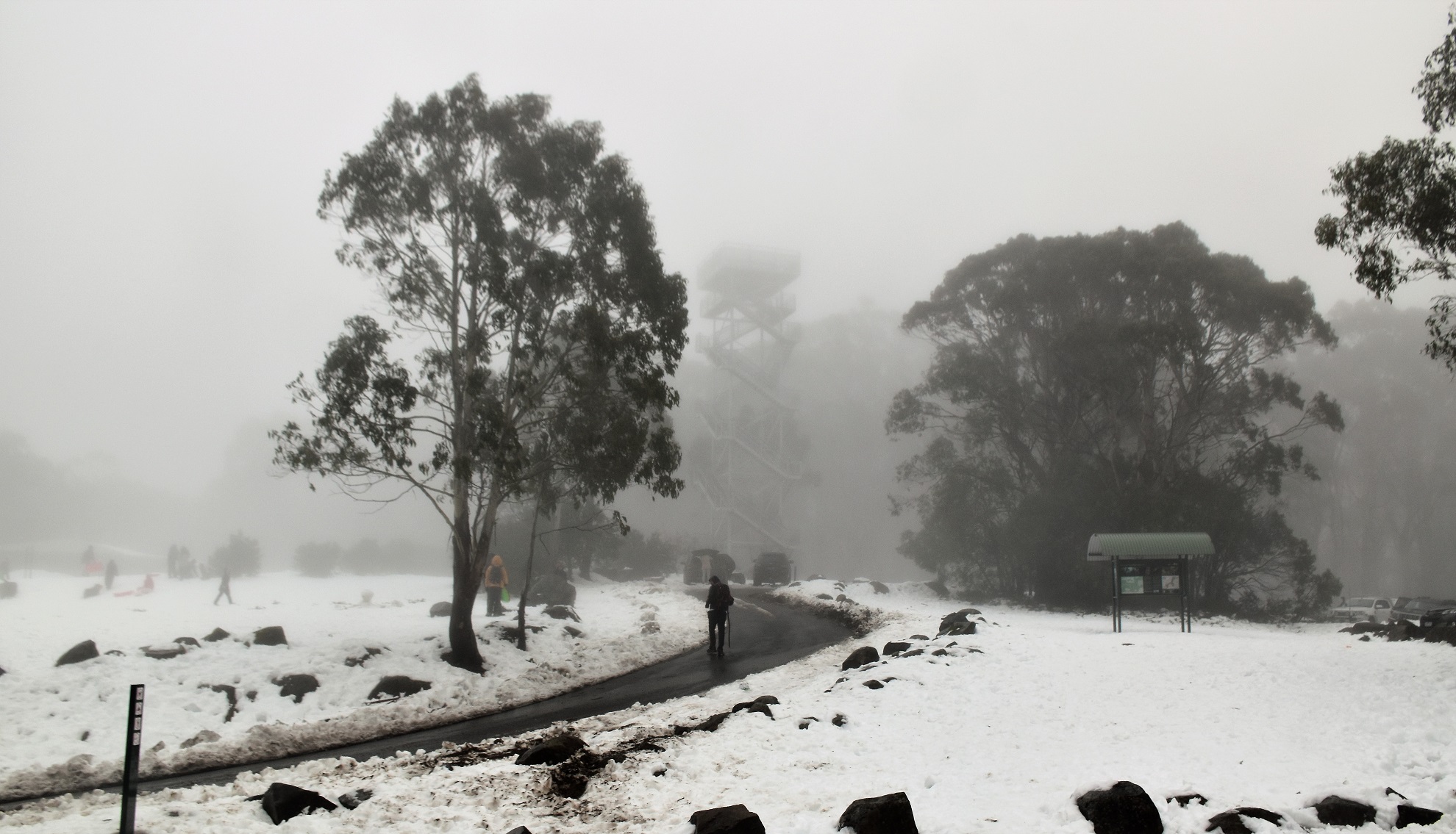
... and emerged on to the fairly busy summit area of Mt Donna Buang.
To be honest I didn't hang around at the summit for long, with lots of people and little visibility there really wasn't any reason to linger. Leaving the summit the good news was that it was now pretty well all down hill, the bad news was that the weather wasn't getting any better. I now retraced my route back down along the ridgeline down to the Ten Mile turn off. While the climb up here in the snow had been solid (there was around 300mm of snow on the ground up near the summit) the walk back down was also a little slow as I negotiated some steep icy sections of the track.


Once back down art the Ten Mile turn off I continued my descent. The track down to the Ten Mile Car Park was also a slippery affair, although as I dropped lower the snow covering pretty well disappeared - to be replaced by mud and water! From the turn off it was only around a kilometre and a half down to the car park and it wasn't long before the big bitumen car park appeared through the trees below me. Emerging from the bush onto Mt Donna Buang I climbed over the bank of snow left from the snow ploughs and shuffled the last few metres back to the ute.

The views from the summit were a little limited this afternoon.

At least I was going down hill now.

It's nice to walk beneath Alpine Ash that aren't all burnt, dead skeletons.

Dropping down the last section back to Ten Mile Car Park.

I'm looking forward to those heated seats!

One last snow bank to negotiate and the walk was over.
The Dirt.
According to my GPS I walked around 7.8 kilometres and climbed about 450 metres on what I'd call a medium grade walk (if there is no snow on the ground then I'd rate it as an easy-medium grade I think). This walk is a nice one if there is anyone out there who is looking for a bit of an introductory snow walk, the tracks are reasonably well marked and signposted and you are never too far from help if something goes pear shaped. Once up on the ridgeline the Cool Temperate Rainforest is a real feature of this stroll. There is parking near the summit of Mt Donna Buang and at Ten Mile. Keep in mind that snow chains must be carried up here in the snow season even if you don't need to use them. This walk is on Alltrails and I used their map today along with my GPS topos today.


No comments:
Post a Comment