
I enjoyed the love swing up on Stewart Head with my significant other today - my pack😉 By the way, Google love swing at your peril!

I hadn't actually seen any blue sky for a couple of days.

The Herberton Mining Museum was my starting point for this long stroll.
Parking at the Herberton Mining Museum I grabbed my pack and set off into the hills. The track that I was following was the Stewart Head Track and it was well signposted as I left the museum grounds. As it turned out, this stroll would require a lot of climbing, and I was into it almost straight away this morning as I climbed a walking track up onto a saddle near an old mine site below St Patrick Hill. It was about now that the looming black clouds had me starting to think that I might just be in a small good weather window, hmm.

Initially I past by quite a lot of mining history.
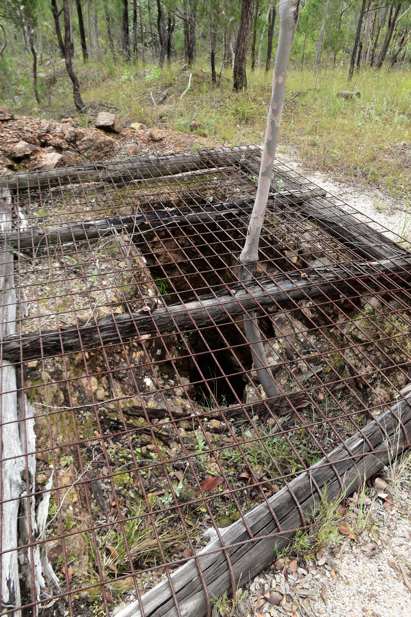
Most of the open shafts were fenced.

Climbing solidly up to a saddle.

I soon picked up the first of a series of 4wd tracks that I would follow today.

Early on I got a few glimpses back down to Herberton through the tress.

As far as walking a 4wd track goes this one wasn't too bad I guess.

Stewart Head in the distance.
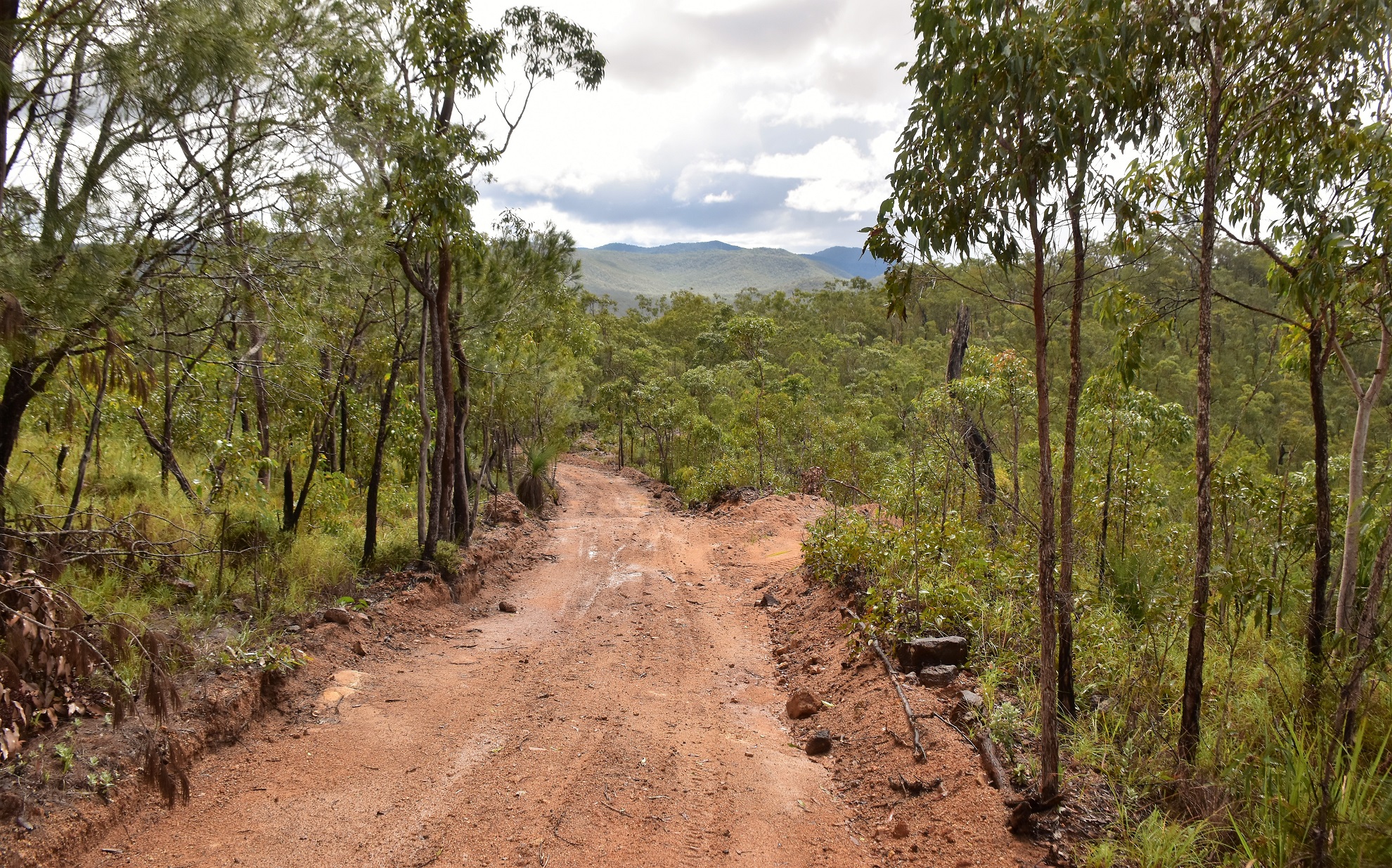
This track was a bit slippery after all the recent rain.

The final pinch up to the summit of Stewart Head was steep...

... so I was looking for any excuse to stop.
Apart from a fairly average looking trig the summit of Stewart Head has two notable things going for it, the first thing is the great view, the second thing is the homemade swing that seems to swing out into the great view... yes, you'd want to take your brave pills if you really wanted to get this swing rocking I think. After enjoying a nice lunch sitting on the swing I grabbed my pack again and set off for the ute, the walk back to the ute retraced my track down off Stewart Head before swinging left (south-west) and starting a very nice descent.

The Stewart Head Trig was a little underwhelming...

... however the view made up for it somewhat.

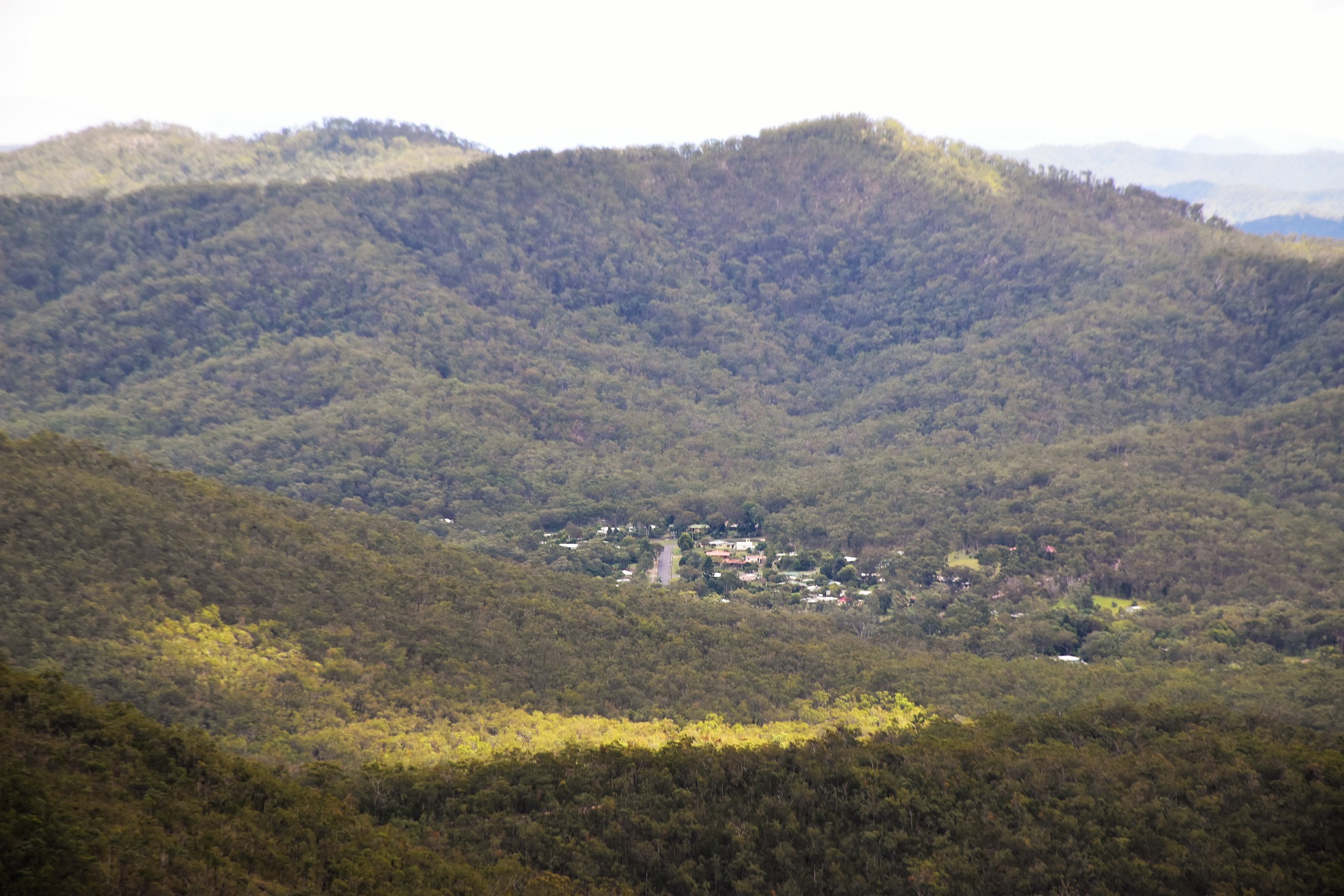
The Atherton Tablelands from Stewart Head.

Those mountains in the distance are some of the highest in Queensland.
I could even get a glimpse of Herberton from the Stewart Head Summit.

It was while dropping down this easy descent that my weather window disappeared again and I found myself once again trudging along under a tropical downpour (at least it was warm). Arriving at an over flowing dam I swung north up an un-marked track and then shortly after kept right to follow an old grassy track. I was now looking for the site of the old Bradlaugh Tin Mine and I was only mildly confident that I was heading the right way, although thankfully at about the same time that the sun came out again I spotted the huge mullock heaps left over from the old mine. There is a lot of left over history at this old mine, everything from mining claims that the trees are slowly reclaiming, to open but flooded mine shafts as well as numerous pieces of equipment rusting away in the scrub.

Conditions were pretty good by the time I left Stewart Head...

... although it didn't look like it would last long.

Why does it always seem to be pissing down at the very time that I need to pull my map and notes out?
After poking around the old mine for awhile I dropped back down to the dam and continued on south (the sign posting is a little hit and miss on the back half of this walk). I was now looking for a track climbing away on my right and eventually I spotted the right spot...although you really need to be concentrating on navigation here as it feels all wrong. Once I'd located this old track things became pretty obvious again although the climbing again slowed me down a bit. Thankfully this was the last solid climb on my days adventure and after avoiding a track on my right I started a long descent.

The old Bradlaugh Mine was a little tricky to find.

Bradlaugh Mine.

That's one wet pack!

The flooded shaft of the Bradlaugh Mine.

Mullock Heaps at the old mine.

I'm guessing that these old blazes were mining leases?

Bradlaugh Mine.
I was now starting to drop down towards Herberton again and this bit of the walk was a nice section. The sun was now out again and all the rain had charged up the ephemeral creeks so they were cascading down the gullies. My route now swung onto a more major dirt road before shortly after morphing into a bitumen road and entering the outskirts of Herberton. This old town is full of old miners cottages and quaint old buildings and is definitely worth checking out I think, my route took me down to the main street before once again climbing gently, now up John Street, back up to the Herberton Mining Museum.

Herberton Range State Forest.

I'm soaking wet however it looks like the suns coming out again.

The back half of this stroll isn't very clearly signposted.

This very vague and un signposted track felt wrong - but was right.

I passed by these old cairns at one stage - I've got no idea off their significance.

The creeks were all flowing well today, a situation that wouldn't be that common up here I think.
The Dirt.
According to my GPS I walked around 14.9 kilometres and climbed about 808 metres on what I'd call a medium-hard grade stroll. There are a few things to consider about this stroll. The first thing is that there is a fair bit of climbing involved. The second thing is it can get hot in these hills and while the creeks had water in them today and I was whinging about the rain these conditions aren't common, it's more likely to be hot and dry. The third thing to think about is the navigation, the outwards route to Stewart Head was pretty easy to follow, however the loop back was very vague (the side trip to Bradlaugh Mine is completely un-signposted). I used the notes and map out of the Woodslane book Best Walks around Cairns & the Tablelands as well as my Alltrails App and my GPS topos.
Relevant Posts.

Walking through the outskirts of Herberton.

I was climbing right up to the Mining Museum.

It was just after Anzac Day.

Next to the Mining Museum is this park celebrating early European explorers.

Back at the Herberton Mining Museum - time to head home (well, back to our holiday apartment anyway).


No comments:
Post a Comment