
The coastal cliffs were a feature of this stroll.

I was on my way by around 10am this morning.

Initially I passed through the outskirts of Corinella.
I'd done a bit of looking at maps and satellite photos before setting off today and had mapped out a rough route and on the first part of my stroll I was going to check out Settlement Point. After leaving the ute I headed back up to town away from the water to make my way over to the south west side of the peninsula of land that Corinella is situated on. Once near the coast again I set off along a cliff top walking track that headed north out onto Settlement Point. This bit of the stroll was along a dedicated walking track that meandered through the coastal Casuarinas, the track here is generally around 15 metres from the cliff edge although there are informal pads accessing the cliff tops - the thing is these cliffs are very unstable and undercut so I wouldn't recommend these view points. Arriving at the empty carpark (I think that the gate was locked) and picnic area that services the Settlement Point Lookout I checked out a lookout that allowed for some good views back along the cliffs that I'd just walked, and the view only reinforced the danger of standing near the edge of these unstable cliffs.

Once on the west side of the small peninsula of land I picked up this track and followed it out onto Settlement Point.

There are some side tracks out to informal cliff top lookouts along here however the clifftops are extremely unstable so I'd give them a miss.

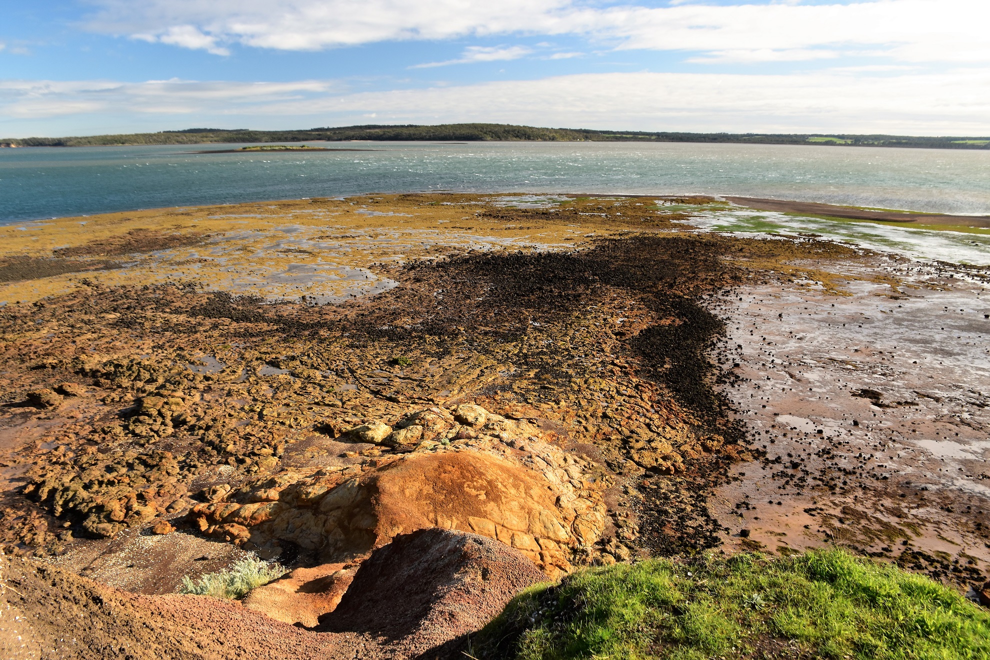
Looking south towards Coronet Bay from the picnic area at Settlement Point - see what I mean about the unstable cliffs.
Passing through the empty carpark I headed out to the Settlement Point Lookout to check things out. This lookout allows for some good views across Westernport Bay towards French Island. While the view here was pretty good it was probably the icy cutting wind that I'll remember, having just returned home from six weeks in North Queensland I was feeling the cold a little bit more than normal today. Heading away from the lookout I now headed back towards the boat ramp, passing an historic cairn and dropping through the sleepy, low key caravan park along the way. After arriving at the boat ramp and checking out the view from the pier I had a decision to make, either head east along the coast or take the roads and tracks above the cliff line - the thing was that with the coast being somewhat Mangrove lined, I wasn't sure if the first kilometre was actually doable at water level.

Heading out to the Settlement Point Lookout.
The view across Westernport Bay towards French Island from the Settlement Point Lookout.

The view east wasn't bad either.

Strzelecki came through here in May 1840 on one of his expeditions.

Westernport Bay is a haven for waterbirds.

Westernport Bay from the Corinella Pier.
Anyone who has read much of my blog will have guessed which route I took, yes I took the exploratory route through the Mangroves. Leaving the boat ramp I walked some fairly easy rocky sections where I passed by some rusting old slipways before I arrived at the crux of the walk - the Mangroves. With the tide pretty much dead low I was lucky enough to find a very narrow section of dry sandy mud which allowed forward progress to be made. These mangroves are ecologically important areas, they are also huge carbon storage areas (along with Salt Marshes and Sea Grass beds) so they need to be protected and appreciated a bit more I think - unfortunately the white shoed property developers just see mud and mozzies getting in the way of coastal development and money. With a bit of wind around and low tide the Mangroves weren't actually that bad to to negotiate this morning, and after around twenty minutes I started to reach sections of sandy beach, I was now confident that I would be able to get through at water level.

After leaving the boat ramp and pier I had some rocks to negotiate...

... which featured some old maritime history...

... before I arrived at the Mangrove lined section.

Mangroves are critical for our planets survival however they can sometimes make for uncomfortable places to walk!

I had a couple of hundred metres of this coastal grass to negotiate which was actually the hardest walking for the day.
Once passed the worst of the Mangroves I continued shuffling my way east at water level. I was now walking a mixture of rocky areas and small beaches. Sometimes the coast was open to the water of Westernport Bay and sometimes I had Mangroves between me and the open water. It wasn't really the sea views that were a feature of this bit of the walk through, it was the textures and colours of the crumbly coastal cliffs that I was stopping to photograph now. I was walking at around the middle of the day by now, however I'm now thinking a late afternoon low tide might be good for this walk as the low afternoon sun would really light up these cliffs (particularly in summer).

Arriving onto some wider sandy beaches signalled that the hardest walking was over.
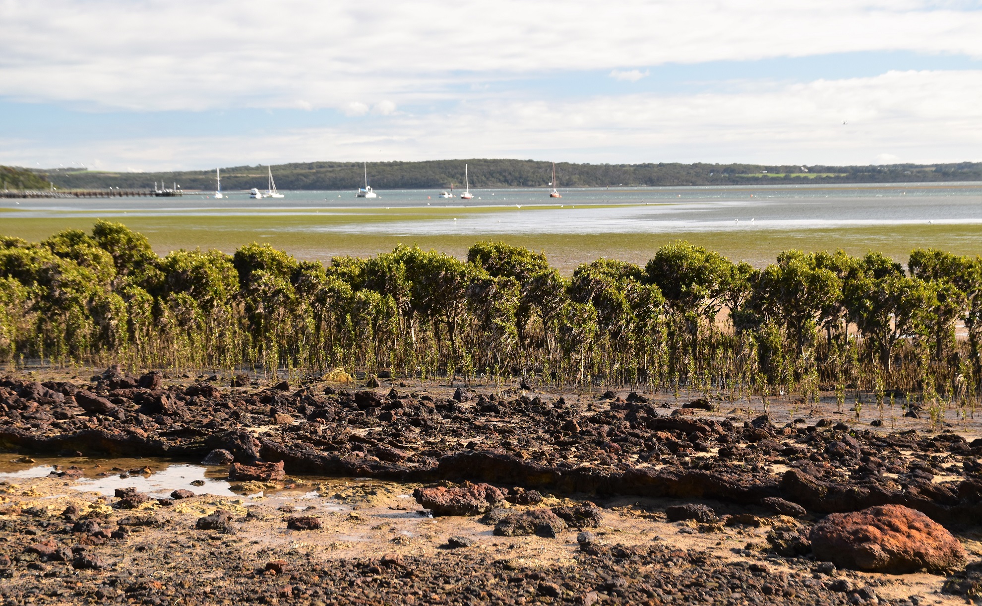
Looking back across the Mangroves and Sea Grass towards the Corinella Pier.

I'm thinking that the golden colour on some of the Casuarinas are them seeding?

The coastline east of Corinella.

As far as the walking goes this was a diverse walk.

This coastal section is somewhat protected by being within the Westernport Bay Intertidal Reserve.

Corinella coastline.
It was along this section that I was lucky enough to have my most notable wildlife encounter of the day as I had a couple of White Bellied Sea Eagles soaring on the thermals above my head. These beautiful birds are a little bit rarer than the more common Wedgetail Eagles (I'm thinking) and I always enjoy watching them, it's very unusual for them to get so close in my experience though. With my raptor mates slowing receding from view as they soared their way along the coast I resumed my walk east. I had now picked up an Alltrails route, so I was looking for the exit point on their map and all to soon the coastal cliffs started to drop in height and I soon found my exit pad. If anyone does this walk without the Alltrail map then the tell on when to head inland is when the coastal cliffs finish and a substantial area of Mangroves start to block forward progress at sea level.

I'm thinking that these are an adult and a juvenile White Bellied Sea Eagle (although that's another Feral fact!).


These cliffs would look good in the late afternoon in summer.


With the Mangroves now lining the coast again I picked up the inland track and started heading back towards the ute.

I was a little surprised to find an established track back along the cliff tops.

I was walking narrow strip of native bush between there cliff tops and the rural land.

After passing through the native scrub I walked through the outskirts of Corinella along a more manicured path.

There are some nice views from the cliff tops - this is looking east along the coastline that I'd walked earlier...

... and this is looking west towards the Corinella boat ramp (and the end of the walk).
The Dirt.
According to my GPS I walked around 6.7 kilometres and climbed about 132 metres on what I'd call an easy - medium grade walk. This walk is one that you can't really get lost on, however it is not a formalised walk, I was linking formal and informal tracks and pads up so some kind of map would be handy. The coast section from the boat ramp to Hamilton Street is a little tricky down at the waterline, I had to negotiate rocks and mangroves and this section should be done on a fairly low tide - you can avoid this section by walk The Esplanade if necessary. Corinella is a very sleepy small coastal town on the shore of Westernport Bay so there aren't a lot of cafés or shops here, I think I passed by a general store on the way in however that would be about it. I used an Alltrails map along with my GPS topos on the walk today.
Relevant Posts.

My walk back occasionally got back down near the waterline.

Corinella

Walking the last few metres back to the ute along The Esplanade in Corinella.


No comments:
Post a Comment